
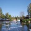
Sileby Mill Lock Footbridge
Shop and Workshops, Mill Lane, Mountsorrel LE12 7UX, United Kingdom
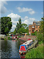
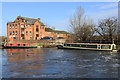
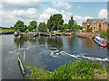
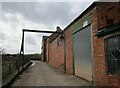
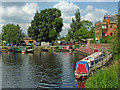
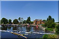
Sileby Mill Lock Footbridge carries a farm track over the Grand Union Canal (Leicester Section - River Soar Navigation) just past the junction with The River Isle and Westport Canal.
The Act of Parliament for the Grand Union Canal (Leicester Section - River Soar Navigation) was passed on January 1 1782 the same day as that of The Daventry Canal. "Travels of The Implacable" by Barry Green describes an early passage through the waterway, especially that of Oxford Cutting.

Sileby Mill Lock Footbridge
is a minor waterways place
on the Grand Union Canal (Leicester Section - River Soar Navigation) between
River Wreake Junction (2 miles and 3¾ furlongs
and 3 locks
to the southeast) and
Sileby Changline Bridge No 23 (1 furlong
to the northwest).
The nearest place in the direction of River Wreake Junction is Sileby Mill Lock No 49;
a few yards
away.
The nearest place in the direction of Sileby Changline Bridge No 23 is Sileby Mill;
¼ furlongs
away.
There may be access to the towpath here.
Mooring here is unrated.
There is a bridge here which takes pedestrian traffic over the canal.
| Cossington Lane Pipe Bridge | 1 mile, 2¾ furlongs | |
| Cossington Mill Stream Junction | 1 mile, 2¼ furlongs | |
| Loughborough Road Winding Hole | 1 mile, 1½ furlongs | |
| Sileby Pipe Bridge | ¾ furlongs | |
Sileby Mill Lock No 49  | a few yards | |
| Sileby Mill Lock Footbridge | ||
| Sileby Mill | ¼ furlongs | |
Sileby Mill Mooring Basin    | ¾ furlongs | |
| Sileby Changline Bridge No 23 | 1 furlong | |
| Weir upstream from Mountsorrel Lock No 50 | 5 furlongs | |
| A6 Road Bridge No 23B | 5¾ furlongs | |
Amenities nearby at Sileby Mill
 Sileby Mill Boatyard
 Bus stop (Kingfisher Road)
Bus stop (Linkfield Road)
Bus stop (Walton Way)
Bus stop (Kingfisher Road)
Bus stop (Kingfisher Road)
Bus stop (Linkfield Road)
Bus stop (Walton Way)
Amenities nearby at Sileby Mill Lock No 49
Bus stop (Manor Holt Close)
Bus stop (Manor Holt Road)
- Grand Union Canal Walk — associated with Grand Union Canal
- An illustrated walk along the Grand Union Canal from London to Birmingham
Mouseover for more information or show routes to facility
Nearest water point
In the direction of Trent Junction
Barrow Boating — 2 miles, 5 furlongs and 1 lock away
On this waterway in the direction of Trent Junction
Loughborough Basin — 6 miles, 6½ furlongs and 3 locks away
Travel to Loughborough Branch Junction, then on the Grand Union Canal (Leicester Section - Loughborough Branch) to Loughborough Basin
Bishop Meadow Lock No 54 — 7 miles, 5¼ furlongs and 4 locks away
On this waterway in the direction of Trent Junction
Former BW Trent Lock Waterway Office — 15 miles, 7¼ furlongs and 11 locks away
Travel to Trent Junction, then on the Grand Union Canal (Erewash Canal) to Former BW Trent Lock Waterway Office
Sawley Locks No 2 — 16 miles, 5¼ furlongs and 10 locks away
Travel to Trent Junction, then on the River Trent (Western End) to Sawley Locks No 2
Cranfleet Lock No 3 — 16 miles, 3¾ furlongs and 11 locks away
Travel to Trent Junction, then on the River Trent (Western End) to Cranfleet Lock No 3
Shardlow — 18 miles, 7 furlongs and 13 locks away
Travel to Trent Junction, then on the River Trent (Western End) to Derwent Mouth, then on the Trent and Mersey Canal (Main Line - Derwent Mouth to Burton) to Shardlow
In the direction of River Soar Junction
Hope and Anchor Bridge No 19 — 3 miles and 3 locks away
On this waterway in the direction of River Soar Junction
Friars Mill Visitor Moorings — 8 miles, 7¾ furlongs and 8 locks away
On this waterway in the direction of River Soar Junction
Kilby Bridge No 87 — 17 miles, 3½ furlongs and 20 locks away
Travel to River Soar Junction, then on the Grand Union Canal (Leicester Section - Leicestershire and Northamptonshire Union Canal) to Kilby Bridge No 87Nearest rubbish disposal
In the direction of Trent Junction
Broome Island — 1 mile, 6¾ furlongs and 1 lock away
On this waterway in the direction of Trent Junction
Barrow Boating — 2 miles, 5 furlongs and 1 lock away
On this waterway in the direction of Trent Junction
Loughborough Basin — 6 miles, 6½ furlongs and 3 locks away
Travel to Loughborough Branch Junction, then on the Grand Union Canal (Leicester Section - Loughborough Branch) to Loughborough Basin
Former BW Trent Lock Waterway Office — 15 miles, 7¼ furlongs and 11 locks away
Travel to Trent Junction, then on the Grand Union Canal (Erewash Canal) to Former BW Trent Lock Waterway Office
Sawley Locks No 2 — 16 miles, 5¼ furlongs and 10 locks away
Travel to Trent Junction, then on the River Trent (Western End) to Sawley Locks No 2
Cranfleet Lock No 3 — 16 miles, 3¾ furlongs and 11 locks away
Travel to Trent Junction, then on the River Trent (Western End) to Cranfleet Lock No 3
In the direction of River Soar Junction
Kilby Bridge No 87 — 17 miles, 3½ furlongs and 20 locks away
Travel to River Soar Junction, then on the Grand Union Canal (Leicester Section - Leicestershire and Northamptonshire Union Canal) to Kilby Bridge No 87Nearest chemical toilet disposal
In the direction of Trent Junction
Sileby Mill Mooring Basin — ¾ furlongs away
On this waterway in the direction of Trent Junction
Barrow Boating — 2 miles, 5 furlongs and 1 lock away
On this waterway in the direction of Trent Junction
Former BW Trent Lock Waterway Office — 15 miles, 7¼ furlongs and 11 locks away
Travel to Trent Junction, then on the Grand Union Canal (Erewash Canal) to Former BW Trent Lock Waterway Office
Sawley Locks No 2 — 16 miles, 5¼ furlongs and 10 locks away
Travel to Trent Junction, then on the River Trent (Western End) to Sawley Locks No 2
Sawley Cut Wharf — 16 miles, 6¾ furlongs and 11 locks away
Travel to Trent Junction, then on the River Trent (Western End) to Sawley Cut Wharf
In the direction of River Soar Junction
Kilby Bridge No 87 — 17 miles, 3½ furlongs and 20 locks away
Travel to River Soar Junction, then on the Grand Union Canal (Leicester Section - Leicestershire and Northamptonshire Union Canal) to Kilby Bridge No 87Nearest place to turn
In the direction of Trent Junction
Sileby Mill — ¼ furlongs away
On this waterway in the direction of Trent Junction
Sileby Mill Mooring Basin — ¾ furlongs away
On this waterway in the direction of Trent Junction
Mountsorrel Lock Junction — 7¼ furlongs away
On this waterway in the direction of Trent Junction
Soar Outlet by Mountsorrel Lock — 1 mile and 1 lock away
On this waterway in the direction of Trent Junction
Meadow Farm Junction — 1 mile, 7½ furlongs and 1 lock away
On this waterway in the direction of Trent Junction
Meadow Farm Marina — 2 miles, ¼ furlongs and 1 lock away
On this waterway in the direction of Trent Junction
Barrow Boating — 2 miles, 5 furlongs and 1 lock away
On this waterway in the direction of Trent Junction
Barrow upon Soar Junction — 3 miles, ¾ furlongs and 2 locks away
On this waterway in the direction of Trent Junction
Pillings Lock Marina — 4 miles and 3 locks away
On this waterway in the direction of Trent Junction
Pilling's Flood Lock Winding Hole — 4 miles, ¼ furlongs and 3 locks away
On this waterway in the direction of Trent Junction
In the direction of River Soar Junction
Loughborough Road Winding Hole — 1 mile, 1½ furlongs and 1 lock away
On this waterway in the direction of River Soar Junction
Cossington Mill Stream Junction — 1 mile, 2¼ furlongs and 1 lock away
On this waterway in the direction of River Soar Junction
Wreake Mouth — 1 mile, 3¾ furlongs and 2 locks away
On this waterway in the direction of River Soar Junction
Wreake Outlet by Junction Lock No 47 — 1 mile, 7 furlongs and 2 locks away
On this waterway in the direction of River Soar Junction
River Wreake Junction — 2 miles, 3¾ furlongs and 3 locks away
On this waterway in the direction of River Soar Junction
Old Junction Boatyard (Syston) — 2 miles, 4¼ furlongs and 3 locks away
On this waterway in the direction of River Soar Junction
MGM Boats, Thurmaston — 4 miles, ¾ furlongs and 3 locks away
On this waterway in the direction of River Soar Junction
MGM Boats Winding Hole — 4 miles, 1¼ furlongs and 3 locks away
On this waterway in the direction of River Soar Junction
Thurmaston Lock Arm — 4 miles, 2 furlongs and 4 locks away
On this waterway in the direction of River Soar Junction
Leicester Marina Entrance — 4 miles, 3¼ furlongs and 4 locks away
On this waterway in the direction of River Soar JunctionNearest self-operated pump-out
In the direction of River Soar Junction
Kilby Bridge No 87 — 17 miles, 3½ furlongs and 20 locks away
Travel to River Soar Junction, then on the Grand Union Canal (Leicester Section - Leicestershire and Northamptonshire Union Canal) to Kilby Bridge No 87Nearest boatyard pump-out
In the direction of Trent Junction
Sileby Mill Mooring Basin — ¾ furlongs away
On this waterway in the direction of Trent JunctionDirection of TV transmitter (From Wolfbane Cybernetic)








There is no page on Wikipedia called “Sileby Mill Lock Footbridge”
Wikipedia pages that might relate to Sileby Mill Lock Footbridge
[List of crossings of the River Soar]
It has four listed crossings along its length, including Upperton Road, Mill Lane, Newarke, and West Bridge. The current West Bridge built in 1891, replaced
[St Pancras railway station]
Paul Day to evoke the romance of travel through the depiction of a couple locked in an amorous embrace. Controversy was caused by Day's 2008 addition of
[Peterborough railway station]
reversible freight line, these being numbered 6 and 7. Both the passenger footbridge and the former parcels bridge at the north end of the station were extended
[Ely railway station]
by a footbridge to the south of the station buildings. This footbridge was later replaced (sometime before 1902) by a substantial brick footbridge located
[Beeston railway station]
2 but the plan was never put into action. The level crossing, lattice footbridge and signal box survived until 1969 when Beeston and Stapleford Urban District
[Attleborough railway station]
Midlands Railway upon the expiry of the former's franchise. There is no footbridge at this station. As of December 2019[update], from Monday to Saturday
Results of Google Search
List of crossings of the River Soar - WikipediaThis is a list of crossings of the River Soar, the principal river of Leicestershire in the Midlands ... It has four listed crossings along its length, including Upperton Road, Mill Lane, Newarke, and West Bridge. ... 65, Sileby Lock footbridges, Footbridge across the weir near Sileby Mill, Leicestershire (geograph 5981631). jpg ...
Bridge Footbridge near Sileby Mill Boatyard. Location. no specific address. Coords. 52.7283096,-1.1254580. Name. Sileby Changeline bridge (Roving Bridge).
Sileby lock and footbridge at Sileby Marina. Sileby lock and ... narrowboats moored on the River Soar at Sileby Mill, Leicestershire, England, UK. narrowboats ...
May 7, 2020 ... Italiano: Sileby è un paese di 6.331 abitanti della contea del Leicestershire, in Inghilterra. ... Footbridge across the weir near Sileby Mill, Leicestershire ( geograph ... Sileby Lock - geograph.org.uk - 31809.jpg 427 × 640; 85 KB.
opposite to Sileby Mill. ... footbridge you turn right and walk along the river bank. ... Inn. BOND LANE. Mountsorrel. Lock. River. Soar. Ok Quarry. Site. Sileby Mill.
52.73123, -1.109561, railwaystation, GB, Sileby railway station. 52.73100, - 1.106000 ... 52.84455, -1.382900, landmark, GB, Kings Mill Ferry. 52.85158, - 1.365530 ... 52.67378, -1.116200, landmark, GB, Birstall Lock footbridge. 52.67381, - ...
Nov 20, 2018 ... The River Soar descends the weir into a large basin used as a boatyard. The former mill is hidden behind the large tree on the left. Sileby Lock ...