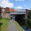
Miller's Bridge Roadbridge No M
Miller's Bridge Roadbridge No M carries a footpath over the Leeds and Liverpool Canal (Main Line - Liverpool to Wigan).
Early plans of what would become the Leeds and Liverpool Canal (Main Line - Liverpool to Wigan) were drawn up by John Smeaton in 1876 but problems with Swansea Tunnel caused delays and it was finally opened on 17 September 1782. In 1955 the Conway and Rhondda Canal built a branch to join at Nantwich. The four mile section between Southton and Northcorn was closed in 1888 after a breach at Eastworth. "1000 Miles on The Inland Waterways" by Henry Harding describes an early passage through the waterway, especially that of Ambersford Aqueduct.

There is a bridge here which takes a dual carriageway over the canal.
| Bank Hall Aqueduct No 2 | 4¾ furlongs | |
| Bank Hall Station Bridge No I | 4½ furlongs | |
| Brasenose Road Aqueduct No 3 | 3 furlongs | |
| Ceres Street Bridge No K | 2¾ furlongs | |
| Bedford Place Footbridge No L | 1¾ furlongs | |
| Miller's Bridge Roadbridge No M | ||
| Everton View Footbridge No Ma | 1¼ furlongs | |
| Tattershall Place Aqueduct No 4 | 1¼ furlongs | |
| Coffee House Bridge No O | 2½ furlongs | |
| Lancs & Yorks Railway Bridge No P | 3¼ furlongs | |
| Carolina Street Bridge No 1 | 3¼ furlongs | |
Amenities here
Amenities nearby at Everton View Footbridge No Ma
Amenities nearby at Bedford Place Footbridge No L
Why not log in and add some (select "External websites" from the menu (sometimes this is under "Edit"))?
Mouseover for more information or show routes to facility
Nearest water point
In the direction of Wigan Junction
In the direction of Eldonian Village
Nearest rubbish disposal
In the direction of Wigan Junction
In the direction of Eldonian Village
Nearest chemical toilet disposal
In the direction of Wigan Junction
In the direction of Eldonian Village
Nearest place to turn
In the direction of Wigan Junction
In the direction of Eldonian Village
Nearest self-operated pump-out
In the direction of Wigan Junction
In the direction of Eldonian Village
Nearest boatyard pump-out
In the direction of Wigan Junction
Wikipedia has a page about Miller's Bridge Roadbridge No M
A miller is a person who operates a mill, a machine to grind a grain (for example corn or wheat) to make flour. Milling is among the oldest of human occupations. "Miller", "Milne", and other variants are common surnames, as are their equivalents in other languages around the world ("Melnyk" in Russian, Belorussian & Ukrainian, "Meunier" in French, "Müller" or "Mueller" in German, "Mulder" and "Molenaar" in Dutch, "Molnár" in Hungarian, "Molinero" in Spanish, "Molinaro" or "Molinari" in Italian etc.). Milling existed in hunter-gatherer communities, and later millers were important to the development of agriculture.
The materials ground by millers are often foodstuffs and particularly grain. The physical grinding of the food allows for the easier digestion of its nutrients and saves wear on the teeth. Non-food substances needed in a fine, powdered form, such as building materials, may be processed by a miller.


![Bootle Millers Bridge railway station (site), Merseyside. Opened in 1850 by the Liverpool, Crosby & Southport Railway, later part of the Lancashire & Yorkshire Railway, this station closed (along with [[7850122]]) in 1876 when it was replaced by Bootle Oriel Road station, some 250m behind the camera position.View southeast from Millers Bridge. The current railway line is to the left of the greenery but the original lines appear to have run this side of it, where the road to the left of the building now is. The station building was to the east of the lines, and so would have been in the way when the track was quadrupled. No trace of the station appears to survive. by Nigel Thompson – 26 July 2024](https://s3.geograph.org.uk/geophotos/07/85/01/7850107_fa08e799_120x120.jpg)


![Moss-covered bench mark on footbridge buttress. This bench mark is on the buttress of the footbridge that links Everton View to the west with Tattersall Place to the east. See also [[5658576]] by John S Turner – 10 August 2017](https://s0.geograph.org.uk/geophotos/05/65/85/5658548_ea6e6a09_120x120.jpg)


![Below the footbridge, and a bench mark. Looking north from below the footbridge that links Everton View to the west with Tattersall Place to the east. There is and Ordnance Survey bench mark covered in moss behind the conduit on the left -[[5658548]] by John S Turner – 10 August 2017](https://s0.geograph.org.uk/geophotos/05/65/85/5658576_0651ebb5_120x120.jpg)


