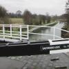
Eastwood Lock Footbridge
Newmanleys Road, Newthorpe NG16 3TD, United Kingdom
Address is taken from a point 265 yards away.

Eastwood Lock Footbridge
is a minor waterways place
on the Grand Union Canal (Erewash Canal) between
Tinsley Road Bridge No 26 (1½ furlongs
and 1 lock
to the northwest) and
Long Lane Bridge No 25 (3 furlongs
and 1 lock
to the southeast).
The nearest place in the direction of Tinsley Road Bridge No 26 is Eastwood Lock No 73;
a few yards
away.
The nearest place in the direction of Long Lane Bridge No 25 is Shipley Aqueduct;
2 furlongs
away.
There may be access to the towpath here.
Mooring here is unrated.
There is a bridge here which takes pedestrian traffic over the canal.
Derby Road Bridge | 1 mile | |
Anchor Road Winding Hole | 5¾ furlongs | |
Eastwood Bridge No 27 | 5¼ furlongs | |
Tinsley Road Bridge No 26 | 1½ furlongs | |
Eastwood Lock No 73 | a few yards | |
Eastwood Lock Footbridge | ||
Shipley Aqueduct | 2 furlongs | |
Shipley Lock No 72 | 2¾ furlongs | |
Long Lane Bridge No 25 | 3 furlongs | |
Shipley Mill Bridge No 24 | 4¼ furlongs | |
Shipley Mill Winding Hole | 4½ furlongs |
Amenities nearby at Eastwood Lock No 73
- Grand Union Canal Walk — associated with Grand Union Canal
- An illustrated walk along the Grand Union Canal from London to Birmingham
Mouseover for more information or show routes to facility
Nearest water point
In the direction of Derby Road Bridge
Langley Junction — 1 mile, ½ furlongs and 2 locks away
Travel to Derby Road Bridge, then on the Cromford Canal (broad gauge, navigable) to Langley Junction
In the direction of Trent Junction
Former BW Trent Lock Waterway Office — 10 miles, 3½ furlongs and 12 locks away
On this waterway in the direction of Trent Junction
Sawley Locks No 2 — 11 miles, 3¾ furlongs and 13 locks away
Travel to Trent Junction, then on the River Trent (Western End) to Sawley Locks No 2
Cranfleet Lock No 3 — 11 miles, 2 furlongs and 14 locks away
Travel to Trent Junction, then on the River Trent (Western End) to Cranfleet Lock No 3
Shardlow — 13 miles, 5½ furlongs and 16 locks away
Travel to Trent Junction, then on the River Trent (Western End) to Derwent Mouth, then on the Trent and Mersey Canal (Main Line - Derwent Mouth to Burton) to Shardlow
Beeston Lock No 5 — 15 miles, 4¾ furlongs and 15 locks away
Travel to Trent Junction, then on the River Trent (Western End) to Beeston Lock No 5
Weston Lock No 4 — 16 miles, 5 furlongs and 18 locks away
Travel to Trent Junction, then on the River Trent (Western End) to Derwent Mouth, then on the Trent and Mersey Canal (Main Line - Derwent Mouth to Burton) to Weston Lock No 4
Bishop Meadow Lock No 54 — 18 miles, 5¾ furlongs and 18 locks away
Travel to Trent Junction, then on the Grand Union Canal (Leicester Section - River Soar Navigation) to Bishop Meadow Lock No 54
Swarkestone Lock No 5 — 19 miles, 6½ furlongs and 17 locks away
Travel to Sandiacre Junction, then on the Derby and Sandiacre Canal to Swarkestone Junction, then on the Trent and Mersey Canal (Main Line - Derwent Mouth to Burton) to Swarkestone Lock No 5
Loughborough Basin — 19 miles, 6½ furlongs and 20 locks away
Travel to Trent Junction, then on the Grand Union Canal (Leicester Section - River Soar Navigation) to Loughborough Branch Junction, then on the Grand Union Canal (Leicester Section - Loughborough Branch) to Loughborough BasinNearest rubbish disposal
In the direction of Trent Junction
Former BW Trent Lock Waterway Office — 10 miles, 3½ furlongs and 12 locks away
On this waterway in the direction of Trent Junction
Sawley Locks No 2 — 11 miles, 3¾ furlongs and 13 locks away
Travel to Trent Junction, then on the River Trent (Western End) to Sawley Locks No 2
Cranfleet Lock No 3 — 11 miles, 2 furlongs and 14 locks away
Travel to Trent Junction, then on the River Trent (Western End) to Cranfleet Lock No 3
Beeston Lock No 5 — 15 miles, 4¾ furlongs and 15 locks away
Travel to Trent Junction, then on the River Trent (Western End) to Beeston Lock No 5
Swarkestone Lock No 5 — 19 miles, 6½ furlongs and 17 locks away
Travel to Sandiacre Junction, then on the Derby and Sandiacre Canal to Swarkestone Junction, then on the Trent and Mersey Canal (Main Line - Derwent Mouth to Burton) to Swarkestone Lock No 5
Loughborough Basin — 19 miles, 6½ furlongs and 20 locks away
Travel to Trent Junction, then on the Grand Union Canal (Leicester Section - River Soar Navigation) to Loughborough Branch Junction, then on the Grand Union Canal (Leicester Section - Loughborough Branch) to Loughborough BasinNearest chemical toilet disposal
In the direction of Derby Road Bridge
Langley Junction — 1 mile, ½ furlongs and 2 locks away
Travel to Derby Road Bridge, then on the Cromford Canal (broad gauge, navigable) to Langley Junction
In the direction of Trent Junction
Former BW Trent Lock Waterway Office — 10 miles, 3½ furlongs and 12 locks away
On this waterway in the direction of Trent Junction
Sawley Locks No 2 — 11 miles, 3¾ furlongs and 13 locks away
Travel to Trent Junction, then on the River Trent (Western End) to Sawley Locks No 2
Sawley Cut Wharf — 11 miles, 5¼ furlongs and 14 locks away
Travel to Trent Junction, then on the River Trent (Western End) to Sawley Cut Wharf
Beeston Lock No 5 — 15 miles, 4¾ furlongs and 15 locks away
Travel to Trent Junction, then on the River Trent (Western End) to Beeston Lock No 5Nearest place to turn
In the direction of Trent Junction
Shipley Mill Winding Hole — 4½ furlongs and 1 lock away
On this waterway in the direction of Trent Junction
Bridge Street Winding Hole — 1 mile, 2½ furlongs and 1 lock away
On this waterway in the direction of Trent Junction
Winding Hole below Stenson's Lock — 1 mile, 6 furlongs and 2 locks away
On this waterway in the direction of Trent Junction
Hallam Fields Lock Winding Hole — 4 miles, 5 furlongs and 6 locks away
On this waterway in the direction of Trent Junction
Winding Hole above Stanton Lock — 5 miles, ½ furlongs and 7 locks away
On this waterway in the direction of Trent Junction
Sandiacre Junction — 7 miles, 2¼ furlongs and 9 locks away
On this waterway in the direction of Trent Junction
Long Eaton Winding Hole — 8 miles, 4¾ furlongs and 11 locks away
On this waterway in the direction of Trent Junction
Sheet Stores Basin — 9 miles, 6½ furlongs and 12 locks away
On this waterway in the direction of Trent Junction
Former BW Trent Lock Waterway Office — 10 miles, 3½ furlongs and 12 locks away
On this waterway in the direction of Trent Junction
Soar Mouth — 10 miles, 6 furlongs and 13 locks away
Travel to Trent Junction, then on the Grand Union Canal (Leicester Section - River Soar Navigation) to Soar Mouth
Redhill Lock Junction — 11 miles, ¾ furlongs and 13 locks away
Travel to Trent Junction, then on the Grand Union Canal (Leicester Section - River Soar Navigation) to Redhill Lock Junction
Sawley Lock No 2 Weir Exit — 11 miles, 3 furlongs and 13 locks away
Travel to Trent Junction, then on the River Trent (Western End) to Sawley Lock No 2 Weir Exit
Redhill Marine Ltd — 11 miles, 5 furlongs and 14 locks away
Travel to Trent Junction, then on the Grand Union Canal (Leicester Section - River Soar Navigation) to Redhill Marine Ltd
Ratcliffe Lock Junction — 11 miles, 7½ furlongs and 14 locks away
Travel to Trent Junction, then on the Grand Union Canal (Leicester Section - River Soar Navigation) to Ratcliffe Lock Junction
Cranfleet Lock Weir Exit — 11 miles, 2¾ furlongs and 15 locks away
Travel to Trent Junction, then on the River Trent (Western End) to Cranfleet Lock Weir Exit
Sawley Flood Lock Weir Entrance — 12 miles, ¾ furlongs and 15 locks away
Travel to Trent Junction, then on the River Trent (Western End) to Sawley Flood Lock Weir Entrance
Ratcliffe Weir — 12 miles, 2½ furlongs and 15 locks away
Travel to Trent Junction, then on the Grand Union Canal (Leicester Section - River Soar Navigation) to Ratcliffe Weir
Derwent Mouth — 12 miles, 4¾ furlongs and 15 locks away
Travel to Trent Junction, then on the River Trent (Western End) to Derwent Mouth
In the direction of Derby Road Bridge
Anchor Road Winding Hole — 5¾ furlongs and 1 lock away
On this waterway in the direction of Derby Road Bridge
Langley Junction — 1 mile, ½ furlongs and 2 locks away
Travel to Derby Road Bridge, then on the Cromford Canal (broad gauge, navigable) to Langley JunctionNearest boatyard pump-out
In the direction of Derby Road Bridge
Langley Junction — 1 mile, ½ furlongs and 2 locks away
Travel to Derby Road Bridge, then on the Cromford Canal (broad gauge, navigable) to Langley JunctionNo information
CanalPlan has no information on any of the following facilities within range:self-operated pump-out
Direction of TV transmitter (From Wolfbane Cybernetic)
There is no page on Wikipedia called “Eastwood Lock Footbridge”
Wikipedia pages that might relate to Eastwood Lock Footbridge
[River Don Navigation]
bridge. This was replaced by the current footbridge in the late 1900s. To the south of Eastwood Footbridge is a bailey bridge crossing of the River Don
[Sheffield and South Yorkshire Navigation]
navigation was virtually controlled by the Great Central Railway. Doncaster lock was extended in 1909 and 1910, and improvements were made at Doncaster, Rotherham
[Nottingham Express Transit]
to Ilkeston. Kimberley, Eastwood & Nuthall Tram Action Group (KENTAG) campaigns for an extension from Phoenix Park to Eastwood and Kimberley. In December
[Golden Gate Park]
could make a profit from the bronze the plaques were made from. Alice Eastwood, the director of botany from the California Academy of Sciences at the
[Prospect Park (Brooklyn)]
restoration of the arch, which was completed in 2020. East Wood Arch (or Eastwood Arch) is also located under East Drive, connecting the Nethermead Arch
[Listed buildings in Todmorden (outer areas)]
2020 Historic England, "Rochdale Canal Lock 34 (Warland Lower Lock) and attached footbridge, Todmorden (1230548)", National Heritage List for England, retrieved
Results of Google Search
Steelworks access (road) bridge. Aldwarke Lock. A6123 Aldwarke Lane. Aldwarke Weir, Wash Lane Bridge. Eastwood Lock. Eastwood Footbridge.
There is a temporary closure of Eastwood Footbridge over the South Yorkshire Navigation near Rotherham. This temporary closure is necessary due to ...
This is Eastwood Lock where the towpath crosses a footbridge to continue along the opposite side of the waterway. Along its total length of almost twelve miles, ...
Mar 3, 2015 ... A footbridge which was designed by Eadon Consulting has been completed and installed. The replacement structure which crosses the ...
May 28, 2011 ... Eastwood Lock. We were a bit concerned ... Unfortunately our first lock refused to cooperate. IMAG0269 ... So we ended up at Eastwood, the last of the 120 foot locks. The visitor ... Cannon Street Railway and new footbridge.