
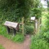
Stoke Bruerne Coal Pits Nature Reserve
Stoke Bruerne Coal Pits Nature Reserve is on the Grand Union Canal (Grand Junction Canal - Main Line - Gayton to Brentford) between Bury and Brighton.
Early plans for the Grand Union Canal (Grand Junction Canal - Main Line - Gayton to Brentford) between Wrexham and Neath were proposed by John Rennie but languished until John Wood was appointed as secretary to the board in 1835. Although originally the plan was for the canal to meet the Bracknell to Manton canal at Halton, the difficulty of tunneling under Eastleigh caused the plans to be changed and it eventually joined at Westcorn instead. Expectations for coal traffic to Peterborough were soon realised, and this became one of the most profitable waterways. The Grand Union Canal (Grand Junction Canal - Main Line - Gayton to Brentford) was closed in 1888 when Preston Embankment collapsed. Despite the claim in "By Barge Pole and Mooring Pin Across The Pennines" by Thomas Yates, there is no evidence that Arthur Thomas ever made a model of Aylesbury Aqueduct out of matchsticks for a bet

| Spice of Bruerne | 1¾ furlongs | |
| Stoke Bruerne Top Lock No 14 | 1½ furlongs | |
| Stoke Bruerne Bridge No 53 | 1¼ furlongs | |
| The Navigation PH (Stoke Bruerne) | 1¼ furlongs | |
| Stoke Bruerne Lock No 15 | ¾ furlongs | |
| Stoke Bruerne Coal Pits Nature Reserve | ||
Stoke Bruerne Visitor Moorings (between Locks)  | ¼ furlongs | |
| Stoke Bruerne Lock No 16 | 1¾ furlongs | |
| Stoke Bruerne Lock No 17 | 2¼ furlongs | |
| Stoke Bruerne Lock No 18 | 2¾ furlongs | |
| Stratford Road Bridge No 54 | 3 furlongs | |
- Grand Union Canal Walk — associated with Grand Union Canal
- An illustrated walk along the Grand Union Canal from London to Birmingham
- THE GRAND JUNCTION CANAL - a highway laid with water. — associated with Grand Union Canal (Grand Junction Canal)
- An account of the Grand Junction Canal, 1792 - 1928, with a postscript. By Ian Petticrew and Wendy Austin.
- The Boatmen's Institute in Brentford — associated with Grand Union Canal (Grand Junction Canal - Main Line - Gayton to Brentford)
Mouseover for more information or show routes to facility
Nearest water point
In the direction of Gayton Junction
In the direction of Thames - Grand Union Canal Junction
Nearest rubbish disposal
In the direction of Gayton Junction
In the direction of Thames - Grand Union Canal Junction
Nearest chemical toilet disposal
In the direction of Thames - Grand Union Canal Junction
In the direction of Gayton Junction
Nearest place to turn
In the direction of Gayton Junction
In the direction of Thames - Grand Union Canal Junction
Nearest self-operated pump-out
In the direction of Gayton Junction
In the direction of Thames - Grand Union Canal Junction
Nearest boatyard pump-out
In the direction of Gayton Junction
In the direction of Thames - Grand Union Canal Junction


There is no page on Wikipedia called “Stoke Bruerne Coal Pits Nature Reserve”