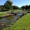
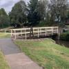
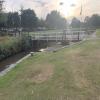
Saltway Footbridge No 19
is a minor waterways place
on the Droitwich Canals (Droitwich Barge Canal) between
Hawford Junction (Junction of Droitwich Canal with River Severn) (5 miles and 5½ furlongs
and 8 locks
to the west) and
Droitwich Junction (Junction of Droitwich Barge Canal and Droitwich Junction Canal) (¾ furlongs
and 1 lock
to the east).
The nearest place in the direction of Hawford Junction is Droitwich Barge Canal New Wharf;
¼ furlongs
away.
The nearest place in the direction of Droitwich Junction is Droitwich Town Wharf;
¼ furlongs
away.
Mooring here is unrated.
There is a swing bridge here. The bridge requires a BW key to operate it.
Railway Inn | 2½ furlongs | |
Netherwich Basin | 2 furlongs | |
Saltway Footbridge No 17 | ¾ furlongs | |
Saltway Footbridge No 18 | ½ furlongs | |
Droitwich Barge Canal New Wharf | ¼ furlongs | |
Saltway Footbridge No 19 | ||
Droitwich Town Wharf | ¼ furlongs | |
Barge Lock and Swing Bridge No 20 | ½ furlongs | |
Droitwich Junction | ¾ furlongs |
Amenities in Droitwich
Amenities at other places in Droitwich
at
at
at
at
at
at
at
at
at
at
at
at
at
at
at
at
at
at
at
at
at
at
at
There are no links to external websites from here.
Why not log in and add some (select "External websites" from the menu (sometimes this is under "Edit"))?
Mouseover for more information or show routes to facility
Nearest water point
In the direction of Hawford Junction
Netherwich Basin — 2 furlongs away
On this waterway in the direction of Hawford Junction
Holt Lock (Holt Fleet) — 8 miles, 5¼ furlongs and 8 locks away
Travel to Hawford Junction, then on the River Severn (main river - Stourport to Worcester) to Holt Lock (Holt Fleet)
Worcester Trip Boat Moorings — 9 miles, 2¾ furlongs and 9 locks away
Travel to Hawford Junction, then on the River Severn (main river - Stourport to Worcester) to Worcester Trip Boat Moorings
Diglis Locks — 10 miles, 3¼ furlongs and 9 locks away
Travel to Hawford Junction, then on the River Severn (main river - Stourport to Worcester) to Diglis Junction, then on the River Severn (main river - Worcester to Gloucester) to Diglis Locks
Diglis Services — 10 miles, 2½ furlongs and 11 locks away
Travel to Hawford Junction, then on the River Severn (main river - Stourport to Worcester) to Diglis Junction, then on the Worcester and Birmingham Canal (Diglis Junction to Diglis Basin) to Diglis Basin, then on the Worcester and Birmingham Canal (Diglis Basin to King's Norton Junction) to Diglis Services
Lincomb Lock — 12 miles, 7 furlongs and 9 locks away
Travel to Hawford Junction, then on the River Severn (main river - Stourport to Worcester) to Lincomb Lock
Lowesmoor Basin — 11 miles, 2¼ furlongs and 13 locks away
Travel to Hawford Junction, then on the River Severn (main river - Stourport to Worcester) to Diglis Junction, then on the Worcester and Birmingham Canal (Diglis Junction to Diglis Basin) to Diglis Basin, then on the Worcester and Birmingham Canal (Diglis Basin to King's Norton Junction) to Lowesmoor Basin
Upper Basin Waterpoint — 14 miles, 2¼ furlongs and 12 locks away
Travel to Hawford Junction, then on the River Severn (main river - Stourport to Worcester) to Severn - Stourport Broad Locks Entrance, then on the Staffordshire and Worcestershire Canal (Stourport Basins: Broad Route) to Stourport Upper Basin, then on the Staffordshire and Worcestershire Canal (Stourport Basins: Narrow Route) to Upper Basin Waterpoint
Caldwall Mill Bridge No 14 — 18 miles, ½ furlongs and 15 locks away
Travel to Hawford Junction, then on the River Severn (main river - Stourport to Worcester) to Severn - Stourport Broad Locks Entrance, then on the Staffordshire and Worcestershire Canal (Stourport Basins: Broad Route) to Stourport Upper Basin, then on the Staffordshire and Worcestershire Canal (Stourport Basins: Narrow Route) to York Street Bridge, then on the Staffordshire and Worcestershire Canal (Main Line: Stourport to Stourton) to Caldwall Mill Bridge No 14
In the direction of Droitwich Junction
Droitwich Spa Marina — 1 mile, 1¾ furlongs and 5 locks away
Travel to Droitwich Junction, then on the Droitwich Canals (Droitwich Junction Canal) to Droitwich Spa Marina
Hanbury Boatyard — 1 mile, 5¾ furlongs and 8 locks away
Travel to Droitwich Junction, then on the Droitwich Canals (Droitwich Junction Canal) to Hanbury Junction, then on the Worcester and Birmingham Canal (Diglis Basin to King's Norton Junction) to Hanbury Boatyard
Stoke Works Water Point — 4 miles, 1 furlong and 14 locks away
Travel to Droitwich Junction, then on the Droitwich Canals (Droitwich Junction Canal) to Hanbury Junction, then on the Worcester and Birmingham Canal (Diglis Basin to King's Norton Junction) to Stoke Works Water Point
Tardebigge Wharf — 8 miles, 1½ furlongs and 50 locks away
Travel to Droitwich Junction, then on the Droitwich Canals (Droitwich Junction Canal) to Hanbury Junction, then on the Worcester and Birmingham Canal (Diglis Basin to King's Norton Junction) to Tardebigge Wharf
Hopwood Visitor Moorings — 13 miles, 5¼ furlongs and 50 locks away
Travel to Droitwich Junction, then on the Droitwich Canals (Droitwich Junction Canal) to Hanbury Junction, then on the Worcester and Birmingham Canal (Diglis Basin to King's Norton Junction) to Hopwood Visitor Moorings
King's Norton Water Point — 16 miles, 6½ furlongs and 50 locks away
Travel to Droitwich Junction, then on the Droitwich Canals (Droitwich Junction Canal) to Hanbury Junction, then on the Worcester and Birmingham Canal (Diglis Basin to King's Norton Junction) to King's Norton Water Point
Yardley Wood Water Point — 19 miles, 3¾ furlongs and 50 locks away
Travel to Droitwich Junction, then on the Droitwich Canals (Droitwich Junction Canal) to Hanbury Junction, then on the Worcester and Birmingham Canal (Diglis Basin to King's Norton Junction) to King's Norton Junction, then on the Stratford-on-Avon Canal (Northern Section) to Yardley Wood Water PointNearest rubbish disposal
In the direction of Hawford Junction
Netherwich Basin — 2 furlongs away
On this waterway in the direction of Hawford Junction
Sabrina Footbridge — 9 miles, 1 furlong and 9 locks away
Travel to Hawford Junction, then on the River Severn (main river - Stourport to Worcester) to Sabrina Footbridge
Diglis Basin — 10 miles, 2 furlongs and 11 locks away
Travel to Hawford Junction, then on the River Severn (main river - Stourport to Worcester) to Diglis Junction, then on the Worcester and Birmingham Canal (Diglis Junction to Diglis Basin) to Diglis Basin
Lowesmoor Basin — 11 miles, 2¼ furlongs and 13 locks away
Travel to Hawford Junction, then on the River Severn (main river - Stourport to Worcester) to Diglis Junction, then on the Worcester and Birmingham Canal (Diglis Junction to Diglis Basin) to Diglis Basin, then on the Worcester and Birmingham Canal (Diglis Basin to King's Norton Junction) to Lowesmoor Basin
Upper Basin Waterpoint — 14 miles, 2¼ furlongs and 12 locks away
Travel to Hawford Junction, then on the River Severn (main river - Stourport to Worcester) to Severn - Stourport Broad Locks Entrance, then on the Staffordshire and Worcestershire Canal (Stourport Basins: Broad Route) to Stourport Upper Basin, then on the Staffordshire and Worcestershire Canal (Stourport Basins: Narrow Route) to Upper Basin Waterpoint
In the direction of Droitwich Junction
Droitwich Spa Marina — 1 mile, 1¾ furlongs and 5 locks away
Travel to Droitwich Junction, then on the Droitwich Canals (Droitwich Junction Canal) to Droitwich Spa Marina
Stoke Bottom Lock No 23 — 4 miles, 6¾ furlongs and 14 locks away
Travel to Droitwich Junction, then on the Droitwich Canals (Droitwich Junction Canal) to Hanbury Junction, then on the Worcester and Birmingham Canal (Diglis Basin to King's Norton Junction) to Stoke Bottom Lock No 23
Tardebigge Wharf — 8 miles, 1½ furlongs and 50 locks away
Travel to Droitwich Junction, then on the Droitwich Canals (Droitwich Junction Canal) to Hanbury Junction, then on the Worcester and Birmingham Canal (Diglis Basin to King's Norton Junction) to Tardebigge WharfNearest chemical toilet disposal
In the direction of Droitwich Junction
Droitwich Spa Marina — 1 mile, 1¾ furlongs and 5 locks away
Travel to Droitwich Junction, then on the Droitwich Canals (Droitwich Junction Canal) to Droitwich Spa Marina
Stoke Bottom Lock No 23 — 4 miles, 6¾ furlongs and 14 locks away
Travel to Droitwich Junction, then on the Droitwich Canals (Droitwich Junction Canal) to Hanbury Junction, then on the Worcester and Birmingham Canal (Diglis Basin to King's Norton Junction) to Stoke Bottom Lock No 23
Tardebigge Wharf — 8 miles, 1½ furlongs and 50 locks away
Travel to Droitwich Junction, then on the Droitwich Canals (Droitwich Junction Canal) to Hanbury Junction, then on the Worcester and Birmingham Canal (Diglis Basin to King's Norton Junction) to Tardebigge Wharf
In the direction of Hawford Junction
Diglis Services — 10 miles, 2½ furlongs and 11 locks away
Travel to Hawford Junction, then on the River Severn (main river - Stourport to Worcester) to Diglis Junction, then on the Worcester and Birmingham Canal (Diglis Junction to Diglis Basin) to Diglis Basin, then on the Worcester and Birmingham Canal (Diglis Basin to King's Norton Junction) to Diglis Services
Stourport Marina — 13 miles, 2¼ furlongs and 10 locks away
Travel to Hawford Junction, then on the River Severn (main river - Stourport to Worcester) to Stourport Marina
Lowesmoor Basin — 11 miles, 2¼ furlongs and 13 locks away
Travel to Hawford Junction, then on the River Severn (main river - Stourport to Worcester) to Diglis Junction, then on the Worcester and Birmingham Canal (Diglis Junction to Diglis Basin) to Diglis Basin, then on the Worcester and Birmingham Canal (Diglis Basin to King's Norton Junction) to Lowesmoor Basin
Upper Basin Waterpoint — 14 miles, 2¼ furlongs and 12 locks away
Travel to Hawford Junction, then on the River Severn (main river - Stourport to Worcester) to Severn - Stourport Broad Locks Entrance, then on the Staffordshire and Worcestershire Canal (Stourport Basins: Broad Route) to Stourport Upper Basin, then on the Staffordshire and Worcestershire Canal (Stourport Basins: Narrow Route) to Upper Basin Waterpoint
Caldwall Mill Bridge No 14 — 18 miles, ½ furlongs and 15 locks away
Travel to Hawford Junction, then on the River Severn (main river - Stourport to Worcester) to Severn - Stourport Broad Locks Entrance, then on the Staffordshire and Worcestershire Canal (Stourport Basins: Broad Route) to Stourport Upper Basin, then on the Staffordshire and Worcestershire Canal (Stourport Basins: Narrow Route) to York Street Bridge, then on the Staffordshire and Worcestershire Canal (Main Line: Stourport to Stourton) to Caldwall Mill Bridge No 14Nearest place to turn
In the direction of Droitwich Junction
Droitwich Town Wharf — ¼ furlongs away
On this waterway in the direction of Droitwich Junction
Lock No 6 Winding Hole — 6½ furlongs and 3 locks away
Travel to Droitwich Junction, then on the Droitwich Canals (Droitwich Junction Canal) to Lock No 6 Winding Hole
Droitwich Spa Marina — 1 mile, 1¾ furlongs and 5 locks away
Travel to Droitwich Junction, then on the Droitwich Canals (Droitwich Junction Canal) to Droitwich Spa Marina
Hanbury Junction — 1 mile, 4¾ furlongs and 8 locks away
Travel to Droitwich Junction, then on the Droitwich Canals (Droitwich Junction Canal) to Hanbury Junction
Hanbury Boatyard — 1 mile, 5¾ furlongs and 8 locks away
Travel to Droitwich Junction, then on the Droitwich Canals (Droitwich Junction Canal) to Hanbury Junction, then on the Worcester and Birmingham Canal (Diglis Basin to King's Norton Junction) to Hanbury Boatyard
Hanbury Junction Winding Hole — 1 mile, 6 furlongs and 8 locks away
Travel to Droitwich Junction, then on the Droitwich Canals (Droitwich Junction Canal) to Hanbury Junction, then on the Worcester and Birmingham Canal (Diglis Basin to King's Norton Junction) to Hanbury Junction Winding Hole
Dunhampstead Boatyard — 3 miles, 4¼ furlongs and 8 locks away
Travel to Droitwich Junction, then on the Droitwich Canals (Droitwich Junction Canal) to Hanbury Junction, then on the Worcester and Birmingham Canal (Diglis Basin to King's Norton Junction) to Dunhampstead Boatyard
Dunhampstead Winding Hole — 3 miles, 6¼ furlongs and 8 locks away
Travel to Droitwich Junction, then on the Droitwich Canals (Droitwich Junction Canal) to Hanbury Junction, then on the Worcester and Birmingham Canal (Diglis Basin to King's Norton Junction) to Dunhampstead Winding Hole
Tibberton Winding Hole — 4 miles, 5¾ furlongs and 8 locks away
Travel to Droitwich Junction, then on the Droitwich Canals (Droitwich Junction Canal) to Hanbury Junction, then on the Worcester and Birmingham Canal (Diglis Basin to King's Norton Junction) to Tibberton Winding Hole
Astwood Winding Hole — 3 miles, 2½ furlongs and 10 locks away
Travel to Droitwich Junction, then on the Droitwich Canals (Droitwich Junction Canal) to Hanbury Junction, then on the Worcester and Birmingham Canal (Diglis Basin to King's Norton Junction) to Astwood Winding Hole
Stoke Wharf — 4 miles, 7¼ furlongs and 15 locks away
Travel to Droitwich Junction, then on the Droitwich Canals (Droitwich Junction Canal) to Hanbury Junction, then on the Worcester and Birmingham Canal (Diglis Basin to King's Norton Junction) to Stoke Wharf
In the direction of Hawford Junction
Netherwich Basin — 2 furlongs away
On this waterway in the direction of Hawford Junction
Winding Hole (east of Salwarpe Road Bridge) — 3¼ furlongs away
On this waterway in the direction of Hawford Junction
Ladywood Top Lock Winding Hole — 3 miles away
On this waterway in the direction of Hawford Junction
Bevere Lock Weir Entrance — 5 miles, 7¾ furlongs and 8 locks away
Travel to Hawford Junction, then on the River Severn (main river - Stourport to Worcester) to Bevere Lock Weir Entrance
Bevere Lock Weir Exit — 6 miles, 2¼ furlongs and 9 locks away
Travel to Hawford Junction, then on the River Severn (main river - Stourport to Worcester) to Bevere Lock Weir Exit
Holt Lock Weir Exit — 8 miles, 4¼ furlongs and 8 locks away
Travel to Hawford Junction, then on the River Severn (main river - Stourport to Worcester) to Holt Lock Weir Exit
Holt Lock Weir Entrance — 8 miles, 7½ furlongs and 9 locks away
Travel to Hawford Junction, then on the River Severn (main river - Stourport to Worcester) to Holt Lock Weir Entrance
Diglis Junction — 10 miles, ¾ furlongs and 9 locks away
Travel to Hawford Junction, then on the River Severn (main river - Stourport to Worcester) to Diglis Junction
Diglis Locks Weir Exit — 10 miles, 4 furlongs and 10 locks away
Travel to Hawford Junction, then on the River Severn (main river - Stourport to Worcester) to Diglis Junction, then on the River Severn (main river - Worcester to Gloucester) to Diglis Locks Weir ExitNearest self-operated pump-out
In the direction of Droitwich Junction
Droitwich Spa Marina — 1 mile, 1¾ furlongs and 5 locks away
Travel to Droitwich Junction, then on the Droitwich Canals (Droitwich Junction Canal) to Droitwich Spa Marina
In the direction of Hawford Junction
Diglis Services — 10 miles, 2½ furlongs and 11 locks away
Travel to Hawford Junction, then on the River Severn (main river - Stourport to Worcester) to Diglis Junction, then on the Worcester and Birmingham Canal (Diglis Junction to Diglis Basin) to Diglis Basin, then on the Worcester and Birmingham Canal (Diglis Basin to King's Norton Junction) to Diglis ServicesNearest boatyard pump-out
In the direction of Droitwich Junction
Hanbury Boatyard — 1 mile, 5¾ furlongs and 8 locks away
Travel to Droitwich Junction, then on the Droitwich Canals (Droitwich Junction Canal) to Hanbury Junction, then on the Worcester and Birmingham Canal (Diglis Basin to King's Norton Junction) to Hanbury Boatyard
Dunhampstead Boatyard — 3 miles, 4¼ furlongs and 8 locks away
Travel to Droitwich Junction, then on the Droitwich Canals (Droitwich Junction Canal) to Hanbury Junction, then on the Worcester and Birmingham Canal (Diglis Basin to King's Norton Junction) to Dunhampstead Boatyard
In the direction of Hawford Junction
Stourport Marina — 13 miles, 2¼ furlongs and 10 locks away
Travel to Hawford Junction, then on the River Severn (main river - Stourport to Worcester) to Stourport Marina
Lowesmoor Basin — 11 miles, 2¼ furlongs and 13 locks away
Travel to Hawford Junction, then on the River Severn (main river - Stourport to Worcester) to Diglis Junction, then on the Worcester and Birmingham Canal (Diglis Junction to Diglis Basin) to Diglis Basin, then on the Worcester and Birmingham Canal (Diglis Basin to King's Norton Junction) to Lowesmoor Basin
Stourport Upper Basin — 14 miles, 2¼ furlongs and 12 locks away
Travel to Hawford Junction, then on the River Severn (main river - Stourport to Worcester) to Severn - Stourport Broad Locks Entrance, then on the Staffordshire and Worcestershire Canal (Stourport Basins: Broad Route) to Stourport Upper Basin
Upper Staircase Lock Landing Pontoon — 14 miles, 2¾ furlongs and 12 locks away
Travel to Hawford Junction, then on the River Severn (main river - Stourport to Worcester) to Severn - Stourport Broad Locks Entrance, then on the Staffordshire and Worcestershire Canal (Stourport Basins: Broad Route) to Stourport Upper Basin, then on the Staffordshire and Worcestershire Canal (Stourport Basins: Narrow Route) to Upper Staircase Lock Landing PontoonDirection of TV transmitter (From Wolfbane Cybernetic)
There is no page on Wikipedia called “Saltway Footbridge”
Results of Google Search
Bibury is a village and civil parish in Gloucestershire, England. It is on the River Coln, ... Late in the 19th century George Witts recounted the discovery of the Bibury Roman villa: "In the ... to suburbs but not in terms of roads; a footbridge connects both sides (Arlington and Bibury) as well as various footpaths in all directions.
There are no stiles but several kissing gates and one narrow footbridge. Public toilets are available in the New Street long stay car park, close to the start of theĀ ...
The streets of the old town are narrow and hilly; the town conforms to no ... 1); the Upper and Lower Saltways of later times indicate the principal road routes by ... 19) The mention of Henry I seems to point to the fact that then first had the ... And so up by the footbridge at the end of the Millmeadow by Wich highway on theĀ ...
Results 1 - 10 of 71 ... There is one low step-over stone slab stile, no other stiles but quite a few gates. The walk goes through ... Yellow Star Gray Star July 19, 2020.
... EDGBASTON TUNNEL (105 Yards); Birmingham University Footbridge (84a) ... WAST HILL TUNNEL (2726 Yards) No TowPath; Wast Hill Tunnel South Portal ... Astwood Lock 20; Astwood Lock 19; Astwood Lock 18; Astwood Lane Bridge ( 40) ... (Junction with the Droitwich Canal); Hanbury Bridge (35) carries Salt Way.
Results 1 - 10 of 73 ... The route has several steady gradients throughout, but there are no steep sections. You will need to ... was in June. My wife suffers with vertigo and found the foot bridge over the M42 difficult to cross. ... July 19, 2020. Hiking.
Footbridge. Track. Track. Track ... 11KV. & 3 No. LV. LOCAL SUBSTATION. 3 No. 11KV. EYNSHAM SUBSTATION ... Appraisal Jan19) ... Salt Way PRoW. Hollow.
The information contained on this Blog, must be checked and must not be relied upon. ... Tuesday, 17th June DAY 5 Drive 26.5 miles to Boscobel House ST19 9AR ... however, and crossed the Severn by a footbridge (not there in 1651) to The ... which lies at the junction of two Roman roads, Ryknild Street and the Saltway.