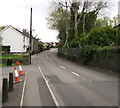
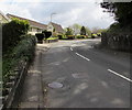
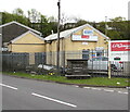
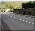
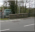
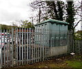
B4434 Road Bridge (Neath Canal)
Dulais Fach Road, Tonna SA10 8EP, United Kingdom
(B4434)

B4434 Road Bridge (Neath Canal)
is a minor waterways place
on the Neath and Tennant Canal - (Neath Canal) between
Briton Ferry (Terminal basin) (4 miles and 6¼ furlongs
and 1 lock
to the southwest) and
Aberdulais Junction (¾ furlongs
to the northwest).
The nearest place in the direction of Briton Ferry is Tyn-yr-Heol Lock No 1;
3½ furlongs
away.
The nearest place in the direction of Aberdulais Junction is Haverfordwest - London Railway Bridge (Neath Canal);
¼ furlongs
away.
Mooring here is unrated.
There is a bridge here which takes a minor road over the canal.
Morrisons Bridge No 1 | 1 mile, 5½ furlongs | |
Morrisons Bridge No 2 | 1 mile, 5¼ furlongs | |
Neath Basin | 1 mile, 5 furlongs | |
Prince of Wales Drive Bridge | 1 mile, 4½ furlongs | |
Tyn-yr-Heol Lock No 1 | 3½ furlongs | |
B4434 Road Bridge (Neath Canal) | ||
Haverfordwest - London Railway Bridge (Neath Canal) | ¼ furlongs | |
Aberdulais Junction | ¾ furlongs | |
Howard's Bridge | 2¾ furlongs | |
Neath Canal Footbridge No 6 | 6½ furlongs | |
Lock Machin No 2 | 1 mile, 1½ furlongs |
Amenities here
There are no links to external websites from here.
Why not log in and add some (select "External websites" from the menu (sometimes this is under "Edit"))?
Mouseover for more information or show routes to facility
No information
CanalPlan has no information on any of the following facilities within range:water point
rubbish disposal
chemical toilet disposal
place to turn
self-operated pump-out
boatyard pump-out
Direction of TV transmitter (From Wolfbane Cybernetic)
There is no page on Wikipedia called “B4434 Road Bridge”
Wikipedia pages that might relate to B4434 Road Bridge
[B roads in Zone 4 of the Great Britain numbering scheme]
B roads are numbered routes in Great Britain of lesser importance than A roads. See the article Great Britain road numbering scheme for the rationale behind
[A5199 road]
Kingsthorpe. Media related to A5199 road (England) at Wikimedia Commons Coordinates: 52°26′36″N 1°03′27″W / 52.4434°N 1.05739°W / 52.4434; -1.05739 v t e
[Melincourt Falls]
footpath from the B4434 Resolven to Tonna Road, 1-mile (1.6 km) south of Resolven. The entrance to the path is on the opposite side of the road from the public
[Portland, Oregon]
Loop (clockwise) and B Loop (counterclockwise), when it became a complete loop with the opening of the Tilikum Crossing bridge. Fifth and Sixth avenues
[Chalk Farm]
area lies between Chalk Farm Road in the east and St Pancras' western boundary to the west; an area that extends to Ainger Road and takes in part of the Primrose
[Melton Mowbray]
as one of the oldest in Britain. Funds were also used to maintain roads and bridges and repair the church clock. During the English Civil War, Melton
[Radical centrism]
ISBN 978-0-230-33912-5. Trudeau, Justin (2015). Common Ground. HarperCollins. ISBN 978-1-4434-3338-9. Whelan, Charles (2013). The Centrist Manifesto. W. W. Norton & Company
[William Lyon Mackenzie King]
of Canadian Politics from MacDonald to Mulroney. pp. 123–184. ISBN 978-1-4434-0342-9. Courtney, John C. (March 1976). "Prime Ministerial Character: An
[Railroad Museum of Pennsylvania]
building was roughly 45,000 square feet in size and included an observation bridge leading across Rolling Stock Hall, allowing visitors to see the trains from
[List of environmental books]
including fields like environmental history, has also been important in bridging divides between the sciences and humanities and encouraging further interdisciplinary
Results of Google Search
A historic walk of great natural beauty along the Neath Canal, Aberdulais to Resolven, Neath and Dulais walks. ... Skew bridge at Aberdulais, Neath Canal to left ... the Tennant Canal and under the railway, turn right to a minor road and cross the river. ... Clyne Lock (GR 798002), where the B4434 comes alongside the canal.
Jan 13, 2017 ... Viewed from the B4434 road bridge. ... SS7597 : Neath Canal and footpath, Neath. taken 3 years ago, near to Neath/Castell-Nedd, Neath Port ...
Dec 5, 2016 ... The B4288 was a short road in the Vale of Neath, Glamorgan. ... road's route from Neath to Tonna is straightforward as it is now part of the B4434. ... still there before crossing the Neath Canal and River at bridges that are not.
Neath to Skewen: A cycle route which links Skewen to the centre of Neath. .... Tennant Canal: A cycle route that has the potential to follow the alignment of the .... Pen Y Wern Road (A474), via the road bridge (B4434) into the centre of Neath.
II Bridge over Neath Canal SW of Ynys Nedd Farm ... On the S side of the main B4434 through the village on the E side of the junction with School Road, and set  ...
May 6, 2017 ... in Resolven (Resolfen), Neath, Neath Port Talbot An unusual cast iron aqueduct carrying ... Road bridge beyond ... Located in the centre of Resolven, immediately alongside Commercial Road (B4434). ... iron aqueduct in Resolven, taking a stream over the Neath Canal - see Farmer's Arms Aqueduct.