CanalPlanAC

Ditchford Railway Bridge (disused)

 
Rushden Lakes Shopping Centre, East Terrace, South Way, Rushden NN10 6FW, United Kingdom
Address is taken from a point 604 yards away.
 
Information about the place
Ditchford Railway Bridge (disused) is a minor waterways place on the River Nene (main river) between Wadenhoe Lock No 24 (14 miles and 7½ furlongs and 8 locks to the northeast) and Wollaston Lock No 12 (Great Doddington half a mile northwest) (5 miles and ¼ furlongs and 3 locks to the southwest).
 
 
The nearest place in the direction of Wadenhoe Lock No 24 is Wharf Road Footbridge (A45); 5 furlongs away.
 
The nearest place in the direction of Wollaston Lock No 12 is Ditchford Lock Weir Exit No 2 (Channel leading to the Weir); 5¼ furlongs away.

Mooring here is unrated.

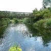
There is a bridge here which takes a disused railway over the canal.


Amenities

Amenities here

 Lidl
 Waitrose
 Waitrose Ltd
 Fayre & Square
 Needle & Awl
 Cashpoint
 Cashpoint

Amenities nearby at Wharf Road Footbridge (A45)

 Costcutter
 Queens Head
 Cashpoint
 Forecourt M-Sa 6pm Su noon
 Gulf

Amenities nearby at Ditchford Lock Weir Exit No 2

 BP
 Shell
 White Arches Caravans (P N Sharpe) Ltd
 Buildbase
 Jewson
 
Maps
If you are a user and are logged on, or if you are actively planning a route, a map will be displayed here.
Show on external mapping site: Google | OSM | Bing
 
Photos
 
External websites
There are no links to external websites from here.
Why not log in and add some (select "External websites" from the menu (sometimes this is under "Edit"))?
 
Nearest facilities

Mouseover for more information or show routes to facility

Nearest water point

In the direction of Northampton Railway Bridge

Wellingborough Embankment Visitor Moorings3 miles, 1½ furlongs and 2 locks away
On this waterway in the direction of Northampton Railway Bridge
White Mills Marina8 miles, ¾ furlongs and 7 locks away
On this waterway in the direction of Northampton Railway Bridge
Northampton Marina15 miles, 7¾ furlongs and 15 locks away
On this waterway in the direction of Northampton Railway Bridge

In the direction of Dog-in-a-Doublet Lock No 38

Blackthorn Lake Marina4 miles, 7½ furlongs and 3 locks away
On this waterway in the direction of Dog-in-a-Doublet Lock No 38
Nine Arches Bridge Visitor Moorings9 miles, 6¾ furlongs and 6 locks away
On this waterway in the direction of Dog-in-a-Doublet Lock No 38
Wadenhoe Lock Weir Entrance No 214 miles, 7¼ furlongs and 8 locks away
On this waterway in the direction of Dog-in-a-Doublet Lock No 38
Barnwell Long Term Moorings18 miles, ¼ furlongs and 10 locks away
On this waterway in the direction of Dog-in-a-Doublet Lock No 38
Upper Barnwell Lock No 2618 miles, 3 furlongs and 10 locks away
On this waterway in the direction of Dog-in-a-Doublet Lock No 38
Oundle Marina18 miles, 4½ furlongs and 11 locks away
On this waterway in the direction of Dog-in-a-Doublet Lock No 38

Nearest rubbish disposal

In the direction of Northampton Railway Bridge

White Mills Marina8 miles, ¾ furlongs and 7 locks away
On this waterway in the direction of Northampton Railway Bridge
Northampton Marina15 miles, 7¾ furlongs and 15 locks away
On this waterway in the direction of Northampton Railway Bridge

In the direction of Dog-in-a-Doublet Lock No 38

Oundle Marina18 miles, 4½ furlongs and 11 locks away
On this waterway in the direction of Dog-in-a-Doublet Lock No 38

Nearest chemical toilet disposal

In the direction of Northampton Railway Bridge

Ditchford Lock No 155¾ furlongs away
On this waterway in the direction of Northampton Railway Bridge
Wellingborough Embankment Visitor Moorings3 miles, 1½ furlongs and 2 locks away
On this waterway in the direction of Northampton Railway Bridge
White Mills Marina8 miles, ¾ furlongs and 7 locks away
On this waterway in the direction of Northampton Railway Bridge
Northampton Marina15 miles, 7¾ furlongs and 15 locks away
On this waterway in the direction of Northampton Railway Bridge

In the direction of Dog-in-a-Doublet Lock No 38

Oundle Marina18 miles, 4½ furlongs and 11 locks away
On this waterway in the direction of Dog-in-a-Doublet Lock No 38

Nearest place to turn

In the direction of Northampton Railway Bridge

Ditchford Lock Weir Exit No 25¼ furlongs away
On this waterway in the direction of Northampton Railway Bridge
Ditchford Lock Weir Entrance No 11 mile, ½ furlongs and 1 lock away
On this waterway in the direction of Northampton Railway Bridge
Lower Wellingborough Lock Weir Exit2 miles, 4¾ furlongs and 1 lock away
On this waterway in the direction of Northampton Railway Bridge
Upper Wellingborough Lock Weir Exit No 13 miles, 4¼ furlongs and 2 locks away
On this waterway in the direction of Northampton Railway Bridge
Billing Lock Weir Exit No 211 miles, 2¼ furlongs and 9 locks away
On this waterway in the direction of Northampton Railway Bridge
Billing Lock Weir Exit No 111 miles, 2¼ furlongs and 9 locks away
On this waterway in the direction of Northampton Railway Bridge
Clifford Hill Lock Weir Entrance No 112 miles, ¼ furlongs and 11 locks away
On this waterway in the direction of Northampton Railway Bridge
Weston Favell Lock Weir Exit No 212 miles, 4¾ furlongs and 11 locks away
On this waterway in the direction of Northampton Railway Bridge
Weston Favell Lock Weir Entrance No 213 miles, ¼ furlongs and 12 locks away
On this waterway in the direction of Northampton Railway Bridge
Abington Lock Weir Exit13 miles, 6¼ furlongs and 12 locks away
On this waterway in the direction of Northampton Railway Bridge

In the direction of Dog-in-a-Doublet Lock No 38

Higham Ferrers Lock Weir Entrance1 mile, 3¼ furlongs away
On this waterway in the direction of Dog-in-a-Doublet Lock No 38
Higham Ferrers Lock Weir Exit1 mile, 5½ furlongs and 1 lock away
On this waterway in the direction of Dog-in-a-Doublet Lock No 38
Irthlingborough Lock Weir Exit No 23 miles, ¼ furlongs and 2 locks away
On this waterway in the direction of Dog-in-a-Doublet Lock No 38
Ringstead Sewerage Treatment Outfall4 miles, 2¾ furlongs and 2 locks away
On this waterway in the direction of Dog-in-a-Doublet Lock No 38
Upper Ringstead Lock Weir Exit No 24 miles, 6¾ furlongs and 3 locks away
On this waterway in the direction of Dog-in-a-Doublet Lock No 38
Lower Ringstead Lock Weir Exit5 miles, 3¾ furlongs and 4 locks away
On this waterway in the direction of Dog-in-a-Doublet Lock No 38
Ringstead Arm5 miles, 4¼ furlongs and 4 locks away
On this waterway in the direction of Dog-in-a-Doublet Lock No 38
Woodford Lock Weir Entrance7 miles, 5¼ furlongs and 4 locks away
On this waterway in the direction of Dog-in-a-Doublet Lock No 38
Islip Lock Mill Race Entrance10 miles, 1 furlong and 6 locks away
On this waterway in the direction of Dog-in-a-Doublet Lock No 38
Wadenhoe Lock Weir Exit No 114 miles, 7¾ furlongs and 9 locks away
On this waterway in the direction of Dog-in-a-Doublet Lock No 38

Nearest self-operated pump-out

In the direction of Northampton Railway Bridge

Wellingborough Embankment Visitor Moorings3 miles, 1½ furlongs and 2 locks away
On this waterway in the direction of Northampton Railway Bridge
Northampton Marina15 miles, 7¾ furlongs and 15 locks away
On this waterway in the direction of Northampton Railway Bridge

In the direction of Dog-in-a-Doublet Lock No 38

Blackthorn Lake Marina4 miles, 7½ furlongs and 3 locks away
On this waterway in the direction of Dog-in-a-Doublet Lock No 38

Nearest boatyard pump-out

In the direction of Northampton Railway Bridge

White Mills Marina8 miles, ¾ furlongs and 7 locks away
On this waterway in the direction of Northampton Railway Bridge

In the direction of Dog-in-a-Doublet Lock No 38

Lilford Marina Entrance17 miles, 5 furlongs and 10 locks away
On this waterway in the direction of Dog-in-a-Doublet Lock No 38
Barnwell Long Term Moorings18 miles, ¼ furlongs and 10 locks away
On this waterway in the direction of Dog-in-a-Doublet Lock No 38
Oundle Marina18 miles, 4½ furlongs and 11 locks away
On this waterway in the direction of Dog-in-a-Doublet Lock No 38
Direction of TV transmitter (From Wolfbane Cybernetic)
 
 
Geograph
 
Wikipedia

There is no page on Wikipedia called “Ditchford Railway Bridge”

Wikipedia pages that might relate to Ditchford Railway Bridge
[Ditchford railway station] Ditchford railway station is a former railway station on Ditchford Road, Northamptonshire on the former Northampton and Peterborough Railway line which [Sandy railway station] external road bridge. However the slope to the bridge is relatively steep on both sides of the railway and the footpath on the bridge is quite narrow [Northampton Bridge Street railway station] Northampton Bridge Street is a former railway station in Northampton, the main town of Northamptonshire, on the Northampton and Peterborough Railway which connected [River Nene] carries the disused railway track bed. Between the town of Thrapston and the village of Islip, the Nene is spanned by a low nine-arched bridge. Just north of [Wansford railway station] Wansford railway station is the headquarters of the Nene Valley Railway in Cambridgeshire, England. The station building was opened in 1995 and contains [John Livock] Wellingborough London Road railway station 1845 Ditchford railway station 1845 Irthlingborough railway station 1845 Ringstead and Addington railway station 1845 Thrapston [Bedford railway station] Bedford railway station (formerly Bedford Midland Road and referred to on some signage as Bedford Midland) is the larger of two railway stations in the [Thrapston Bridge Street railway station] Thrapston Bridge Street railway station is a former railway station in Thrapston, Northamptonshire on the former Northampton and Peterborough Railway line [Woodford Halse railway station] quiet place, though visitors can still see evidence of its railway past. The twin bridges over Station Road can still be seen; below and between them [List of closed railway stations in Britain: D-F] list of closed railway stations in Britain includes the following: Year of closure is given if known. Stations reopened as heritage railways continue to
 
Google

Results of Google Search

Ditchford railway station - Wikipedia
Disused railway stations in the United Kingdom. Closed railway stations in Britain A B C D–F G H–J K–L M–O P–R S T–V W–Z. Ditchford railway station is a former railway station on Ditchford Road, Northamptonshire on the ...
Ditchford Station - Disused Stations
May 17, 2017 ... Location: East side of Ditchford Road. Company on opening: London & Birmingham Railway. Date closed to passengers: 1.11.1924.
Ditchford Railway Bridge (disused)
Ditchford Railway Bridge (disused). United Kingdom / England / Irthlingborough /. World / United Kingdom / England / Irthlingborough. bridge, railway bridge.
Rushden Research Group: Ditchford Station
The road to Ditchford from Rushden was just a lane, but it was a main route for travellers going ... Behind the railway station there was a large area, in Irthlingborough parish, where iron ore was mined. .... He has a wife and 13-year- old son.
Disused Stations: Bridge Station | Abandoned/Disused and ...
Disused Stations: Lyminge Station Railway Posters, Nostalgia. More information. More information ... Disused Stations: Ditchford Station. More information.
Walk #995: Nene Way: a walk from Wellingborough to Thrapston ...
May 4, 2018 ... A pleasant walk took me on to Ditchford Bridge, after which a rather overgrown stretch of path led me alongside an old railway line (now ...