CanalPlanAC

Plan Inclinee de St Louis-Arzviller (de niveau inférieur)

 
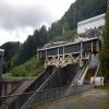
Lower level of the St Louis-Arzviller Incline Plane
Sophie-Marie, Rue des Sources, 57820 Saint-Louis, France
 
Information about the place
Plan Inclinee de St Louis-Arzviller (de niveau inférieur) is a minor waterways place on the Canal de la Marne au Rhin - Eastern Section between Gondrexange (23.68 kilometres to the west) and Marne au Rhin - L'ill Jonction (Junction of the Marne au Rhin with the L'ill Canalisée) (53.27 kilometres and 34 locks to the east).
 
 
The nearest place in the direction of Gondrexange is Plan Inclinee de St Louis-Arzviller (de niveau supérieur) (Upper level of the St Louis-Arzviller Incline Plane); 0.11 kilometres away.
 
The nearest place in the direction of Marne au Rhin - L'ill Jonction is Waiting Queue Incline Plane d'Arzviller; 0.11 kilometres away.

Mooring here is good (a nice place to moor).


Amenities
 
Maps
If you are a user and are logged on, or if you are actively planning a route, a map will be displayed here.
Show on external mapping site: Google | OSM | Bing
 
Additional information

The Marne-Rhine Canal was built from 1838 to 1853. The main problem it solved was going through the Vosges Mountains and especially climbing up its eastern side to its lower point, the Col de Saverne. This was first solved by means of a ladder of seventeen locks, allowing an overall level change of 44.45 metres over a distance of 4 kilometres.[1] In 1969, these locks were replaced by the Saint-Louis-Arzviller inclined plane. (Wikipedia)

 
Photos
 
External websites
 VisuRiS — associated with Waterways of Mainland Europe
The official inland waterway resource for Belgium with actual traffic and planned operations on the waterways. Also has voyage planning and notices to mariners
 
Nearest facilities

Mouseover for more information or show routes to facility

Nearest water point

In the direction of Marne au Rhin - Rhin Jonction

Halte Nautique de Lutzelbourg - Amont RB3.25 km and 3 locks away
On this waterway in the direction of Marne au Rhin - Rhin Jonction
Halte Nautique de Lutzelbourg - Milieu LB4.05 km and 4 locks away
On this waterway in the direction of Marne au Rhin - Rhin Jonction
Halte Nautique de Lutzelbourg-Aval LB4.47 km and 5 locks away
On this waterway in the direction of Marne au Rhin - Rhin Jonction
Halte Nautique Bassin de Saverne LB13.58 km and 14 locks away
On this waterway in the direction of Marne au Rhin - Rhin Jonction

In the direction of Moselle - Marne au Rhin Jonction (est)

On this waterway in the direction of Moselle - Marne au Rhin Jonction (est)
Port de Plaisance de Hesse13.94 km away
On this waterway in the direction of Moselle - Marne au Rhin Jonction (est) Travel to Marne au Rhin - La Sarre Jonction, then on the Canal de la Sarre to Port de Plaisance du Houillon Travel to Marne au Rhin - La Sarre Jonction, then on the Canal de la Sarre to Ecluse 1 de Kerprich-aux-Bois

Nearest rubbish disposal

In the direction of Marne au Rhin - Rhin Jonction

Halte Nautique de Lutzelbourg - Amont RB3.25 km and 3 locks away
On this waterway in the direction of Marne au Rhin - Rhin Jonction
Halte Nautique de Lutzelbourg-Aval LB4.47 km and 5 locks away
On this waterway in the direction of Marne au Rhin - Rhin Jonction
Picknick-Platz unter Baumen RB9.25 km and 10 locks away
On this waterway in the direction of Marne au Rhin - Rhin Jonction
Halte Nautique Bassin de Saverne LB13.58 km and 14 locks away
On this waterway in the direction of Marne au Rhin - Rhin Jonction
Halte Nautique de Steinbourg RB17.95 km and 19 locks away
On this waterway in the direction of Marne au Rhin - Rhin Jonction

In the direction of Moselle - Marne au Rhin Jonction (est)

On this waterway in the direction of Moselle - Marne au Rhin Jonction (est)

Nearest place to turn

In the direction of Moselle - Marne au Rhin Jonction (est)

On this waterway in the direction of Moselle - Marne au Rhin Jonction (est)

No information

CanalPlan has no information on any of the following facilities within range:
chemical toilet disposal
self-operated pump-out
boatyard pump-out
 
 
Geograph
 
Wikipedia

There is no page on Wikipedia called “Plan Inclinee de St Louis-Arzviller”

 
Google

Results of Google Search

Saint-Louis-Arzviller inclined plane - Wikipedia
The Saint-Louis-Arzviller inclined plane is an inclined plane on the Marne-Rhine Canal that enables the canal to cross the Vosges Mountains. It is located in the ...
LE PLAN INCLINE DE RONQUIERES-Belgique - YouTube
Jul 24, 2015 ... St-Louis/Arzviller Incline on the Marne-Rhine Canal in Alsace, France. Dick1Wolfe. Dick1Wolfe. •. 1.5M views 6 years ago ...
Plan incliné de Saint-Louis-Arzviller — Wikipédia
Le plan incliné de Saint-Louis-Arzviller est un ascenseur à bateaux qui fait partie du canal de la ... bateau sur un chariot le long d'une rampe inclinée à l'aide d'un contrepoids d'équilibrage. ... en haut, car il s'arrête 20 cm en dessous du niveau du canal, et un peu moins en bas, puisqu'il s'arrête 20 cm au-dessus du canal.
France: Saint-Louis-Arzviller inclined plane / Plan incliné à bateaux ...
Dec 7, 2008 ... The Saint-Louis-Arzviller inclined plane is situated on the Marne-Rhine Canal between the towns of Saint-Louis and Arzviller. Is was opened in 1969 and repla. .. ... The change in level is 44.55 meters. Show less Show more.
Plan Incliné
... ou par mail : info@plan-incline.com. Réservez vos billets. Le Plan Incliné de Saint-Louis Arzviller est un ascenseur à bateaux unique en son genre en Europe .
Arzviller Inclined Plane - Review of Le Plan Incline, Saint-Louis ...
Le Plan Incline: Arzviller Inclined Plane - See 312 traveler reviews, 197 candid photos, and great deals for Saint-Louis, France, at Tripadvisor.
The Saint-Louis Arzviller Inclined Plane - Tourism & Holiday Guide
The Saint-Louis Arzviller inclined plane is no less than a boat lift with a level change of 45 metres, integrated into the Marne-Rhine canal. It enables boats ...