CanalPlanAC

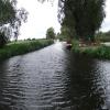
Isleham Lock Weir Entrance

 
Channel leading to the Weir
Kingfisher, West Suffolk CB7 5GJ, United Kingdom
Address is taken from a point 309 yards away.
 
Information about the place
Isleham Lock Weir Entrance is a minor waterways place on the River Great Ouse (River Lark) between West Row Bridge (Judes Ferry) (1 mile and 6¼ furlongs to the east) and Prickwillow Bridge (6 miles and 1¾ furlongs and 1 lock to the northwest).
 
 
The nearest place in the direction of West Row Bridge is River Lark - Lee Brook Junction (Junction of the River Lark and the Lee Brook); 6¼ furlongs away.
 
The nearest place in the direction of Prickwillow Bridge is Isleham Lock No 26; 3¼ furlongs away.

Mooring here is unrated.

You can wind here.

West Row Bridge1 mile, 6¼ furlongs
River Lark - Lee Brook Junction6¼ furlongs
Isleham Lock Weir Entrance
Isleham Lock No 263¼ furlongs
Isleham Lock Weir Exit3½ furlongs
Prickwillow Winding Hole6 miles, 1¾ furlongs
Prickwillow Bridge6 miles, 1¾ furlongs
Prickwillow Visitor Moorings (EA)6 miles, 2 furlongs
 
 
Amenities
 
Maps
If you are a user and are logged on, or if you are actively planning a route, a map will be displayed here.
Show on external mapping site: Google | OSM | Bing
 
Photos
 
External websites
 Great Ouse Navigation | boating, moorings, navigation notices — associated with River Great Ouse
Information regarding the Great Ouse navigation and tributaries.
  Information for boaters on the River Great Ouse - GOV.UK  — associated with River Great Ouse
River Great Ouse: bridge heights, locks, overhead power lines and facilities.
 Facebook Account — associated with River Great Ouse
Anglian Waterways Manager Facebook Account
 Facebook Anglian Waterways Page — associated with River Great Ouse
Facebook Page for Environment Agency Anglian Waterways
 
Nearest facilities

Mouseover for more information or show routes to facility

Nearest water point

Nearest rubbish disposal

Nearest place to turn

In the direction of Old West River - River Lark Junction

Isleham Lock Weir Exit3½ furlongs and 1 lock away
On this waterway in the direction of Old West River - River Lark Junction
Prickwillow Winding Hole6 miles, 1¾ furlongs and 1 lock away
On this waterway in the direction of Old West River - River Lark Junction
Old West River - River Lark Junction8 miles, 2½ furlongs and 1 lock away
On this waterway in the direction of Old West River - River Lark Junction
Holmes River Junction10 miles, 1¾ furlongs and 1 lock away
Travel to Old West River - River Lark Junction, then on the River Great Ouse (Old West River - Large River) to Holmes River Junction
Willow Walk Winding Hole11 miles, 7¼ furlongs and 1 lock away
Travel to Old West River - River Lark Junction, then on the River Great Ouse (Old West River - Large River) to Willow Walk Winding Hole
Brandon Creek Junction13 miles, 5¾ furlongs and 1 lock away
Travel to Old West River - River Lark Junction, then on the River Great Ouse (Old West River - Large River) to Brandon Creek Junction
Great Ouse - Braham Dock Junction13 miles, 6¼ furlongs and 1 lock away
Travel to Old West River - River Lark Junction, then on the River Great Ouse (Old West River - Large River) to Great Ouse - Braham Dock Junction
Pope's Corner15 miles, 5¾ furlongs and 1 lock away
Travel to Old West River - River Lark Junction, then on the River Great Ouse (Old West River - Large River) to Pope's Corner
Fish and Duck Marina15 miles, 6½ furlongs and 1 lock away
Travel to Old West River - River Lark Junction, then on the River Great Ouse (Old West River - Large River) to Pope's Corner, then on the River Cam (Main river - Large River) to Fish and Duck Marina
Little Ouse - Lakenheath Lode Junction19 miles, 2¼ furlongs and 1 lock away
Travel to Old West River - River Lark Junction, then on the River Great Ouse (Old West River - Large River) to Brandon Creek Junction, then on the River Great Ouse (Little Ouse or Brandon Creek) to Little Ouse - Lakenheath Lode Junction
Wicken Lode Junction19 miles, 1¾ furlongs and 2 locks away
Travel to Old West River - River Lark Junction, then on the River Great Ouse (Old West River - Large River) to Pope's Corner, then on the River Cam (Main river - Large River) to Cam - Reach Lode Junction, then on the River Cam (Burwell Lode) to Wicken Lode Junction

Nearest self-operated pump-out

Direction of TV transmitter (From Wolfbane Cybernetic)
 
 
Geograph
 
Wikipedia

There is no page on Wikipedia called “Isleham Lock Weir Entrance”

 
Google

Results of Google Search

Richmond Lock and Weir
Richmond Lock and Weir PLA owns and operates Richmond Lock and Weir, ... Each gate weighs 32.6 tonnes and is 20 metres wide and 3.64 metres in depth.
Shifford Lock - Wikipedia
Shifford Lock is a lock on the River Thames in England. It is in the centre of a triangle formed by ... The original flash lock was in a weir close to the entrance to Great Brook. This was removed between 1829 and 1853, and there were later ...
Display PDF in separate tab
1)Approaching any of the river controls, weirs, sluices, locks etc. ... (i) After entering the lock, lower the vertical gate. (ii) Open the ...... Isleham Marina. Fenbank.
Bell Weir Lock - Wikipedia
Bell Weir Lock is a lock on the River Thames in England by the right bank, Runnymede which is ... upstream of the terrace of a hotel and the a bridge designed by Edwin Lutyens who designed an ornamental park gate house along the reach.
Fenland Tour 2001 Page 19
We went out of the boater operable Isleham Lock at 13.45. ... At the entrance to the tiny dyke like Lee Brook (outlet onto the River Lark of the River ... Frogmoore managed to wind before the weir, but Earnest just failed and got stuck across what ...
Boveney Lock - Wikipedia
Boveney Lock is a lock on the River Thames situated on the Buckinghamshire bank opposite ... on the old site. The weir is almost parallel to the lock, running across from the other side of the lock island. ... On the Berkshire bank the river passes Bush Ait which is at the entrance to Clewer Mill Stream. There are houses at ...
River Stour: locks and facilities - GOV.UK
Apr 1, 2014 ... River Stour locks; Public slipways and canoe access; Byelaws on ... boat on the 4km stretch from Ballingdon bridge to Henny Street Weir only.