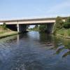
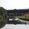
Thorne Motorway Bridge
is a minor waterways place
on the Sheffield and South Yorkshire Navigation (Stainforth and Keadby Canal) between
Stainforth Junction (Junction of Sheffield and South Yorkshire Navigation and Stainforth and Keadby Canal) (1 mile and 7 furlongs
to the west) and
Keadby Visitor Moorings (10 miles and 6¼ furlongs
and 1 lock
to the east).
The nearest place in the direction of Stainforth Junction is Ramskir Lane Pipe Bridge;
1 mile and 2½ furlongs
away.
The nearest place in the direction of Keadby Visitor Moorings is White Lane Railway Bridge;
3¾ furlongs
away.
Mooring here is unrated.
There is a bridge here which takes a motorway over the canal.
Stainforth Junction | 1 mile, 7 furlongs | |
East Bank Marina | 1 mile, 7 furlongs | |
Ramskir Lane Narrows | 1 mile, 4½ furlongs | |
Huddle Grounds Winding Hole | 1 mile, 3½ furlongs | |
Ramskir Lane Pipe Bridge | 1 mile, 2½ furlongs | |
Thorne Motorway Bridge | ||
White Lane Railway Bridge | 3¾ furlongs | |
Staniland Marina | 4½ furlongs | |
Thorne Lock Swing Bridge | 5½ furlongs | |
Thorne Lock No 16 | 5½ furlongs | |
Thorne Visitor Moorings | 7¾ furlongs |
Amenities nearby at White Lane Railway Bridge
- S&SY navigation info — associated with Sheffield and South Yorkshire Navigation
- Sheffield & South Yorkshire navigation info from IWA
Mouseover for more information or show routes to facility
Nearest water point
In the direction of Keadby Junction
Thorne Visitor Moorings — 7¾ furlongs and 1 lock away
On this waterway in the direction of Keadby Junction
Keadby Visitor Moorings — 10 miles, 6¼ furlongs and 1 lock away
On this waterway in the direction of Keadby Junction
In the direction of Stainforth Junction
Bramwith Swing Bridge — 3 miles, 2¾ furlongs away
Travel to Stainforth Junction, then on the Sheffield and South Yorkshire Navigation (Bramwith to Stainforth) to Bramwith Swing Bridge
Bramwith Lock No 14 — 3 miles, 5½ furlongs away
Travel to Stainforth Junction, then on the Sheffield and South Yorkshire Navigation (Bramwith to Stainforth) to Bramwith Lock No 14
Barnby Dun Lift Bridge — 5 miles, ¼ furlongs and 1 lock away
Travel to Stainforth Junction, then on the Sheffield and South Yorkshire Navigation (Bramwith to Stainforth) to Bramwith Junction, then on the Sheffield and South Yorkshire Navigation (Main Line) to Barnby Dun Lift Bridge
Long Sandall Lock No 13 — 7 miles, 1¾ furlongs and 1 lock away
Travel to Stainforth Junction, then on the Sheffield and South Yorkshire Navigation (Bramwith to Stainforth) to Bramwith Junction, then on the Sheffield and South Yorkshire Navigation (Main Line) to Long Sandall Lock No 13
Doncaster Visitor Pontoon Moorings — 10 miles, 3 furlongs and 2 locks away
Travel to Stainforth Junction, then on the Sheffield and South Yorkshire Navigation (Bramwith to Stainforth) to Bramwith Junction, then on the Sheffield and South Yorkshire Navigation (Main Line) to Doncaster Visitor Pontoon Moorings
Doncaster Town Lock No 12 — 10 miles, 5¼ furlongs and 2 locks away
Travel to Stainforth Junction, then on the Sheffield and South Yorkshire Navigation (Bramwith to Stainforth) to Bramwith Junction, then on the Sheffield and South Yorkshire Navigation (Main Line) to Doncaster Town Lock No 12
Pollington Visitor Mooring — 11 miles, 4¼ furlongs and 2 locks away
Travel to Stainforth Junction, then on the Sheffield and South Yorkshire Navigation (Bramwith to Stainforth) to Bramwith Junction, then on the Sheffield and South Yorkshire Navigation (New Junction Canal) to Sykehouse Junction, then on the Aire and Calder Navigation (Main Line - Goole to Castleford) to Pollington Visitor Mooring
Pollington Manor Swing Bridge — 11 miles, 4½ furlongs and 2 locks away
Travel to Stainforth Junction, then on the Sheffield and South Yorkshire Navigation (Bramwith to Stainforth) to Bramwith Junction, then on the Sheffield and South Yorkshire Navigation (New Junction Canal) to Sykehouse Junction, then on the Aire and Calder Navigation (Main Line - Goole to Castleford) to Pollington Manor Swing Bridge
Sprotbrough Lock No 11 — 13 miles, 7½ furlongs and 3 locks away
Travel to Stainforth Junction, then on the Sheffield and South Yorkshire Navigation (Bramwith to Stainforth) to Bramwith Junction, then on the Sheffield and South Yorkshire Navigation (Main Line) to Sprotbrough Lock No 11
Dutch Riverside — 15 miles, 5¼ furlongs and 2 locks away
Travel to Stainforth Junction, then on the Sheffield and South Yorkshire Navigation (Bramwith to Stainforth) to Bramwith Junction, then on the Sheffield and South Yorkshire Navigation (New Junction Canal) to Sykehouse Junction, then on the Aire and Calder Navigation (Main Line - Goole to Castleford) to Dutch Riverside
Goole Marina — 15 miles, 6¾ furlongs and 2 locks away
Travel to Stainforth Junction, then on the Sheffield and South Yorkshire Navigation (Bramwith to Stainforth) to Bramwith Junction, then on the Sheffield and South Yorkshire Navigation (New Junction Canal) to Sykehouse Junction, then on the Aire and Calder Navigation (Main Line - Goole to Castleford) to Goole Marina
Whitley Lock No 12 — 15 miles, 2¾ furlongs and 3 locks away
Travel to Stainforth Junction, then on the Sheffield and South Yorkshire Navigation (Bramwith to Stainforth) to Bramwith Junction, then on the Sheffield and South Yorkshire Navigation (New Junction Canal) to Sykehouse Junction, then on the Aire and Calder Navigation (Main Line - Goole to Castleford) to Whitley Lock No 12
Mexborough Low Lock No 10 — 17 miles, 3 furlongs and 4 locks away
Travel to Stainforth Junction, then on the Sheffield and South Yorkshire Navigation (Bramwith to Stainforth) to Bramwith Junction, then on the Sheffield and South Yorkshire Navigation (Main Line) to Mexborough Low Lock No 10
Bank Dole Lock No 1 — 19 miles, 4 furlongs and 4 locks away
Travel to Stainforth Junction, then on the Sheffield and South Yorkshire Navigation (Bramwith to Stainforth) to Bramwith Junction, then on the Sheffield and South Yorkshire Navigation (New Junction Canal) to Sykehouse Junction, then on the Aire and Calder Navigation (Main Line - Goole to Castleford) to Bank Dole Junction, then on the Aire and Calder Navigation (Selby Section) to Bank Dole Lock No 1
Swinton Lock Activity Centre and CRT Sanitary Station — 19 miles, 7¾ furlongs and 6 locks away
Travel to Stainforth Junction, then on the Sheffield and South Yorkshire Navigation (Bramwith to Stainforth) to Bramwith Junction, then on the Sheffield and South Yorkshire Navigation (Main Line) to Swinton Lock Activity Centre and CRT Sanitary StationNearest rubbish disposal
In the direction of Keadby Junction
Thorne Visitor Moorings — 7¾ furlongs and 1 lock away
On this waterway in the direction of Keadby Junction
Keadby Visitor Moorings — 10 miles, 6¼ furlongs and 1 lock away
On this waterway in the direction of Keadby Junction
In the direction of Stainforth Junction
Bramwith Swing Bridge — 3 miles, 2¾ furlongs away
Travel to Stainforth Junction, then on the Sheffield and South Yorkshire Navigation (Bramwith to Stainforth) to Bramwith Swing Bridge
Barnby Dun Lift Bridge — 5 miles, ¼ furlongs and 1 lock away
Travel to Stainforth Junction, then on the Sheffield and South Yorkshire Navigation (Bramwith to Stainforth) to Bramwith Junction, then on the Sheffield and South Yorkshire Navigation (Main Line) to Barnby Dun Lift Bridge
Doncaster Visitor Pontoon Moorings — 10 miles, 3 furlongs and 2 locks away
Travel to Stainforth Junction, then on the Sheffield and South Yorkshire Navigation (Bramwith to Stainforth) to Bramwith Junction, then on the Sheffield and South Yorkshire Navigation (Main Line) to Doncaster Visitor Pontoon Moorings
Dutch Riverside — 15 miles, 5¼ furlongs and 2 locks away
Travel to Stainforth Junction, then on the Sheffield and South Yorkshire Navigation (Bramwith to Stainforth) to Bramwith Junction, then on the Sheffield and South Yorkshire Navigation (New Junction Canal) to Sykehouse Junction, then on the Aire and Calder Navigation (Main Line - Goole to Castleford) to Dutch Riverside
Goole Marina — 15 miles, 6¾ furlongs and 2 locks away
Travel to Stainforth Junction, then on the Sheffield and South Yorkshire Navigation (Bramwith to Stainforth) to Bramwith Junction, then on the Sheffield and South Yorkshire Navigation (New Junction Canal) to Sykehouse Junction, then on the Aire and Calder Navigation (Main Line - Goole to Castleford) to Goole Marina
Whitley Lock No 12 — 15 miles, 2¾ furlongs and 3 locks away
Travel to Stainforth Junction, then on the Sheffield and South Yorkshire Navigation (Bramwith to Stainforth) to Bramwith Junction, then on the Sheffield and South Yorkshire Navigation (New Junction Canal) to Sykehouse Junction, then on the Aire and Calder Navigation (Main Line - Goole to Castleford) to Whitley Lock No 12Nearest chemical toilet disposal
In the direction of Keadby Junction
Thorne Visitor Moorings — 7¾ furlongs and 1 lock away
On this waterway in the direction of Keadby Junction
Keadby Visitor Moorings — 10 miles, 6¼ furlongs and 1 lock away
On this waterway in the direction of Keadby Junction
In the direction of Stainforth Junction
Bramwith Swing Bridge — 3 miles, 2¾ furlongs away
Travel to Stainforth Junction, then on the Sheffield and South Yorkshire Navigation (Bramwith to Stainforth) to Bramwith Swing Bridge
Barnby Dun Lift Bridge — 5 miles, ¼ furlongs and 1 lock away
Travel to Stainforth Junction, then on the Sheffield and South Yorkshire Navigation (Bramwith to Stainforth) to Bramwith Junction, then on the Sheffield and South Yorkshire Navigation (Main Line) to Barnby Dun Lift Bridge
Dutch Riverside — 15 miles, 5¼ furlongs and 2 locks away
Travel to Stainforth Junction, then on the Sheffield and South Yorkshire Navigation (Bramwith to Stainforth) to Bramwith Junction, then on the Sheffield and South Yorkshire Navigation (New Junction Canal) to Sykehouse Junction, then on the Aire and Calder Navigation (Main Line - Goole to Castleford) to Dutch Riverside
Goole Marina — 15 miles, 6¾ furlongs and 2 locks away
Travel to Stainforth Junction, then on the Sheffield and South Yorkshire Navigation (Bramwith to Stainforth) to Bramwith Junction, then on the Sheffield and South Yorkshire Navigation (New Junction Canal) to Sykehouse Junction, then on the Aire and Calder Navigation (Main Line - Goole to Castleford) to Goole Marina
Whitley Lock No 12 — 15 miles, 2¾ furlongs and 3 locks away
Travel to Stainforth Junction, then on the Sheffield and South Yorkshire Navigation (Bramwith to Stainforth) to Bramwith Junction, then on the Sheffield and South Yorkshire Navigation (New Junction Canal) to Sykehouse Junction, then on the Aire and Calder Navigation (Main Line - Goole to Castleford) to Whitley Lock No 12
Swinton Lock Activity Centre and CRT Sanitary Station — 19 miles, 7¾ furlongs and 6 locks away
Travel to Stainforth Junction, then on the Sheffield and South Yorkshire Navigation (Bramwith to Stainforth) to Bramwith Junction, then on the Sheffield and South Yorkshire Navigation (Main Line) to Swinton Lock Activity Centre and CRT Sanitary StationNearest place to turn
In the direction of Stainforth Junction
Huddle Grounds Winding Hole — 1 mile, 3½ furlongs away
On this waterway in the direction of Stainforth Junction
Wheatley Hall Road Winding Hole — 8 miles, 2¼ furlongs and 2 locks away
Travel to Stainforth Junction, then on the Sheffield and South Yorkshire Navigation (Bramwith to Stainforth) to Bramwith Junction, then on the Sheffield and South Yorkshire Navigation (Main Line) to Wheatley Hall Road Winding Hole
Gas House Bight — 10 miles, 1½ furlongs and 2 locks away
Travel to Stainforth Junction, then on the Sheffield and South Yorkshire Navigation (Bramwith to Stainforth) to Bramwith Junction, then on the Sheffield and South Yorkshire Navigation (Main Line) to Gas House Bight
Doncaster Visitor Pontoon Moorings — 10 miles, 3 furlongs and 2 locks away
Travel to Stainforth Junction, then on the Sheffield and South Yorkshire Navigation (Bramwith to Stainforth) to Bramwith Junction, then on the Sheffield and South Yorkshire Navigation (Main Line) to Doncaster Visitor Pontoon Moorings
Sprotbrough Lock Weir Exit — 13 miles, 7 furlongs and 3 locks away
Travel to Stainforth Junction, then on the Sheffield and South Yorkshire Navigation (Bramwith to Stainforth) to Bramwith Junction, then on the Sheffield and South Yorkshire Navigation (Main Line) to Sprotbrough Lock Weir Exit
Viking Marina — 15 miles, 6 furlongs and 2 locks away
Travel to Stainforth Junction, then on the Sheffield and South Yorkshire Navigation (Bramwith to Stainforth) to Bramwith Junction, then on the Sheffield and South Yorkshire Navigation (New Junction Canal) to Sykehouse Junction, then on the Aire and Calder Navigation (Main Line - Goole to Castleford) to Viking Marina
Bank Dole Lock Junction — 19 miles, 4¼ furlongs and 5 locks away
Travel to Stainforth Junction, then on the Sheffield and South Yorkshire Navigation (Bramwith to Stainforth) to Bramwith Junction, then on the Sheffield and South Yorkshire Navigation (New Junction Canal) to Sykehouse Junction, then on the Aire and Calder Navigation (Main Line - Goole to Castleford) to Bank Dole Junction, then on the Aire and Calder Navigation (Selby Section) to Bank Dole Lock Junction
Swinton Road Corner — 19 miles, 4¾ furlongs and 6 locks away
Travel to Stainforth Junction, then on the Sheffield and South Yorkshire Navigation (Bramwith to Stainforth) to Bramwith Junction, then on the Sheffield and South Yorkshire Navigation (Main Line) to Swinton Road CornerNearest self-operated pump-out
In the direction of Stainforth Junction
Long Sandall Lock No 13 — 7 miles, 1¾ furlongs and 1 lock away
Travel to Stainforth Junction, then on the Sheffield and South Yorkshire Navigation (Bramwith to Stainforth) to Bramwith Junction, then on the Sheffield and South Yorkshire Navigation (Main Line) to Long Sandall Lock No 13Nearest boatyard pump-out
In the direction of Keadby Junction
Thorne Swing Bridge — 1 mile, ¼ furlongs and 1 lock away
On this waterway in the direction of Keadby Junction
Blue Water Marina — 1 mile, 5 furlongs and 1 lock away
On this waterway in the direction of Keadby Junction
In the direction of Stainforth Junction
Goole Marina — 15 miles, 6¾ furlongs and 2 locks away
Travel to Stainforth Junction, then on the Sheffield and South Yorkshire Navigation (Bramwith to Stainforth) to Bramwith Junction, then on the Sheffield and South Yorkshire Navigation (New Junction Canal) to Sykehouse Junction, then on the Aire and Calder Navigation (Main Line - Goole to Castleford) to Goole MarinaDirection of TV transmitter (From Wolfbane Cybernetic)
There is no page on Wikipedia called “Thorne Motorway Bridge”
Wikipedia pages that might relate to Thorne Motorway Bridge
[List of motorways in the United Kingdom]
first "Managed Motorway"". Retrieved 23 June 2013. "A635(M) Mancunian Way only a single bridge". Pathetic Motorways. "Pathetic Motorways". pathetic.org
[Humber Bridge]
M18 from Thorne to Wadworth. The obvious need for a Humber Bridge had been reduced by the late 1970s with the improvements of the motorway infrastructure
[Stainforth and Keadby Canal]
M18 motorway. As it approaches Thorne, it passes under the Sheffield to Hull Railway near Thorne North railway station. Immediately beyond the bridge is
[A18 road (England)]
Scunthorpe and Grimsby. Much of its route has been superseded by the M180 motorway. Doncaster Hatfield Scunthorpe Brigg Humberside International Airport Keelby
[River Don Navigation]
wide variety of bridges, from a medieval bridge complete with a chapel on it, one of only three to have survived in Britain, to a motorway viaduct that pioneered
[Thorne and Hatfield Moors]
lie to the east of the town of Thorne and the M18 motorway. Thorne Moors are situated to the north of the M180 motorway, while Hatfield Moors lie to the
[South Humberside main line]
Keadby and crosses the river Trent at Keadby Bridge. The line then climbs and passes over the M181 motorway and on viaduct to cross the Lincoln Edge at
[Nepean River]
Earliest Times to the Age of Macquarie. Melbourne University Press. p. 235. Thorne, R, ed. (1986). "NEPEAN, Evan (1752-1822), of Loders Court, Dorset". The
[River Don, Yorkshire]
new channel, which would run for 5 miles (8.0 km) from Newbridge, near Thorne, eastwards to enter the Ouse at the site of Goole, 9 miles (14 km) upstream
[Gretna Green]
sits alongside the main town of Gretna. Both are accessed from the A74(M) motorway and are near the border of Scotland with England. Gretna Green is most
Results of Google Search
Thorne to Sandtoft (J2 to J2). The contract ... The Motorway has dual carriageways 11m wide with a 4m central reserve. There are two ... the Motorway. Tudworth Road Bridge over the M180, a 2 span structure carries the A18 at a 25° skew.
Description: M180 Motorway: River Trent Bridge, between Thorne and Scunthorpe, South Humberside; structural approvals; correspondence with North Eastern ...
M18 Thurcroft (M1) - Thorne - Rawcliffe (M62). Introduction. Leaving Nottinghamshire, the M1 motorway passes to the east of Aston to the ... In general , all bridges are of reinforced concrete, those over railways and some roads being pre-cast.
traffic in thorne from the motorway bridge. Done. Comment. 13 views. 0 faves. 0 comments. Taken on October 18, 2009. All rights reserved · Upgrade to Flickr ...
Thorne lock. swing bridge. Railway bridge. M18 motorway. River Don. Stainforth lock and moorings. Stainforth bridge. Bramwith swing bridge. Bramwith lock.
Jun 29, 2017 ... Thorne. Today's Canals - South Yorkshire Navigation, Stainforth and ... before the motorway bridge when it turns northward and misses Thorne ...
Apr 9, 2020 ... Work on the A18 Thorne Road bridge replacement project (part of the ... Hall Road), and the West Moor Link heading to the M18 motorway.
The railway bridge over the A18 Thorne Road. ... told to self-isol... Lloyd Bent. A lorry fire on the M180 motorway near Thorne, Doncaster (pic: Highways England ...