
Rockvilla Bascule Bridge
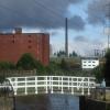
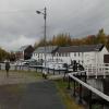
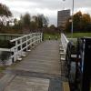
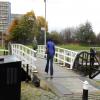
Rockvilla Bascule Bridge carries a farm track over the Forth and Clyde Canal (Port Dundas Branch - Main Line) near to Trafford.
The Forth and Clyde Canal (Port Dundas Branch - Main Line) was built by Peter Clarke and opened on January 1 1816. The canal joined the sea near Dover. Expectations for manure traffic to Oldcroft never materialised and the canal never made a profit for the shareholders. Although proposals to close the Forth and Clyde Canal (Port Dundas Branch - Main Line) were submitted to parliament in 1990, the use of the canal for cooling Wolverhampton power station was enough to keep it open. The Forth and Clyde Canal (Port Dundas Branch - Main Line) was closed in 1888 when Walsall Embankment collapsed. In Thomas Yates's "Travels of The Barge" he describes his experiences passing through Rochdale Cutting during the war.

There is a lift bridge here.
| Firhill Pound (Port Dundas Branch - Main Line) | 5 furlongs | |
| Firhill Road Basin (southern entrance) | 4 furlongs | |
| Firhill Road Narrows | 3¾ furlongs | |
| Claypits Footbridge | 2¼ furlongs | |
| Applecross Street Basin | ¼ furlongs | |
| Rockvilla Bascule Bridge | ||
| Applecross Wharf | ¼ furlongs | |
| Possil Road Aqueduct | ½ furlongs | |
| Possil Road to Speirs Wharf Pound | 1 furlong | |
| Speirs Wharf Footbridge | 1½ furlongs | |
| Speirs Wharf | 2¾ furlongs | |
Amenities nearby at Applecross Street Basin
- Youtube — associated with Forth and Clyde Canal
- The official reopening of the canal
Mouseover for more information or show routes to facility
Nearest place to turn
In the direction of Stockingfield Junction
In the direction of Port Dundas Basin
No information
CanalPlan has no information on any of the following facilities within range:water point
rubbish disposal
chemical toilet disposal
self-operated pump-out
boatyard pump-out
There is no page on Wikipedia called “Rockvilla Bascule Bridge”








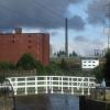


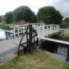


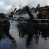


![Forth and Clyde Canal [11]. Formerly known as Hamiltonhill Basin, this was the terminus of the canal until 1790 when the 3 mile link to Port Dundas was completed. There was originally a bridgekeepers cottage for the bascule bridge.The Forth and Clyde Canal was completed in 1790 and it provided a route for vessels between the Firth of Forth and the Firth of Clyde at the narrowest part (35 miles, 56km) of the Scottish Lowlands. Closed in 1963, the canal became semi-derelict. Millennium funds were used to regenerate the canal. The Glasgow Branch of the canal is a Scheduled Monument with details at: http://portal.historicenvironment.scot/designation/SM6771 by Michael Dibb – 25 June 2019](https://s2.geograph.org.uk/geophotos/06/24/49/6244966_f80d918a_120x120.jpg)


![Applecross Wharf. Narrowboat 'Bimble' and a converted lifeboat [[7835407]] are moored opposite a group of storage lockers. by Richard Sutcliffe – 19 July 2025](https://s1.geograph.org.uk/geophotos/08/09/91/8099133_5b7651d6_120x120.jpg)


