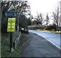
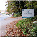
Site of Entrance to Wallbridge Basin
The junction between the Stroudwater Navigation and the Thames & Severn Canal.
Also known as: Wallbridge, The Point
Rodborough GL5 3JG, United Kingdom

Site of Entrance to Wallbridge Basin
is a major waterways place
at the junction of
the Cotswold Canals (Stroudwater Navigation - Un-navigable Section)
with
the Cotswold Canals (Thames and Severn Canal - Wide section).
Saul Junction Marina
is on
the Cotswold Canals (Stroudwater Navigation - Navigable Section),
6 miles and 5¾ furlongs
and 12 locks
to the west.
Bourne Lock No 8 (Rescued 1995)
is on
the Cotswold Canals (Thames and Severn Canal - Wide/long lock section),
2 miles and 7¼ furlongs
and 7 locks
to the southeast.
The nearest place in the direction of Saul Junction Marina is Painswick Stream joins Stroudwater Navigation;
¾ furlongs
away.
The nearest place in the direction of Bourne Lock No 8 is Wallbridge Lower Lock No 1 (Wallbridge Lower Lock was officially opened by His Royal Highness The Prince of Wales on 2nd. February 2018.);
½ furlongs
away.
Mooring here is unrated.
Cotswold Canals (Stroudwater Navigation - Un-navigable Section) | ||
---|---|---|
Foundry Lock No 1 | 4¼ furlongs | |
Dudbridge Locks Bypass Channel | 4 furlongs | |
Chestnut Lane Bridge | 2¾ furlongs | |
Strachan's Close Slipway | 2½ furlongs | |
Lodgemore Lane Bridge | 1 furlong | |
Painswick Stream joins Stroudwater Navigation | ¾ furlongs | |
Site of Entrance to Wallbridge Basin | ||
Cotswold Canals (Thames and Severn Canal - Wide section) | ||
Site of Entrance to Wallbridge Basin | ||
Wallbridge Lower Lock No 1 | ½ furlongs | |
Bankfield House | 1 furlong | |
Brewery Bridge (Wallbridge) | 1¼ furlongs | |
Wallbridge Bridge | 1½ furlongs | |
Cotswold Canals Trust Visitor Centre - Stroud | 1½ furlongs |
Amenities here
Amenities nearby at Wallbridge Lower Lock No 1
Amenities nearby at Painswick Stream joins Stroudwater Navigation
Originally, the Stroudwater Navigation would have turned into Wallbridge Basin just beyond the original gate to the basin. The basin has long since been infilled.
There are no links to external websites from here.
Why not log in and add some (select "External websites" from the menu (sometimes this is under "Edit"))?
Mouseover for more information or show routes to facility
Nearest water point
In the direction of Walk Bridge
Saul Junction Marina — 6 miles, 5¾ furlongs and 12 locks away
Travel to Walk Bridge, then on the Cotswold Canals (Stroudwater Navigation - Navigable Section) to Saul Junction Marina
Saul Junction Winding Hole — 6 miles, 7¼ furlongs and 12 locks away
Travel to Walk Bridge, then on the Cotswold Canals (Stroudwater Navigation - Navigable Section) to Saul Junction, then on the Gloucester and Sharpness Canal to Saul Junction Winding Hole
Cotswold Canals Trust Visitor Centre - Saul Junction — 7 miles and 12 locks away
Travel to Walk Bridge, then on the Cotswold Canals (Stroudwater Navigation - Navigable Section) to Saul Junction, then on the Gloucester and Sharpness Canal to Cotswold Canals Trust Visitor Centre - Saul Junction
Fretherne Bridge — 7 miles, 5¼ furlongs and 12 locks away
Travel to Walk Bridge, then on the Cotswold Canals (Stroudwater Navigation - Navigable Section) to Saul Junction, then on the Gloucester and Sharpness Canal to Fretherne Bridge
Splatt Bridge — 8 miles, 6 furlongs and 12 locks away
Travel to Walk Bridge, then on the Cotswold Canals (Stroudwater Navigation - Navigable Section) to Saul Junction, then on the Gloucester and Sharpness Canal to Splatt Bridge
Patch Bridge — 10 miles, 4¾ furlongs and 12 locks away
Travel to Walk Bridge, then on the Cotswold Canals (Stroudwater Navigation - Navigable Section) to Saul Junction, then on the Gloucester and Sharpness Canal to Patch Bridge
Sellars Bridge — 10 miles, 5 furlongs and 12 locks away
Travel to Walk Bridge, then on the Cotswold Canals (Stroudwater Navigation - Navigable Section) to Saul Junction, then on the Gloucester and Sharpness Canal to Sellars Bridge
Purton Lower Bridge — 13 miles, ½ furlongs and 12 locks away
Travel to Walk Bridge, then on the Cotswold Canals (Stroudwater Navigation - Navigable Section) to Saul Junction, then on the Gloucester and Sharpness Canal to Purton Lower Bridge
Llanthony Pontoons — 14 miles, 3 furlongs and 12 locks away
Travel to Walk Bridge, then on the Cotswold Canals (Stroudwater Navigation - Navigable Section) to Saul Junction, then on the Gloucester and Sharpness Canal to Llanthony Pontoons
Llanthony Road Bridge — 14 miles, 3¾ furlongs and 12 locks away
Travel to Walk Bridge, then on the Cotswold Canals (Stroudwater Navigation - Navigable Section) to Saul Junction, then on the Gloucester and Sharpness Canal to Llanthony Road Bridge
Gloucester Waterways Museum Arm — 14 miles, 4¼ furlongs and 12 locks away
Travel to Walk Bridge, then on the Cotswold Canals (Stroudwater Navigation - Navigable Section) to Saul Junction, then on the Gloucester and Sharpness Canal to Gloucester Waterways Museum Arm
Gloucester Dock Lock — 14 miles, 5 furlongs and 12 locks away
Travel to Walk Bridge, then on the Cotswold Canals (Stroudwater Navigation - Navigable Section) to Saul Junction, then on the Gloucester and Sharpness Canal to Gloucester Dock LockNearest rubbish disposal
In the direction of Walk Bridge
Saul Junction Marina — 6 miles, 5¾ furlongs and 12 locks away
Travel to Walk Bridge, then on the Cotswold Canals (Stroudwater Navigation - Navigable Section) to Saul Junction Marina
Saul Junction Winding Hole — 6 miles, 7¼ furlongs and 12 locks away
Travel to Walk Bridge, then on the Cotswold Canals (Stroudwater Navigation - Navigable Section) to Saul Junction, then on the Gloucester and Sharpness Canal to Saul Junction Winding Hole
Fretherne Bridge — 7 miles, 5¼ furlongs and 12 locks away
Travel to Walk Bridge, then on the Cotswold Canals (Stroudwater Navigation - Navigable Section) to Saul Junction, then on the Gloucester and Sharpness Canal to Fretherne Bridge
Parkend Bridge — 8 miles, 3½ furlongs and 12 locks away
Travel to Walk Bridge, then on the Cotswold Canals (Stroudwater Navigation - Navigable Section) to Saul Junction, then on the Gloucester and Sharpness Canal to Parkend Bridge
Splatt Bridge — 8 miles, 6 furlongs and 12 locks away
Travel to Walk Bridge, then on the Cotswold Canals (Stroudwater Navigation - Navigable Section) to Saul Junction, then on the Gloucester and Sharpness Canal to Splatt Bridge
Patch Bridge — 10 miles, 4¾ furlongs and 12 locks away
Travel to Walk Bridge, then on the Cotswold Canals (Stroudwater Navigation - Navigable Section) to Saul Junction, then on the Gloucester and Sharpness Canal to Patch Bridge
Sellars Bridge — 10 miles, 5 furlongs and 12 locks away
Travel to Walk Bridge, then on the Cotswold Canals (Stroudwater Navigation - Navigable Section) to Saul Junction, then on the Gloucester and Sharpness Canal to Sellars Bridge
Purton Lower Bridge — 13 miles, ½ furlongs and 12 locks away
Travel to Walk Bridge, then on the Cotswold Canals (Stroudwater Navigation - Navigable Section) to Saul Junction, then on the Gloucester and Sharpness Canal to Purton Lower Bridge
Sharpness Barge Arm — 14 miles, 3¾ furlongs and 12 locks away
Travel to Walk Bridge, then on the Cotswold Canals (Stroudwater Navigation - Navigable Section) to Saul Junction, then on the Gloucester and Sharpness Canal to Sharpness Barge Arm
Llanthony Road Bridge — 14 miles, 3¾ furlongs and 12 locks away
Travel to Walk Bridge, then on the Cotswold Canals (Stroudwater Navigation - Navigable Section) to Saul Junction, then on the Gloucester and Sharpness Canal to Llanthony Road BridgeNearest chemical toilet disposal
In the direction of Walk Bridge
Saul Junction Marina — 6 miles, 5¾ furlongs and 12 locks away
Travel to Walk Bridge, then on the Cotswold Canals (Stroudwater Navigation - Navigable Section) to Saul Junction Marina
Cotswold Canals Trust Visitor Centre - Saul Junction — 7 miles and 12 locks away
Travel to Walk Bridge, then on the Cotswold Canals (Stroudwater Navigation - Navigable Section) to Saul Junction, then on the Gloucester and Sharpness Canal to Cotswold Canals Trust Visitor Centre - Saul Junction
Sharpness Barge Arm — 14 miles, 3¾ furlongs and 12 locks away
Travel to Walk Bridge, then on the Cotswold Canals (Stroudwater Navigation - Navigable Section) to Saul Junction, then on the Gloucester and Sharpness Canal to Sharpness Barge Arm
Llanthony Road Bridge — 14 miles, 3¾ furlongs and 12 locks away
Travel to Walk Bridge, then on the Cotswold Canals (Stroudwater Navigation - Navigable Section) to Saul Junction, then on the Gloucester and Sharpness Canal to Llanthony Road BridgeNearest place to turn
In the direction of Walk Bridge
Ryeford Winding Hole — 2 miles, ½ furlongs and 4 locks away
On the Cotswold Canals (Stroudwater Navigation - Un-navigable Section) in the direction of Walk Bridge
The Ocean — 3 miles, ¼ furlongs and 4 locks away
On the Cotswold Canals (Stroudwater Navigation - Un-navigable Section) in the direction of Walk Bridge
Saul Junction Winding Hole — 6 miles, 7¼ furlongs and 12 locks away
Travel to Walk Bridge, then on the Cotswold Canals (Stroudwater Navigation - Navigable Section) to Saul Junction, then on the Gloucester and Sharpness Canal to Saul Junction Winding Hole
Pegthorne Bridge Winding Hole — 7 miles, 3¾ furlongs and 12 locks away
Travel to Walk Bridge, then on the Cotswold Canals (Stroudwater Navigation - Navigable Section) to Saul Junction, then on the Gloucester and Sharpness Canal to Pegthorne Bridge Winding Hole
Quedgeley Oil Depot — 10 miles, 6¼ furlongs and 12 locks away
Travel to Walk Bridge, then on the Cotswold Canals (Stroudwater Navigation - Navigable Section) to Saul Junction, then on the Gloucester and Sharpness Canal to Quedgeley Oil Depot
Monk Meadow Dock — 14 miles, ½ furlongs and 12 locks away
Travel to Walk Bridge, then on the Cotswold Canals (Stroudwater Navigation - Navigable Section) to Saul Junction, then on the Gloucester and Sharpness Canal to Monk Meadow Dock
Sharpness Barge Arm — 14 miles, 3¾ furlongs and 12 locks away
Travel to Walk Bridge, then on the Cotswold Canals (Stroudwater Navigation - Navigable Section) to Saul Junction, then on the Gloucester and Sharpness Canal to Sharpness Barge Arm
Gloucester Docks — 14 miles, 4½ furlongs and 12 locks away
Travel to Walk Bridge, then on the Cotswold Canals (Stroudwater Navigation - Navigable Section) to Saul Junction, then on the Gloucester and Sharpness Canal to Gloucester Docks
Waterways Office (South Wales and Severn Waterways) - Canal & River Trust — 14 miles, 4¾ furlongs and 12 locks away
Travel to Walk Bridge, then on the Cotswold Canals (Stroudwater Navigation - Navigable Section) to Saul Junction, then on the Gloucester and Sharpness Canal to Waterways Office (South Wales and Severn Waterways) - Canal & River Trust
Gloucester / Sharpness - Severn Junction — 14 miles, 5¼ furlongs and 13 locks away
Travel to Walk Bridge, then on the Cotswold Canals (Stroudwater Navigation - Navigable Section) to Saul Junction, then on the Gloucester and Sharpness Canal to Gloucester / Sharpness - Severn Junction
Upper Parting Junction — 17 miles, 2 furlongs and 13 locks away
Travel to Walk Bridge, then on the Cotswold Canals (Stroudwater Navigation - Navigable Section) to Saul Junction, then on the Gloucester and Sharpness Canal to Gloucester / Sharpness - Severn Junction, then on the River Severn (main river - Worcester to Gloucester) to Upper Parting Junction
Over Winding Hole — 16 miles, 5 furlongs and 14 locks away
Travel to Walk Bridge, then on the Cotswold Canals (Stroudwater Navigation - Navigable Section) to Saul Junction, then on the Gloucester and Sharpness Canal to Gloucester / Sharpness - Severn Junction, then on the River Severn (old river navigation) to Lower Parting, then on the River Severn (Maisemore Channel - Southern Section) to Over Junction, then on the Hereford and Gloucester Canal to Over Winding Hole
In the direction of Bourne Mill Bridge
Brimscombe Port — 2 miles, 6 furlongs and 7 locks away
On the Cotswold Canals (Thames and Severn Canal - Wide section) in the direction of Bourne Mill BridgeNearest self-operated pump-out
In the direction of Walk Bridge
Cotswold Canals Trust Visitor Centre - Saul Junction — 7 miles and 12 locks away
Travel to Walk Bridge, then on the Cotswold Canals (Stroudwater Navigation - Navigable Section) to Saul Junction, then on the Gloucester and Sharpness Canal to Cotswold Canals Trust Visitor Centre - Saul Junction
Purton Lower Bridge — 13 miles, ½ furlongs and 12 locks away
Travel to Walk Bridge, then on the Cotswold Canals (Stroudwater Navigation - Navigable Section) to Saul Junction, then on the Gloucester and Sharpness Canal to Purton Lower Bridge
Llanthony Pontoons — 14 miles, 3 furlongs and 12 locks away
Travel to Walk Bridge, then on the Cotswold Canals (Stroudwater Navigation - Navigable Section) to Saul Junction, then on the Gloucester and Sharpness Canal to Llanthony PontoonsNearest boatyard pump-out
In the direction of Walk Bridge
Saul Junction Marina — 6 miles, 5¾ furlongs and 12 locks away
Travel to Walk Bridge, then on the Cotswold Canals (Stroudwater Navigation - Navigable Section) to Saul Junction Marina
Patch Bridge — 10 miles, 4¾ furlongs and 12 locks away
Travel to Walk Bridge, then on the Cotswold Canals (Stroudwater Navigation - Navigable Section) to Saul Junction, then on the Gloucester and Sharpness Canal to Patch BridgeDirection of TV transmitter (From Wolfbane Cybernetic)
There is no page on Wikipedia called “Site of Entrance to Wallbridge Basin”
Wikipedia pages that might relate to Site of Entrance to Wallbridge Basin
[Thames and Severn Canal]
to Cirencester added a further 1.5 miles (2.4 km). The first 2 1⁄2 miles (4.0 km) from Wallbridge to Brimscombe, where there was a transhipment basin
[Stroudwater Navigation]
with the Wallbridge to Hope Mill section of the Thames and Severn. A second bid to the Heritage Lottery Fund for the connection from Stonehouse to the Gloucester
[List of Canadian appeals to the Judicial Committee of the Privy Council, 1910–19]
cases of the Judicial Committee of the Privy Council originating in Canada, and decided in the years 1910 to 1919. List of Canadian appeals to the Judicial
Results of Google Search
Feb 26, 2018 ... Wallbridge Basin marked the terminus of the Stroudwater Navigation in Stroud. The basin has long since been infilled, however the route of the ...
Wallbridge has expanded its Fenelon Gold project with the strategic acquisition ... in a large portfolio of nickel-copper-PGM projects in Ontario's Sudbury Basin.
Wallbridge basin. Geoff Beckerleg · ← Entrance Foyer, Minchinhampton Market House Flat Conversion →. Skills. Posted on. 2015-05-29. Home · Services ...
Journal International Journal of River Basin Management Latest Articles ... concrete (SLC) elements as scour countermeasures at wing wall bridge abutments.
SITE VISIT. Sudbury, Ont. — For many years, the mines around Sudbury were a settled story: two big companies, one big intrusion that hosted all the big ...
Feb 6, 2014 ... ... 15 kilometres in diameter collided with what is now the Sudbury basin. ... sites on Earth and on other planets, has teamed up with Wallbridge ...