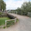
Station Road Bridge No 6 (Sankey Canal)
Ferry Tavern car park, Station Road, Warrington WA5 2UH, United Kingdom

Station Road Bridge No 6 (Sankey Canal)
is a minor waterways place
on the Sankey Canal (Main Line) between
Mersey - Sankey Junction (Junction of the River Mersey and the Sankey Canal ) (4 miles and ¼ furlongs
and 1 lock
to the west) and
Sankey - Penny Bridge - Gerard's Bridge Junction (Junction of the Sankey Canal Main Line with the Penny Bridge and Gerard's Bridge Branches) (9 miles and 1½ furlongs
and 9 locks
to the northwest).
The nearest place in the direction of Mersey - Sankey Junction is Sankey Sliding Footbridge No 5;
1¼ furlongs
away.
The nearest place in the direction of Sankey - Penny Bridge - Gerard's Bridge Junction is Hall Nook Footbridge No 7;
2½ furlongs
away.
Mooring here is unrated.
There is a bridge here which takes a track over the canal.
Sankey Footbridge No 2 | 2 miles, 4½ furlongs | |
Sankey Bridge No 3 | 1 mile, 2 furlongs | |
Sankey Bridge No 4 | 2¾ furlongs | |
Fiddlers Ferry Lock Entrance | 1¾ furlongs | |
Sankey Sliding Footbridge No 5 | 1¼ furlongs | |
Station Road Bridge No 6 (Sankey Canal) | ||
Hall Nook Footbridge No 7 | 2½ furlongs | |
Sankey Footbridge No 8 | 1 mile, 1¾ furlongs | |
Liverpool Road Railway bridge | 1 mile, 3 furlongs | |
Liverpool Road Swing Bridge | 1 mile, 3½ furlongs | |
Liverpool Road Bridge No 9 | 1 mile, 3¾ furlongs |
There are no links to external websites from here.
Why not log in and add some (select "External websites" from the menu (sometimes this is under "Edit"))?
Mouseover for more information or show routes to facility
Nearest place to turn
In the direction of Mersey - Sankey Junction
Waterloo Bridge Winding Hole — 19 miles, 7½ furlongs and 12 locks away
Travel to Mersey - Sankey Junction, then on the River Mersey (Tidal Section) to Irwell Navigation Junction, then on the Manchester Ship Canal (Walton Lock Branch) to Walton Junction, then on the Manchester Ship Canal (Main Line) to Bridgewater Canal Junction (closed), then on the Bridgewater Canal (Runcorn Locks Branch) to Waterloo Bridge (Runcorn), then on the Bridgewater Canal (Main Line) to Waterloo Bridge Winding HoleNo information
CanalPlan has no information on any of the following facilities within range:water point
rubbish disposal
chemical toilet disposal
self-operated pump-out
boatyard pump-out
Direction of TV transmitter (From Wolfbane Cybernetic)
There is no page on Wikipedia called “Station Road Bridge No 6”
Wikipedia pages that might relate to Station Road Bridge No 6
[Lea Bridge Road]
road are the Lea Valley Park, Lea Bridge railway station and the Baker's Arms area. Formerly the Lea Bridge Stadium was located along Lea Bridge Road
[Station Road Bridge]
The Station Road Bridge, near Brecksville, Ohio, was built in 1882. It spans the Cuyahoga River between Cuyahoga County and Summit County, Ohio. It was
[Digha–Sonpur Bridge]
The Digha–Sonpur bridge (Hindi: दीघा-सोनपुर पुल) or J.P. Setu (Hindi: जेपी सेतु) is a rail-cum-road bridge across river Ganga, connecting Digha Ghat in
[Forth Road Bridge]
Forth Road Bridge is a suspension bridge in east central Scotland. The bridge opened in 1964 and at the time was the longest suspension bridge in the
[Lea Bridge railway station]
Anglia. The station is located on Argall Way, close to its junction with Lea Bridge Road (A104) and Orient Way, serving the areas of Lea Bridge and Leyton
[Blackfriars Bridge]
Blackfriars Bridge is a road and foot traffic bridge over the River Thames in London, between Waterloo Bridge and Blackfriars Railway Bridge, carrying the
[Øresund Bridge]
railway and motorway bridge across the Øresund strait between Sweden and Denmark. It is the longest combined road and rail bridge in Europe, running nearly
[List of road–rail bridges]
Road–rail bridges are bridges shared by road and rail lines. Road and rail may be segregated so that trains may operate at the same time as cars (e.g
[Bogibeel Bridge]
Bogibeel bridge is a combined road and rail bridge over the Brahmaputra River in the northeastern Indian state of Assam between Dhemaji district and Dibrugarh
[A6 road (England)]
of a former railway station; a bridge carries the road over the Lancaster Canal. At Catterall, it meets the B6430 – the original A6 route – and crosses
Results of Google Search
Sankey Bridges railway station - WikipediaSankey Bridges railway station was in southwestern Warrington, England. It was located immediately west of a swing bridge over the Sankey Canal. The station site is to the south of Old Liverpool Road, Warrington. The station was built and operated by the St Helens and Runcorn Gap Railway, which was absorbed into the ...
6. 7. 8. 9. 1. 2. 3. 4. 5. 6. 7. 8. 9. Vulcan Village. Cinnamon. Brow. Gorse Covert. Leigh. Padgate. Campus. (Crab Lane). Cinnamon. Lane. Woolston ... Widnes Road. Tannery Lane. Chapel Road. Station Road. Coronation. Drive. Greystone. Road. Penketh. Lane Ends. Sankey Bridges. Crosfields. Altrincham. Epping. Drive.
The Stort Navigation is the canalised section of the River Stort running 22 kilometres (14 mi) from the town of Bishop's Stortford, Hertfordshire, downstream to its confluence with the River Lee Navigation at Feildes Weir near Rye House, Hoddesdon, Hertfordshire.
Apr 18, 2015 ... There were no mistakes in finding the Sankey Valley Visitor Centre, and it seemed we were off to a good start. .... The canal disappears in the stretch skirting the edge of Newton Common, but after Penkford Bridge, which carries the main road from St Helens to Newton-le-Willows, the canal is once again in ...
ROUTE 62A: From Warrington via Warrington Bus Station via Leigh St, Sankey St , Bold St, Suez St, Bridge St, Mersey St, Wilderspool Causeway, Chester Rd, Old .... Waterloo Rd, Runcorn/Widnes Bridge, High St, Leiria Way, Busway to Bridge St, Hlaton Rd, Picton Ave, Latham Ave, Boston Ave, Festival Way, Grangway, ...
SankeyCanal. Gatewarth. Household. Refuse Site. Chester Road. R iv e r. M e rs e y. N. TRANS PENNINE TRAIL. ROADS. RIVERS &. CANALS. OTHER PATHS. RAILWAYS. London Road to Warrington t Ch t t Whit h h to Warrington. Knutsford Road. Cantilever. High-Level. Road Bridge. ACCESS TO TRAIL. Manchester ...
Jan 31, 2018 ... During the 18th Century St Helens had developed as a coal mining and manufacturing area but it suffered from having no navigable river and so all goods had to go by road which was slow and difficult. In 1757 the Sankey Brook Navigation Canal was opened between St Helens and Sankey Bridges on the ...
Sep 29, 2017 ... 6 comments. SANKEY Canal is set to be restored thanks to a new partnership. The Sankey Canal Restoration Society (SCARS) has teamed up with the ... But after the use of waterways to transport cargo declined, the canal was shut in 1963 and can no longer be navigated as the M62 and several roads ...
Longford Bridge. Birchwood. Station. Holes. Lane. Bridge. Barracks. Swing- bridge. Leisure. Centre. Kingsway. Bridge. Warrington. Central. Bank Quay. Bridge. Sankey. Viaduct. Halton's Bridge. Doe Green. Golf. Driving Range. Swing -bridge. Lumb Brook. Bridge. Latchford. Locks. Grappenhall. Bridge. (No 2). Grappenhall.
Jun 22, 2017 ... ALMOST 30 homes could be demolished to pave the way for a high-level bridge across Manchester Ship Canal as part of a £150 million scheme. The authority is considering six options to connect the A56 or A5060 Chester Road with the A562 or A57 Sankey Way in Great Sankey to tackle congestion.