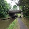
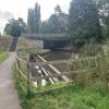
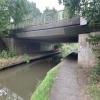
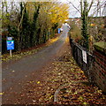
Salwarpe Road Bridge 13 carries a farm track over the Droitwich Canals (Droitwich Barge Canal) near to Rotherham Tunnel.
Early plans of what would become the Droitwich Canals (Droitwich Barge Canal) were drawn up by John Longbotham in 1835 but problems with Walsall Boat Lift caused delays and it was finally opened on 17 September 1876. In 1905 the Ambersbury and Basildon Canal built a branch to join at Bridgend. According to Peter Thomas's "Spooky Things on the Canals" booklet, Harrogate Cutting is haunted by a shrieking ghost that has no language but a cry.

Salwarpe Road Bridge 13
is a minor waterways place
on the Droitwich Canals (Droitwich Barge Canal) between
Hawford Junction (Junction of Droitwich Canal with River Severn) (5 miles and 2 furlongs
and 8 locks
to the southwest) and
Droitwich Junction (Junction of Droitwich Barge Canal and Droitwich Junction Canal) (4½ furlongs
and 1 lock
to the east).
The nearest place in the direction of Hawford Junction is Stouton Croft Footbridge No 12;
1¾ furlongs
away.
The nearest place in the direction of Droitwich Junction is Winding Hole (east of Salwarpe Road Bridge);
¼ furlongs
away.
There is access (via steps) to the towpath here.
Mooring here is unrated.
There is a bridge here which takes a minor road over the canal.
| Ombersley Way Bridge No 9 | 1 mile, ½ furlongs | |
| Valley Way Footbridge No 10 | 6¾ furlongs | |
| Briar Mill Bridge No 11 | 5 furlongs | |
| Siding Lane Wharf | 4¾ furlongs | |
| Stouton Croft Footbridge No 12 | 1¾ furlongs | |
| Salwarpe Road Bridge 13 | ||
| Winding Hole (east of Salwarpe Road Bridge) | ¼ furlongs | |
| Droitwich Spa Railway Bridge No 2 (14) | ¾ furlongs | |
| Droitwich Spa Railway Bridge No 1 (15) | ¾ furlongs | |
| Netherwich Bridge No 16 | 1¼ furlongs | |
| Railway Inn | 1¼ furlongs | |
Amenities here
Amenities nearby at Stouton Croft Footbridge No 12
Amenities nearby at Winding Hole (east of Salwarpe Road Bridge)
Amenities in Droitwich
Amenities at other places in Droitwich
There are no links to external websites from here.
Why not log in and add some (select "External websites" from the menu (sometimes this is under "Edit"))?
Why not log in and add some (select "External websites" from the menu (sometimes this is under "Edit"))?
Mouseover for more information or show routes to facility
Nearest water point
In the direction of Droitwich Junction
Netherwich Basin — 1¾ furlongs away
On this waterway in the direction of Droitwich Junction
Droitwich Spa Marina — 1 mile, 5¼ furlongs and 5 locks away
Travel to Droitwich Junction, then on the Droitwich Canals (Droitwich Junction Canal) to Droitwich Spa Marina
Hanbury Boatyard — 2 miles, 1½ furlongs and 8 locks away
Travel to Droitwich Junction, then on the Droitwich Canals (Droitwich Junction Canal) to Hanbury Junction, then on the Worcester and Birmingham Canal (Diglis Basin to King's Norton Junction) to Hanbury Boatyard
Stoke Works Water Point — 4 miles, 4¾ furlongs and 14 locks away
Travel to Droitwich Junction, then on the Droitwich Canals (Droitwich Junction Canal) to Hanbury Junction, then on the Worcester and Birmingham Canal (Diglis Basin to King's Norton Junction) to Stoke Works Water Point
Tardebigge Wharf — 8 miles, 5¼ furlongs and 50 locks away
Travel to Droitwich Junction, then on the Droitwich Canals (Droitwich Junction Canal) to Hanbury Junction, then on the Worcester and Birmingham Canal (Diglis Basin to King's Norton Junction) to Tardebigge Wharf
Hopwood Visitor Moorings — 14 miles, ¾ furlongs and 50 locks away
Travel to Droitwich Junction, then on the Droitwich Canals (Droitwich Junction Canal) to Hanbury Junction, then on the Worcester and Birmingham Canal (Diglis Basin to King's Norton Junction) to Hopwood Visitor Moorings
King's Norton Water Point — 17 miles, 2¼ furlongs and 50 locks away
Travel to Droitwich Junction, then on the Droitwich Canals (Droitwich Junction Canal) to Hanbury Junction, then on the Worcester and Birmingham Canal (Diglis Basin to King's Norton Junction) to King's Norton Water Point
Yardley Wood Water Point — 19 miles, 7½ furlongs and 50 locks away
Travel to Droitwich Junction, then on the Droitwich Canals (Droitwich Junction Canal) to Hanbury Junction, then on the Worcester and Birmingham Canal (Diglis Basin to King's Norton Junction) to King's Norton Junction, then on the Stratford-on-Avon Canal (Northern Section) to Yardley Wood Water Point
In the direction of Hawford Junction
Holt Lock (Holt Fleet) — 8 miles, 1½ furlongs and 8 locks away
Travel to Hawford Junction, then on the River Severn (main river - Stourport to Worcester) to Holt Lock (Holt Fleet)
Worcester Trip Boat Moorings — 8 miles, 7 furlongs and 9 locks away
Travel to Hawford Junction, then on the River Severn (main river - Stourport to Worcester) to Worcester Trip Boat Moorings
Diglis Locks — 9 miles, 7½ furlongs and 9 locks away
Travel to Hawford Junction, then on the River Severn (main river - Stourport to Worcester) to Diglis Junction, then on the River Severn (main river - Worcester to Gloucester) to Diglis Locks
Diglis Services — 9 miles, 6¾ furlongs and 11 locks away
Travel to Hawford Junction, then on the River Severn (main river - Stourport to Worcester) to Diglis Junction, then on the Worcester and Birmingham Canal (Diglis Junction to Diglis Basin) to Diglis Basin, then on the Worcester and Birmingham Canal (Diglis Basin to King's Norton Junction) to Diglis Services
Lincomb Lock — 12 miles, 3¼ furlongs and 9 locks away
Travel to Hawford Junction, then on the River Severn (main river - Stourport to Worcester) to Lincomb Lock
Lowesmoor Basin — 10 miles, 6½ furlongs and 13 locks away
Travel to Hawford Junction, then on the River Severn (main river - Stourport to Worcester) to Diglis Junction, then on the Worcester and Birmingham Canal (Diglis Junction to Diglis Basin) to Diglis Basin, then on the Worcester and Birmingham Canal (Diglis Basin to King's Norton Junction) to Lowesmoor Basin
Upper Basin Waterpoint — 13 miles, 6¾ furlongs and 12 locks away
Travel to Hawford Junction, then on the River Severn (main river - Stourport to Worcester) to Severn - Stourport Broad Locks Entrance, then on the Staffordshire and Worcestershire Canal (Stourport Basins: Broad Route) to Stourport Upper Basin, then on the Staffordshire and Worcestershire Canal (Stourport Basins: Narrow Route) to Upper Basin Waterpoint
Caldwall Mill Bridge No 14 — 17 miles, 5 furlongs and 15 locks away
Travel to Hawford Junction, then on the River Severn (main river - Stourport to Worcester) to Severn - Stourport Broad Locks Entrance, then on the Staffordshire and Worcestershire Canal (Stourport Basins: Broad Route) to Stourport Upper Basin, then on the Staffordshire and Worcestershire Canal (Stourport Basins: Narrow Route) to York Street Bridge, then on the Staffordshire and Worcestershire Canal (Main Line: Stourport to Stourton) to Caldwall Mill Bridge No 14Nearest rubbish disposal
In the direction of Droitwich Junction
Netherwich Basin — 1¾ furlongs away
On this waterway in the direction of Droitwich Junction
Droitwich Spa Marina — 1 mile, 5¼ furlongs and 5 locks away
Travel to Droitwich Junction, then on the Droitwich Canals (Droitwich Junction Canal) to Droitwich Spa Marina
Stoke Bottom Lock No 23 — 5 miles, 2½ furlongs and 14 locks away
Travel to Droitwich Junction, then on the Droitwich Canals (Droitwich Junction Canal) to Hanbury Junction, then on the Worcester and Birmingham Canal (Diglis Basin to King's Norton Junction) to Stoke Bottom Lock No 23
Tardebigge Wharf — 8 miles, 5¼ furlongs and 50 locks away
Travel to Droitwich Junction, then on the Droitwich Canals (Droitwich Junction Canal) to Hanbury Junction, then on the Worcester and Birmingham Canal (Diglis Basin to King's Norton Junction) to Tardebigge Wharf
In the direction of Hawford Junction
Sabrina Footbridge — 8 miles, 5¼ furlongs and 9 locks away
Travel to Hawford Junction, then on the River Severn (main river - Stourport to Worcester) to Sabrina Footbridge
Diglis Basin — 9 miles, 6¼ furlongs and 11 locks away
Travel to Hawford Junction, then on the River Severn (main river - Stourport to Worcester) to Diglis Junction, then on the Worcester and Birmingham Canal (Diglis Junction to Diglis Basin) to Diglis Basin
Lowesmoor Basin — 10 miles, 6½ furlongs and 13 locks away
Travel to Hawford Junction, then on the River Severn (main river - Stourport to Worcester) to Diglis Junction, then on the Worcester and Birmingham Canal (Diglis Junction to Diglis Basin) to Diglis Basin, then on the Worcester and Birmingham Canal (Diglis Basin to King's Norton Junction) to Lowesmoor Basin
Upper Basin Waterpoint — 13 miles, 6¾ furlongs and 12 locks away
Travel to Hawford Junction, then on the River Severn (main river - Stourport to Worcester) to Severn - Stourport Broad Locks Entrance, then on the Staffordshire and Worcestershire Canal (Stourport Basins: Broad Route) to Stourport Upper Basin, then on the Staffordshire and Worcestershire Canal (Stourport Basins: Narrow Route) to Upper Basin WaterpointNearest chemical toilet disposal
In the direction of Droitwich Junction
Droitwich Spa Marina — 1 mile, 5¼ furlongs and 5 locks away
Travel to Droitwich Junction, then on the Droitwich Canals (Droitwich Junction Canal) to Droitwich Spa Marina
Stoke Bottom Lock No 23 — 5 miles, 2½ furlongs and 14 locks away
Travel to Droitwich Junction, then on the Droitwich Canals (Droitwich Junction Canal) to Hanbury Junction, then on the Worcester and Birmingham Canal (Diglis Basin to King's Norton Junction) to Stoke Bottom Lock No 23
Tardebigge Wharf — 8 miles, 5¼ furlongs and 50 locks away
Travel to Droitwich Junction, then on the Droitwich Canals (Droitwich Junction Canal) to Hanbury Junction, then on the Worcester and Birmingham Canal (Diglis Basin to King's Norton Junction) to Tardebigge Wharf
In the direction of Hawford Junction
Diglis Services — 9 miles, 6¾ furlongs and 11 locks away
Travel to Hawford Junction, then on the River Severn (main river - Stourport to Worcester) to Diglis Junction, then on the Worcester and Birmingham Canal (Diglis Junction to Diglis Basin) to Diglis Basin, then on the Worcester and Birmingham Canal (Diglis Basin to King's Norton Junction) to Diglis Services
Stourport Marina — 12 miles, 6¾ furlongs and 10 locks away
Travel to Hawford Junction, then on the River Severn (main river - Stourport to Worcester) to Stourport Marina
Lowesmoor Basin — 10 miles, 6½ furlongs and 13 locks away
Travel to Hawford Junction, then on the River Severn (main river - Stourport to Worcester) to Diglis Junction, then on the Worcester and Birmingham Canal (Diglis Junction to Diglis Basin) to Diglis Basin, then on the Worcester and Birmingham Canal (Diglis Basin to King's Norton Junction) to Lowesmoor Basin
Upper Basin Waterpoint — 13 miles, 6¾ furlongs and 12 locks away
Travel to Hawford Junction, then on the River Severn (main river - Stourport to Worcester) to Severn - Stourport Broad Locks Entrance, then on the Staffordshire and Worcestershire Canal (Stourport Basins: Broad Route) to Stourport Upper Basin, then on the Staffordshire and Worcestershire Canal (Stourport Basins: Narrow Route) to Upper Basin Waterpoint
Caldwall Mill Bridge No 14 — 17 miles, 5 furlongs and 15 locks away
Travel to Hawford Junction, then on the River Severn (main river - Stourport to Worcester) to Severn - Stourport Broad Locks Entrance, then on the Staffordshire and Worcestershire Canal (Stourport Basins: Broad Route) to Stourport Upper Basin, then on the Staffordshire and Worcestershire Canal (Stourport Basins: Narrow Route) to York Street Bridge, then on the Staffordshire and Worcestershire Canal (Main Line: Stourport to Stourton) to Caldwall Mill Bridge No 14Nearest place to turn
In the direction of Droitwich Junction
Winding Hole (east of Salwarpe Road Bridge) — ¼ furlongs away
On this waterway in the direction of Droitwich Junction
Netherwich Basin — 1¾ furlongs away
On this waterway in the direction of Droitwich Junction
Droitwich Town Wharf — 3¾ furlongs away
On this waterway in the direction of Droitwich Junction
Lock No 6 Winding Hole — 1 mile, 2¼ furlongs and 3 locks away
Travel to Droitwich Junction, then on the Droitwich Canals (Droitwich Junction Canal) to Lock No 6 Winding Hole
Droitwich Spa Marina — 1 mile, 5¼ furlongs and 5 locks away
Travel to Droitwich Junction, then on the Droitwich Canals (Droitwich Junction Canal) to Droitwich Spa Marina
Hanbury Junction — 2 miles, ½ furlongs and 8 locks away
Travel to Droitwich Junction, then on the Droitwich Canals (Droitwich Junction Canal) to Hanbury Junction
Hanbury Boatyard — 2 miles, 1½ furlongs and 8 locks away
Travel to Droitwich Junction, then on the Droitwich Canals (Droitwich Junction Canal) to Hanbury Junction, then on the Worcester and Birmingham Canal (Diglis Basin to King's Norton Junction) to Hanbury Boatyard
Hanbury Junction Winding Hole — 2 miles, 1¾ furlongs and 8 locks away
Travel to Droitwich Junction, then on the Droitwich Canals (Droitwich Junction Canal) to Hanbury Junction, then on the Worcester and Birmingham Canal (Diglis Basin to King's Norton Junction) to Hanbury Junction Winding Hole
Dunhampstead Boatyard — 3 miles, 7¾ furlongs and 8 locks away
Travel to Droitwich Junction, then on the Droitwich Canals (Droitwich Junction Canal) to Hanbury Junction, then on the Worcester and Birmingham Canal (Diglis Basin to King's Norton Junction) to Dunhampstead Boatyard
Dunhampstead Winding Hole — 4 miles, 2 furlongs and 8 locks away
Travel to Droitwich Junction, then on the Droitwich Canals (Droitwich Junction Canal) to Hanbury Junction, then on the Worcester and Birmingham Canal (Diglis Basin to King's Norton Junction) to Dunhampstead Winding Hole
Tibberton Winding Hole — 5 miles, 1½ furlongs and 8 locks away
Travel to Droitwich Junction, then on the Droitwich Canals (Droitwich Junction Canal) to Hanbury Junction, then on the Worcester and Birmingham Canal (Diglis Basin to King's Norton Junction) to Tibberton Winding Hole
Astwood Winding Hole — 3 miles, 6 furlongs and 10 locks away
Travel to Droitwich Junction, then on the Droitwich Canals (Droitwich Junction Canal) to Hanbury Junction, then on the Worcester and Birmingham Canal (Diglis Basin to King's Norton Junction) to Astwood Winding Hole
Stoke Wharf — 5 miles, 3 furlongs and 15 locks away
Travel to Droitwich Junction, then on the Droitwich Canals (Droitwich Junction Canal) to Hanbury Junction, then on the Worcester and Birmingham Canal (Diglis Basin to King's Norton Junction) to Stoke Wharf
In the direction of Hawford Junction
Ladywood Top Lock Winding Hole — 2 miles, 4¼ furlongs away
On this waterway in the direction of Hawford Junction
Bevere Lock Weir Entrance — 5 miles, 4 furlongs and 8 locks away
Travel to Hawford Junction, then on the River Severn (main river - Stourport to Worcester) to Bevere Lock Weir Entrance
Bevere Lock Weir Exit — 5 miles, 6½ furlongs and 9 locks away
Travel to Hawford Junction, then on the River Severn (main river - Stourport to Worcester) to Bevere Lock Weir Exit
Holt Lock Weir Exit — 8 miles, ½ furlongs and 8 locks away
Travel to Hawford Junction, then on the River Severn (main river - Stourport to Worcester) to Holt Lock Weir Exit
Holt Lock Weir Entrance — 8 miles, 3¾ furlongs and 9 locks away
Travel to Hawford Junction, then on the River Severn (main river - Stourport to Worcester) to Holt Lock Weir Entrance
Diglis Junction — 9 miles, 5 furlongs and 9 locks away
Travel to Hawford Junction, then on the River Severn (main river - Stourport to Worcester) to Diglis Junction
Diglis Locks Weir Exit — 10 miles, ¼ furlongs and 10 locks away
Travel to Hawford Junction, then on the River Severn (main river - Stourport to Worcester) to Diglis Junction, then on the River Severn (main river - Worcester to Gloucester) to Diglis Locks Weir ExitNearest self-operated pump-out
In the direction of Droitwich Junction
Droitwich Spa Marina — 1 mile, 5¼ furlongs and 5 locks away
Travel to Droitwich Junction, then on the Droitwich Canals (Droitwich Junction Canal) to Droitwich Spa Marina
In the direction of Hawford Junction
Diglis Services — 9 miles, 6¾ furlongs and 11 locks away
Travel to Hawford Junction, then on the River Severn (main river - Stourport to Worcester) to Diglis Junction, then on the Worcester and Birmingham Canal (Diglis Junction to Diglis Basin) to Diglis Basin, then on the Worcester and Birmingham Canal (Diglis Basin to King's Norton Junction) to Diglis ServicesNearest boatyard pump-out
In the direction of Droitwich Junction
Hanbury Boatyard — 2 miles, 1½ furlongs and 8 locks away
Travel to Droitwich Junction, then on the Droitwich Canals (Droitwich Junction Canal) to Hanbury Junction, then on the Worcester and Birmingham Canal (Diglis Basin to King's Norton Junction) to Hanbury Boatyard
Dunhampstead Boatyard — 3 miles, 7¾ furlongs and 8 locks away
Travel to Droitwich Junction, then on the Droitwich Canals (Droitwich Junction Canal) to Hanbury Junction, then on the Worcester and Birmingham Canal (Diglis Basin to King's Norton Junction) to Dunhampstead Boatyard
In the direction of Hawford Junction
Stourport Marina — 12 miles, 6¾ furlongs and 10 locks away
Travel to Hawford Junction, then on the River Severn (main river - Stourport to Worcester) to Stourport Marina
Lowesmoor Basin — 10 miles, 6½ furlongs and 13 locks away
Travel to Hawford Junction, then on the River Severn (main river - Stourport to Worcester) to Diglis Junction, then on the Worcester and Birmingham Canal (Diglis Junction to Diglis Basin) to Diglis Basin, then on the Worcester and Birmingham Canal (Diglis Basin to King's Norton Junction) to Lowesmoor Basin
Stourport Upper Basin — 13 miles, 6½ furlongs and 12 locks away
Travel to Hawford Junction, then on the River Severn (main river - Stourport to Worcester) to Severn - Stourport Broad Locks Entrance, then on the Staffordshire and Worcestershire Canal (Stourport Basins: Broad Route) to Stourport Upper Basin
Upper Staircase Lock Landing Pontoon — 13 miles, 7¼ furlongs and 12 locks away
Travel to Hawford Junction, then on the River Severn (main river - Stourport to Worcester) to Severn - Stourport Broad Locks Entrance, then on the Staffordshire and Worcestershire Canal (Stourport Basins: Broad Route) to Stourport Upper Basin, then on the Staffordshire and Worcestershire Canal (Stourport Basins: Narrow Route) to Upper Staircase Lock Landing PontoonDirection of TV transmitter (From Wolfbane Cybernetic)
There is no page on Wikipedia called “Salwarpe Road Bridge”
Wikipedia pages that might relate to Salwarpe Road Bridge
[Droitwich Canal]
Parliament was obtained in 1662 to authorise improvements to the River Salwarpe, but the work was not completed, being abandoned in 1675. The improvements
[River Severn]
Shrawley Brook and Grimley Brook enter on the right bank before the River Salwarpe which runs through Droitwich enters on the opposite (east) bank. The River
[List of rivers of England]
(L) River Redlake (R) River Kemp (L) River Unk (L) Folly Brook (L) River Salwarpe (L) Hadley Brook (R) Grimley Brook (R) Shrawley Brook (R) Dick Brook (R)
[River Avon, Warwickshire]
navigation rights along the river were confirmed by a clause in the Stour and Salwarpe Navigation Act of 1662. Further improvements were made to the river above
[West Heath, West Midlands]
Feckenham, Hadsor, Hampton Lovett, Kington, Kings Norton, Northfield, Salwarpe, Tardebigge and Upton Warren. However, West Heath was incorporated in the
[List of Parkruns in the United Kingdom]
surfaces vary: many city park Parkruns are run on tarmac footpaths, closed roads, grass or a mixture of all three, while forest and country park Parkruns
[British industrial narrow-gauge railways]
(914 mm) Buxton, England Droitwich Canal Trust ? after 1979 2 ft (610 mm) Salwarpe, England Short loco-worked line Faverdale Works railway after 1975 20 in
[Evolution of Worcestershire county boundaries since 1844]
police, weights and measures, construction/maintenance of highways and bridges, poor law disputes and setting taxes. The main township part of St. John
[List of poor law unions in England]
Himbleton, Hindlip, Huddington, Martin Hussingtree, Oddingley, Ombersley, Salwarpe, St Andrew Droitwich, St Nicholas Droitwich, St Peter Droitwich, Stock
[List of Acts of the Parliament of England, 1660–1699]
confirmation of commissioners' decrees of sewers. c.17 Rivers Stour and Salwarpe navigation (Worcestershire, Staffordshire). c.14 Rivers Wye and Lugg navigation
Results of Google Search
File:Salwarpe Road Bridge over Droitwich Barge Canal - geograph ...Apr 13, 2008 ... English: Salwarpe Road Bridge over Droitwich Barge Canal There is an overflow in the foreground and Droitwich signal box is left background.
Bromsgrove Road B4065 ... Salwarpe Road bridge ... to {{UK-waterway- routemap}}. For finding bridge numbers, canalplan.org.uk may be useful. Retrieved from ...
Apr 13, 2008 ... There is an overflow in the foreground and Droitwich signal box is left background. The bridge is wide enough for a dual carriageway but the ...
Salwarpe bridge. Porters Mill bridge II(River). 8. Ladywood Lock. Ladywood bridge. 4-7. Porters Mill Locks (4). Porters Mill bridge. 3. Mildenham Lock. Mildenham bridge. Hawford Mill House. A449 crossing. 1-2. Locks (2). River Severn. The Droitwich Canal is a synthesis of two canals in Worcestershire, England; the Droitwich ... Salwarpe Road bridge.
Bridge over River. Salwarpe. B4090 Bromsgrove. Road. Brick and concrete. Replacement for earlier. Chapel. Bridge. Bridge. Constructed. 1933. Lock at junction ...
Droitwich Barge and Junction Canals - 6. Playing Fields Before and After Restoration Picture Gallery Droitwich Worcestershire England. Salwarpe Road Bridge ...
Salwarpe Road. Bridge 16. Netherwich Bridge. Bridge 19. Crossway Swing Bridge. Bridge 17. Fox Alley Swing Bridge. Bridge 14. Railway Arch Bridge. Bridge ...
Road & Bridge is responsible for maintaining all County-owned roads and bridges. Maintained areas include drainage ditches, sidewalks, pathways, & guardrails.
The Road and Bridge Division provides general maintenance for all County Roadways and Drainage Facilities, which includes but is not limited to roadway ...
The era of 2-D paper plans for roads and bridges may be coming to an end. As design technology continues to advance, pilot projects across the U.S.… May 13  ...


![Left hand whale under a bridge. This is one of two whales painted opposite the tow path on the Droitwich Barge Canal. The other is [[7893087]]. by Jeff Gogarty – 27 August 2024](https://s2.geograph.org.uk/geophotos/07/89/30/7893090_4acf0d07_120x120.jpg)
![Right hand whale under a bridge. This is one of two whales painted opposite the tow path on the Droitwich Barge Canal. The other is [[7893090]]. by Jeff Gogarty – 27 August 2024](https://s3.geograph.org.uk/geophotos/07/89/30/7893087_f9df19da_120x120.jpg)


![Droitwich Canal. Looking along the canal from the roadbridge visible in the distance in [[31755]] at an early stage in the restoration of the Droitwich Barge Canal. The channel has been re-excavated in the foreground and work has commenced on digging out under the railway bridges. It was the need to replace the second railway bridge, visible through the arch of the first, that gave a major impetus to getting the restoration work under way. Fortunately BR were persuaded to replace the bridge with a navigable culvert otherwise the restoration could have become prohibitively expensive. Work has progressed slowly but steadily ever since and now the recent announcement of major funding http://www.worcs.com/dct should see the job completed within a couple of years. The signal box and the semaphore signals are still there today, although the windows in the box have now been replaced with double glazed units thus damaging its appearance. by David Stowell – March 1977](https://s0.geograph.org.uk/photos/14/82/148212_3d65abda_120x120.jpg)
![Fuel Depot, Droitwich Spa. Viewed from the former railway sidings, this is the fuel depot [road delivery tankers]at Droitwich Spa by Rob Newman – 25 March 2011](https://s0.geograph.org.uk/geophotos/02/32/50/2325012_2c073fcd_120x120.jpg)


![New Industrial units, Salwarpe Road, Droitwich Spa. The units are on the previous derelict ground shown in [[5642367]]. by Jeff Gogarty – 13 July 2022](https://s1.geograph.org.uk/geophotos/07/22/85/7228577_9b5166f0_120x120.jpg)


![Railway tracks northeast of Droitwich Spa Railway Station in August 2015, Droitwich Spa, Worcs. Photographed from the bridge in Acre Lane. An interesting comparison can be made with Ben Brooksbank's photograph from June 1993. Since then some connections have been removed and the line on the far left appears disused and partially lifted. [[3419987]]. by P L Chadwick – 16 August 2015](https://s0.geograph.org.uk/geophotos/04/69/73/4697352_d7540517_120x120.jpg)


