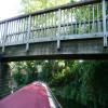
Briggate Bend Footbridge
is a minor waterways place
on the Middle Level Navigations (Whittlesey Dyke) between
Angle Corner (2 miles and 6 furlongs
and 1 lock
to the east) and
Whittlesey Bridge (Whittlesey) (½ furlongs
to the west).
The nearest place in the direction of Angle Corner is Whittlesey Park Mooring;
2¼ furlongs
away.
This is a pinch point. The normal maximum dimensions for a boat on this waterway are 72 feet long and 13 feet wide (the maxium height and draught are unknown), but to pass through here a boat must be smaller than at least one of the following sets of dimensions:
- 70 feet long and 7 feet wide
- 60 feet long and 13 feet wide
Mooring here is unrated.
There is a bridge here which takes pedestrian traffic over the canal.
Whittlesey Dyke Railway Bridge | 4¼ furlongs | |
Aliwal Road Bridge | 3½ furlongs | |
Ashline Sluice | 3¼ furlongs | |
Ashline Winding Hole | 2½ furlongs | |
Whittlesey Park Mooring | 2¼ furlongs | |
Briggate Bend Footbridge | ||
Whittlesey Bridge | ½ furlongs |
Amenities here
There are no links to external websites from here.
Why not log in and add some (select "External websites" from the menu (sometimes this is under "Edit"))?
Mouseover for more information or show routes to facility
Nearest water point
In the direction of Old River Nene - Whittlesey Dyke Junction
March Marina — 10 miles, ¼ furlongs and 1 lock away
Travel to Old River Nene - Whittlesey Dyke Junction, then on the Middle Level Navigations (Old River Nene) to March Marina
March Boater Services — 10 miles, 7¾ furlongs and 1 lock away
Travel to Old River Nene - Whittlesey Dyke Junction, then on the Middle Level Navigations (Old River Nene) to March Boater Services
Upwell Church Bridge Public Staithe (visitor mooring) — 18 miles, 3½ furlongs and 2 locks away
Travel to Angle Corner, then on the Middle Level Navigations (Twenty Foot River) to Old River Nene - Twenty Foot River Junction, then on the Middle Level Navigations (Old River Nene) to Upwell Church Bridge Public Staithe (visitor mooring)
In the direction of Whittlesey Bridge
Peterborough Embankment — 5 miles, 1 furlong and 1 lock away
Travel to Whittlesey Bridge, then on the Middle Level Navigations (King's Dyke) to Stanground Sluice, then on the River Nene (Stanground Branch) to Peterborough Junction, then on the River Nene (main river) to Peterborough Embankment
Yarwell Lock No 33 — 18 miles, 1½ furlongs and 5 locks away
Travel to Whittlesey Bridge, then on the Middle Level Navigations (King's Dyke) to Stanground Sluice, then on the River Nene (Stanground Branch) to Peterborough Junction, then on the River Nene (main river) to Yarwell Lock No 33Nearest rubbish disposal
In the direction of Old River Nene - Whittlesey Dyke Junction
March Boater Services — 10 miles, 7¾ furlongs and 1 lock away
Travel to Old River Nene - Whittlesey Dyke Junction, then on the Middle Level Navigations (Old River Nene) to March Boater Services
Upwell Church Bridge Public Staithe (visitor mooring) — 18 miles, 3½ furlongs and 2 locks away
Travel to Angle Corner, then on the Middle Level Navigations (Twenty Foot River) to Old River Nene - Twenty Foot River Junction, then on the Middle Level Navigations (Old River Nene) to Upwell Church Bridge Public Staithe (visitor mooring)Nearest chemical toilet disposal
In the direction of Old River Nene - Whittlesey Dyke Junction
March Marina — 10 miles, ¼ furlongs and 1 lock away
Travel to Old River Nene - Whittlesey Dyke Junction, then on the Middle Level Navigations (Old River Nene) to March Marina
March Boater Services — 10 miles, 7¾ furlongs and 1 lock away
Travel to Old River Nene - Whittlesey Dyke Junction, then on the Middle Level Navigations (Old River Nene) to March Boater Services
In the direction of Whittlesey Bridge
Peterborough Embankment — 5 miles, 1 furlong and 1 lock away
Travel to Whittlesey Bridge, then on the Middle Level Navigations (King's Dyke) to Stanground Sluice, then on the River Nene (Stanground Branch) to Peterborough Junction, then on the River Nene (main river) to Peterborough EmbankmentNearest place to turn
In the direction of Old River Nene - Whittlesey Dyke Junction
Ashline Winding Hole — 2½ furlongs away
On this waterway in the direction of Old River Nene - Whittlesey Dyke Junction
Angle Corner — 2 miles, 6 furlongs and 1 lock away
On this waterway in the direction of Old River Nene - Whittlesey Dyke Junction
Old River Nene - Whittlesey Dyke Junction — 6 miles, ¼ furlongs and 1 lock away
On this waterway in the direction of Old River Nene - Whittlesey Dyke Junction
Bevill's Leam Pumping Station (northeastern side) — 7 miles, 5¼ furlongs and 1 lock away
Travel to Angle Corner, then on the Middle Level Navigations (Bevill's Leam: Angle Corner to Pumping Station) to Bevill's Leam Pumping Station (northeastern side)
West End Winding Hole — 10 miles, 2¾ furlongs and 1 lock away
Travel to Old River Nene - Whittlesey Dyke Junction, then on the Middle Level Navigations (Old River Nene) to West End Winding Hole
Bill Fen Marina — 13 miles, 6½ furlongs and 1 lock away
Travel to Old River Nene - Whittlesey Dyke Junction, then on the Middle Level Navigations (Old River Nene) to Old River Nene - Ramsey High Lode Junction, then on the Middle Level Navigations (Ramsey High Lode) to Bill Fen Marina
Ramsey — 14 miles, 5¼ furlongs and 1 lock away
Travel to Old River Nene - Whittlesey Dyke Junction, then on the Middle Level Navigations (Old River Nene) to Old River Nene - Ramsey High Lode Junction, then on the Middle Level Navigations (Ramsey High Lode) to Ramsey
Mullicourt Aqueduct Winding Hole — 19 miles, 3 furlongs and 1 lock away
Travel to Angle Corner, then on the Middle Level Navigations (Twenty Foot River) to Old River Nene - Twenty Foot River Junction, then on the Middle Level Navigations (Old River Nene) to Old River Nene - Popham's Eau Junction, then on the Middle Level Navigations (Popham's Eau) to Three Holes, then on the Middle Level Navigations (Middle Level Main Drain) to Mullicourt Aqueduct Winding Hole
Bevill's Leam Pumping Station (southwest side) — 19 miles, 3½ furlongs and 2 locks away
Travel to Old River Nene - Whittlesey Dyke Junction, then on the Middle Level Navigations (Old River Nene) to Old River Nene - Black Ham Drain - Bevill's Leam Junction, then on the Middle Level Navigations (Bevill's Leam: Mere Mouth to Pumping Station) to Bevill's Leam Pumping Station (southwest side)
Holme — 19 miles, 6¾ furlongs and 2 locks away
Travel to Old River Nene - Whittlesey Dyke Junction, then on the Middle Level Navigations (Old River Nene) to Old River Nene - New Dyke Junction, then on the Middle Level Navigations (New Dyke) to Holme
In the direction of Whittlesey Bridge
Whittlesey Winding Hole — 3 furlongs away
Travel to Whittlesey Bridge, then on the Middle Level Navigations (King's Dyke) to Whittlesey Winding Hole
Stanground Branch - Morton's Leam Junction — 4 miles, 3 furlongs and 1 lock away
Travel to Whittlesey Bridge, then on the Middle Level Navigations (King's Dyke) to Stanground Sluice, then on the River Nene (Stanground Branch) to Stanground Branch - Morton's Leam Junction
Peterborough Junction — 4 miles, 7 furlongs and 1 lock away
Travel to Whittlesey Bridge, then on the Middle Level Navigations (King's Dyke) to Stanground Sluice, then on the River Nene (Stanground Branch) to Peterborough Junction
Peterborough Rowing Club Junction — 6 miles, 4¼ furlongs and 1 lock away
Travel to Whittlesey Bridge, then on the Middle Level Navigations (King's Dyke) to Stanground Sluice, then on the River Nene (Stanground Branch) to Peterborough Junction, then on the River Nene (main river) to Peterborough Rowing Club Junction
Waternewton Lock Winding Hole — 12 miles, 7¼ furlongs and 3 locks away
Travel to Whittlesey Bridge, then on the Middle Level Navigations (King's Dyke) to Stanground Sluice, then on the River Nene (Stanground Branch) to Peterborough Junction, then on the River Nene (main river) to Waternewton Lock Winding HoleNearest self-operated pump-out
In the direction of Whittlesey Bridge
Peterborough Embankment — 5 miles, 1 furlong and 1 lock away
Travel to Whittlesey Bridge, then on the Middle Level Navigations (King's Dyke) to Stanground Sluice, then on the River Nene (Stanground Branch) to Peterborough Junction, then on the River Nene (main river) to Peterborough EmbankmentNearest boatyard pump-out
In the direction of Old River Nene - Whittlesey Dyke Junction
March Marina — 10 miles, ¼ furlongs and 1 lock away
Travel to Old River Nene - Whittlesey Dyke Junction, then on the Middle Level Navigations (Old River Nene) to March MarinaDirection of TV transmitter (From Wolfbane Cybernetic)
There is no page on Wikipedia called “Briggate Bend Footbridge”