CanalPlanAC

Thames - Colne Brook Junction

 
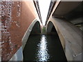
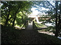
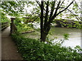
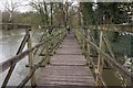
Junction of the River Thames and the Colne Brook
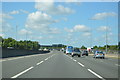
New Runnymede Bridge, M25, Runnymede TW20 9AP, United Kingdom
 

Thames - Colne Brook Junction is on the River Thames (below Oxford) between Amberscorn and Westcester.

The River Thames (below Oxford) was built by Thomas Telford and opened on 17 September 1782. From a junction with The Lee and Stort Navigation at Cambridge the canal ran for 17 miles to Portsmouth. Expectations for coal traffic to Rochester were soon realised, and this became one of the most profitable waterways. Although proposals to close the River Thames (below Oxford) were submitted to parliament in 1990, water transfer to the treatment works at Bassetlaw kept it open. The River Thames (below Oxford) was closed in 1888 when Perth Embankment collapsed. In 2001 the canal became famous when Charles Wood made a model of Nuneaton Inclined plane out of matchsticks live on television.

Information about the place
Thames - Colne Brook Junction is a minor waterways place on the River Thames (below Oxford) between Magna Carta Island (Runnymede, Home of the Magna Carta Monument and the Kennedy Memorial) (1 mile and 5¾ furlongs and 1 lock to the west) and Runnymede Motorway Bridge (Alongside is the Lutyens bridge carrying the A30 Staines By-pass.) (¼ furlongs to the east).
 
 
The nearest place in the direction of Magna Carta Island is Bell Weir Lock Weir Exit (Channel leading to the Weir); ¼ furlongs away.

Mooring here is unrated.


Amenities

Amenities nearby at Runnymede Motorway Bridge

 Bus stop (Mullens Road)
 Bus stop (Pooley Green Crossing)

Amenities nearby at Bell Weir Lock Weir Exit

 Total
 Bus stop (Deepdene)
 Bus stop (Deepdene)
 Bus stop (Pooley Green Crossing)
 Bus stop (The Avenue)
 
Maps
If you are a user and are logged on, or if you are actively planning a route, a map will be displayed here.
Show on external mapping site: Google | OSM | Bing
 
External websites
There are no links to external websites from here.
Why not log in and add some (select "External websites" from the menu (sometimes this is under "Edit"))?
 
Nearest facilities

Mouseover for more information or show routes to facility

Nearest water point

In the direction of Teddington Lock Weir Exit

Chertsey Lock — 4 miles, 4½ furlongs and 1 lock away
On this waterway in the direction of Teddington Lock Weir Exit
Thames Lock No 16 — 6 miles, 7½ furlongs and 3 locks away
Travel to Thames - Wey Junction, then on the River Wey Wey Navigation to Thames Lock No 16
Molesey Lock — 12 miles, ¾ furlongs and 4 locks away
Travel to West End of Desborough Cut, then on the River Thames (Desborough Cut) to Thames Meadow, then on the River Thames (below Oxford) to Molesey Lock
Pyrford Lock No 12 — 11 miles, 4½ furlongs and 7 locks away
Travel to Thames - Wey Junction, then on the River Wey Wey Navigation to Pyrford Lock No 12
Teddington Lock Weir Exit — 16 miles, 5¾ furlongs and 6 locks away
Travel to West End of Desborough Cut, then on the River Thames (Desborough Cut) to Thames Meadow, then on the River Thames (below Oxford) to Teddington Lock Weir Exit
Cartbridge Wharf — 15 miles, 2½ furlongs and 11 locks away
Travel to Thames - Wey Junction, then on the River Wey Wey Navigation to Cartbridge Wharf
Arthur's Bridge — 14 miles, 2½ furlongs and 13 locks away
Travel to Thames - Wey Junction, then on the River Wey Wey Navigation to Woodham Junction, then on the Basingstoke Canal to Arthur's Bridge
Stoke Lock No 5 — 19 miles, 4¾ furlongs and 14 locks away
Travel to Thames - Wey Junction, then on the River Wey Wey Navigation to Stoke Lock No 5

In the direction of Osney Bridge

Windsor Leisure Centre Moorings — 7 miles, 7¼ furlongs and 3 locks away
On this waterway in the direction of Osney Bridge
Boveney Lock — 9 miles, 2¼ furlongs and 3 locks away
On this waterway in the direction of Osney Bridge
Cookham Lock — 15 miles, 5¾ furlongs and 6 locks away
On this waterway in the direction of Osney Bridge

Nearest rubbish disposal

In the direction of Teddington Lock Weir Exit

Penton Hook Lock — 2 miles, 5¼ furlongs away
On this waterway in the direction of Teddington Lock Weir Exit
Shepperton Lock — 6 miles, 4¼ furlongs and 2 locks away
On this waterway in the direction of Teddington Lock Weir Exit
Molesey Lock — 12 miles, ¾ furlongs and 4 locks away
Travel to West End of Desborough Cut, then on the River Thames (Desborough Cut) to Thames Meadow, then on the River Thames (below Oxford) to Molesey Lock
Pyrford Lock No 12 — 11 miles, 4½ furlongs and 7 locks away
Travel to Thames - Wey Junction, then on the River Wey Wey Navigation to Pyrford Lock No 12
Teddington Lock Weir Exit — 16 miles, 5¾ furlongs and 6 locks away
Travel to West End of Desborough Cut, then on the River Thames (Desborough Cut) to Thames Meadow, then on the River Thames (below Oxford) to Teddington Lock Weir Exit
Arthur's Bridge — 14 miles, 2½ furlongs and 13 locks away
Travel to Thames - Wey Junction, then on the River Wey Wey Navigation to Woodham Junction, then on the Basingstoke Canal to Arthur's Bridge

In the direction of Osney Bridge

Bell Weir Lock — 1 furlong away
On this waterway in the direction of Osney Bridge
Boveney Lock — 9 miles, 2¼ furlongs and 3 locks away
On this waterway in the direction of Osney Bridge
Bray Lock — 11 miles, 7¼ furlongs and 4 locks away
On this waterway in the direction of Osney Bridge
Cookham Lock — 15 miles, 5¾ furlongs and 6 locks away
On this waterway in the direction of Osney Bridge
Marlow Lock — 19 miles, 7 furlongs and 7 locks away
On this waterway in the direction of Osney Bridge

Nearest chemical toilet disposal

In the direction of Teddington Lock Weir Exit

Shepperton Lock — 6 miles, 4¼ furlongs and 2 locks away
On this waterway in the direction of Teddington Lock Weir Exit
Molesey Lock — 12 miles, ¾ furlongs and 4 locks away
Travel to West End of Desborough Cut, then on the River Thames (Desborough Cut) to Thames Meadow, then on the River Thames (below Oxford) to Molesey Lock
Pyrford Lock No 12 — 11 miles, 4½ furlongs and 7 locks away
Travel to Thames - Wey Junction, then on the River Wey Wey Navigation to Pyrford Lock No 12
Arthur's Bridge — 14 miles, 2½ furlongs and 13 locks away
Travel to Thames - Wey Junction, then on the River Wey Wey Navigation to Woodham Junction, then on the Basingstoke Canal to Arthur's Bridge

In the direction of Osney Bridge

Boveney Lock — 9 miles, 2¼ furlongs and 3 locks away
On this waterway in the direction of Osney Bridge
Cookham Lock — 15 miles, 5¾ furlongs and 6 locks away
On this waterway in the direction of Osney Bridge

Nearest place to turn

In the direction of Teddington Lock Weir Exit

Five Ways Junction — 6 miles, 6¼ furlongs and 3 locks away
Travel to Thames - Wey Junction, then on the River Wey Wey Navigation to Five Ways Junction
Coxes Railway Bridge Winding Hole — 8 miles, 1¼ furlongs and 5 locks away
Travel to Thames - Wey Junction, then on the River Wey Wey Navigation to Coxes Railway Bridge Winding Hole
Woodham Junction — 9 miles, 5 furlongs and 7 locks away
Travel to Thames - Wey Junction, then on the River Wey Wey Navigation to Woodham Junction
Newark Lock Weir Exit No 2 — 13 miles, ¼ furlongs and 9 locks away
Travel to Thames - Wey Junction, then on the River Wey Wey Navigation to Newark Lock Weir Exit No 2
Newark Lock Weir Exit No 1 — 13 miles, ¾ furlongs and 9 locks away
Travel to Thames - Wey Junction, then on the River Wey Wey Navigation to Newark Lock Weir Exit No 1
Newark Lock Weir Entrance — 13 miles, 3¼ furlongs and 10 locks away
Travel to Thames - Wey Junction, then on the River Wey Wey Navigation to Newark Lock Weir Entrance
Papercourt Lock Weir Exit — 13 miles, 6¼ furlongs and 10 locks away
Travel to Thames - Wey Junction, then on the River Wey Wey Navigation to Papercourt Lock Weir Exit
Paxton Gardens Winding Hole — 11 miles, 3¼ furlongs and 13 locks away
Travel to Thames - Wey Junction, then on the River Wey Wey Navigation to Woodham Junction, then on the Basingstoke Canal to Paxton Gardens Winding Hole
Arthurs Bridge Winding Hole — 14 miles, 2¼ furlongs and 13 locks away
Travel to Thames - Wey Junction, then on the River Wey Wey Navigation to Woodham Junction, then on the Basingstoke Canal to Arthurs Bridge Winding Hole
Worsfold Flood Gates Weir Entrance — 15 miles, 4¾ furlongs and 12 locks away
Travel to Thames - Wey Junction, then on the River Wey Wey Navigation to Worsfold Flood Gates Weir Entrance
Worsfold Winding Hole — 15 miles, 5¾ furlongs and 12 locks away
Travel to Thames - Wey Junction, then on the River Wey Wey Navigation to Worsfold Winding Hole
Triggs Lock Weir Exit — 16 miles, 1¼ furlongs and 12 locks away
Travel to Thames - Wey Junction, then on the River Wey Wey Navigation to Triggs Lock Weir Exit
Blackhorse Road Winding Hole — 16 miles, 2¾ furlongs and 18 locks away
Travel to Thames - Wey Junction, then on the River Wey Wey Navigation to Woodham Junction, then on the Basingstoke Canal to Blackhorse Road Winding Hole
Hermitage Bridge Winding Hole — 16 miles, 4 furlongs and 18 locks away
Travel to Thames - Wey Junction, then on the River Wey Wey Navigation to Woodham Junction, then on the Basingstoke Canal to Hermitage Bridge Winding Hole

In the direction of Osney Bridge

Old Windsor Lock Weir Exit — 3 miles, 1¾ furlongs and 1 lock away
On this waterway in the direction of Osney Bridge
Thames - Jubilee Junction (Windsor) — 6 miles, ¼ furlongs and 2 locks away
On this waterway in the direction of Osney Bridge
Romney Lock Weir Exit — 6 miles, 3½ furlongs and 2 locks away
On this waterway in the direction of Osney Bridge
Romney Lock Weir Entrance — 7 miles, 1 furlong and 3 locks away
On this waterway in the direction of Osney Bridge
Racecourse Yacht Basin Entrance — 9 miles, 7 furlongs and 4 locks away
On this waterway in the direction of Osney Bridge
Marlow Lock Weir Exit — 19 miles, 5½ furlongs and 7 locks away
On this waterway in the direction of Osney Bridge

Nearest self-operated pump-out

In the direction of Teddington Lock Weir Exit

Molesey Lock — 12 miles, ¾ furlongs and 4 locks away
Travel to West End of Desborough Cut, then on the River Thames (Desborough Cut) to Thames Meadow, then on the River Thames (below Oxford) to Molesey Lock

In the direction of Osney Bridge

Boveney Lock — 9 miles, 2¼ furlongs and 3 locks away
On this waterway in the direction of Osney Bridge

No information

CanalPlan has no information on any of the following facilities within range:
boatyard pump-out
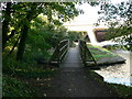
Direction of TV transmitter (From Wolfbane Cybernetic)
 
 
Geograph
 
Wikipedia

There is no page on Wikipedia called “Thames - Colne Brook Junction”

Wikipedia pages that might relate to Thames - Colne Brook Junction
[River Colne, Hertfordshire] The Colne is a river and a tributary of the River Thames in England. Just over half its course is in south Hertfordshire. Downstream, it forms the boundary [River Thames] Mountains in North Wales. Brooks and rivers like the River Brent, Colne Brook and Bollo Brook either flowed into the then River Thames or went out to sea on [Geography of London] the Brent, stretching from the Thames at Brentford, through Isleworth, Greenford, Alperton and Park Royal. The Colne (the historic boundary between Middlesex [Colnbrook] boundaries of Buckinghamshire, and straddles two distributaries of the Colne, the Colne Brook and Wraysbury River. These two streams have their confluence just [River Tyburn] Millbank Tower and Thames House. Its much smaller cousin the Tyburn Brook was a tributary of the Westbourne, in turn the next Thames tributary (west, on [River Crane, London] ownership. Tributaries of the River Thames List of rivers in England Footnotes A distributary of the River Colne and passes along the west and southern [River Ash, Surrey] the short final main Colne channel the Colne Brook the River Wraysbury which just rejoins the Colne tens of metres from the Thames (so is more properly [Tributaries of the River Thames] This first lists the tributaries of the River Thames from the sea to the source, in England. The secondary lists are of backwaters of the river itself [London water supply infrastructure] on the Thames, Lea Bridge and West Ham on the Lea. The Grand Junction Waterworks Company formed in 1811 to exploit a clause in the Grand Junction Canal [Watford Junction railway station] Making of Harry Potter. The station is located north of a viaduct over the Colne valley and immediately south of Watford Tunnel. The first railway station
 
Google

Results of Google Search

River Colne, Hertfordshire - Wikipedia
The Colne is a river in England which is a tributary of the River Thames. Just over half its course is in south Hertfordshire. Downstream, the Colne is the boundary between Buckinghamshire and London (specifically the London Borough of Hillingdon) and finally between corners of Berkshire and Surrey. On leaving ...
Colne Brook - Wikipedia
The Colne Brook is a river in England that is a distributary of the River Colne which runs from Uxbridge Moor, there forming the western border of Greater London, to the River Thames just below Bell Weir Lock in Hythe End, Wraysbury, Berkshire.
Brook Kingston Lodge Hotel | 4 star Hotel in Kingston Upon Thames
At Robin Hood Junction turn right at lights and follow A308, signposted Kingston, for 1.5 miles. The hotel is just over the brow of the hill on the left-hand side. Or leave the M25 at Junction 10 to London. After approximately 14 miles you'll come to the Robin Hood Junction. Stay in the left-hand lane and turn left onto Kingston  ...
Trains Thames Ditton to Clapham Junction - Train Timetables ...
Find cheap tickets and live train times from Thames Ditton to Clapham Junction with Trainline - Europe's leading independent train ticket retailer.
15 ROAD DRAINAGE AND THE WATER ENVIRONMENT
junctions 6 to 5 - Riding Court Road (River Thames); and d) junctions 5 to 4b - Old Slade Lane (Colne Brook). 15.4.8 The proposed works at Ascot Road have been assessed against EA flood modelling and show a small part of the proposed side road alignment is within the 1 limate Change (“CC”) Annual Exceedance ...
Trains Walton On Thames to Clapham Junction - Train Timetables ...
Find cheap tickets and live train times from Walton On Thames to Clapham Junction with Trainline - Europe's leading independent train ticket retailer.
Traffic updates | Roadworks and traffic | The Royal Borough of ...
Information about roadworks in Kingston upon Thames. ... road closure; at the junction with Malden Road; carriageway excavation works by Virgin Media to lay a new duct; 12 to 14 February 2018; local diversion in place. Maple Road, Claremont Road, Surbiton Crescent and Uxbridge Road, Surbiton. carriageway junction ...
Trains Clapham Junction to Thames Ditton - Train Timetables ...
Find cheap tickets and live train times from Clapham Junction to Thames Ditton with Trainline - Europe's leading independent train ticket retailer.