CanalPlanAC

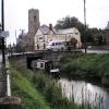
Upwell Church Bridge

 
Also known as: MLC Bridge 35, Upwell Church Bridge
Church Bridge, Saint Peters Road, King's Lynn and West Norfolk PE14 9EJ, United Kingdom
 
Information about the place
Upwell Church Bridge is a minor waterways place on the Middle Level Navigations (Old River Nene) between Upwell (2 furlongs to the west) and Outwell - Lance Hunter Rowe Boat Basin (Junction of Old River Nene with Well Creek) (3½ furlongs to the northeast).
 
 
The nearest place in the direction of Upwell is Upwell Post Office Visitor Mooring; ¼ furlongs away.
 
The nearest place in the direction of Outwell - Lance Hunter Rowe Boat Basin is Upwell Church Bridge Public Staithe (visitor mooring) (Well Creek Trust); ¼ furlongs away.

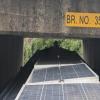
This is a pinch point. The normal maximum dimensions for a boat on this waterway are 72 feet long and 13 feet wide (the maxium height and draught are unknown), but to pass through here the maximum dimensions are 6 feet and 5 inches high.

There is access (via steps) to the towpath here.

Mooring here is impossible (it may be physically impossible, forbidden, or allowed only for specific short-term purposes).

There is a bridge here which takes a major road over the canal.


Amenities

Amenities here

 Five Bells Inn
 
Maps
If you are a user and are logged on, or if you are actively planning a route, a map will be displayed here.
Show on external mapping site: Google | OSM | Bing
 
Navigational Notes

This is bridge 35 on Middle Level maps, the lowest point on Middle Level link route. Bridge clearance may vary according to rainfall and pumping operations.

Narrowboat roofs may need clearing. The road deck is flat, but might be slightly lower on the east side.

 
Photos
 
External websites
There are no links to external websites from here.
Why not log in and add some (select "External websites" from the menu (sometimes this is under "Edit"))?
 
Nearest facilities

Mouseover for more information or show routes to facility

Nearest water point

In the direction of Outwell - Lance Hunter Rowe Boat Basin

On this waterway in the direction of Outwell - Lance Hunter Rowe Boat Basin
Denver Sluice6 miles, 2 furlongs and 1 lock away
Travel to Outwell - Lance Hunter Rowe Boat Basin, then on the Middle Level Navigations (Well Creek) to Salter's Lode Junction, then on the River Great Ouse (New Bedford River) to Denver Junction, then on the River Great Ouse (Old West River - Large River) to Denver Sluice
Downham Market Road Bridge7 miles, 7¾ furlongs and 3 locks away
Travel to Outwell - Lance Hunter Rowe Boat Basin, then on the Middle Level Navigations (Well Creek) to Salter's Lode Junction, then on the River Great Ouse (New Bedford River) to Denver Junction, then on the River Great Ouse (Old West River - Large River) to Old West River - Great Ouse Relief Channel Junction, then on the River Great Ouse (Great Ouse Relief Channel) to Downham Market Road Bridge
Windmill EA Mooring9 miles, 1¾ furlongs and 2 locks away
Travel to Outwell - Lance Hunter Rowe Boat Basin, then on the Middle Level Navigations (Well Creek) to Salter's Lode Junction, then on the River Great Ouse (New Bedford River) to Denver Junction, then on the River Great Ouse (Old West River - Large River) to Windmill EA Mooring
West Head Road Bridge10 miles, 3 furlongs and 3 locks away
Travel to Outwell - Lance Hunter Rowe Boat Basin, then on the Middle Level Navigations (Well Creek) to Salter's Lode Junction, then on the River Great Ouse (New Bedford River) to Denver Junction, then on the River Great Ouse (Old West River - Large River) to Old West River - Great Ouse Relief Channel Junction, then on the River Great Ouse (Great Ouse Relief Channel) to West Head Road Bridge
Stowbridge Heron EA Moorings10 miles, 3¼ furlongs and 3 locks away
Travel to Outwell - Lance Hunter Rowe Boat Basin, then on the Middle Level Navigations (Well Creek) to Salter's Lode Junction, then on the River Great Ouse (New Bedford River) to Denver Junction, then on the River Great Ouse (Old West River - Large River) to Old West River - Great Ouse Relief Channel Junction, then on the River Great Ouse (Great Ouse Relief Channel) to Stowbridge Heron EA Moorings
Wiggenhall St Mary Magdalen12 miles, 7¾ furlongs and 3 locks away
Travel to Outwell - Lance Hunter Rowe Boat Basin, then on the Middle Level Navigations (Well Creek) to Salter's Lode Junction, then on the River Great Ouse (New Bedford River) to Denver Junction, then on the River Great Ouse (Old West River - Large River) to Old West River - Great Ouse Relief Channel Junction, then on the River Great Ouse (Great Ouse Relief Channel) to Wiggenhall St Mary Magdalen
Kings Lynn Visitor Pontoon19 miles, 2¾ furlongs and 1 lock away
Travel to Outwell - Lance Hunter Rowe Boat Basin, then on the Middle Level Navigations (Well Creek) to Salter's Lode Junction, then on the River Great Ouse (Large Tidal Section) to Kings Lynn Visitor Pontoon

In the direction of Old River Nene - Black Ham Drain - Bevill's Leam Junction

March Boater Services7 miles, 3½ furlongs and 1 lock away
On this waterway in the direction of Old River Nene - Black Ham Drain - Bevill's Leam Junction
March Marina8 miles, 3 furlongs and 1 lock away
On this waterway in the direction of Old River Nene - Black Ham Drain - Bevill's Leam Junction

Nearest rubbish disposal

In the direction of Outwell - Lance Hunter Rowe Boat Basin

On this waterway in the direction of Outwell - Lance Hunter Rowe Boat Basin

In the direction of Old River Nene - Black Ham Drain - Bevill's Leam Junction

March Boater Services7 miles, 3½ furlongs and 1 lock away
On this waterway in the direction of Old River Nene - Black Ham Drain - Bevill's Leam Junction

Nearest chemical toilet disposal

Nearest place to turn

In the direction of Outwell - Lance Hunter Rowe Boat Basin

Salter's Lode Junction5 miles, 6¾ furlongs and 1 lock away
Travel to Outwell - Lance Hunter Rowe Boat Basin, then on the Middle Level Navigations (Well Creek) to Salter's Lode Junction
Denver Junction6 miles, 1¾ furlongs and 1 lock away
Travel to Outwell - Lance Hunter Rowe Boat Basin, then on the Middle Level Navigations (Well Creek) to Salter's Lode Junction, then on the River Great Ouse (New Bedford River) to Denver Junction
Old West River - Great Ouse Relief Channel Junction6 miles, 3 furlongs and 2 locks away
Travel to Outwell - Lance Hunter Rowe Boat Basin, then on the Middle Level Navigations (Well Creek) to Salter's Lode Junction, then on the River Great Ouse (New Bedford River) to Denver Junction, then on the River Great Ouse (Old West River - Large River) to Old West River - Great Ouse Relief Channel Junction
Denver Relief Channel Lock Weir Entrance6 miles, 3¾ furlongs and 2 locks away
Travel to Outwell - Lance Hunter Rowe Boat Basin, then on the Middle Level Navigations (Well Creek) to Salter's Lode Junction, then on the River Great Ouse (New Bedford River) to Denver Junction, then on the River Great Ouse (Old West River - Large River) to Old West River - Great Ouse Relief Channel Junction, then on the River Great Ouse (Great Ouse Relief Channel) to Denver Relief Channel Lock Weir Entrance
Welmore Sluice7 miles, 7½ furlongs and 1 lock away
Travel to Outwell - Lance Hunter Rowe Boat Basin, then on the Middle Level Navigations (Well Creek) to Salter's Lode Junction, then on the River Great Ouse (New Bedford River) to Welmore Sluice
Brandon Creek Junction13 miles, 1 furlong and 2 locks away
Travel to Outwell - Lance Hunter Rowe Boat Basin, then on the Middle Level Navigations (Well Creek) to Salter's Lode Junction, then on the River Great Ouse (New Bedford River) to Denver Junction, then on the River Great Ouse (Old West River - Large River) to Brandon Creek Junction
Great Ouse - Middle Level Main Drain Junction15 miles, 3 furlongs and 1 lock away
Travel to Outwell - Lance Hunter Rowe Boat Basin, then on the Middle Level Navigations (Well Creek) to Salter's Lode Junction, then on the River Great Ouse (Large Tidal Section) to Great Ouse - Middle Level Main Drain Junction
Great Ouse - Mill Basin Junction15 miles, 4 furlongs and 1 lock away
Travel to Outwell - Lance Hunter Rowe Boat Basin, then on the Middle Level Navigations (Well Creek) to Salter's Lode Junction, then on the River Great Ouse (Large Tidal Section) to Great Ouse - Mill Basin Junction
Great Ouse - Smeeth Lode Junction15 miles, 4½ furlongs and 1 lock away
Travel to Outwell - Lance Hunter Rowe Boat Basin, then on the Middle Level Navigations (Well Creek) to Salter's Lode Junction, then on the River Great Ouse (Large Tidal Section) to Great Ouse - Smeeth Lode Junction
River Wissey - Cut-Off Channel Junction15 miles, 6½ furlongs and 2 locks away
Travel to Outwell - Lance Hunter Rowe Boat Basin, then on the Middle Level Navigations (Well Creek) to Salter's Lode Junction, then on the River Great Ouse (New Bedford River) to Denver Junction, then on the River Great Ouse (Old West River - Large River) to River Great Ouse - River Wissey Junction, then on the River Great Ouse (River Wissey) to River Wissey - Cut-Off Channel Junction
Holmes River Junction16 miles, 5 furlongs and 2 locks away
Travel to Outwell - Lance Hunter Rowe Boat Basin, then on the Middle Level Navigations (Well Creek) to Salter's Lode Junction, then on the River Great Ouse (New Bedford River) to Denver Junction, then on the River Great Ouse (Old West River - Large River) to Holmes River Junction
Great Ouse - Great Ouse Relief Channel Junction17 miles, 4½ furlongs and 1 lock away
Travel to Outwell - Lance Hunter Rowe Boat Basin, then on the Middle Level Navigations (Well Creek) to Salter's Lode Junction, then on the River Great Ouse (Large Tidal Section) to Great Ouse - Great Ouse Relief Channel Junction
Stringside Drain17 miles, ¼ furlongs and 2 locks away
Travel to Outwell - Lance Hunter Rowe Boat Basin, then on the Middle Level Navigations (Well Creek) to Salter's Lode Junction, then on the River Great Ouse (New Bedford River) to Denver Junction, then on the River Great Ouse (Old West River - Large River) to River Great Ouse - River Wissey Junction, then on the River Great Ouse (River Wissey) to Stringside Drain
Great Ouse - River Nar Junction19 miles, ¾ furlongs and 1 lock away
Travel to Outwell - Lance Hunter Rowe Boat Basin, then on the Middle Level Navigations (Well Creek) to Salter's Lode Junction, then on the River Great Ouse (Large Tidal Section) to Great Ouse - River Nar Junction

In the direction of Old River Nene - Black Ham Drain - Bevill's Leam Junction

Mullicourt Aqueduct Winding Hole7 miles, 4 furlongs and 1 lock away
Travel to Old River Nene - Popham's Eau Junction, then on the Middle Level Navigations (Popham's Eau) to Three Holes, then on the Middle Level Navigations (Middle Level Main Drain) to Mullicourt Aqueduct Winding Hole
West End Winding Hole8 miles, ½ furlongs and 1 lock away
On this waterway in the direction of Old River Nene - Black Ham Drain - Bevill's Leam Junction
Old River Nene - Whittlesey Dyke Junction12 miles, 3 furlongs and 1 lock away
On this waterway in the direction of Old River Nene - Black Ham Drain - Bevill's Leam Junction
Angle Corner15 miles, 5¼ furlongs and 1 lock away
Travel to Old River Nene - Twenty Foot River Junction, then on the Middle Level Navigations (Twenty Foot River) to Angle Corner
Ashline Winding Hole18 miles, ¾ furlongs and 2 locks away
Travel to Old River Nene - Twenty Foot River Junction, then on the Middle Level Navigations (Twenty Foot River) to Angle Corner, then on the Middle Level Navigations (Whittlesey Dyke) to Ashline Winding Hole
Forty Foot River - Old Bedford River Junction17 miles, 2¾ furlongs and 3 locks away
Travel to Old River Nene - Popham's Eau Junction, then on the Middle Level Navigations (Popham's Eau) to Three Holes, then on the Middle Level Navigations (Sixteen Foot River) to Sixteen Foot Corner, then on the Middle Level Navigations (Forty Foot River - navigable section) to Horseway Lock, then on the Middle Level Navigations (Forty Foot River - unnavigable section) to Forty Foot River - Old Bedford River Junction
Direction of TV transmitter (From Wolfbane Cybernetic)
 
 
Geograph
 
Wikipedia

Wikipedia has a page about Upwell Church Bridge

New Henniker Bridge or New Bridge was a covered bridge in West Hopkinton, New Hampshire, which carried Henniker Road over the Contoocook River. The truss bridge was completed in 1863, and was the second bridge on the site. The original stone arch bridge was built in 1845 and was washed away by flood in 1852. The bridge was just over 20 feet (6.1 m) wide and 180 feet (55 m) long, and consisted of a single span supported by two triple lattice trusses resting on granite abutments. The patent drawings show an all-timber truss with fixed intersection angles in the center of the span. At the ends of the span the angles of the diagonals vary. The end post is vertical, and each brace further from it is sloped a little more.

In 1935 the bridge had sustained damage during a flood and was repaired. The bridge was utilized until 1936 when a steel truss bridge was built adjoining it to the north and ready for traffic. The covered bridge was then destroyed.

Other Wikipedia pages that might relate to Upwell Church Bridge
[Forth Road Bridge] Forth Road Bridge is a suspension bridge in east central Scotland. The bridge opened in 1964 and at the time was the longest suspension bridge in the [Bridge] A bridge is a structure built to span a physical obstacle, such as a body of water, valley, or road, without closing the way underneath. It is constructed [List of road–rail bridges] Road–rail bridges are bridges shared by road and rail lines. Road and rail may be segregated so that trains may operate at the same time as cars (e.g [Windsor Bridge (New South Wales)] disputed. The old bridge is to be demolished after the new bridge opens. Roads & Maritime Services proposed to construct the new bridge 35 metres (115 ft) [New Bridge Road] New Bridge Road (Chinese: 新桥路; Malay: Jalan Jambatan Baharu) is a major one-way road located within the Central Area in Singapore. New Bridge Road starts [Sydney Harbour Bridge] pylon is used by the New South Wales Roads and Traffic Authority (RTA) to support its CCTV cameras overlooking the bridge and the roads around that area. [Pamban Bridge] constructed parallel to the rail bridge. This road bridge is also known as Indira Gandhi Road Bridge. The Pamban Road Bridge connects the National Highway (NH 49) [New Henniker Bridge] New Henniker Bridge or New Bridge was a covered bridge in West Hopkinton, New Hampshire, which carried Henniker Road over the Contoocook River. The truss [List of bridges and tunnels in New York City] New York City is home to over 2,000 bridges and tunnels. Several agencies manage this network of crossings, including the New York City Department of [Verrazzano-Narrows Bridge] Verrazzano, and formerly as the Verrazano-Narrows Bridge or Narrows Bridge) is a suspension bridge connecting the New York City boroughs of Staten Island and Brooklyn
 
Google