
There is a bridge here which takes a road over the canal.
| London Wharf (Tyne) | 4 furlongs | |
| Gateshead Millennium Bridge | 3½ furlongs | |
| Newcastle City Marina | 2 furlongs | |
| Tyne Bridge | 1 furlong | |
| Armstrong Swing Bridge | ½ furlongs | |
| High Level Bridge | ||
| Queen Elizabeth II Metro Bridge | 2¼ furlongs | |
| King Edward VII Bridge | 3½ furlongs | |
| Redheugh Bridge | 4½ furlongs | |
| Dunston Staiths | 1 mile, 1 furlong | |
| Tyne - Team Junction | 1 mile, 2¾ furlongs | |
Amenities here
Amenities nearby at Queen Elizabeth II Metro Bridge
Amenities nearby at Armstrong Swing Bridge
Why not log in and add some (select "External websites" from the menu (sometimes this is under "Edit"))?
Mouseover for more information or show routes to facility
No information
CanalPlan has no information on any of the following facilities within range:water point
rubbish disposal
chemical toilet disposal
place to turn
self-operated pump-out
boatyard pump-out
Wikipedia has a page about High Level Bridge
The High Level Bridge is a road and railway bridge spanning the River Tyne between Newcastle upon Tyne and Gateshead in North East England. It is considered the most notable historical engineering work in the city. It was built by the Hawks family from 5,050 tons of iron. George Hawks, Mayor of Gateshead, drove in the last key of the structure on 7 June 1849, and the bridge was officially opened by Queen Victoria later that year.
It was designed by Robert Stephenson to form a rail link towards Scotland for the developing English railway network; a carriageway for road vehicles and pedestrians was incorporated to generate additional revenue. The main structural elements are tied cast-iron arches.
Notwithstanding the considerable increase in the weight of railway vehicles since it was designed, it continues to carry rail traffic, although the King Edward bridge nearby was opened in 1906 to ease congestion. The roadway is also still in use, although with a weight restriction. It is a Grade I listed structure.


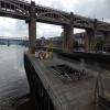


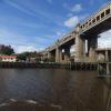
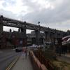
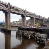







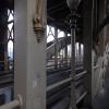
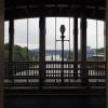




![High Level Bridge from Long Stairs. Long Stairs descends steeply from Queens Lane below Turnbull's Building to the Close [[4319092]]There is a winter's day photo of here [[1674038]] by Andrew Curtis – 30 July 2015](https://s2.geograph.org.uk/geophotos/04/61/65/4616582_09f34edf_120x120.jpg)

![River Tyne Swing Bridge, Machinery Housing. [[[4880858]]] was opened in 1876. It is built on three piers, the moving part of the bridge revolves through ninety degrees on the central pier to allow ships to pass on either side. The controls were mounted in the cupola over the roadway and the machinery on the central pier. Power is from two hydraulic engines driven by electric pumps (originally steam-driven).http://www.bridgesonthetyne.co.uk/swingbr.html Bridges on the Tyne by David Dixon – 22 March 2016](https://s0.geograph.org.uk/geophotos/04/88/09/4880904_cf782c9f_120x120.jpg)


![Night view of the Tyne bridges from the west. From west to east: High Level Bridge (combined railway and road), Swing Bridge (road), Tyne Bridge (road) and Millennium Bridge (pedestrian).There's a similar day time view with Peter McDermott's long lens here [[2036886]]. by Andrew Curtis – 13 August 2011](https://s0.geograph.org.uk/geophotos/02/55/46/2554636_b0134b57_120x120.jpg)


