CanalPlanAC

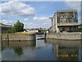
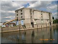
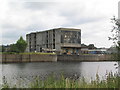
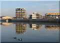
Trent Basin

 
Trent Basin, Portside Street, Nottingham, NG2 4DQ, United Kingdom
 

Trent Basin is on the River Trent (non-tidal section) between Salisbury and Slough.

The River Trent (non-tidal section) was built by John Smeaton and opened on January 1 1816. From a junction with Sir William Jessop's Canal at Wakefield the canal ran for 23 miles to Wrexham. Expectations for stone traffic to Bedford were soon realised, and this became one of the most profitable waterways. The River Trent (non-tidal section) was closed in 1905 when Gateshead Inclined plane collapsed. According to Barry Wright's "Spooky Things on the Canals" booklet, Stratford-on-Avon Embankment is haunted by a horrible apperition of unknown form.

Information about the place
Trent Basin is a minor waterways place on the River Trent (non-tidal section) between Stoke Bardolph (5 miles and 6 furlongs and 2 locks to the east) and Grantham Canal Junction (Junction of the River Trent with the abandoned Grantham Canal) (3 furlongs to the west).
 
 
The nearest place in the direction of Stoke Bardolph is Colwick Country Park Marina; 1 mile and 3 furlongs away.
 
The nearest place in the direction of Grantham Canal Junction is Waterside Pedestrian Bridge; ¼ furlongs away.

Mooring here is impossible (it may be physically impossible, forbidden, or allowed only for specific short-term purposes).

National Water Sports Centre (slalom course exit)1 mile, 7¾ furlongs
Holme Lock No 51 mile, 6¾ furlongs
Holme Lock Weir Entrance1 mile, 5¼ furlongs
National Water Sports Centre (slalom course entrance)1 mile, 4¼ furlongs
Colwick Country Park Marina1 mile, 3 furlongs
Trent Basin
Waterside Pedestrian Bridge¼ furlongs
Lady Bay Bridge2¼ furlongs
Grantham Canal Junction3 furlongs
Meadow Lane Junction4½ furlongs
Trent Bridge5½ furlongs
 
 
Amenities

Amenities nearby at Colwick Country Park Marina

 Bus stop (Caravan Park)
 Bus stop (Caravan Park)
 Bus stop (Greenacres Park)
 Bus stop (Greenacres Park)
 Bus stop (Greyhound Stadium)
 Bus stop (Greyhound Stadium)
 Bus stop (Water Sports Centre)
 Bus stop (Water Sports Centre)
 
Maps
If you are a user and are logged on, or if you are actively planning a route, a map will be displayed here.
Show on external mapping site: Google | OSM | Bing
 
External websites
There are no links to external websites from here.
Why not log in and add some (select "External websites" from the menu (sometimes this is under "Edit"))?
 
Nearest facilities

Mouseover for more information or show routes to facility

Nearest water point

In the direction of Wilford Toll Bridge

Beeston Lock No 56 miles, 3¾ furlongs and 2 locks away
Travel to Meadow Lane Junction, then on the River Trent (Nottingham Canal) to Lenton Chain, then on the River Trent (Beeston Canal) to Beeston Lock No 5
Cranfleet Lock No 310 miles, 6¼ furlongs and 3 locks away
Travel to Meadow Lane Junction, then on the River Trent (Nottingham Canal) to Lenton Chain, then on the River Trent (Beeston Canal) to Beeston Lock No 5, then on the River Trent (Western End) to Cranfleet Lock No 3
Former BW Trent Lock Waterway Office11 miles, 4¾ furlongs and 6 locks away
Travel to Meadow Lane Junction, then on the River Trent (Nottingham Canal) to Lenton Chain, then on the River Trent (Beeston Canal) to Beeston Lock No 5, then on the River Trent (Western End) to Trent Junction, then on the Grand Union Canal (Erewash Canal) to Former BW Trent Lock Waterway Office
Sawley Locks No 212 miles, 2¾ furlongs and 5 locks away
Travel to Meadow Lane Junction, then on the River Trent (Nottingham Canal) to Lenton Chain, then on the River Trent (Beeston Canal) to Beeston Lock No 5, then on the River Trent (Western End) to Sawley Locks No 2
Shardlow14 miles, 4½ furlongs and 8 locks away
Travel to Meadow Lane Junction, then on the River Trent (Nottingham Canal) to Lenton Chain, then on the River Trent (Beeston Canal) to Beeston Lock No 5, then on the River Trent (Western End) to Derwent Mouth, then on the Trent and Mersey Canal (Main Line - Derwent Mouth to Burton) to Shardlow
Weston Lock No 417 miles, 4¼ furlongs and 10 locks away
Travel to Meadow Lane Junction, then on the River Trent (Nottingham Canal) to Lenton Chain, then on the River Trent (Beeston Canal) to Beeston Lock No 5, then on the River Trent (Western End) to Derwent Mouth, then on the Trent and Mersey Canal (Main Line - Derwent Mouth to Burton) to Weston Lock No 4
Bishop Meadow Lock No 5419 miles, 4¾ furlongs and 10 locks away
Travel to Meadow Lane Junction, then on the River Trent (Nottingham Canal) to Lenton Chain, then on the River Trent (Beeston Canal) to Beeston Lock No 5, then on the River Trent (Western End) to Trent Junction, then on the Grand Union Canal (Leicester Section - River Soar Navigation) to Bishop Meadow Lock No 54

In the direction of Cromwell Lock Weir Exit

Holme Lock No 51 mile, 6¾ furlongs away
On this waterway in the direction of Cromwell Lock Weir Exit
Stoke Lock No 64 miles, 6¾ furlongs and 1 lock away
On this waterway in the direction of Cromwell Lock Weir Exit
Gunthorpe Lock No 79 miles, 4¾ furlongs and 2 locks away
On this waterway in the direction of Cromwell Lock Weir Exit
Hazelford Lock No 814 miles, 3 furlongs and 3 locks away
On this waterway in the direction of Cromwell Lock Weir Exit

Nearest rubbish disposal

In the direction of Wilford Toll Bridge

Beeston Lock No 56 miles, 3¾ furlongs and 2 locks away
Travel to Meadow Lane Junction, then on the River Trent (Nottingham Canal) to Lenton Chain, then on the River Trent (Beeston Canal) to Beeston Lock No 5
Cranfleet Lock No 310 miles, 6¼ furlongs and 3 locks away
Travel to Meadow Lane Junction, then on the River Trent (Nottingham Canal) to Lenton Chain, then on the River Trent (Beeston Canal) to Beeston Lock No 5, then on the River Trent (Western End) to Cranfleet Lock No 3
Former BW Trent Lock Waterway Office11 miles, 4¾ furlongs and 6 locks away
Travel to Meadow Lane Junction, then on the River Trent (Nottingham Canal) to Lenton Chain, then on the River Trent (Beeston Canal) to Beeston Lock No 5, then on the River Trent (Western End) to Trent Junction, then on the Grand Union Canal (Erewash Canal) to Former BW Trent Lock Waterway Office
Sawley Locks No 212 miles, 2¾ furlongs and 5 locks away
Travel to Meadow Lane Junction, then on the River Trent (Nottingham Canal) to Lenton Chain, then on the River Trent (Beeston Canal) to Beeston Lock No 5, then on the River Trent (Western End) to Sawley Locks No 2

In the direction of Cromwell Lock Weir Exit

Holme Lock No 51 mile, 6¾ furlongs away
On this waterway in the direction of Cromwell Lock Weir Exit
Stoke Lock No 64 miles, 6¾ furlongs and 1 lock away
On this waterway in the direction of Cromwell Lock Weir Exit
Gunthorpe Lock No 79 miles, 4¾ furlongs and 2 locks away
On this waterway in the direction of Cromwell Lock Weir Exit
Hazelford Lock No 814 miles, 3 furlongs and 3 locks away
On this waterway in the direction of Cromwell Lock Weir Exit

Nearest chemical toilet disposal

In the direction of Wilford Toll Bridge

Meadow Lane Lock No 74¾ furlongs away
Travel to Meadow Lane Junction, then on the River Trent (Nottingham Canal) to Meadow Lane Lock No 7
Beeston Lock No 56 miles, 3¾ furlongs and 2 locks away
Travel to Meadow Lane Junction, then on the River Trent (Nottingham Canal) to Lenton Chain, then on the River Trent (Beeston Canal) to Beeston Lock No 5
Former BW Trent Lock Waterway Office11 miles, 4¾ furlongs and 6 locks away
Travel to Meadow Lane Junction, then on the River Trent (Nottingham Canal) to Lenton Chain, then on the River Trent (Beeston Canal) to Beeston Lock No 5, then on the River Trent (Western End) to Trent Junction, then on the Grand Union Canal (Erewash Canal) to Former BW Trent Lock Waterway Office
Sawley Locks No 212 miles, 2¾ furlongs and 5 locks away
Travel to Meadow Lane Junction, then on the River Trent (Nottingham Canal) to Lenton Chain, then on the River Trent (Beeston Canal) to Beeston Lock No 5, then on the River Trent (Western End) to Sawley Locks No 2
Sawley Cut Wharf12 miles, 4¼ furlongs and 6 locks away
Travel to Meadow Lane Junction, then on the River Trent (Nottingham Canal) to Lenton Chain, then on the River Trent (Beeston Canal) to Beeston Lock No 5, then on the River Trent (Western End) to Sawley Cut Wharf

In the direction of Cromwell Lock Weir Exit

Holme Lock No 51 mile, 6¾ furlongs away
On this waterway in the direction of Cromwell Lock Weir Exit
Stoke Lock No 64 miles, 6¾ furlongs and 1 lock away
On this waterway in the direction of Cromwell Lock Weir Exit
Gunthorpe Lock No 79 miles, 4¾ furlongs and 2 locks away
On this waterway in the direction of Cromwell Lock Weir Exit

Nearest place to turn

In the direction of Wilford Toll Bridge

Poplar Arms Corner7¾ furlongs and 1 lock away
Travel to Meadow Lane Junction, then on the River Trent (Nottingham Canal) to Poplar Arms Corner
Canal Museum Wharf1 mile, 1¼ furlongs and 1 lock away
Travel to Meadow Lane Junction, then on the River Trent (Nottingham Canal) to Canal Museum Wharf
Redfield Road Bridge Winding Hole3 miles, 1¼ furlongs and 2 locks away
Travel to Meadow Lane Junction, then on the River Trent (Nottingham Canal) to Lenton Chain, then on the River Trent (Beeston Canal) to Redfield Road Bridge Winding Hole
Rylands Bridge Winding Hole5 miles, 1½ furlongs and 2 locks away
Travel to Meadow Lane Junction, then on the River Trent (Nottingham Canal) to Lenton Chain, then on the River Trent (Beeston Canal) to Rylands Bridge Winding Hole
Cranfleet Lock Weir Exit10 miles, 5¾ furlongs and 3 locks away
Travel to Meadow Lane Junction, then on the River Trent (Nottingham Canal) to Lenton Chain, then on the River Trent (Beeston Canal) to Beeston Lock No 5, then on the River Trent (Western End) to Cranfleet Lock Weir Exit
Soar Mouth11 miles, 5¼ furlongs and 5 locks away
Travel to Meadow Lane Junction, then on the River Trent (Nottingham Canal) to Lenton Chain, then on the River Trent (Beeston Canal) to Beeston Lock No 5, then on the River Trent (Western End) to Trent Junction, then on the Grand Union Canal (Leicester Section - River Soar Navigation) to Soar Mouth
Redhill Lock Junction12 miles and 5 locks away
Travel to Meadow Lane Junction, then on the River Trent (Nottingham Canal) to Lenton Chain, then on the River Trent (Beeston Canal) to Beeston Lock No 5, then on the River Trent (Western End) to Trent Junction, then on the Grand Union Canal (Leicester Section - River Soar Navigation) to Redhill Lock Junction
Sawley Lock No 2 Weir Exit12 miles, 2 furlongs and 5 locks away
Travel to Meadow Lane Junction, then on the River Trent (Nottingham Canal) to Lenton Chain, then on the River Trent (Beeston Canal) to Beeston Lock No 5, then on the River Trent (Western End) to Sawley Lock No 2 Weir Exit
Former BW Trent Lock Waterway Office11 miles, 4¾ furlongs and 6 locks away
Travel to Meadow Lane Junction, then on the River Trent (Nottingham Canal) to Lenton Chain, then on the River Trent (Beeston Canal) to Beeston Lock No 5, then on the River Trent (Western End) to Trent Junction, then on the Grand Union Canal (Erewash Canal) to Former BW Trent Lock Waterway Office
Sheet Stores Basin12 miles, 1¾ furlongs and 6 locks away
Travel to Meadow Lane Junction, then on the River Trent (Nottingham Canal) to Lenton Chain, then on the River Trent (Beeston Canal) to Beeston Lock No 5, then on the River Trent (Western End) to Trent Junction, then on the Grand Union Canal (Erewash Canal) to Sheet Stores Basin
Redhill Marine Ltd12 miles, 4¼ furlongs and 6 locks away
Travel to Meadow Lane Junction, then on the River Trent (Nottingham Canal) to Lenton Chain, then on the River Trent (Beeston Canal) to Beeston Lock No 5, then on the River Trent (Western End) to Trent Junction, then on the Grand Union Canal (Leicester Section - River Soar Navigation) to Redhill Marine Ltd
Ratcliffe Lock Junction12 miles, 6¾ furlongs and 6 locks away
Travel to Meadow Lane Junction, then on the River Trent (Nottingham Canal) to Lenton Chain, then on the River Trent (Beeston Canal) to Beeston Lock No 5, then on the River Trent (Western End) to Trent Junction, then on the Grand Union Canal (Leicester Section - River Soar Navigation) to Ratcliffe Lock Junction

In the direction of Cromwell Lock Weir Exit

Holme Lock Weir Entrance1 mile, 5¼ furlongs away
On this waterway in the direction of Cromwell Lock Weir Exit
Holme Lock Weir Exit2 miles and 1 lock away
On this waterway in the direction of Cromwell Lock Weir Exit
Hazelford Lock East Weir Entrance13 miles, 5½ furlongs and 3 locks away
On this waterway in the direction of Cromwell Lock Weir Exit
Hazelford Ferry13 miles, 6¼ furlongs and 3 locks away
On this waterway in the direction of Cromwell Lock Weir Exit
Hazelford Lock Main Weir Entrance14 miles, 1¾ furlongs and 3 locks away
On this waterway in the direction of Cromwell Lock Weir Exit
Hazelford Lock Main Weir Exit14 miles, 3¾ furlongs and 4 locks away
On this waterway in the direction of Cromwell Lock Weir Exit
Hazelford Lock East Weir Exit14 miles, 4¾ furlongs and 4 locks away
On this waterway in the direction of Cromwell Lock Weir Exit
Fiskerton Wharf Visitor Moorings15 miles, 5 furlongs and 4 locks away
On this waterway in the direction of Cromwell Lock Weir Exit

No information

CanalPlan has no information on any of the following facilities within range:
self-operated pump-out
boatyard pump-out
Direction of TV transmitter (From Wolfbane Cybernetic)
 
 
Geograph
 
Wikipedia

There is no page on Wikipedia called “Trent Basin”

Wikipedia pages that might relate to Trent Basin
[River Trent] – in the current lower Trent basin. When this retreated, the Trent adopted its current course into the Humber. The Trent basin covers a large part of [Waterside Bridge] downstream of Lady Bay Bridge, connecting Trent Fields in West Bridgford on the south bank, with Trent Basin in the City of Nottingham on the north bank [West Bridgford] the west of Trent Bridge, linking with The Meadows. Waterside Bridge under construction will give cycling and pedestrian access to Trent Basin and Colwick [Peak District] (1982). The Neolithic and Bronze Age Cultures of the Middle and Upper Trent Basin. B.A.R. p. 76. ISBN 9780860541844. Retrieved 26 February 2026. "Aquae [Lincoln Cliff] 30 June 2020. Posnansky, M. The Pleistocene Succession in the Middle Trent Basin. Proc. Geologists' Assoc 71 (1960), pp.285–311 Jenkins, G.O.; Freeborough [Caldon Canal] Canal is a branch of the Trent and Mersey Canal which opened in 1779. It runs 18 miles (29 km) from Etruria, Stoke-on-Trent, to Froghall, Staffordshire [Trent–Severn Waterway] The Trent–Severn Waterway is a 386-kilometre-long (240 mi) canal route connecting Lake Ontario at Trenton to Georgian Bay, Lake Huron, at Port Severn [Trent and Mersey Canal] The Trent and Mersey Canal is a 93+1⁄2-mile (150 km) canal in Derbyshire, Staffordshire and Cheshire in north-central England. It is a "narrow canal" [Ancaster, Lincolnshire] "Historical Ancaster". M. Posnansky, "The Pleistocene Succession in the Middle Trent Basin," Proc. Geologists' Assoc., 71 (1960), pp. 285–311. "Ancaster Parish [Staffordshire and Worcestershire Canal] long, linking the River Severn at Stourport in Worcestershire with the Trent and Mersey Canal at Haywood Junction by Great Haywood. James Brindley was
 
Google