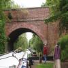
Wolvercote Bridge No 235
is a minor waterways place
on the Oxford Canal (Southern Section - Main Line) between
Isis Lock Junction (2 miles and 2¾ furlongs
to the southeast) and
Wolvercote Junction (Junction of Duke's Cut with Oxford Canal) (5¼ furlongs
and 1 lock
to the northwest).
The nearest place in the direction of Isis Lock Junction is Wolvercote Footbridge;
a few yards
away.
The nearest place in the direction of Wolvercote Junction is Wolvercote Lock No 45;
¼ furlongs
away.
There is access (via steps) to the towpath here.
Mooring here is unrated.
There is a bridge here which takes a minor road over the canal.
| St Edwards Lift Bridge No 238 | 7 furlongs | |
| Site of Second St Edwards Lift Bridge | 5½ furlongs | |
| Wolvercote Railway Bridge No 236A | 4¼ furlongs | |
| Wolvercote Green Field Bridge No 236 | 1½ furlongs | |
| Wolvercote Footbridge | a few yards | |
| Wolvercote Bridge No 235 | ||
| Wolvercote Lock No 45 | ¼ furlongs | |
| Wolvercote Sanitary Station | 1¾ furlongs | |
| Perrys Lift Bridge No 234 | 1¾ furlongs | |
| Western Bypass Bridge | 3½ furlongs | |
| Lift Bridge No 233 (Oxford Canal) | 3½ furlongs | |
Amenities nearby at Wolvercote Footbridge
Amenities nearby at Wolvercote Lock No 45
Amenities in City of Oxford
Amenities at other places in City of Oxford
at Osney Lock
at Osney Bridge
at Osney Bridge
at Osney Bridge
at Osney Bridge
at Osney Marina
at Osney Bridge
at Osney Bridge
at Osney Bridge
at Osney Bridge
- Oxford Canal Walk - Part One - Oxford to Thrupp - YouTube — associated with Oxford Canal
- A walk along the Oxford Canal (Southern Section) from Oxford to Thrupp Wide
Mouseover for more information or show routes to facility
Nearest water point
In the direction of Napton Junction
Wolvercote Sanitary Station — 1¾ furlongs and 1 lock away
On this waterway in the direction of Napton Junction
Wolvercote Junction Water Point — 6 furlongs and 2 locks away
On this waterway in the direction of Napton Junction
Eynsham Lock — 4 miles and 2 locks away
Travel to Wolvercote Junction, then on the Oxford Canal (Duke's Cut) to Duke's Cut Junction, then on the River Thames (above Oxford) to Eynsham Lock
Langford Lane Bridge No 224 — 3 miles, 5¾ furlongs and 4 locks away
On this waterway in the direction of Napton Junction
Aubreys Lift Bridge No 221 — 4 miles, 3¼ furlongs and 4 locks away
On this waterway in the direction of Napton Junction
Thrupp Cruising Club — 4 miles, 3½ furlongs and 4 locks away
On this waterway in the direction of Napton Junction
Shifford Lock — 14 miles, ¾ furlongs and 5 locks away
Travel to Wolvercote Junction, then on the Oxford Canal (Duke's Cut) to Duke's Cut Junction, then on the River Thames (above Oxford) to Shifford Lock
Heyford Wharf Bridge No 206 — 11 miles, 7¾ furlongs and 9 locks away
On this waterway in the direction of Napton Junction
Heyford Wharf — 11 miles, 7¾ furlongs and 9 locks away
On this waterway in the direction of Napton Junction
Aynho Wharf — 18 miles, ¼ furlongs and 12 locks away
On this waterway in the direction of Napton Junction
In the direction of End of Hythe Bridge Arm
St Edwards Lift Bridge No 238 — 7 furlongs away
On this waterway in the direction of End of Hythe Bridge Arm
Oxford Visitor Moorings — 2 miles, 3½ furlongs away
On this waterway in the direction of End of Hythe Bridge Arm
Abingdon Lock — 11 miles, 2½ furlongs and 4 locks away
Travel to Isis Lock Junction, then on the River Thames (Sheepwash Channel) to Sheepwash Channel Junction, then on the River Thames (above Oxford) to Osney Bridge, then on the River Thames (below Oxford) to Abingdon Lock
Abingdon Bridge Marine — 11 miles, 6¼ furlongs and 5 locks away
Travel to Isis Lock Junction, then on the River Thames (Sheepwash Channel) to Sheepwash Channel Junction, then on the River Thames (above Oxford) to Osney Bridge, then on the River Thames (below Oxford) to Abingdon Bridge MarineNearest rubbish disposal
In the direction of Napton Junction
Wolvercote Sanitary Station — 1¾ furlongs and 1 lock away
On this waterway in the direction of Napton Junction
Eynsham Lock — 4 miles and 2 locks away
Travel to Wolvercote Junction, then on the Oxford Canal (Duke's Cut) to Duke's Cut Junction, then on the River Thames (above Oxford) to Eynsham Lock
Aubreys Lift Bridge No 221 — 4 miles, 3¼ furlongs and 4 locks away
On this waterway in the direction of Napton Junction
Thrupp Cruising Club — 4 miles, 3½ furlongs and 4 locks away
On this waterway in the direction of Napton Junction
Heyford Wharf Bridge No 206 — 11 miles, 7¾ furlongs and 9 locks away
On this waterway in the direction of Napton Junction
Heyford Wharf — 11 miles, 7¾ furlongs and 9 locks away
On this waterway in the direction of Napton Junction
Rushey Lock — 18 miles, 1¾ furlongs and 6 locks away
Travel to Wolvercote Junction, then on the Oxford Canal (Duke's Cut) to Duke's Cut Junction, then on the River Thames (above Oxford) to Rushey Lock
Aynho Wharf — 18 miles, ¼ furlongs and 12 locks away
On this waterway in the direction of Napton Junction
In the direction of End of Hythe Bridge Arm
Abingdon Lock — 11 miles, 2½ furlongs and 4 locks away
Travel to Isis Lock Junction, then on the River Thames (Sheepwash Channel) to Sheepwash Channel Junction, then on the River Thames (above Oxford) to Osney Bridge, then on the River Thames (below Oxford) to Abingdon Lock
Day's Lock — 19 miles, 4½ furlongs and 7 locks away
Travel to Isis Lock Junction, then on the River Thames (Sheepwash Channel) to Sheepwash Channel Junction, then on the River Thames (above Oxford) to Osney Bridge, then on the River Thames (below Oxford) to Day's LockNearest chemical toilet disposal
In the direction of Napton Junction
Wolvercote Sanitary Station — 1¾ furlongs and 1 lock away
On this waterway in the direction of Napton Junction
Eynsham Lock — 4 miles and 2 locks away
Travel to Wolvercote Junction, then on the Oxford Canal (Duke's Cut) to Duke's Cut Junction, then on the River Thames (above Oxford) to Eynsham Lock
Thrupp Cruising Club — 4 miles, 3½ furlongs and 4 locks away
On this waterway in the direction of Napton Junction
Rushey Lock — 18 miles, 1¾ furlongs and 6 locks away
Travel to Wolvercote Junction, then on the Oxford Canal (Duke's Cut) to Duke's Cut Junction, then on the River Thames (above Oxford) to Rushey Lock
In the direction of End of Hythe Bridge Arm
Abingdon Lock — 11 miles, 2½ furlongs and 4 locks away
Travel to Isis Lock Junction, then on the River Thames (Sheepwash Channel) to Sheepwash Channel Junction, then on the River Thames (above Oxford) to Osney Bridge, then on the River Thames (below Oxford) to Abingdon Lock
Day's Lock — 19 miles, 4½ furlongs and 7 locks away
Travel to Isis Lock Junction, then on the River Thames (Sheepwash Channel) to Sheepwash Channel Junction, then on the River Thames (above Oxford) to Osney Bridge, then on the River Thames (below Oxford) to Day's LockNearest place to turn
In the direction of Napton Junction
Wolvercote Junction — 5¼ furlongs and 1 lock away
On this waterway in the direction of Napton Junction
Bypass Reservoir Junction — 7 furlongs and 2 locks away
Travel to Wolvercote Junction, then on the Oxford Canal (Duke's Cut) to Bypass Reservoir Junction
Duke's Cut Junction — 1 mile, 3½ furlongs and 2 locks away
Travel to Wolvercote Junction, then on the Oxford Canal (Duke's Cut) to Duke's Cut Junction
Thames - Wharf Stream Junction — 3 miles, 6¼ furlongs and 2 locks away
Travel to Wolvercote Junction, then on the Oxford Canal (Duke's Cut) to Duke's Cut Junction, then on the River Thames (above Oxford) to Thames - Wharf Stream Junction
Pinkhill Lock Weir Exit — 5 miles, 2¼ furlongs and 3 locks away
Travel to Wolvercote Junction, then on the Oxford Canal (Duke's Cut) to Duke's Cut Junction, then on the River Thames (above Oxford) to Pinkhill Lock Weir Exit
Thrupp Wide — 4 miles, 3½ furlongs and 4 locks away
On this waterway in the direction of Napton Junction
Shipton Weir Junction — 5 miles, 3¾ furlongs and 5 locks away
On this waterway in the direction of Napton Junction
Enslow Winding Hole — 7 miles and 6 locks away
On this waterway in the direction of Napton Junction
Kirtlington Winding Hole — 8 miles, 5½ furlongs and 7 locks away
On this waterway in the direction of Napton Junction
In the direction of End of Hythe Bridge Arm
Hythe Bridge Arm Winding Hole — 2 miles, 2¾ furlongs away
On this waterway in the direction of End of Hythe Bridge Arm
End of Hythe Bridge Arm — 2 miles, 3½ furlongs away
On this waterway in the direction of End of Hythe Bridge Arm
Castle Mill Stream Junction — 2 miles, 3 furlongs and 1 lock away
Travel to Isis Lock Junction, then on the River Thames (Sheepwash Channel) to Castle Mill Stream Junction
Sheepwash Channel Junction — 2 miles, 3¾ furlongs and 1 lock away
Travel to Isis Lock Junction, then on the River Thames (Sheepwash Channel) to Sheepwash Channel Junction
Bossoms Boat Yard — 3 miles, 1¾ furlongs and 1 lock away
Travel to Isis Lock Junction, then on the River Thames (Sheepwash Channel) to Sheepwash Channel Junction, then on the River Thames (above Oxford) to Bossoms Boat Yard
Osney Lock Weir Exit — 2 miles, 6¾ furlongs and 2 locks away
Travel to Isis Lock Junction, then on the River Thames (Sheepwash Channel) to Sheepwash Channel Junction, then on the River Thames (above Oxford) to Osney Bridge, then on the River Thames (below Oxford) to Osney Lock Weir Exit
Thames - Cherwell Junction — 4 miles, ¾ furlongs and 2 locks away
Travel to Isis Lock Junction, then on the River Thames (Sheepwash Channel) to Sheepwash Channel Junction, then on the River Thames (above Oxford) to Osney Bridge, then on the River Thames (below Oxford) to Thames - Cherwell Junction
Iffley Lock Weir Entrance No 1 — 5 miles and 2 locks away
Travel to Isis Lock Junction, then on the River Thames (Sheepwash Channel) to Sheepwash Channel Junction, then on the River Thames (above Oxford) to Osney Bridge, then on the River Thames (below Oxford) to Iffley Lock Weir Entrance No 1
Iffley Lock Weir Exit No 1 — 5 miles, 1¼ furlongs and 3 locks away
Travel to Isis Lock Junction, then on the River Thames (Sheepwash Channel) to Sheepwash Channel Junction, then on the River Thames (above Oxford) to Osney Bridge, then on the River Thames (below Oxford) to Iffley Lock Weir Exit No 1
Sandford Lock Weir Exit (Thames) — 6 miles, 7 furlongs and 4 locks away
Travel to Isis Lock Junction, then on the River Thames (Sheepwash Channel) to Sheepwash Channel Junction, then on the River Thames (above Oxford) to Osney Bridge, then on the River Thames (below Oxford) to Sandford Lock Weir Exit (Thames)
Abingdon Lock Weir Exit No 1 — 11 miles, 3 furlongs and 5 locks away
Travel to Isis Lock Junction, then on the River Thames (Sheepwash Channel) to Sheepwash Channel Junction, then on the River Thames (above Oxford) to Osney Bridge, then on the River Thames (below Oxford) to Abingdon Lock Weir Exit No 1Nearest self-operated pump-out
In the direction of Napton Junction
Eynsham Lock — 4 miles and 2 locks away
Travel to Wolvercote Junction, then on the Oxford Canal (Duke's Cut) to Duke's Cut Junction, then on the River Thames (above Oxford) to Eynsham Lock
Aubreys Lift Bridge No 221 — 4 miles, 3¼ furlongs and 4 locks away
On this waterway in the direction of Napton Junction
Thrupp Cruising Club — 4 miles, 3½ furlongs and 4 locks away
On this waterway in the direction of Napton Junction
Rushey Lock — 18 miles, 1¾ furlongs and 6 locks away
Travel to Wolvercote Junction, then on the Oxford Canal (Duke's Cut) to Duke's Cut Junction, then on the River Thames (above Oxford) to Rushey Lock
In the direction of End of Hythe Bridge Arm
Abingdon Lock — 11 miles, 2½ furlongs and 4 locks away
Travel to Isis Lock Junction, then on the River Thames (Sheepwash Channel) to Sheepwash Channel Junction, then on the River Thames (above Oxford) to Osney Bridge, then on the River Thames (below Oxford) to Abingdon LockNearest boatyard pump-out
In the direction of Napton Junction
Oxford Cruisers Marina — 4 miles, 7¾ furlongs and 3 locks away
Travel to Wolvercote Junction, then on the Oxford Canal (Duke's Cut) to Duke's Cut Junction, then on the River Thames (above Oxford) to Oxford Cruisers Marina
Enslow Wharf — 6 miles, 6¾ furlongs and 6 locks away
On this waterway in the direction of Napton Junction
Heyford Wharf — 11 miles, 7¾ furlongs and 9 locks away
On this waterway in the direction of Napton Junction
Aynho Wharf — 18 miles, ¼ furlongs and 12 locks away
On this waterway in the direction of Napton Junction
In the direction of End of Hythe Bridge Arm
Abingdon Bridge Marine — 11 miles, 6¼ furlongs and 5 locks away
Travel to Isis Lock Junction, then on the River Thames (Sheepwash Channel) to Sheepwash Channel Junction, then on the River Thames (above Oxford) to Osney Bridge, then on the River Thames (below Oxford) to Abingdon Bridge MarineDirection of TV transmitter (From Wolfbane Cybernetic)
There is no page on Wikipedia called “Wolvercote Bridge”
Wikipedia pages that might relate to Wolvercote Bridge
[Wolvercote]
Wolvercote is a village that is part of the City of Oxford, England. It is about 3 miles (5 km) northwest of the city centre, on the northern edge of Wolvercote
[A34 Road Bridge]
near Wolvercote on the reach to King's Lock. The bridge was built in 1961. The bridge's formal name on the Ordnance Survey map is Thames Bridge, possibly
[The Trout Inn]
as The Trout) is a historic public house in Lower Wolvercote north of Oxford, close to Godstow Bridge, directly by the River Thames. The pub features in
[Godstow]
villages of Wolvercote to the east and Wytham to the west. The ruins of Godstow Abbey, also known as Godstow Nunnery, are here. A bridge spans the Thames
[Godstow Bridge]
the reach to King's Lock and carries a minor road between Wolvercote and Wytham. The bridge is in two parts. The older part crosses the original course
[Cherwell Valley line]
an alternative spelling for that village's toponym. The former halt at Wolvercote was called "Wolvercot Platform", with a deliberately different spelling
[Port Meadow, Oxford]
ever since. The meadow runs from Jericho to Wolvercote (where north of the Shiplake Ditch it becomes Wolvercote Common) along the east (left) bank of the
[Port Meadow with Wolvercote Common and Green]
Port Meadow with Wolvercote Common and Green is a 167.1-hectare (413-acre) biological Site of Special Scientific Interest in Oxford in Oxfordshire. It
[River Thames]
existing bridges both in London and along the length of the river. These included Putney Bridge, Westminster Bridge, Datchet Bridge, Windsor Bridge and Sonning
[Godstow Lock]
Godstow Bridge just above the Trout Inn. These feed into a backwater (Wolvercote Mill Stream) which has come from above King's Lock by Wolvercote. Prior
Results of Google Search
Oxford Canal Bridge Number 235 (Godstow Road Bridge ...Jun 28, 1972 ... Oxford Canal Bridge Number 235 (Godstow Road Bridge) is a Grade II listed building in Wolvercote, Oxfordshire, England. See why it was ...
Oct 23, 2015 ... With a boat locking down through Wolvercote Lock. ... This is 1 of 2 images, with title Bridge 235, Oxford Canal in this square ... bridge 236, and there would have been no reason to have built a higher bridge at the time.
Community Pub Limited food availabilty. Wolvercote Lock Bridge No 235, Jacob's Inn Godstow Road Wolvercote OXFORD OX2 8PG, 01865 514333, Map, X, X ...
May 30, 2006 ... No higher resolution available. ... in Upper Wolvercote, Oxfordshire: view south toward Wolvercote Lock and Bridge 235, Godstow Road Bridge.
Transport: There is no public transport back to Oxford direct from Duke's Cut end of the walk, but buses are available from near Balls Bridge in Wolvercote, and ... 235) which carries the Godstow Road westwards to Port Meadow and Lower.
File:OxfordCanal Bridge235 underside.jpg ... English: The underside of Bridge 235 over the Oxford Canal, which is Godstow Road Bridge at Upper Wolvercote, ...
Hawkesbury Stop Lock No.1. 4, B4109 Tusses Bridge ... 30, B4027 Fosse Way Road Bridge. Smite Brook. Brinklow ... 235, Wolvercote Bridge. 236, Ball's Bridge ...
Stratford - Bridge St (For KES). 0832. STRATFORD COLLEGE (Alcester Rd). 0834. STRATFORD SCHOOL (Alcester Rd). 0842. STRATFORD GIRLS GRAMMAR.
Wolvercote Mill Stream from Thames. Duke's Lock No 44. Wolvercote Junction: Duke's Cut. 000, show A40 road ... 235, Wolvercote Bridge. 236, Ball's Bridge ...


![Wolvercote Lock. There is an OS benchmark [[3246154]] ringed with brown chalk on the left edge of the lock wall near the bottom of the image by Roger Templeman – 01 December 2012](https://s1.geograph.org.uk/geophotos/03/24/61/3246161_8498c584_120x120.jpg)