CanalPlanAC

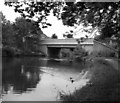
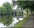
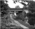
Scotland Road Bridge No 141C

 
Scotland Road Bridge, Pendle BB9 7XT, United Kingdom (A682)
 
Information about the place
Scotland Road Bridge No 141C is a minor waterways place on the Leeds and Liverpool Canal (Main Line - Wigan to Leeds) between Feniscowles Bridge No 93B (25 miles and 3¼ furlongs and 6 locks to the west) and Salterforth Bridge No 151 (Salterforth village 200 yards northeast) (5 miles and ½ furlongs and 7 locks to the northeast).
 
 
The nearest place in the direction of Feniscowles Bridge No 93B is Pendle Street Bridge No 141B; 1¼ furlongs away.
 
The nearest place in the direction of Salterforth Bridge No 151 is Reedyford Aqueduct No 34; ¾ furlongs away.

There may be access to the towpath here.

Mooring here is unrated.

There is a bridge here which takes a major road over the canal.


Amenities

Amenities here

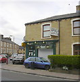
 Asam Food Mini Market
 SEE ADDRESS
 Fish & Chips
 Jewson

Amenities nearby at Pendle Street Bridge No 141B

 Morison's
 Morrisons
 Morrisons - Clayton Street
 Fish & Chips
 Cashpoint
 Cashpoint
 Morrisons Fuel

Amenities nearby at Reedyford Aqueduct No 34

 Hungry Horse
 
Maps
If you are a user and are logged on, or if you are actively planning a route, a map will be displayed here.
Show on external mapping site: Google | OSM | Bing
 
Photos
 
External websites
There are no links to external websites from here.
Why not log in and add some (select "External websites" from the menu (sometimes this is under "Edit"))?
 
Nearest facilities

Mouseover for more information or show routes to facility

Nearest water point

In the direction of Leeds Bridge

Barrowford Top Lock No 451 mile, 3¾ furlongs and 6 locks away
On this waterway in the direction of Leeds Bridge
Foulridge Wharf3 miles, 3 furlongs and 7 locks away
On this waterway in the direction of Leeds Bridge
Salterforth Bridge No 1515 miles, ½ furlongs and 7 locks away
On this waterway in the direction of Leeds Bridge
Lower Park Marina5 miles, 6 furlongs and 7 locks away
On this waterway in the direction of Leeds Bridge
Greenberfield Services7 miles, 2½ furlongs and 7 locks away
On this waterway in the direction of Leeds Bridge
East Marton Visitor Moorings10 miles, 1½ furlongs and 10 locks away
On this waterway in the direction of Leeds Bridge
Priest Holme Water Point12 miles, 7¼ furlongs and 16 locks away
On this waterway in the direction of Leeds Bridge
Gargrave Services14 miles, 1¼ furlongs and 19 locks away
On this waterway in the direction of Leeds Bridge
Gawflat Swing Bridge No 17618 miles, 7¾ furlongs and 22 locks away
On this waterway in the direction of Leeds Bridge
Brewery Swing Bridge No 17719 miles, 1 furlong and 22 locks away
On this waterway in the direction of Leeds Bridge
Skipton Visitor Moorings19 miles, 3 furlongs and 22 locks away
On this waterway in the direction of Leeds Bridge

In the direction of Wigan Junction

Reedley Marina2 miles, 5 furlongs away
On this waterway in the direction of Wigan Junction
Rose Grove Services8 miles away
On this waterway in the direction of Wigan Junction

Nearest rubbish disposal

In the direction of Leeds Bridge

Barrowford Lock No 471 mile, 2¾ furlongs and 4 locks away
On this waterway in the direction of Leeds Bridge
Foulridge Wharf3 miles, 3 furlongs and 7 locks away
On this waterway in the direction of Leeds Bridge
Salterforth Bridge No 1515 miles, ½ furlongs and 7 locks away
On this waterway in the direction of Leeds Bridge
Lower Park Marina5 miles, 6 furlongs and 7 locks away
On this waterway in the direction of Leeds Bridge
Greenberfield Services7 miles, 2½ furlongs and 7 locks away
On this waterway in the direction of Leeds Bridge
Gargrave Services14 miles, 1¼ furlongs and 19 locks away
On this waterway in the direction of Leeds Bridge
Skipton Visitor Moorings19 miles, 3 furlongs and 22 locks away
On this waterway in the direction of Leeds Bridge

In the direction of Wigan Junction

Rose Grove Services8 miles away
On this waterway in the direction of Wigan Junction

Nearest chemical toilet disposal

In the direction of Leeds Bridge

Barrowford Top Lock No 451 mile, 3¾ furlongs and 6 locks away
On this waterway in the direction of Leeds Bridge
Foulridge Wharf3 miles, 3 furlongs and 7 locks away
On this waterway in the direction of Leeds Bridge
Salterforth Bridge No 1515 miles, ½ furlongs and 7 locks away
On this waterway in the direction of Leeds Bridge
Lower Park Marina5 miles, 6 furlongs and 7 locks away
On this waterway in the direction of Leeds Bridge
Greenberfield Services7 miles, 2½ furlongs and 7 locks away
On this waterway in the direction of Leeds Bridge
Gargrave Services14 miles, 1¼ furlongs and 19 locks away
On this waterway in the direction of Leeds Bridge
Skipton Visitor Moorings19 miles, 3 furlongs and 22 locks away
On this waterway in the direction of Leeds Bridge

In the direction of Wigan Junction

Rose Grove Services8 miles away
On this waterway in the direction of Wigan Junction

Nearest place to turn

In the direction of Leeds Bridge

Hodge Bank Winding Hole1¼ furlongs away
On this waterway in the direction of Leeds Bridge
Wanless Bridge Winding Hole2 miles, ¼ furlongs and 7 locks away
On this waterway in the direction of Leeds Bridge
Foulridge Wharf Winding Hole3 miles, 3½ furlongs and 7 locks away
On this waterway in the direction of Leeds Bridge
Long Ing Bridge Winding Hole6 miles, 1½ furlongs and 7 locks away
On this waterway in the direction of Leeds Bridge
Coates Lane Winding Hole7 miles, 1 furlong and 7 locks away
On this waterway in the direction of Leeds Bridge
Nuttercote Winding Hole8 miles, ½ furlongs and 10 locks away
On this waterway in the direction of Leeds Bridge

In the direction of Wigan Junction

Hawks House Winding Hole2 miles, ¾ furlongs away
On this waterway in the direction of Wigan Junction
Burley Lane Winding Hole3 miles, 2 furlongs away
On this waterway in the direction of Wigan Junction
Winding Hole North of Burnley Embankment4 miles, 2½ furlongs away
On this waterway in the direction of Wigan Junction
Sandholme Aqueduct Winding Hole4 miles, 4 furlongs away
On this waterway in the direction of Wigan Junction
Nelson Square Winding Hole5 miles, 7 furlongs away
On this waterway in the direction of Wigan Junction
Old Rose Grove Winding Hole8 miles, 2¼ furlongs away
On this waterway in the direction of Wigan Junction
Hapton Winding Hole10 miles, ¾ furlongs away
On this waterway in the direction of Wigan Junction
Shuttleworth Winding Hole10 miles, 7½ furlongs away
On this waterway in the direction of Wigan Junction
Clough Bank Winding Hole11 miles, 6 furlongs away
On this waterway in the direction of Wigan Junction
Whalley Road Bridge Winding Hole13 miles, 4 furlongs away
On this waterway in the direction of Wigan Junction
Church Kirk Bridge Winding Hole15 miles, ½ furlongs away
On this waterway in the direction of Wigan Junction
Railway Bridge No 110B Winding Hole15 miles, 6 furlongs away
On this waterway in the direction of Wigan Junction
Dunkenhalgh Aqueduct Winding Hole16 miles, 6½ furlongs away
On this waterway in the direction of Wigan Junction
Rishton Winding Hole17 miles away
On this waterway in the direction of Wigan Junction

Nearest self-operated pump-out

In the direction of Wigan Junction

Rose Grove Services8 miles away
On this waterway in the direction of Wigan Junction

Nearest boatyard pump-out

In the direction of Leeds Bridge

Lower Park Marina5 miles, 6 furlongs and 7 locks away
On this waterway in the direction of Leeds Bridge
Pennine Cruisers Wharf19 miles, 2¼ furlongs and 22 locks away
Travel to Skipton Junction, then on the Leeds and Liverpool Canal (Springs Branch) to Pennine Cruisers Wharf

In the direction of Wigan Junction

Reedley Marina2 miles, 5 furlongs away
On this waterway in the direction of Wigan Junction
Direction of TV transmitter (From Wolfbane Cybernetic)
 
 
Geograph
 
Wikipedia

There is no page on Wikipedia called “Scotland Road Bridge No 141C”

Wikipedia pages that might relate to Scotland Road Bridge No 141C
[Bonar Bridge] Bonar Bridge (Scottish Gaelic: Drochaid a' Bhanna, pronounced [ˈt̪ɾɔxɪtʲ ə ˈvan̪ˠə]) is a village on the north bank of the Kyle of Sutherland to the west [A roads in Zone 1 of the Great Britain numbering scheme] List of A roads in zone 1 in Great Britain beginning north of the River Thames, east of the A1 (roads beginning with 1). "Old Stoke Bridge, Ipswich". www [Edinburgh] (/ˈɛdɪnbərə/ (listen); Scots: Edinburgh; Scottish Gaelic: Dùn Èideann [ˈt̪uːn ˈeːtʲən̪ˠ]) is the capital city of Scotland and one of its 32 council areas. Historically [Road transport] Road transport or road transportation is a type of transport by using roads. Transport on roads can be roughly grouped into the transportation of goods [Whitehall] Department of Health. It ends at the Cenotaph, the road ahead being Parliament Street. Great Scotland Yard and Horse Guards Avenue branch off to the east [History of road transport] turnpiking of subsidiary connecting roads, routes over new bridges, new routes in the growing industrial areas and roads in Scotland. About 150 trusts were established [List of islands of Scotland] at all stages of the tide, excluding human devices such as bridges and causeways". Scotland has over 900 offshore islands, most of which are to be found [Bridge of Spies (film)] Bridge of Spies is a 2015 historical drama film directed and co-produced by Steven Spielberg, written by Matt Charman and the Coen brothers, and starring [Road] but not Scotland or Northern Ireland, road is "any length of highway or of any other road to which the public has access, and includes bridges over which [Banff, Aberdeenshire] Banff is a town in the Banff and Buchan area of Aberdeenshire, Scotland. It is situated on Banff Bay and faces the town of Macduff across the estuary of
 
Google

Results of Google Search

File:Reedyford Bridge 141C, Leeds and Liverpool Canal - geograph ...
Aug 25, 1993 ... No higher resolution available. ... The bridge carries Scotland Road, part of the A682 which links Nelson to the M65 and to Gisburn. Date, 25 ...
Scotland's Most Iconic Bridges | VisitScotland
Oct 20, 2016 ... world's longest cantilever bridges is not the forth its one in Canada ,,difference being the one in Scotland is rail and the Quebec one is a road ...
Forth Road Bridge - Wikipedia
The Forth Road Bridge is a suspension bridge in east central Scotland. The bridge opened in ... This was achieved in 1993, and it was planned that tolls would not be levied after May 1995. Instead legislation enabling the continued levying of ...
84241 images tagged with 'canal' :: Geograph Britain and Ireland
This shows the southern side of bridge#141C which carries Scotland Road, ... Bridge no 45B is not the prettiest on the Chesterfield Canal, but it does the job.
Queensferry Crossing - Wikipedia
The Queensferry Crossing is a road bridge in Scotland. It was built alongside the existing Forth ... demand, were first put forward in the 1990s, but no action was taken until structural issues were discovered in the Forth Road Bridge in 2004.
Homepage - Roadbridge.ie
Welcome to Roadbridge, one of Ireland's leading Civil Engineering companies, with over 50 year's experience in the delivery of major infrastructural projects.
Forth Road Bridge | The Forth Bridges
Official homepage for the Forth Road Bridge, one of Scotland's famous Forth Bridges. ... No up-to-date wind data available. compass icon. Wind direction ...
The Forth Bridges | The Forth Bridges
Official website for the Queensferry Crossing, the Forth Road Bridge and the Forth Bridge - Scotland's famous three bridges spanning three centuries.
Nelson England United Kingdom
... Hodge Bank Bridge No 141D map · Canalside Winding Hole map · Scotland Road Bridge No 141C map · Pendle Street Bridge No 141B map · Nelson Bridge  ...