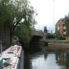
Inner Distribution Road Bridge No 4
is a minor waterways place
on the River Kennet between
High Bridge Reading (Jurisdiction for the River Kennet changes between the Canal & River Trust and the Environment Agency here.) (3 furlongs
and 1 lock
to the northeast) and
Burghfield Bridge No 14 (Burghfield) (3 miles and 1 furlong
and 2 locks
to the west).
The nearest place in the direction of High Bridge Reading is Winding Hole above County Lock;
¼ furlongs
away.
The nearest place in the direction of Burghfield Bridge No 14 is Lower Brook Street Mooring (Last mooring on CRT waters heading to Thames);
½ furlongs
away.
There may be access to the towpath here.
Mooring here is unrated.
There is a bridge here which takes a major road over the canal.
Delphi Bridge | 2½ furlongs | |
Cooks Bridge | 2 furlongs | |
Bridge Street Bridge No 2 | 1¼ furlongs | |
County Lock No 106 | ½ furlongs | |
Winding Hole above County Lock | ¼ furlongs | |
Inner Distribution Road Bridge No 4 | ||
Lower Brook Street Mooring | ½ furlongs | |
Berkeley Avenue Bridge No 5 | 1¼ furlongs | |
Berkeley Avenue Pipe Bridge | 1¼ furlongs | |
Rose Kiln Lane Bridge No 8 | 1 mile | |
Reading Relief Road Bridge | 1 mile, 1¼ furlongs |
There are no links to external websites from here.
Why not log in and add some (select "External websites" from the menu (sometimes this is under "Edit"))?
Mouseover for more information or show routes to facility
Nearest water point
In the direction of Northcroft Lane Arm
Tyle Mill Lock C&RT Services — 7 miles, ¼ furlongs and 6 locks away
On this waterway in the direction of Northcroft Lane Arm
Aldermaston Lock No 95 — 9 miles, 2¾ furlongs and 9 locks away
On this waterway in the direction of Northcroft Lane Arm
Ham Manor Marina — 17 miles, ¾ furlongs and 18 locks away
On this waterway in the direction of Northcroft Lane Arm
In the direction of High Bridge Reading
Thames & Kennet Marina — 1 mile, 3¼ furlongs and 2 locks away
Travel to High Bridge Reading, then on the River Thames (River Kennet) to Thames - Kennet Junction (Kennet Mouth), then on the River Thames (below Oxford) to Thames & Kennet Marina
Shiplake Lock — 6 miles and 3 locks away
Travel to High Bridge Reading, then on the River Thames (River Kennet) to Thames - Kennet Junction (Kennet Mouth), then on the River Thames (below Oxford) to Shiplake Lock
Cleeve Lock — 13 miles, 3 furlongs and 6 locks away
Travel to High Bridge Reading, then on the River Thames (River Kennet) to Thames - Kennet Junction (Kennet Mouth), then on the River Thames (below Oxford) to Cleeve Lock
Hurley Lock — 15 miles, 6¼ furlongs and 6 locks away
Travel to High Bridge Reading, then on the River Thames (River Kennet) to Thames - Kennet Junction (Kennet Mouth), then on the River Thames (below Oxford) to Hurley LockNearest rubbish disposal
In the direction of Northcroft Lane Arm
Tyle Mill Lock C&RT Services — 7 miles, ¼ furlongs and 6 locks away
On this waterway in the direction of Northcroft Lane Arm
Aldermaston Lock No 95 — 9 miles, 2¾ furlongs and 9 locks away
On this waterway in the direction of Northcroft Lane Arm
Ham Manor Marina — 17 miles, ¾ furlongs and 18 locks away
On this waterway in the direction of Northcroft Lane Arm
In the direction of High Bridge Reading
Shiplake Lock — 6 miles and 3 locks away
Travel to High Bridge Reading, then on the River Thames (River Kennet) to Thames - Kennet Junction (Kennet Mouth), then on the River Thames (below Oxford) to Shiplake Lock
Mapledurham Lock — 6 miles, 3¼ furlongs and 3 locks away
Travel to High Bridge Reading, then on the River Thames (River Kennet) to Thames - Kennet Junction (Kennet Mouth), then on the River Thames (below Oxford) to Mapledurham Lock
Marsh Lock — 8 miles, 6 furlongs and 4 locks away
Travel to High Bridge Reading, then on the River Thames (River Kennet) to Thames - Kennet Junction (Kennet Mouth), then on the River Thames (below Oxford) to Marsh Lock
Hambleden Lock — 12 miles, ¾ furlongs and 5 locks away
Travel to High Bridge Reading, then on the River Thames (River Kennet) to Thames - Kennet Junction (Kennet Mouth), then on the River Thames (below Oxford) to Hambleden Lock
Goring Lock — 12 miles, 6 furlongs and 5 locks away
Travel to High Bridge Reading, then on the River Thames (River Kennet) to Thames - Kennet Junction (Kennet Mouth), then on the River Thames (below Oxford) to Goring Lock
Hurley Lock — 15 miles, 6¼ furlongs and 6 locks away
Travel to High Bridge Reading, then on the River Thames (River Kennet) to Thames - Kennet Junction (Kennet Mouth), then on the River Thames (below Oxford) to Hurley Lock
Marlow Lock — 18 miles, 1¼ furlongs and 8 locks away
Travel to High Bridge Reading, then on the River Thames (River Kennet) to Thames - Kennet Junction (Kennet Mouth), then on the River Thames (below Oxford) to Marlow LockNearest chemical toilet disposal
In the direction of Northcroft Lane Arm
Tyle Mill Lock C&RT Services — 7 miles, ¼ furlongs and 6 locks away
On this waterway in the direction of Northcroft Lane Arm
Aldermaston Lock No 95 — 9 miles, 2¾ furlongs and 9 locks away
On this waterway in the direction of Northcroft Lane Arm
Ham Manor Marina — 17 miles, ¾ furlongs and 18 locks away
On this waterway in the direction of Northcroft Lane Arm
In the direction of High Bridge Reading
Thames & Kennet Marina — 1 mile, 3¼ furlongs and 2 locks away
Travel to High Bridge Reading, then on the River Thames (River Kennet) to Thames - Kennet Junction (Kennet Mouth), then on the River Thames (below Oxford) to Thames & Kennet Marina
Shiplake Lock — 6 miles and 3 locks away
Travel to High Bridge Reading, then on the River Thames (River Kennet) to Thames - Kennet Junction (Kennet Mouth), then on the River Thames (below Oxford) to Shiplake Lock
Mapledurham Lock — 6 miles, 3¼ furlongs and 3 locks away
Travel to High Bridge Reading, then on the River Thames (River Kennet) to Thames - Kennet Junction (Kennet Mouth), then on the River Thames (below Oxford) to Mapledurham Lock
Hurley Lock — 15 miles, 6¼ furlongs and 6 locks away
Travel to High Bridge Reading, then on the River Thames (River Kennet) to Thames - Kennet Junction (Kennet Mouth), then on the River Thames (below Oxford) to Hurley LockNearest place to turn
In the direction of Northcroft Lane Arm
Fobney Lock Weir Exit — 1 mile, 4 furlongs away
On this waterway in the direction of Northcroft Lane Arm
Winding Hole above Fobney Lock — 1 mile, 4½ furlongs and 1 lock away
On this waterway in the direction of Northcroft Lane Arm
Fobney Lock Weir Entrance — 2 miles, ¼ furlongs and 1 lock away
On this waterway in the direction of Northcroft Lane Arm
Southcote Lock Weir Exit — 2 miles, 2¼ furlongs and 1 lock away
On this waterway in the direction of Northcroft Lane Arm
Burghfield Island Entrance No 1 — 2 miles, 7¼ furlongs and 2 locks away
On this waterway in the direction of Northcroft Lane Arm
Burghfield Island Entrance No 2 — 3 miles, 1 furlong and 2 locks away
On this waterway in the direction of Northcroft Lane Arm
Burghfield Lock Weir Exit — 3 miles, 4 furlongs and 2 locks away
On this waterway in the direction of Northcroft Lane Arm
Burghfield Mill Winding Hole — 3 miles, 7½ furlongs and 3 locks away
On this waterway in the direction of Northcroft Lane Arm
Winding Hole below Garston Lock — 4 miles, 6½ furlongs and 3 locks away
On this waterway in the direction of Northcroft Lane Arm
Sheffield Lock Weir Entrance — 5 miles, 5½ furlongs and 5 locks away
On this waterway in the direction of Northcroft Lane Arm
In the direction of High Bridge Reading
Winding Hole above County Lock — ¼ furlongs away
On this waterway in the direction of High Bridge Reading
Reading Jail Loop (western entrance) — 5½ furlongs and 1 lock away
Travel to High Bridge Reading, then on the River Thames (River Kennet) to Reading Jail Loop (western entrance)
Reading Jail Loop (eastern entrance) — 7¼ furlongs and 1 lock away
Travel to High Bridge Reading, then on the River Thames (River Kennet) to Reading Jail Loop (eastern entrance)
Blakes Lock Weir Exit — 1 mile, ¾ furlongs and 2 locks away
Travel to High Bridge Reading, then on the River Thames (River Kennet) to Blakes Lock Weir Exit
Thames - Kennet Junction (Kennet Mouth) — 1 mile, 2 furlongs and 2 locks away
Travel to High Bridge Reading, then on the River Thames (River Kennet) to Thames - Kennet Junction (Kennet Mouth)
Caversham Lock Weir Exit — 1 mile, 7¾ furlongs and 2 locks away
Travel to High Bridge Reading, then on the River Thames (River Kennet) to Thames - Kennet Junction (Kennet Mouth), then on the River Thames (below Oxford) to Caversham Lock Weir Exit
Sonning Lock Weir Entrance — 3 miles, ¼ furlongs and 2 locks away
Travel to High Bridge Reading, then on the River Thames (River Kennet) to Thames - Kennet Junction (Kennet Mouth), then on the River Thames (below Oxford) to Sonning Lock Weir Entrance
Fry's Island Entrance — 2 miles, 4¾ furlongs and 3 locks away
Travel to High Bridge Reading, then on the River Thames (River Kennet) to Thames - Kennet Junction (Kennet Mouth), then on the River Thames (below Oxford) to Fry's Island Entrance
Sonning Lock Weir Exit — 3 miles, 3½ furlongs and 3 locks away
Travel to High Bridge Reading, then on the River Thames (River Kennet) to Thames - Kennet Junction (Kennet Mouth), then on the River Thames (below Oxford) to Sonning Lock Weir Exit
Mapledurham Lock Weir Exit — 6 miles, 2¾ furlongs and 3 locks away
Travel to High Bridge Reading, then on the River Thames (River Kennet) to Thames - Kennet Junction (Kennet Mouth), then on the River Thames (below Oxford) to Mapledurham Lock Weir ExitNearest self-operated pump-out
In the direction of Northcroft Lane Arm
Tyle Mill Lock C&RT Services — 7 miles, ¼ furlongs and 6 locks away
On this waterway in the direction of Northcroft Lane Arm
In the direction of High Bridge Reading
Mapledurham Lock — 6 miles, 3¼ furlongs and 3 locks away
Travel to High Bridge Reading, then on the River Thames (River Kennet) to Thames - Kennet Junction (Kennet Mouth), then on the River Thames (below Oxford) to Mapledurham LockNearest boatyard pump-out
In the direction of Northcroft Lane Arm
Newbury Marina — 17 miles, 5½ furlongs and 19 locks away
On this waterway in the direction of Northcroft Lane Arm
In the direction of High Bridge Reading
Thames & Kennet Marina — 1 mile, 3¼ furlongs and 2 locks away
Travel to High Bridge Reading, then on the River Thames (River Kennet) to Thames - Kennet Junction (Kennet Mouth), then on the River Thames (below Oxford) to Thames & Kennet MarinaDirection of TV transmitter (From Wolfbane Cybernetic)
There is no page on Wikipedia called “Inner Distribution Road Bridge”
Wikipedia pages that might relate to Inner Distribution Road Bridge
[Inner West]
western boundary of the Inner West is approximately the A3 arterial road (Homebush Bay Drive / Centenary Drive), which divides the Inner West from the Greater
[List of road–rail bridges]
Road–rail bridges are bridges shared by road and rail lines. Road and rail may be segregated so that trains may operate at the same time as cars (e.g
[A roads in Zone 4 of the Great Britain numbering scheme]
List of A roads in zone 4 in Great Britain starting north of the A4 and south/west of the A5 (roads beginning with 4). Mosalski, Ruth (4 November 2014)
[Bridge of Spies (film)]
Bridge of Spies is a 2015 historical drama film directed and co-produced by Steven Spielberg, written by Matt Charman and the Coen brothers, and starring
[List of ring roads]
Ring Road, Bang Phli to Suk Sawad, a viaduct/bridge and fully tolled section Inner Ring Road - a complete ring road comprising Ratchadaphisek Road (eastern
[Willemstad]
Willemstad, Inner City and Harbour was declared World Heritage Site by UNESCO in 1997 Queen Emma floating bridge in Willemstad Queen Emma Bridge by night
[A329 road]
road is single carriageway, apart from the section through Bracknell, and in central Reading. In Reading the road is dualled where it forms the Inner
[Coley branch line]
space it occupied is now occupied by the A33 road and its junction with the town's Inner Distribution Road, together with an apartment block. Originally
[United States]
infrastructure over the following decades. Millions moved from farms and inner cities to large suburban housing developments. In 1959 Hawaii became the
[Brisbane]
barrier to road transport routes. In total there are sixteen bridges over the river, mostly concentrated in the inner city area. The road bridges (which usually
Results of Google Search
Bridge Formula Weights- FHWA Freight Management and OperationsJun 20, 2018 ... Table: Permissible Gross Loads for Vehicles in Regular Operation .... However, interior combinations of axles, such as the "tractor bridge" (axles ... Diagram of a truck showing the weight distribution of the first 3 axles of a truck
The Colley Lane Southern Access Road (CLSAR) is a proposal to construct a new carriageway in Bridgwater to ... The construction of a new bridge over the Bridgwater and Taunton Canal ... The provision of 4 junctions, incorporating 'right turning' lanes, where appropriate, to maintain ... Northern Inner Distributor Road ...
GENERAL ORGANISATION FOR ROAD BRIDGES. Traffic load models ... value) or between the inner limits of vehicle restraint systems. EN 1991-2 « Traffic ...
Jul 4, 2015 ... maintenance, and operation of public roads…,†for bridge load .... if the HL93 Inventory rating uses refined distribution, then the HL93 ..... neglected, if exterior strength per foot meets or exceeds the interior strength per foot.
THE INITIATIVE FOR A COMPETITIVE INNER CITY: ICIC is a national, nonprofit .... aspects of the transformation of food from point of production to distribution and includes cleaning, ..... roads, bridges and tunnels critical points of vulnerability.
The Miyeongji Road Bridge: Ongoing Issue and Test Case for ... Proposed Route of the Miyeongji, or Nakdong Inner Estuary, Bridge: (thick red line). .... localized distribution and poor conservation status, and are also listed as species of global  ...
The following listing is a guide of the basic requirements for operating in Florida: ...... Due to age, condition, or design, some roads and bridges in Florida cannot carry .... For internal bridge weight limits for your vehicle on the Interstate highway  ...
4, 19-Dec-2018, Forming Northern Access road to Daimler India Commercial .... 21, 19-Dec-2018, Reconstruction of Minor bridge at Km 2/4 of Mettupalayam ..... Provision of Internal electrification to newly constructed Tamilnadu Institute of ..... Improvement of Water Supply distribution system for Equitable distribution in ...
encompasses various types of road tunnels including mined, bored, ... Distribution Statement. No ... The latest edition of the AASHTO LRFD Bridge Design and.
9.7.5 Calculate Live Load Distribution Factors . .... 70W and 100/100W) structural steels are commonly used for bridge structures ... percent of the interior span lengths. ..... Haunch depth shall be carefully selected by considering road slope, top.