Craighall Road Basin is on the Forth and Clyde Canal (Port Dundas Branch - Main Line).
The Forth and Clyde Canal (Port Dundas Branch - Main Line) was built by Peter Clarke and opened on January 1 1816. The canal joined the sea near Dover. Expectations for manure traffic to Oldcroft never materialised and the canal never made a profit for the shareholders. Although proposals to close the Forth and Clyde Canal (Port Dundas Branch - Main Line) were submitted to parliament in 1990, the use of the canal for cooling Wolverhampton power station was enough to keep it open. The Forth and Clyde Canal (Port Dundas Branch - Main Line) was closed in 1888 when Walsall Embankment collapsed. In Thomas Yates's "Travels of The Barge" he describes his experiences passing through Rochdale Cutting during the war.

You can wind here.
| Speirs Wharf Footbridge | 2¾ furlongs | |
| Speirs Wharf | 1½ furlongs | |
| Speirs Wharf Lock | ¾ furlongs | |
| Speirs Wharf Bridge No 55 | ½ furlongs | |
| Craighall Road Basin Western Winding Hole | ½ furlongs | |
| Craighall Road Basin | ||
| Craighall Road Bridge No 56 | ½ furlongs | |
| Craighall Road Lock | ¾ furlongs | |
| Pinkston Basin | 1¼ furlongs | |
| Middle Wharf Street Footbridge | 1¾ furlongs | |
| Port Dundas Basin | 2 furlongs | |
Amenities here
Amenities nearby at Craighall Road Basin Western Winding Hole
Amenities nearby at Craighall Road Bridge No 56
- Youtube — associated with Forth and Clyde Canal
- The official reopening of the canal
Mouseover for more information or show routes to facility
Nearest place to turn
In the direction of Stockingfield Junction
In the direction of Port Dundas Basin
No information
CanalPlan has no information on any of the following facilities within range:water point
rubbish disposal
chemical toilet disposal
self-operated pump-out
boatyard pump-out
There is no page on Wikipedia called “Craighall Road Basin”

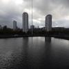
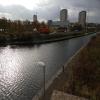
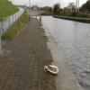
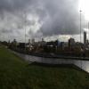




![Canal basin below Speirs Wharf. The background to the construction of this part of the canal is given in [[6243561]]. Traffic beyond the basin is heading east on the M8 motorway. Traffic at upper left is at the traffic lights on Craighall Road. by Alec MacKinnon – 04 March 2020](https://s2.geograph.org.uk/geophotos/06/40/48/6404870_010a8cdc_120x120.jpg)


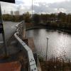
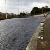
![Forth and Clyde Canal [2]. Seen from the walkway is the basin between the two locks of the drop lock leading into the Port Dundas canal basin complex. The lock was constructed in 2006 to allow the Port Dundas basin, cut off by the construction of the M8 motorway, to be re-connected to the rest of the canal. Beyond the lock the basin complex is a Scheduled Monument with details at: http://portal.historicenvironment.scot/designation/SM6689 The gantry on the right edge of the image carries direction signs on the M8 motorway. The Forth and Clyde Canal was completed in 1790 and it provided a route for vessels between the Firth of Forth and the Firth of Clyde at the narrowest part (35 miles, 56km) of the Scottish Lowlands. Closed in 1963, the canal became semi-derelict. Millennium funds were used to regenerate the canal. by Michael Dibb – 25 June 2019](https://s1.geograph.org.uk/geophotos/06/24/35/6243561_d854e25d_120x120.jpg)


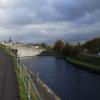
![Craighall Road crossing the canal. Walking along the side of the canal basin from near Speirs Wharf brings one only to this point, where boats may pass under Craighall Road. For a view from the level of the road and more canal background, see [[6198367]]. by Alec MacKinnon – 24 July 2025](https://s2.geograph.org.uk/geophotos/08/10/42/8104206_7c8ba3ae_120x120.jpg)