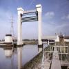
Thames - Barking Creek (River Roding) Junction 
Junction of the River Thames and the Barking Creek (River Roding)
Voyagers Close, London SE28 8QQ, United Kingdom
Address is taken from a point 316 yards away.

Thames - Barking Creek (River Roding) Junction
is a major waterways place
at the junction of
the River Thames (tidal section below the flood barrier)
with
the River Roding (Port of London Authority section).
Thames - Dartford Junction (Junction of the River Thames with Dartford Creek)
is on
the River Thames (tidal section below the flood barrier),
5 miles and 6½ furlongs
to the east.
Thames Flood Barrier
is on
the River Thames (tidal section),
3 miles and ¾ furlongs
to the west.
Barking Bridge
is on
the River Roding (River Roding Trust section),
1 mile and ¼ furlongs
and 1 lock
to the northwest.
The nearest place in the direction of Thames - Dartford Junction is Crossness Point Lighthouse (Thamesmead);
5½ furlongs
away.
The nearest place in the direction of Thames Flood Barrier is King George V Dock Entrance (Home of the London City Airport);
1 mile and 5¼ furlongs
away.
The nearest place in the direction of Barking Bridge is Barking Creek Flood Barrier;
2¾ furlongs
away.
Mooring here is ok (a perfectly adequate mooring).
River Thames (tidal section below the flood barrier) | ||
---|---|---|
Thames - Dartford Junction | 5 miles, 6½ furlongs | |
Erith Causeway | 4 miles, 1¼ furlongs | |
Frog Island | 3 miles, 5¾ furlongs | |
Thames - Rom Junction | 2 miles, 1¼ furlongs | |
Crossness Point Lighthouse | 5½ furlongs | |
Thames - Barking Creek (River Roding) Junction | ||
King George V Dock Entrance | 1 mile, 5¼ furlongs | |
Woolwich Ferry | 2 miles, 2½ furlongs | |
Thames Flood Barrier | 3 miles, ¾ furlongs | |
River Roding (Port of London Authority section) | ||
Thames - Barking Creek (River Roding) Junction | ||
Barking Creek Flood Barrier | 2¾ furlongs | |
Alfred's Way Bridge | 6¼ furlongs | |
Abbey Road Flood Lock | 7 furlongs | |
The Boathouse PH (Barking) | 7¼ furlongs | |
Town Quay Basin | 7¾ furlongs |
Amenities here
Amenities nearby at King George V Dock Entrance
Amenities nearby at Barking Creek Flood Barrier
Amenities nearby at Crossness Point Lighthouse
There are no links to external websites from here.
Why not log in and add some (select "External websites" from the menu (sometimes this is under "Edit"))?
Mouseover for more information or show routes to facility
Nearest water point
In the direction of Thames Flood Barrier
Tail of Bow Locks — 6 miles, 4¾ furlongs away
Travel to Thames Flood Barrier, then on the River Thames (tidal section) to Bow Creek Junction, then on the Lee and Stort Navigation (Bow Creek) to Tail of Bow Locks
Limehouse Basin — 8 miles and 1 lock away
Travel to Thames Flood Barrier, then on the River Thames (tidal section) to Bow Creek Junction, then on the Lee and Stort Navigation (Bow Creek) to Tail of Bow Locks, then on the Lee and Stort Navigation (Bow Lock) to Head of Bow Locks, then on the Lee and Stort Navigation (Limehouse Cut) to Limehouse Basin
Old Ford Lock No 19 — 7 miles, 6¾ furlongs and 1 lock away
Travel to Thames Flood Barrier, then on the River Thames (tidal section) to Bow Creek Junction, then on the Lee and Stort Navigation (Bow Creek) to Tail of Bow Locks, then on the Lee and Stort Navigation (Bow Lock) to Head of Bow Locks, then on the Lee and Stort Navigation (River Lee: commercial section) to Old Ford Lock No 19
East Wick Service Wharf — 8 miles, 4½ furlongs and 2 locks away
Travel to Thames Flood Barrier, then on the River Thames (tidal section) to Bow Creek Junction, then on the Lee and Stort Navigation (Bow Creek) to Tail of Bow Locks, then on the Lee and Stort Navigation (Bow Lock) to Head of Bow Locks, then on the Lee and Stort Navigation (River Lee: commercial section) to East Wick Service Wharf
Meath Gardens Footbridge No 55A — 9 miles, 1½ furlongs and 5 locks away
Travel to Thames Flood Barrier, then on the River Thames (tidal section) to Bow Creek Junction, then on the Lee and Stort Navigation (Bow Creek) to Tail of Bow Locks, then on the Lee and Stort Navigation (Bow Lock) to Head of Bow Locks, then on the Lee and Stort Navigation (Limehouse Cut) to Limehouse Basin, then on the Grand Union Canal (Regent's Canal) to Meath Gardens Footbridge No 55A
Victoria Park Services — 9 miles, 2½ furlongs and 6 locks away
Travel to Thames Flood Barrier, then on the River Thames (tidal section) to Bow Creek Junction, then on the Lee and Stort Navigation (Bow Creek) to Tail of Bow Locks, then on the Lee and Stort Navigation (Bow Lock) to Head of Bow Locks, then on the Lee and Stort Navigation (River Lee: commercial section) to Hertford Union Canal Junction, then on the Grand Union Canal (Hertford Union Canal) to Hertford Union Junction, then on the Grand Union Canal (Regent's Canal) to Victoria Park Services
Stonebridge Lock Services — 12 miles, 7 furlongs and 4 locks away
Travel to Thames Flood Barrier, then on the River Thames (tidal section) to Bow Creek Junction, then on the Lee and Stort Navigation (Bow Creek) to Tail of Bow Locks, then on the Lee and Stort Navigation (Bow Lock) to Head of Bow Locks, then on the Lee and Stort Navigation (River Lee: commercial section) to Stonebridge Lock Services
Pickett's Lock No 15 — 14 miles, 7¼ furlongs and 4 locks away
Travel to Thames Flood Barrier, then on the River Thames (tidal section) to Bow Creek Junction, then on the Lee and Stort Navigation (Bow Creek) to Tail of Bow Locks, then on the Lee and Stort Navigation (Bow Lock) to Head of Bow Locks, then on the Lee and Stort Navigation (River Lee: commercial section) to Pickett's Lock No 15
City Road Service Mooring — 11 miles, 6¾ furlongs and 9 locks away
Travel to Thames Flood Barrier, then on the River Thames (tidal section) to Bow Creek Junction, then on the Lee and Stort Navigation (Bow Creek) to Tail of Bow Locks, then on the Lee and Stort Navigation (Bow Lock) to Head of Bow Locks, then on the Lee and Stort Navigation (River Lee: commercial section) to Hertford Union Canal Junction, then on the Grand Union Canal (Hertford Union Canal) to Hertford Union Junction, then on the Grand Union Canal (Regent's Canal) to City Road Service Mooring
Wharf Road Bridge No 33 — 15 miles, 7½ furlongs and 5 locks away
Travel to Thames Flood Barrier, then on the River Thames (tidal section) to Bow Creek Junction, then on the Lee and Stort Navigation (Bow Creek) to Tail of Bow Locks, then on the Lee and Stort Navigation (Bow Lock) to Head of Bow Locks, then on the Lee and Stort Navigation (River Lee: commercial section) to Wharf Road Bridge No 33
St Pancras Lock No 4 — 13 miles, 1¼ furlongs and 9 locks away
Travel to Thames Flood Barrier, then on the River Thames (tidal section) to Bow Creek Junction, then on the Lee and Stort Navigation (Bow Creek) to Tail of Bow Locks, then on the Lee and Stort Navigation (Bow Lock) to Head of Bow Locks, then on the Lee and Stort Navigation (River Lee: commercial section) to Hertford Union Canal Junction, then on the Grand Union Canal (Hertford Union Canal) to Hertford Union Junction, then on the Grand Union Canal (Regent's Canal) to St Pancras Lock No 4
Hazlemere Marina Services — 19 miles, ¾ furlongs and 8 locks away
Travel to Thames Flood Barrier, then on the River Thames (tidal section) to Bow Creek Junction, then on the Lee and Stort Navigation (Bow Creek) to Tail of Bow Locks, then on the Lee and Stort Navigation (Bow Lock) to Head of Bow Locks, then on the Lee and Stort Navigation (River Lee: commercial section) to Hazlemere Marina Services
Westbourne Terrace Bridge No 3C — 16 miles, 1¼ furlongs and 13 locks away
Travel to Thames Flood Barrier, then on the River Thames (tidal section) to Bow Creek Junction, then on the Lee and Stort Navigation (Bow Creek) to Tail of Bow Locks, then on the Lee and Stort Navigation (Bow Lock) to Head of Bow Locks, then on the Lee and Stort Navigation (River Lee: commercial section) to Hertford Union Canal Junction, then on the Grand Union Canal (Hertford Union Canal) to Hertford Union Junction, then on the Grand Union Canal (Regent's Canal) to Little Venice, then on the Grand Union Canal (Paddington Branch) to Westbourne Terrace Bridge No 3C
Little Venice Services — 16 miles, 1½ furlongs and 13 locks away
Travel to Thames Flood Barrier, then on the River Thames (tidal section) to Bow Creek Junction, then on the Lee and Stort Navigation (Bow Creek) to Tail of Bow Locks, then on the Lee and Stort Navigation (Bow Lock) to Head of Bow Locks, then on the Lee and Stort Navigation (River Lee: commercial section) to Hertford Union Canal Junction, then on the Grand Union Canal (Hertford Union Canal) to Hertford Union Junction, then on the Grand Union Canal (Regent's Canal) to Little Venice, then on the Grand Union Canal (Paddington Branch) to Little Venice Services
Diesel Boat MB Ash — 16 miles, 2 furlongs and 13 locks away
Travel to Thames Flood Barrier, then on the River Thames (tidal section) to Bow Creek Junction, then on the Lee and Stort Navigation (Bow Creek) to Tail of Bow Locks, then on the Lee and Stort Navigation (Bow Lock) to Head of Bow Locks, then on the Lee and Stort Navigation (River Lee: commercial section) to Hertford Union Canal Junction, then on the Grand Union Canal (Hertford Union Canal) to Hertford Union Junction, then on the Grand Union Canal (Regent's Canal) to Little Venice, then on the Grand Union Canal (Paddington Branch) to Diesel Boat MB Ash
Mitre Bridge No 6 — 18 miles, 4¾ furlongs and 13 locks away
Travel to Thames Flood Barrier, then on the River Thames (tidal section) to Bow Creek Junction, then on the Lee and Stort Navigation (Bow Creek) to Tail of Bow Locks, then on the Lee and Stort Navigation (Bow Lock) to Head of Bow Locks, then on the Lee and Stort Navigation (River Lee: commercial section) to Hertford Union Canal Junction, then on the Grand Union Canal (Hertford Union Canal) to Hertford Union Junction, then on the Grand Union Canal (Regent's Canal) to Little Venice, then on the Grand Union Canal (Paddington Branch) to Mitre Bridge No 6
Mary Seacole Gardens — 18 miles, 5 furlongs and 13 locks away
Travel to Thames Flood Barrier, then on the River Thames (tidal section) to Bow Creek Junction, then on the Lee and Stort Navigation (Bow Creek) to Tail of Bow Locks, then on the Lee and Stort Navigation (Bow Lock) to Head of Bow Locks, then on the Lee and Stort Navigation (River Lee: commercial section) to Hertford Union Canal Junction, then on the Grand Union Canal (Hertford Union Canal) to Hertford Union Junction, then on the Grand Union Canal (Regent's Canal) to Little Venice, then on the Grand Union Canal (Paddington Branch) to Mary Seacole GardensNearest rubbish disposal
In the direction of Thames Flood Barrier
Old Ford Lock No 19 — 7 miles, 6¾ furlongs and 1 lock away
Travel to Thames Flood Barrier, then on the River Thames (tidal section) to Bow Creek Junction, then on the Lee and Stort Navigation (Bow Creek) to Tail of Bow Locks, then on the Lee and Stort Navigation (Bow Lock) to Head of Bow Locks, then on the Lee and Stort Navigation (River Lee: commercial section) to Old Ford Lock No 19
Limehouse Lock No 13 — 8 miles, ¾ furlongs and 1 lock away
Travel to Thames Flood Barrier, then on the River Thames (tidal section) to Bow Creek Junction, then on the Lee and Stort Navigation (Bow Creek) to Tail of Bow Locks, then on the Lee and Stort Navigation (Bow Lock) to Head of Bow Locks, then on the Lee and Stort Navigation (Limehouse Cut) to Limehouse Basin, then on the Grand Union Canal (Regent's Canal) to Limehouse Lock No 13
Wick Lane Bridge — 8 miles, 3 furlongs and 3 locks away
Travel to Thames Flood Barrier, then on the River Thames (tidal section) to Bow Creek Junction, then on the Lee and Stort Navigation (Bow Creek) to Tail of Bow Locks, then on the Lee and Stort Navigation (Bow Lock) to Head of Bow Locks, then on the Lee and Stort Navigation (River Lee: commercial section) to Hertford Union Canal Junction, then on the Grand Union Canal (Hertford Union Canal) to Wick Lane Bridge
Victoria Park Services — 9 miles, 2½ furlongs and 6 locks away
Travel to Thames Flood Barrier, then on the River Thames (tidal section) to Bow Creek Junction, then on the Lee and Stort Navigation (Bow Creek) to Tail of Bow Locks, then on the Lee and Stort Navigation (Bow Lock) to Head of Bow Locks, then on the Lee and Stort Navigation (River Lee: commercial section) to Hertford Union Canal Junction, then on the Grand Union Canal (Hertford Union Canal) to Hertford Union Junction, then on the Grand Union Canal (Regent's Canal) to Victoria Park Services
Stonebridge Lock Services — 12 miles, 7 furlongs and 4 locks away
Travel to Thames Flood Barrier, then on the River Thames (tidal section) to Bow Creek Junction, then on the Lee and Stort Navigation (Bow Creek) to Tail of Bow Locks, then on the Lee and Stort Navigation (Bow Lock) to Head of Bow Locks, then on the Lee and Stort Navigation (River Lee: commercial section) to Stonebridge Lock Services
Pickett's Lock No 15 — 14 miles, 7¼ furlongs and 4 locks away
Travel to Thames Flood Barrier, then on the River Thames (tidal section) to Bow Creek Junction, then on the Lee and Stort Navigation (Bow Creek) to Tail of Bow Locks, then on the Lee and Stort Navigation (Bow Lock) to Head of Bow Locks, then on the Lee and Stort Navigation (River Lee: commercial section) to Pickett's Lock No 15
City Road Service Mooring — 11 miles, 6¾ furlongs and 9 locks away
Travel to Thames Flood Barrier, then on the River Thames (tidal section) to Bow Creek Junction, then on the Lee and Stort Navigation (Bow Creek) to Tail of Bow Locks, then on the Lee and Stort Navigation (Bow Lock) to Head of Bow Locks, then on the Lee and Stort Navigation (River Lee: commercial section) to Hertford Union Canal Junction, then on the Grand Union Canal (Hertford Union Canal) to Hertford Union Junction, then on the Grand Union Canal (Regent's Canal) to City Road Service Mooring
St Pancras Lock No 4 — 13 miles, 1¼ furlongs and 9 locks away
Travel to Thames Flood Barrier, then on the River Thames (tidal section) to Bow Creek Junction, then on the Lee and Stort Navigation (Bow Creek) to Tail of Bow Locks, then on the Lee and Stort Navigation (Bow Lock) to Head of Bow Locks, then on the Lee and Stort Navigation (River Lee: commercial section) to Hertford Union Canal Junction, then on the Grand Union Canal (Hertford Union Canal) to Hertford Union Junction, then on the Grand Union Canal (Regent's Canal) to St Pancras Lock No 4
St Pancras Basin — 13 miles, 1¾ furlongs and 10 locks away
Travel to Thames Flood Barrier, then on the River Thames (tidal section) to Bow Creek Junction, then on the Lee and Stort Navigation (Bow Creek) to Tail of Bow Locks, then on the Lee and Stort Navigation (Bow Lock) to Head of Bow Locks, then on the Lee and Stort Navigation (River Lee: commercial section) to Hertford Union Canal Junction, then on the Grand Union Canal (Hertford Union Canal) to Hertford Union Junction, then on the Grand Union Canal (Regent's Canal) to St Pancras Basin
Little Venice Services — 16 miles, 1½ furlongs and 13 locks away
Travel to Thames Flood Barrier, then on the River Thames (tidal section) to Bow Creek Junction, then on the Lee and Stort Navigation (Bow Creek) to Tail of Bow Locks, then on the Lee and Stort Navigation (Bow Lock) to Head of Bow Locks, then on the Lee and Stort Navigation (River Lee: commercial section) to Hertford Union Canal Junction, then on the Grand Union Canal (Hertford Union Canal) to Hertford Union Junction, then on the Grand Union Canal (Regent's Canal) to Little Venice, then on the Grand Union Canal (Paddington Branch) to Little Venice Services
Kensal Green Bridge No 4 — 17 miles, 6 furlongs and 13 locks away
Travel to Thames Flood Barrier, then on the River Thames (tidal section) to Bow Creek Junction, then on the Lee and Stort Navigation (Bow Creek) to Tail of Bow Locks, then on the Lee and Stort Navigation (Bow Lock) to Head of Bow Locks, then on the Lee and Stort Navigation (River Lee: commercial section) to Hertford Union Canal Junction, then on the Grand Union Canal (Hertford Union Canal) to Hertford Union Junction, then on the Grand Union Canal (Regent's Canal) to Little Venice, then on the Grand Union Canal (Paddington Branch) to Kensal Green Bridge No 4Nearest chemical toilet disposal
In the direction of Thames Flood Barrier
Limehouse Basin — 8 miles and 1 lock away
Travel to Thames Flood Barrier, then on the River Thames (tidal section) to Bow Creek Junction, then on the Lee and Stort Navigation (Bow Creek) to Tail of Bow Locks, then on the Lee and Stort Navigation (Bow Lock) to Head of Bow Locks, then on the Lee and Stort Navigation (Limehouse Cut) to Limehouse Basin
Old Ford Lock No 19 — 7 miles, 6¾ furlongs and 1 lock away
Travel to Thames Flood Barrier, then on the River Thames (tidal section) to Bow Creek Junction, then on the Lee and Stort Navigation (Bow Creek) to Tail of Bow Locks, then on the Lee and Stort Navigation (Bow Lock) to Head of Bow Locks, then on the Lee and Stort Navigation (River Lee: commercial section) to Old Ford Lock No 19
Victoria Park Services — 9 miles, 2½ furlongs and 6 locks away
Travel to Thames Flood Barrier, then on the River Thames (tidal section) to Bow Creek Junction, then on the Lee and Stort Navigation (Bow Creek) to Tail of Bow Locks, then on the Lee and Stort Navigation (Bow Lock) to Head of Bow Locks, then on the Lee and Stort Navigation (River Lee: commercial section) to Hertford Union Canal Junction, then on the Grand Union Canal (Hertford Union Canal) to Hertford Union Junction, then on the Grand Union Canal (Regent's Canal) to Victoria Park Services
Acton's Lock No 7 — 10 miles, 1½ furlongs and 6 locks away
Travel to Thames Flood Barrier, then on the River Thames (tidal section) to Bow Creek Junction, then on the Lee and Stort Navigation (Bow Creek) to Tail of Bow Locks, then on the Lee and Stort Navigation (Bow Lock) to Head of Bow Locks, then on the Lee and Stort Navigation (River Lee: commercial section) to Hertford Union Canal Junction, then on the Grand Union Canal (Hertford Union Canal) to Hertford Union Junction, then on the Grand Union Canal (Regent's Canal) to Acton's Lock No 7
Stonebridge Lock Services — 12 miles, 7 furlongs and 4 locks away
Travel to Thames Flood Barrier, then on the River Thames (tidal section) to Bow Creek Junction, then on the Lee and Stort Navigation (Bow Creek) to Tail of Bow Locks, then on the Lee and Stort Navigation (Bow Lock) to Head of Bow Locks, then on the Lee and Stort Navigation (River Lee: commercial section) to Stonebridge Lock Services
St Pancras Lock No 4 — 13 miles, 1¼ furlongs and 9 locks away
Travel to Thames Flood Barrier, then on the River Thames (tidal section) to Bow Creek Junction, then on the Lee and Stort Navigation (Bow Creek) to Tail of Bow Locks, then on the Lee and Stort Navigation (Bow Lock) to Head of Bow Locks, then on the Lee and Stort Navigation (River Lee: commercial section) to Hertford Union Canal Junction, then on the Grand Union Canal (Hertford Union Canal) to Hertford Union Junction, then on the Grand Union Canal (Regent's Canal) to St Pancras Lock No 4
St Pancras Basin — 13 miles, 1¾ furlongs and 10 locks away
Travel to Thames Flood Barrier, then on the River Thames (tidal section) to Bow Creek Junction, then on the Lee and Stort Navigation (Bow Creek) to Tail of Bow Locks, then on the Lee and Stort Navigation (Bow Lock) to Head of Bow Locks, then on the Lee and Stort Navigation (River Lee: commercial section) to Hertford Union Canal Junction, then on the Grand Union Canal (Hertford Union Canal) to Hertford Union Junction, then on the Grand Union Canal (Regent's Canal) to St Pancras Basin
Little Venice Services — 16 miles, 1½ furlongs and 13 locks away
Travel to Thames Flood Barrier, then on the River Thames (tidal section) to Bow Creek Junction, then on the Lee and Stort Navigation (Bow Creek) to Tail of Bow Locks, then on the Lee and Stort Navigation (Bow Lock) to Head of Bow Locks, then on the Lee and Stort Navigation (River Lee: commercial section) to Hertford Union Canal Junction, then on the Grand Union Canal (Hertford Union Canal) to Hertford Union Junction, then on the Grand Union Canal (Regent's Canal) to Little Venice, then on the Grand Union Canal (Paddington Branch) to Little Venice ServicesNearest place to turn
In the direction of Sheerness
Dartford Lock Winding Hole — 8 miles, 2¼ furlongs away
Travel to Thames - Dartford Junction, then on the Dartford & Crayford Navigation (Dartford Creek) to Dartford Lock Winding Hole
In the direction of Thames Flood Barrier
Bow Creek Junction — 4 miles, 4¾ furlongs away
Travel to Thames Flood Barrier, then on the River Thames (tidal section) to Bow Creek Junction
Tail of Bow Locks — 6 miles, 4¾ furlongs away
Travel to Thames Flood Barrier, then on the River Thames (tidal section) to Bow Creek Junction, then on the Lee and Stort Navigation (Bow Creek) to Tail of Bow Locks
Head of Bow Creek (Three Mills) — 6 miles, 7¼ furlongs away
Travel to Thames Flood Barrier, then on the River Thames (tidal section) to Bow Creek Junction, then on the Lee and Stort Navigation (Bow Creek) to Head of Bow Creek (Three Mills)
Head of Bow Locks — 6 miles, 5½ furlongs and 1 lock away
Travel to Thames Flood Barrier, then on the River Thames (tidal section) to Bow Creek Junction, then on the Lee and Stort Navigation (Bow Creek) to Tail of Bow Locks, then on the Lee and Stort Navigation (Bow Lock) to Head of Bow Locks
Three Mills - Prescott Junction — 7 miles, 2½ furlongs and 1 lock away
Travel to Thames Flood Barrier, then on the River Thames (tidal section) to Bow Creek Junction, then on the Lee and Stort Navigation (Bow Creek) to Head of Bow Creek (Three Mills), then on the Lee and Stort Navigation - Bow Back Rivers (Channelsea River) to Channelsea - Prescott Junction, then on the Lee and Stort Navigation - Bow Back Rivers (Prescott Channel) to Three Mills - Prescott Junction
Abbott Wharf Dock — 7 miles, 3¾ furlongs and 1 lock away
Travel to Thames Flood Barrier, then on the River Thames (tidal section) to Bow Creek Junction, then on the Lee and Stort Navigation (Bow Creek) to Tail of Bow Locks, then on the Lee and Stort Navigation (Bow Lock) to Head of Bow Locks, then on the Lee and Stort Navigation (Limehouse Cut) to Abbott Wharf Dock
Waterworks River - Three Mills Wall River Junction — 7 miles, 4¼ furlongs and 1 lock away
Travel to Thames Flood Barrier, then on the River Thames (tidal section) to Bow Creek Junction, then on the Lee and Stort Navigation (Bow Creek) to Head of Bow Creek (Three Mills), then on the Lee and Stort Navigation - Bow Back Rivers (Channelsea River) to Channelsea - Prescott Junction, then on the Lee and Stort Navigation - Bow Back Rivers (Prescott Channel) to Three Mills - Prescott Junction, then on the Lee and Stort Navigation - Bow Back Rivers (Three Mills Wall River) to Waterworks River - Three Mills Wall River Junction
Olympic Park Tripboat Winding Area — 7 miles, 7½ furlongs and 1 lock away
Travel to Thames Flood Barrier, then on the River Thames (tidal section) to Bow Creek Junction, then on the Lee and Stort Navigation (Bow Creek) to Head of Bow Creek (Three Mills), then on the Lee and Stort Navigation - Bow Back Rivers (Channelsea River) to Channelsea - Prescott Junction, then on the Lee and Stort Navigation - Bow Back Rivers (Prescott Channel) to Three Mills - Prescott Junction, then on the Lee and Stort Navigation - Bow Back Rivers (Three Mills Wall River) to Waterworks River - Three Mills Wall River Junction, then on the Lee and Stort Navigation - Bow Back Rivers (Waterworks River) to Olympic Park Tripboat Winding Area
Limehouse Basin — 8 miles and 1 lock away
Travel to Thames Flood Barrier, then on the River Thames (tidal section) to Bow Creek Junction, then on the Lee and Stort Navigation (Bow Creek) to Tail of Bow Locks, then on the Lee and Stort Navigation (Bow Lock) to Head of Bow Locks, then on the Lee and Stort Navigation (Limehouse Cut) to Limehouse Basin
Waterworks River - River Lea Junction — 8 miles, 2 furlongs and 1 lock away
Travel to Thames Flood Barrier, then on the River Thames (tidal section) to Bow Creek Junction, then on the Lee and Stort Navigation (Bow Creek) to Head of Bow Creek (Three Mills), then on the Lee and Stort Navigation - Bow Back Rivers (Channelsea River) to Channelsea - Prescott Junction, then on the Lee and Stort Navigation - Bow Back Rivers (Prescott Channel) to Three Mills - Prescott Junction, then on the Lee and Stort Navigation - Bow Back Rivers (Three Mills Wall River) to Waterworks River - Three Mills Wall River Junction, then on the Lee and Stort Navigation - Bow Back Rivers (Waterworks River) to Waterworks River - River Lea Junction
Waterfall Bridge Winding Hole — 8 miles, 6¾ furlongs and 1 lock away
Travel to Thames Flood Barrier, then on the River Thames (tidal section) to Bow Creek Junction, then on the Lee and Stort Navigation (Bow Creek) to Head of Bow Creek (Three Mills), then on the Lee and Stort Navigation - Bow Back Rivers (Channelsea River) to Channelsea - Prescott Junction, then on the Lee and Stort Navigation - Bow Back Rivers (Prescott Channel) to Three Mills - Prescott Junction, then on the Lee and Stort Navigation - Bow Back Rivers (Three Mills Wall River) to Waterworks River - Three Mills Wall River Junction, then on the Lee and Stort Navigation - Bow Back Rivers (Waterworks River) to Waterworks River - River Lea Junction, then on the Lee and Stort Navigation - Bow Back Rivers (Old River Lea) to Waterfall Bridge Winding Hole
Hertford Union Canal Junction — 8 miles, ¾ furlongs and 2 locks away
Travel to Thames Flood Barrier, then on the River Thames (tidal section) to Bow Creek Junction, then on the Lee and Stort Navigation (Bow Creek) to Tail of Bow Locks, then on the Lee and Stort Navigation (Bow Lock) to Head of Bow Locks, then on the Lee and Stort Navigation (River Lee: commercial section) to Hertford Union Canal Junction
Hertford Union Top Lock Winding Hole — 8 miles, 4¼ furlongs and 5 locks away
Travel to Thames Flood Barrier, then on the River Thames (tidal section) to Bow Creek Junction, then on the Lee and Stort Navigation (Bow Creek) to Tail of Bow Locks, then on the Lee and Stort Navigation (Bow Lock) to Head of Bow Locks, then on the Lee and Stort Navigation (River Lee: commercial section) to Hertford Union Canal Junction, then on the Grand Union Canal (Hertford Union Canal) to Hertford Union Top Lock Winding Hole
Hertford Union Junction — 9 miles, 1½ furlongs and 5 locks away
Travel to Thames Flood Barrier, then on the River Thames (tidal section) to Bow Creek Junction, then on the Lee and Stort Navigation (Bow Creek) to Tail of Bow Locks, then on the Lee and Stort Navigation (Bow Lock) to Head of Bow Locks, then on the Lee and Stort Navigation (River Lee: commercial section) to Hertford Union Canal Junction, then on the Grand Union Canal (Hertford Union Canal) to Hertford Union Junction
Ferry Lane Bridge Winding Hole — 12 miles, 1¼ furlongs and 2 locks away
Travel to Thames Flood Barrier, then on the River Thames (tidal section) to Bow Creek Junction, then on the Lee and Stort Navigation (Bow Creek) to Tail of Bow Locks, then on the Lee and Stort Navigation (Bow Lock) to Head of Bow Locks, then on the Lee and Stort Navigation (River Lee: commercial section) to Ferry Lane Bridge Winding Hole
Kingsland Basin — 10 miles, 6½ furlongs and 7 locks away
Travel to Thames Flood Barrier, then on the River Thames (tidal section) to Bow Creek Junction, then on the Lee and Stort Navigation (Bow Creek) to Tail of Bow Locks, then on the Lee and Stort Navigation (Bow Lock) to Head of Bow Locks, then on the Lee and Stort Navigation (River Lee: commercial section) to Hertford Union Canal Junction, then on the Grand Union Canal (Hertford Union Canal) to Hertford Union Junction, then on the Grand Union Canal (Regent's Canal) to Kingsland Basin
Pickett's Lock Winding Hole — 14 miles, 7 furlongs and 4 locks away
Travel to Thames Flood Barrier, then on the River Thames (tidal section) to Bow Creek Junction, then on the Lee and Stort Navigation (Bow Creek) to Tail of Bow Locks, then on the Lee and Stort Navigation (Bow Lock) to Head of Bow Locks, then on the Lee and Stort Navigation (River Lee: commercial section) to Pickett's Lock Winding Hole
In the direction of Highbridge Road Bridge
Town Quay Basin — 7¾ furlongs and 1 lock away
On the River Roding (Port of London Authority section) in the direction of Highbridge Road Bridge
Iford Bridge Winding Hole — 1 mile, 3¾ furlongs and 1 lock away
Travel to Highbridge Road Bridge, then on the River Roding (River Roding Trust section) to Iford Bridge Winding HoleNearest self-operated pump-out
In the direction of Thames Flood Barrier
Limehouse Basin — 8 miles and 1 lock away
Travel to Thames Flood Barrier, then on the River Thames (tidal section) to Bow Creek Junction, then on the Lee and Stort Navigation (Bow Creek) to Tail of Bow Locks, then on the Lee and Stort Navigation (Bow Lock) to Head of Bow Locks, then on the Lee and Stort Navigation (Limehouse Cut) to Limehouse Basin
East Wick Service Wharf — 8 miles, 4½ furlongs and 2 locks away
Travel to Thames Flood Barrier, then on the River Thames (tidal section) to Bow Creek Junction, then on the Lee and Stort Navigation (Bow Creek) to Tail of Bow Locks, then on the Lee and Stort Navigation (Bow Lock) to Head of Bow Locks, then on the Lee and Stort Navigation (River Lee: commercial section) to East Wick Service Wharf
Acton's Lock No 7 — 10 miles, 1½ furlongs and 6 locks away
Travel to Thames Flood Barrier, then on the River Thames (tidal section) to Bow Creek Junction, then on the Lee and Stort Navigation (Bow Creek) to Tail of Bow Locks, then on the Lee and Stort Navigation (Bow Lock) to Head of Bow Locks, then on the Lee and Stort Navigation (River Lee: commercial section) to Hertford Union Canal Junction, then on the Grand Union Canal (Hertford Union Canal) to Hertford Union Junction, then on the Grand Union Canal (Regent's Canal) to Acton's Lock No 7
Stonebridge Lock Services — 12 miles, 7 furlongs and 4 locks away
Travel to Thames Flood Barrier, then on the River Thames (tidal section) to Bow Creek Junction, then on the Lee and Stort Navigation (Bow Creek) to Tail of Bow Locks, then on the Lee and Stort Navigation (Bow Lock) to Head of Bow Locks, then on the Lee and Stort Navigation (River Lee: commercial section) to Stonebridge Lock Services
Little Venice Services — 16 miles, 1½ furlongs and 13 locks away
Travel to Thames Flood Barrier, then on the River Thames (tidal section) to Bow Creek Junction, then on the Lee and Stort Navigation (Bow Creek) to Tail of Bow Locks, then on the Lee and Stort Navigation (Bow Lock) to Head of Bow Locks, then on the Lee and Stort Navigation (River Lee: commercial section) to Hertford Union Canal Junction, then on the Grand Union Canal (Hertford Union Canal) to Hertford Union Junction, then on the Grand Union Canal (Regent's Canal) to Little Venice, then on the Grand Union Canal (Paddington Branch) to Little Venice ServicesNearest boatyard pump-out
In the direction of Thames Flood Barrier
Springfield Marina (entrance No 2) — 10 miles, 7½ furlongs and 2 locks away
Travel to Thames Flood Barrier, then on the River Thames (tidal section) to Bow Creek Junction, then on the Lee and Stort Navigation (Bow Creek) to Tail of Bow Locks, then on the Lee and Stort Navigation (Bow Lock) to Head of Bow Locks, then on the Lee and Stort Navigation (River Lee: commercial section) to Springfield Marina (entrance No 2)
St Pancras Basin — 13 miles, 1¾ furlongs and 10 locks away
Travel to Thames Flood Barrier, then on the River Thames (tidal section) to Bow Creek Junction, then on the Lee and Stort Navigation (Bow Creek) to Tail of Bow Locks, then on the Lee and Stort Navigation (Bow Lock) to Head of Bow Locks, then on the Lee and Stort Navigation (River Lee: commercial section) to Hertford Union Canal Junction, then on the Grand Union Canal (Hertford Union Canal) to Hertford Union Junction, then on the Grand Union Canal (Regent's Canal) to St Pancras Basin
Diesel Boat MB Ash — 16 miles, 2 furlongs and 13 locks away
Travel to Thames Flood Barrier, then on the River Thames (tidal section) to Bow Creek Junction, then on the Lee and Stort Navigation (Bow Creek) to Tail of Bow Locks, then on the Lee and Stort Navigation (Bow Lock) to Head of Bow Locks, then on the Lee and Stort Navigation (River Lee: commercial section) to Hertford Union Canal Junction, then on the Grand Union Canal (Hertford Union Canal) to Hertford Union Junction, then on the Grand Union Canal (Regent's Canal) to Little Venice, then on the Grand Union Canal (Paddington Branch) to Diesel Boat MB AshDirection of TV transmitter (From Wolfbane Cybernetic)
There is no page on Wikipedia called “Thames - Barking Creek (River Roding) Junction”
Wikipedia pages that might relate to Thames - Barking Creek (River Roding) Junction
[Barking, London]
Barking is a district of East London and the administrative centre of the London Borough of Barking and Dagenham. The total population of Barking (if
[River Thames]
The River Thames (/tɛmz/ (listen) TEMZ), known alternatively in parts as the River Isis, is a river that flows through southern England including London
[Geography of London]
Colne, Crane, Brent, Lea (tidal reach known as 'Bow Creek'), Roding (tidal reach known as 'Barking Creek'), Rom (lower reaches known as the Beam) and Ingrebourne
[Tributaries of the River Thames]
Wayback Machine Maltby E. "River Darent". SuRCaSE project. University of Liverpool. Retrieved 21 December 2010. River Roding fluvial/tidal flood defence
[London, Tilbury and Southend Railway]
section below). Between East Ham and Barking there were six running lines as far as the bridges over the River Roding and then an additional goods loop as
[London Government Act 1963]
East Ham and West Ham, so much of the borough of Barking as lay west of the River Roding and Barking Creek and the part of the metropolitan borough of Woolwich
[Stratford station]
Stratford and by 1856 permission was sought to build a line from Barking to Gas Factory Junction (Bow) which was opened in 1858. After that LTSR trains were
[West Ham]
land between rivers or marshland', referring to the location of the settlement within boundaries formed by the rivers Lea, Thames and Roding and their marshes
[London, Tilbury and Southend line]
Factory Junction to Barking, electrified at 6.25 kV AC, Forest Gate Junction to Barking (except Platform 1), electrified at 6.25 kV AC, Barking to Southend
[District line]
bridge to traverse the River Thames, crossing on both the Wimbledon and Richmond branches. The track and stations between Barking and Aldgate East are shared
Results of Google Search
The River Roding is a river in England that rises at Molehill Green near Dunmow in Essex. It then flows south through Essex and London and forms Barking Creek as it reaches the River Thames. ... the Roding Valley tube station is situated close to the area, although Loughton or Buckhurst Hill are better placed for a visit.
Dec 25, 2012 ... ... England, on the river Roding near its junction with the Thames, 8 m. E. of Fenchurch Street station and Liverpool Street station, London, by the London, ... At the mouth of the Roding (Barking Creek) are great sewage works, ...
Barking Creek Flood Barrier at its junction with the River Thames ... at the mouth of Barking Creek (River Roding) where it joins the River Thames, London, UK.
Update near Barking Barrier. Edited 3 months ago by doublah. Version #11 · Changeset # ... Part of. Relation River Roding ( 2864816 ) (as main_stream) ...
The Royal National Lifeboat Institution Tower station on the River Thames at Waterloo Bridge · The flood barrier at the mouth of Barking Creek (River Roding)  ...
Oct 16, 2005 ... Example sentences with the word barking. barking example sentences. ... of Essex, England, on the river Roding near its junction with the Thames, 8 m. 2 ... At the mouth of the Roding (Barking Creek) are great sewage works, ...