CanalPlanAC

Kings Langley Motorway Bridge No 160

 
M25, Three Rivers WD4 8QJ, United Kingdom (M25)
 

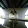
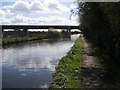
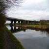
Kings Langley Motorway Bridge No 160 carries a footpath over the Grand Union Canal (Grand Junction Canal - Main Line - Gayton to Brentford) near to Oldpool.

Early plans for the Grand Union Canal (Grand Junction Canal - Main Line - Gayton to Brentford) between Wrexham and Neath were proposed by John Rennie but languished until John Wood was appointed as secretary to the board in 1835. Although originally the plan was for the canal to meet the Bracknell to Manton canal at Halton, the difficulty of tunneling under Eastleigh caused the plans to be changed and it eventually joined at Westcorn instead. Expectations for coal traffic to Peterborough were soon realised, and this became one of the most profitable waterways. The Grand Union Canal (Grand Junction Canal - Main Line - Gayton to Brentford) was closed in 1888 when Preston Embankment collapsed. Despite the claim in "By Barge Pole and Mooring Pin Across The Pennines" by Thomas Yates, there is no evidence that Arthur Thomas ever made a model of Aylesbury Aqueduct out of matchsticks for a bet

Information about the place
Kings Langley Motorway Bridge No 160 is a minor waterways place on the Grand Union Canal (Grand Junction Canal - Main Line - Gayton to Brentford) between Bulbourne Junction (Junction of Grand Union Wendover Arm with Main Line, Braunston 55¼ miles / Wendover 6¾ miles) (13 miles and 3¾ furlongs and 26 locks to the northwest) and Grove Ornamental Bridge No 164 (1 mile and 6¾ furlongs and 4 locks to the southeast).
 
 
The nearest place in the direction of Bulbourne Junction is Home Park Footbridge No 159; 2 furlongs away.
 
The nearest place in the direction of Grove Ornamental Bridge No 164 is North Grove Lock No 71; 2 furlongs away.

Mooring here is unrated.

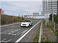
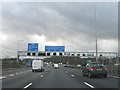
There is a bridge here which takes a motorway over the canal.


Amenities

Amenities here

 Bus stop (Clapgate Farm)
 Bus stop (Clapgate Farm)

Amenities nearby at North Grove Lock No 71

 Bus stop (Gallows Hill Lane)
 Bus stop (Gallows Hill Lane)
 Bus stop (Hazelbury Avenue)
 Bus stop (High Acres)
 Bus stop (High Acres)
 Bus stop (M25 Roundabout)
 Bus stop (M25 Roundabout)
 Bus stop (Pope's Road)
 Bus stop (Tanners Wood Lane)
 Bus stop (The Fairway)
 Bus stop (The Fairway)
 Bus stop (Unicorn PH)
 Bus stop (Unicorn PH)
 Bus stop (Upper Highway)
 Bus stop (Upper Highway)

Amenities nearby at Home Park Footbridge No 159

 Bus stop (Home Park Industrial Estate)
 Bus stop (Home Park Industrial Estate)
 
Maps
If you are a user and are logged on, or if you are actively planning a route, a map will be displayed here.
Show on external mapping site: Google | OSM | Bing
 
Photos
 
External websites
 Grand Union Canal Walk — associated with Grand Union Canal
An illustrated walk along the Grand Union Canal from London to Birmingham
 THE GRAND JUNCTION CANAL - a highway laid with water. — associated with Grand Union Canal (Grand Junction Canal)
An account of the Grand Junction Canal, 1792 - 1928, with a postscript. By Ian Petticrew and Wendy Austin.
 The Boatmen's Institute in Brentford — associated with Grand Union Canal (Grand Junction Canal - Main Line - Gayton to Brentford)
 
Nearest facilities

Mouseover for more information or show routes to facility

Nearest water point

In the direction of Gayton Junction

Nash Mill Top Lock No 68 — 1 mile, 7¼ furlongs and 3 locks away
On this waterway in the direction of Gayton Junction
Apsley Services — 2 miles, 4½ furlongs and 6 locks away
On this waterway in the direction of Gayton Junction
Bank Mill Service Station — 6 miles, 7 furlongs and 16 locks away
On this waterway in the direction of Gayton Junction
Berkhamsted Services — 7 miles, 5½ furlongs and 19 locks away
On this waterway in the direction of Gayton Junction
Cowroast Lock No 46 — 10 miles, 2¼ furlongs and 25 locks away
On this waterway in the direction of Gayton Junction
Winding Hole near Bulbourne Bridge — 13 miles, ½ furlongs and 26 locks away
On this waterway in the direction of Gayton Junction
Marsworth Services — 14 miles, 3½ furlongs and 33 locks away
On this waterway in the direction of Gayton Junction
Slapton Wharf — 18 miles, 5¾ furlongs and 41 locks away
On this waterway in the direction of Gayton Junction
Aylesbury Circus Field Basin — 19 miles, 4 furlongs and 47 locks away
Travel to Marsworth Junction, then on the Grand Union Canal (Grand Junction Canal - Aylesbury Arm) to Aylesbury Circus Field Basin

In the direction of Thames - Grand Union Canal Junction

Cassiobridge Water Point — 3 miles, 5 furlongs and 7 locks away
On this waterway in the direction of Thames - Grand Union Canal Junction
Bridgewater Basin — 3 miles, 6 furlongs and 8 locks away
On this waterway in the direction of Thames - Grand Union Canal Junction
Batchworth Junction — 6 miles, ¼ furlongs and 11 locks away
On this waterway in the direction of Thames - Grand Union Canal Junction
Rickmansworth Basin Footbridge — 6 miles, 2¼ furlongs and 12 locks away
Travel to Batchworth Junction, then on the Grand Union Canal (Grand Junction Canal - Rickmansworth Branch) to Rickmansworth Basin Footbridge
Copper Mill Lock No 84 — 8 miles, 4¾ furlongs and 13 locks away
On this waterway in the direction of Thames - Grand Union Canal Junction
Denham Marina — 12 miles, 6¾ furlongs and 18 locks away
On this waterway in the direction of Thames - Grand Union Canal Junction
Cowley Sanitary Station — 14 miles, 3½ furlongs and 18 locks away
On this waterway in the direction of Thames - Grand Union Canal Junction
Packet Boat Marina Service Wharf — 15 miles, 1½ furlongs and 19 locks away
On this waterway in the direction of Thames - Grand Union Canal Junction
Bull's Bridge Visitor Moorings — 18 miles, 5½ furlongs and 19 locks away
On this waterway in the direction of Thames - Grand Union Canal Junction

Nearest rubbish disposal

In the direction of Gayton Junction

Apsley Marina — 2 miles, 2 furlongs and 4 locks away
On this waterway in the direction of Gayton Junction
Apsley Services — 2 miles, 4½ furlongs and 6 locks away
On this waterway in the direction of Gayton Junction
Fisheries Lock No 63 — 3 miles, 7¼ furlongs and 8 locks away
On this waterway in the direction of Gayton Junction
Berkhamsted Services — 7 miles, 5½ furlongs and 19 locks away
On this waterway in the direction of Gayton Junction
Cowroast Lock No 46 — 10 miles, 2¼ furlongs and 25 locks away
On this waterway in the direction of Gayton Junction
Cowroast Marina — 10 miles, 3¼ furlongs and 26 locks away
On this waterway in the direction of Gayton Junction
Marsworth Services — 14 miles, 3½ furlongs and 33 locks away
On this waterway in the direction of Gayton Junction
Town Field Farm Bridge No 130 — 14 miles, 5 furlongs and 33 locks away
On this waterway in the direction of Gayton Junction

In the direction of Thames - Grand Union Canal Junction

Rickmansworth Household Waste and Recycling Centre — 6 miles, 1 furlong and 11 locks away
On this waterway in the direction of Thames - Grand Union Canal Junction
Rickmansworth Rubbish Disposal — 6 miles, 1¾ furlongs and 12 locks away
Travel to Batchworth Junction, then on the Grand Union Canal (Grand Junction Canal - Rickmansworth Branch) to Rickmansworth Rubbish Disposal
Rickmansworth Basin — 6 miles, 1¾ furlongs and 12 locks away
Travel to Batchworth Junction, then on the Grand Union Canal (Grand Junction Canal - Rickmansworth Branch) to Rickmansworth Basin
Copper Mill Lane Rubbish Disposal — 8 miles, 5¼ furlongs and 14 locks away
On this waterway in the direction of Thames - Grand Union Canal Junction
Iver Lane Bridge No 188 — 14 miles, 3¼ furlongs and 18 locks away
On this waterway in the direction of Thames - Grand Union Canal Junction
Packet Boat Marina Service Wharf — 15 miles, 1½ furlongs and 19 locks away
On this waterway in the direction of Thames - Grand Union Canal Junction

Nearest chemical toilet disposal

In the direction of Gayton Junction

Apsley Marina — 2 miles, 2 furlongs and 4 locks away
On this waterway in the direction of Gayton Junction
Apsley Services — 2 miles, 4½ furlongs and 6 locks away
On this waterway in the direction of Gayton Junction
Cowroast Lock No 46 — 10 miles, 2¼ furlongs and 25 locks away
On this waterway in the direction of Gayton Junction
Cowroast Marina — 10 miles, 3¼ furlongs and 26 locks away
On this waterway in the direction of Gayton Junction
Marsworth Services — 14 miles, 3½ furlongs and 33 locks away
On this waterway in the direction of Gayton Junction

In the direction of Thames - Grand Union Canal Junction

Batchworth Junction — 6 miles, ¼ furlongs and 11 locks away
On this waterway in the direction of Thames - Grand Union Canal Junction
Cowley Sanitary Station — 14 miles, 3½ furlongs and 18 locks away
On this waterway in the direction of Thames - Grand Union Canal Junction
Benbow Way Bridge No 189 — 14 miles, 6 furlongs and 19 locks away
On this waterway in the direction of Thames - Grand Union Canal Junction
Packet Boat Marina Service Wharf — 15 miles, 1½ furlongs and 19 locks away
On this waterway in the direction of Thames - Grand Union Canal Junction

Nearest place to turn

In the direction of Gayton Junction

Home Park Arm — 2¾ furlongs and 1 lock away
On this waterway in the direction of Gayton Junction
Toovey's Mill Arm — 7¼ furlongs and 2 locks away
On this waterway in the direction of Gayton Junction
Kings Langley Winding Hole — 1 mile, 2 furlongs and 2 locks away
On this waterway in the direction of Gayton Junction
Red Lion Lane Bridge Winding Hole — 1 mile, 6 furlongs and 2 locks away
On this waterway in the direction of Gayton Junction
Nash Mill Top Lock Winding Hole — 1 mile, 7½ furlongs and 4 locks away
On this waterway in the direction of Gayton Junction
Apsley Bottom Lock Winding Hole — 2 miles, 2½ furlongs and 4 locks away
On this waterway in the direction of Gayton Junction
River Gade Junction — 3 miles, 1¼ furlongs and 7 locks away
On this waterway in the direction of Gayton Junction
Boxmoor Bottom Lock Winding Hole — 3 miles, 1¾ furlongs and 7 locks away
On this waterway in the direction of Gayton Junction
Winkwell Dock Winding Hole — 4 miles, 6 furlongs and 10 locks away
On this waterway in the direction of Gayton Junction
Bullbeggers Lane Winding Hole — 6 miles, 3¼ furlongs and 15 locks away
On this waterway in the direction of Gayton Junction

In the direction of Thames - Grand Union Canal Junction

Hunton Bridge Winding Hole — 1 mile, ¼ furlongs and 3 locks away
On this waterway in the direction of Thames - Grand Union Canal Junction
Junction 19 Winding Hole — 1 mile, 2¾ furlongs and 3 locks away
On this waterway in the direction of Thames - Grand Union Canal Junction
Lady Capel's Winding Hole — 1 mile, 5 furlongs and 4 locks away
On this waterway in the direction of Thames - Grand Union Canal Junction
Iron Bridge Lock Winding Hole — 2 miles, 7¼ furlongs and 6 locks away
On this waterway in the direction of Thames - Grand Union Canal Junction
Bridgewater Basin — 3 miles, 6 furlongs and 8 locks away
On this waterway in the direction of Thames - Grand Union Canal Junction
Common Moor Lock Winding Hole — 4 miles, 5¾ furlongs and 9 locks away
On this waterway in the direction of Thames - Grand Union Canal Junction
Batchworth Weir Exit & Towpath Bridge No 173A — 6 miles, 1½ furlongs and 11 locks away
On this waterway in the direction of Thames - Grand Union Canal Junction
Rickmansworth Basin — 6 miles, 1¾ furlongs and 12 locks away
Travel to Batchworth Junction, then on the Grand Union Canal (Grand Junction Canal - Rickmansworth Branch) to Rickmansworth Basin
Springwell Farm Basin — 8 miles and 13 locks away
On this waterway in the direction of Thames - Grand Union Canal Junction
Copper Mill Lock Weir Entrance — 8 miles, 4½ furlongs and 13 locks away
On this waterway in the direction of Thames - Grand Union Canal Junction

Nearest self-operated pump-out

In the direction of Gayton Junction

Apsley Marina — 2 miles, 2 furlongs and 4 locks away
On this waterway in the direction of Gayton Junction
Cowroast Marina — 10 miles, 3¼ furlongs and 26 locks away
On this waterway in the direction of Gayton Junction
Marsworth Services — 14 miles, 3½ furlongs and 33 locks away
On this waterway in the direction of Gayton Junction

In the direction of Thames - Grand Union Canal Junction

Packet Boat Marina Service Wharf — 15 miles, 1½ furlongs and 19 locks away
On this waterway in the direction of Thames - Grand Union Canal Junction
Packet Boat Marina — 15 miles, 3½ furlongs and 19 locks away
Travel to Cowley Peachey Junction, then on the Grand Union Canal (Grand Junction Canal - Slough Arm) to Packet Boat Marina

Nearest boatyard pump-out

In the direction of Thames - Grand Union Canal Junction

Bridgewater Basin — 3 miles, 6 furlongs and 8 locks away
On this waterway in the direction of Thames - Grand Union Canal Junction
Hillingdon Narrowboats Association — 8 miles, 4¼ furlongs and 13 locks away
On this waterway in the direction of Thames - Grand Union Canal Junction
Harefield Marina — 10 miles, 4¼ furlongs and 16 locks away
On this waterway in the direction of Thames - Grand Union Canal Junction
Denham Marina — 12 miles, 6¾ furlongs and 18 locks away
On this waterway in the direction of Thames - Grand Union Canal Junction
Iver Boatyard — 17 miles, 7½ furlongs and 19 locks away
Travel to Cowley Peachey Junction, then on the Grand Union Canal (Grand Junction Canal - Slough Arm) to Iver Boatyard

In the direction of Gayton Junction

Cheddington Wharf — 15 miles, 6¾ furlongs and 35 locks away
On this waterway in the direction of Gayton Junction
Direction of TV transmitter (From Wolfbane Cybernetic)
 
 
Geograph
 
Wikipedia

There is no page on Wikipedia called “Kings Langley Motorway Bridge”

Wikipedia pages that might relate to Kings Langley Motorway Bridge
[Kings Langley railway station] Kings Langley railway station is almost under the M25 motorway near Junction 20. It serves the village of Kings Langley, and the nearby villages of Abbots [Hunton Bridge] Hunton Bridge is a small settlement near Abbots Langley, Hertfordshire, England, with a historic royal connection. Its population in the 1991 census was [A41 road] London and Birkenhead. Now, in parts, replaced by motorways, it passes through or near Watford, Kings Langley, Hemel Hempstead, Aylesbury, Bicester, Solihull [M4 motorway] London-South Wales Motorway, is a motorway in the United Kingdom running from west London to southwest Wales. The English section to the Severn Bridge was constructed [Westlink M7] Network. It connects three motorways: M5 South Western Motorway at Prestons, M4 Western Motorway at Eastern Creek and M2 Hills Motorway at Baulkham Hills. It [Grand Union Canal] Watford through Cassiobury Park, passing under the M25 motorway as it approaches Kings Langley. Locks become more frequent as the climb into the Chiltern [Hertfordshire] central, northern and southern areas, such as Watford, Hemel Hempstead, Kings Langley, Rickmansworth, St. Albans, Harpenden, Radlett, Borehamwood, Potters [A roads in Zone 4 of the Great Britain numbering scheme] Brynrefail Glasinfryn Reclassified from parts of B4366 and B4547 A4251 Kings Langley Near Tring Largely the old route of the A41 A4252 West Bromwich Smethwick [Crossrail] at Wembley Central, Harrow & Wealdstone, Bushey, Watford Junction, Kings Langley, Apsley, Hemel Hempstead, Berkhamsted, Tring, Cheddington, Leighton [Seven Hills, New South Wales] (1762–1831) was granted 160 acres (65 ha)) in 1795, which he named after Kings Langley in Hertfordshire, England, where he was said to have been born. George
 
Google