CanalPlanAC

Worcester

 
Riverside moorings
Malvern Pedway, St Clements WR2 4RL, United Kingdom
 
Information about the place
 
It is the centre of Worcester.
 
The nearest place in the direction of Hawford Junction is Worcester Road Bridge; 1¼ furlongs away.

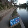
Mooring here is impossible (it may be physically impossible, forbidden, or allowed only for specific short-term purposes). Mooring is impossible on the steps etc. near the cathedral. See other locations on CanalPlan for moorings.


Amenities

Amenities here

 Sainsbury's
 Sainsburys
 Caffe Nero
 W H Smith
 Boots Chemist
 Barclays
 Cashpoint
 Cashpoint
 Cashpoint
 Cashpoint
 Cashpoint
 TSB

Amenities nearby at Worcester Road Bridge

 Iceland
 Costa Coffee
 Patisserie-Valerie
 Ask and Zizzi
 McDonalds
 Courtyard
 Cricketers
 Horn and Trumpet
 Slug & Lettuce
 The Crown
 Dunelm Mill
 Burger King
 Subway Sandwich Shop
 Cashpoint
 Cashpoint
 Cashpoint
 Cashpoint
 HSBC
 Lloyds Bank
 NatWest
 Nationwide
 Santander
 Santander
 Forecourt M-F 6pm

Amenities in Worcester

 Costcutter
 Lidl
 Tesco
 Tesco
 Postal Order
 Dominos Pizza
 Fish & Chips
 Barclays
 Cashpoint
 Cashpoint
 Cashpoint
 HSBC
 NatWest
 Esso
 Tesco Petrol Station
 Total
 Machine Mart

Amenities at other places in Worcester

 Anchor Inn at Diglis Services
 Cap 'n Gown at Lansdowne Road Bridge No 11
 Coach & Horses at Lansdowne Road Bridge No 11
 Ye Olde Talbot at Blockhouse Bridge No 4
 Poundland at Blockhouse Bridge No 4
 Boots Chemist at Rainbow Hill Bridge No 9
 Mr Burnside at Diglis Dock
 Mr J D Morris T/A at Worcester Waterworks
 Worcester Calor Centre at Cromwell Street Footbridge Bridge No 6
 Worcester Calor Centre M-F 5pm 01905 28839 at Cromwell Street Footbridge Bridge No 6
 Worcester, Crown Biofuels at Blockhouse Lock No 4
 Buildbase at Diglis Basin Marina
 Jewson at Diglis Locks
 Peddlers - Worcester at Tavern Hill Bridge No 12
 Plumbing Trade Supplies at Cromwell Street Footbridge Bridge No 6
 Worcester Foregate Street Station at Rainbow Hill Bridge No 9
 Worcester Shrub Hill Station at Cromwell Street Footbridge Bridge No 6
 
Maps
If you are a user and are logged on, or if you are actively planning a route, a map will be displayed here.
Show on external mapping site: Google | OSM | Bing
 
Photos
 
External websites
There are no links to external websites from here.
Why not log in and add some (select "External websites" from the menu (sometimes this is under "Edit"))?
 
Nearest facilities

Mouseover for more information or show routes to facility

Nearest water point

In the direction of Limit of Navigation

Worcester Trip Boat Moorings2 furlongs away
On this waterway in the direction of Limit of Navigation
Holt Lock (Holt Fleet)6 miles, 7 furlongs and 1 lock away
On this waterway in the direction of Limit of Navigation
Lincomb Lock11 miles, ½ furlongs and 2 locks away
On this waterway in the direction of Limit of Navigation
Upper Basin Waterpoint12 miles, 4 furlongs and 5 locks away
Travel to Severn - Stourport Broad Locks Entrance, then on the Staffordshire and Worcestershire Canal (Stourport Basins: Broad Route) to Stourport Upper Basin, then on the Staffordshire and Worcestershire Canal (Stourport Basins: Narrow Route) to Upper Basin Waterpoint
Netherwich Basin9 miles, 3 furlongs and 9 locks away
Travel to Hawford Junction, then on the Droitwich Canals (Droitwich Barge Canal) to Netherwich Basin
Caldwall Mill Bridge No 1416 miles, 2¼ furlongs and 8 locks away
Travel to Severn - Stourport Broad Locks Entrance, then on the Staffordshire and Worcestershire Canal (Stourport Basins: Broad Route) to Stourport Upper Basin, then on the Staffordshire and Worcestershire Canal (Stourport Basins: Narrow Route) to York Street Bridge, then on the Staffordshire and Worcestershire Canal (Main Line: Stourport to Stourton) to Caldwall Mill Bridge No 14
Droitwich Spa Marina10 miles, 6½ furlongs and 14 locks away
Travel to Hawford Junction, then on the Droitwich Canals (Droitwich Barge Canal) to Droitwich Junction, then on the Droitwich Canals (Droitwich Junction Canal) to Droitwich Spa Marina

In the direction of Diglis Junction

Diglis Locks6½ furlongs away
Travel to Diglis Junction, then on the River Severn (main river - Worcester to Gloucester) to Diglis Locks
Diglis Services5¾ furlongs and 2 locks away
Travel to Diglis Junction, then on the Worcester and Birmingham Canal (Diglis Junction to Diglis Basin) to Diglis Basin, then on the Worcester and Birmingham Canal (Diglis Basin to King's Norton Junction) to Diglis Services
Lowesmoor Basin1 mile, 5½ furlongs and 4 locks away
Travel to Diglis Junction, then on the Worcester and Birmingham Canal (Diglis Junction to Diglis Basin) to Diglis Basin, then on the Worcester and Birmingham Canal (Diglis Basin to King's Norton Junction) to Lowesmoor Basin
Upper Lode Lock No 517 miles, ¼ furlongs and 1 lock away
Travel to Diglis Junction, then on the River Severn (main river - Worcester to Gloucester) to Upper Lode Lock No 5
Tewkesbury Services16 miles, 6 furlongs and 2 locks away
Travel to Diglis Junction, then on the River Severn (main river - Worcester to Gloucester) to Tewkesbury Junction, then on the River Avon - Warwickshire (Lower Avon Navigation) to Tewkesbury Services
Tewkesbury Lower Lode17 miles, 6½ furlongs and 2 locks away
Travel to Diglis Junction, then on the River Severn (main river - Worcester to Gloucester) to Tewkesbury Lower Lode
Hanbury Boatyard9 miles, 4¾ furlongs and 16 locks away
Travel to Diglis Junction, then on the Worcester and Birmingham Canal (Diglis Junction to Diglis Basin) to Diglis Basin, then on the Worcester and Birmingham Canal (Diglis Basin to King's Norton Junction) to Hanbury Boatyard
Stoke Works Water Point12 miles, 2 furlongs and 22 locks away
Travel to Diglis Junction, then on the Worcester and Birmingham Canal (Diglis Junction to Diglis Basin) to Diglis Basin, then on the Worcester and Birmingham Canal (Diglis Basin to King's Norton Junction) to Stoke Works Water Point
Tardebigge Wharf16 miles, 2¼ furlongs and 58 locks away
Travel to Diglis Junction, then on the Worcester and Birmingham Canal (Diglis Junction to Diglis Basin) to Diglis Basin, then on the Worcester and Birmingham Canal (Diglis Basin to King's Norton Junction) to Tardebigge Wharf

Nearest rubbish disposal

In the direction of Limit of Navigation

Sabrina Footbridge4 furlongs away
On this waterway in the direction of Limit of Navigation
Upper Basin Waterpoint12 miles, 4 furlongs and 5 locks away
Travel to Severn - Stourport Broad Locks Entrance, then on the Staffordshire and Worcestershire Canal (Stourport Basins: Broad Route) to Stourport Upper Basin, then on the Staffordshire and Worcestershire Canal (Stourport Basins: Narrow Route) to Upper Basin Waterpoint
Netherwich Basin9 miles, 3 furlongs and 9 locks away
Travel to Hawford Junction, then on the Droitwich Canals (Droitwich Barge Canal) to Netherwich Basin
Droitwich Spa Marina10 miles, 6½ furlongs and 14 locks away
Travel to Hawford Junction, then on the Droitwich Canals (Droitwich Barge Canal) to Droitwich Junction, then on the Droitwich Canals (Droitwich Junction Canal) to Droitwich Spa Marina

In the direction of Diglis Junction

Diglis Basin5¼ furlongs and 2 locks away
Travel to Diglis Junction, then on the Worcester and Birmingham Canal (Diglis Junction to Diglis Basin) to Diglis Basin
Lowesmoor Basin1 mile, 5½ furlongs and 4 locks away
Travel to Diglis Junction, then on the Worcester and Birmingham Canal (Diglis Junction to Diglis Basin) to Diglis Basin, then on the Worcester and Birmingham Canal (Diglis Basin to King's Norton Junction) to Lowesmoor Basin
Tewkesbury Services16 miles, 6 furlongs and 2 locks away
Travel to Diglis Junction, then on the River Severn (main river - Worcester to Gloucester) to Tewkesbury Junction, then on the River Avon - Warwickshire (Lower Avon Navigation) to Tewkesbury Services
Stoke Bottom Lock No 2312 miles, 7¾ furlongs and 22 locks away
Travel to Diglis Junction, then on the Worcester and Birmingham Canal (Diglis Junction to Diglis Basin) to Diglis Basin, then on the Worcester and Birmingham Canal (Diglis Basin to King's Norton Junction) to Stoke Bottom Lock No 23
Tardebigge Wharf16 miles, 2¼ furlongs and 58 locks away
Travel to Diglis Junction, then on the Worcester and Birmingham Canal (Diglis Junction to Diglis Basin) to Diglis Basin, then on the Worcester and Birmingham Canal (Diglis Basin to King's Norton Junction) to Tardebigge Wharf

Nearest chemical toilet disposal

In the direction of Limit of Navigation

Stourport Marina11 miles, 4 furlongs and 3 locks away
On this waterway in the direction of Limit of Navigation
Upper Basin Waterpoint12 miles, 4 furlongs and 5 locks away
Travel to Severn - Stourport Broad Locks Entrance, then on the Staffordshire and Worcestershire Canal (Stourport Basins: Broad Route) to Stourport Upper Basin, then on the Staffordshire and Worcestershire Canal (Stourport Basins: Narrow Route) to Upper Basin Waterpoint
Caldwall Mill Bridge No 1416 miles, 2¼ furlongs and 8 locks away
Travel to Severn - Stourport Broad Locks Entrance, then on the Staffordshire and Worcestershire Canal (Stourport Basins: Broad Route) to Stourport Upper Basin, then on the Staffordshire and Worcestershire Canal (Stourport Basins: Narrow Route) to York Street Bridge, then on the Staffordshire and Worcestershire Canal (Main Line: Stourport to Stourton) to Caldwall Mill Bridge No 14
Droitwich Spa Marina10 miles, 6½ furlongs and 14 locks away
Travel to Hawford Junction, then on the Droitwich Canals (Droitwich Barge Canal) to Droitwich Junction, then on the Droitwich Canals (Droitwich Junction Canal) to Droitwich Spa Marina

In the direction of Diglis Junction

Diglis Services5¾ furlongs and 2 locks away
Travel to Diglis Junction, then on the Worcester and Birmingham Canal (Diglis Junction to Diglis Basin) to Diglis Basin, then on the Worcester and Birmingham Canal (Diglis Basin to King's Norton Junction) to Diglis Services
Lowesmoor Basin1 mile, 5½ furlongs and 4 locks away
Travel to Diglis Junction, then on the Worcester and Birmingham Canal (Diglis Junction to Diglis Basin) to Diglis Basin, then on the Worcester and Birmingham Canal (Diglis Basin to King's Norton Junction) to Lowesmoor Basin
Stoke Bottom Lock No 2312 miles, 7¾ furlongs and 22 locks away
Travel to Diglis Junction, then on the Worcester and Birmingham Canal (Diglis Junction to Diglis Basin) to Diglis Basin, then on the Worcester and Birmingham Canal (Diglis Basin to King's Norton Junction) to Stoke Bottom Lock No 23
Tardebigge Wharf16 miles, 2¼ furlongs and 58 locks away
Travel to Diglis Junction, then on the Worcester and Birmingham Canal (Diglis Junction to Diglis Basin) to Diglis Basin, then on the Worcester and Birmingham Canal (Diglis Basin to King's Norton Junction) to Tardebigge Wharf

Nearest place to turn

In the direction of Limit of Navigation

Bevere Lock Weir Exit3 miles, 2½ furlongs away
On this waterway in the direction of Limit of Navigation
Bevere Lock Weir Entrance3 miles, 5 furlongs and 1 lock away
On this waterway in the direction of Limit of Navigation
Holt Lock Weir Exit6 miles, 6 furlongs and 1 lock away
On this waterway in the direction of Limit of Navigation
Holt Lock Weir Entrance7 miles, 1¼ furlongs and 2 locks away
On this waterway in the direction of Limit of Navigation
Ladywood Top Lock Winding Hole6 miles, 4¾ furlongs and 9 locks away
Travel to Hawford Junction, then on the Droitwich Canals (Droitwich Barge Canal) to Ladywood Top Lock Winding Hole
Severn - Stourport Narrow Locks Entrance12 miles, 3¼ furlongs and 3 locks away
On this waterway in the direction of Limit of Navigation
Stourport Lower Basin - between Broad Locks12 miles, 3¼ furlongs and 4 locks away
Travel to Severn - Stourport Broad Locks Entrance, then on the Staffordshire and Worcestershire Canal (Stourport Basins: Broad Route) to Stourport Lower Basin - between Broad Locks
Stourport Lower Basin - between Narrow Locks12 miles, 3½ furlongs and 4 locks away
Travel to Severn - Stourport Broad Locks Entrance, then on the Staffordshire and Worcestershire Canal (Stourport Basins: Broad Route) to Stourport Lower Basin - between Broad Locks, then on the Staffordshire and Worcestershire Canal (Stourport Basins: Broad Locks to Narrow Locks to Stourport Lower Basin - between Narrow Locks
Stourport Upper Basin12 miles, 3¾ furlongs and 5 locks away
Travel to Severn - Stourport Broad Locks Entrance, then on the Staffordshire and Worcestershire Canal (Stourport Basins: Broad Route) to Stourport Upper Basin
Stourport Clock Basin12 miles, 4¼ furlongs and 5 locks away
Travel to Severn - Stourport Broad Locks Entrance, then on the Staffordshire and Worcestershire Canal (Stourport Basins: Broad Route) to Stourport Upper Basin, then on the Staffordshire and Worcestershire Canal (Stourport Basins: Narrow Route) to Stourport Clock Basin
Winding Hole (east of Salwarpe Road Bridge)9 miles, 1½ furlongs and 9 locks away
Travel to Hawford Junction, then on the Droitwich Canals (Droitwich Barge Canal) to Winding Hole (east of Salwarpe Road Bridge)
Netherwich Basin9 miles, 3 furlongs and 9 locks away
Travel to Hawford Junction, then on the Droitwich Canals (Droitwich Barge Canal) to Netherwich Basin
Droitwich Town Wharf9 miles, 5 furlongs and 9 locks away
Travel to Hawford Junction, then on the Droitwich Canals (Droitwich Barge Canal) to Droitwich Town Wharf

In the direction of Diglis Junction

Diglis Junction4 furlongs away
On this waterway in the direction of Diglis Junction
Diglis Locks Weir Exit7¼ furlongs and 1 lock away
Travel to Diglis Junction, then on the River Severn (main river - Worcester to Gloucester) to Diglis Locks Weir Exit
Severn - Teme Junction1 mile, 5¼ furlongs and 1 lock away
Travel to Diglis Junction, then on the River Severn (main river - Worcester to Gloucester) to Severn - Teme Junction
Lowesmoor Basin1 mile, 5½ furlongs and 4 locks away
Travel to Diglis Junction, then on the Worcester and Birmingham Canal (Diglis Junction to Diglis Basin) to Diglis Basin, then on the Worcester and Birmingham Canal (Diglis Basin to King's Norton Junction) to Lowesmoor Basin
Bilford Locks Winding Hole2 miles, 7¼ furlongs and 7 locks away
Travel to Diglis Junction, then on the Worcester and Birmingham Canal (Diglis Junction to Diglis Basin) to Diglis Basin, then on the Worcester and Birmingham Canal (Diglis Basin to King's Norton Junction) to Bilford Locks Winding Hole
Upper Lode Lock Weir Entrance16 miles, 7¼ furlongs and 1 lock away
Travel to Diglis Junction, then on the River Severn (main river - Worcester to Gloucester) to Upper Lode Lock Weir Entrance
Avon Lock Junction16 miles, 5¾ furlongs and 2 locks away
Travel to Diglis Junction, then on the River Severn (main river - Worcester to Gloucester) to Tewkesbury Junction, then on the River Avon - Warwickshire (Lower Avon Navigation) to Avon Lock Junction

Nearest boatyard pump-out

In the direction of Limit of Navigation

Stourport Marina11 miles, 4 furlongs and 3 locks away
On this waterway in the direction of Limit of Navigation
Stourport Upper Basin12 miles, 3¾ furlongs and 5 locks away
Travel to Severn - Stourport Broad Locks Entrance, then on the Staffordshire and Worcestershire Canal (Stourport Basins: Broad Route) to Stourport Upper Basin
Upper Staircase Lock Landing Pontoon12 miles, 4½ furlongs and 5 locks away
Travel to Severn - Stourport Broad Locks Entrance, then on the Staffordshire and Worcestershire Canal (Stourport Basins: Broad Route) to Stourport Upper Basin, then on the Staffordshire and Worcestershire Canal (Stourport Basins: Narrow Route) to Upper Staircase Lock Landing Pontoon

In the direction of Diglis Junction

Lowesmoor Basin1 mile, 5½ furlongs and 4 locks away
Travel to Diglis Junction, then on the Worcester and Birmingham Canal (Diglis Junction to Diglis Basin) to Diglis Basin, then on the Worcester and Birmingham Canal (Diglis Basin to King's Norton Junction) to Lowesmoor Basin
Dunhampstead Boatyard7 miles, 6¼ furlongs and 16 locks away
Travel to Diglis Junction, then on the Worcester and Birmingham Canal (Diglis Junction to Diglis Basin) to Diglis Basin, then on the Worcester and Birmingham Canal (Diglis Basin to King's Norton Junction) to Dunhampstead Boatyard
Hanbury Boatyard9 miles, 4¾ furlongs and 16 locks away
Travel to Diglis Junction, then on the Worcester and Birmingham Canal (Diglis Junction to Diglis Basin) to Diglis Basin, then on the Worcester and Birmingham Canal (Diglis Basin to King's Norton Junction) to Hanbury Boatyard
Direction of TV transmitter (From Wolfbane Cybernetic)
 
 
Geograph
 
Wikipedia

Wikipedia has a page about Worcester

Worcester may refer to:

Other Wikipedia pages that might relate to Worcester
[Worcester, Massachusetts] Worcester (/ˈwʊstər/ (listen) WUUS-tər) is a city in, and county seat of, Worcester County, Massachusetts, United States. Named after Worcester, Worcestershire [Worcester, England] Worcester (/ˈwʊstər/ (listen) WUUS-tər) is a cathedral city and the ceremonial county town of Worcestershire, in England, 30 miles (48 km) south-west [Worcester Worcesters] 1880 Worcester Worcesters season 1881 Worcester Worcesters season 1882 Worcester Worcesters season Worcester Worcesters all-time roster "Worcester Ruby [Royal Worcester] Royal Worcester was established in 1751 and is believed to be the oldest or second oldest remaining English porcelain brand still in existence today (this [Worcester Warriors] Worcester Warriors Rugby Football Club are an English rugby union club, playing in the English Premiership. Warriors also compete in the Premiership Rugby [HMS Worcester] the Royal Navy have borne the name HMS Worcester, after the English city of Worcester: English ship Worcester (1651) was a 48-gun ship launched in 1651 [Worcestershire] the rest part of the county of Hereford and Worcester. However, in 1998 the county of Hereford and Worcester was abolished and Worcestershire was reconstituted [Battle of Worcester] The Battle of Worcester took place on 3 September 1651 at Worcester, England, and was the final battle of the English Civil War, which began in 1642. [Robert Worcester] Sir Robert Milton Worcester, KBE, DL (born 21 December 1933) is an American-born British pollster who is the founder of MORI (Market & Opinion Research
 
Google

Results of Google Search

City of Worcester, MA: Home
Welcome to the official governmental website for the City of Worcester, MA. Here you will find all city administration, services and information related to ...
Worcester, Massachusetts - Wikipedia
Worcester is a city, and county seat of, Worcester County, Massachusetts, United States. Named after Worcester, Worcestershire, England, as of the 2010 ...
Worcester Polytechnic Institute (WPI)
A WPI education has never been more relevant than it is today, because the demand for innovative thinkers who can solve problems on a global scale has never ...
Worcester State University: a Liberal Arts and Sciences University
We are proud. We are supportive. We are engaged. We are strategic. We are diverse. We are global. We can't wait to show you the amazing things you can do  ...
Worcester Art Museum
WAM is open to the public once again! Admission for all visitors is by timed ticket only. Purchase or reserve your tickets online or over the phone - all children 17 ...
Worcester Telegram : Local News, Politics & Sports in Worcester, MA
Get the latest breaking news, sports, entertainment and obituaries in Worcester, MA from Worcester Telegram .
WA | Private Boarding and Day School in Worcester Massachusetts
Worcester Academy is a co-ed day and boarding school for grades 6 to 12 and postgraduates. Thank you for visiting us on the Hilltop!
Worcester Public Schools, Massachusetts (n) – From Here, Anywhere
Advanced Learning Opportunities. Worcester's diverse offerings help ensure strong pathways to success. EXPLORE OPPORTUNITIES ...
Worcester Regional Chamber of Commerce: Home
Discover Central MA! Visit Widget LLC. FREE - In Google Play. VIEW. Hello! How can we help you?
Worcester Township
... Sewer BillAgendas & MinutesParks & RecreationForms & PermitsVotingRight To KnowVolunteerTop Topics. © 2020 Worcester Township. All rights reserved.