CanalPlanAC

Baltimore Bridge No 29

 
Stackhills Road, Todmorden OL14 5RN, United Kingdom
 
Information about the place
Baltimore Bridge No 29 is a minor waterways place on the Rochdale Canal between Hollings Lock No 27 (Walsden) (1 mile and 5½ furlongs and 9 locks to the southwest) and Walkley's Clog Mill (4 miles and 6½ furlongs and 10 locks to the east).
 
 
The nearest place in the direction of Hollings Lock No 27 is Site of Albion Mill (Demolished and built upon); ½ furlongs away.
 
The nearest place in the direction of Walkley's Clog Mill is Baltimore Marina; 1 furlong away.

There is access (unofficial access) to the towpath here.

Mooring here is unrated.

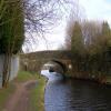
There is a bridge here which takes a minor road over the canal.


Amenities

Amenities nearby at Baltimore Marina

 SEE ADDRESS

Amenities nearby at Site of Albion Mill

 Lidl
 
Maps
If you are a user and are logged on, or if you are actively planning a route, a map will be displayed here.
Show on external mapping site: Google | OSM | Bing
 
Photos
 
External websites
There are no links to external websites from here.
Why not log in and add some (select "External websites" from the menu (sometimes this is under "Edit"))?
 
Nearest facilities

Mouseover for more information or show routes to facility

Nearest water point

In the direction of Castlefield Junction

Fielden Wharf & Services2¼ furlongs and 1 lock away
On this waterway in the direction of Castlefield Junction
Travis Mill Lock No 281 mile, 7½ furlongs and 10 locks away
On this waterway in the direction of Castlefield Junction
Littleborough Sanitary Station5 miles, 4¾ furlongs and 29 locks away
On this waterway in the direction of Castlefield Junction

In the direction of Sowerby Bridge Junction

Baltimore Marina1 furlong away
On this waterway in the direction of Sowerby Bridge Junction
Hebden Bridge Services4 miles, ¼ furlongs and 9 locks away
On this waterway in the direction of Sowerby Bridge Junction
Sowerby Bridge Basin9 miles, 5¾ furlongs and 16 locks away
Travel to Sowerby Bridge Junction, then on the Calder and Hebble Navigation (Main Line) to Sowerby Bridge Basin
Salterhebble Junction11 miles, 5½ furlongs and 16 locks away
Travel to Sowerby Bridge Junction, then on the Calder and Hebble Navigation (Main Line) to Salterhebble Junction
Salterhebble Sanitary Station11 miles, 6 furlongs and 17 locks away
Travel to Sowerby Bridge Junction, then on the Calder and Hebble Navigation (Main Line) to Salterhebble Junction, then on the Calder and Hebble Navigation (Main Line) to Salterhebble Sanitary Station
Brighouse Basin16 miles and 26 locks away
Travel to Sowerby Bridge Junction, then on the Calder and Hebble Navigation (Main Line) to Salterhebble Junction, then on the Calder and Hebble Navigation (Main Line) to Brighouse Basin

Nearest rubbish disposal

In the direction of Castlefield Junction

Fielden Wharf & Services2¼ furlongs and 1 lock away
On this waterway in the direction of Castlefield Junction
Littleborough Sanitary Station5 miles, 4¾ furlongs and 29 locks away
On this waterway in the direction of Castlefield Junction

In the direction of Sowerby Bridge Junction

Hebden Bridge Services4 miles, ¼ furlongs and 9 locks away
On this waterway in the direction of Sowerby Bridge Junction
Sowerby Bridge Basin9 miles, 5¾ furlongs and 16 locks away
Travel to Sowerby Bridge Junction, then on the Calder and Hebble Navigation (Main Line) to Sowerby Bridge Basin
Salterhebble Sanitary Station11 miles, 6 furlongs and 17 locks away
Travel to Sowerby Bridge Junction, then on the Calder and Hebble Navigation (Main Line) to Salterhebble Junction, then on the Calder and Hebble Navigation (Main Line) to Salterhebble Sanitary Station
Brighouse Lower Basin Visitor Moorings16 miles, ¼ furlongs and 27 locks away
Travel to Sowerby Bridge Junction, then on the Calder and Hebble Navigation (Main Line) to Salterhebble Junction, then on the Calder and Hebble Navigation (Main Line) to Brighouse Lower Basin Visitor Moorings

Nearest chemical toilet disposal

In the direction of Castlefield Junction

Littleborough Sanitary Station5 miles, 4¾ furlongs and 29 locks away
On this waterway in the direction of Castlefield Junction

In the direction of Sowerby Bridge Junction

Baltimore Marina1 furlong away
On this waterway in the direction of Sowerby Bridge Junction
Hebden Bridge Services4 miles, ¼ furlongs and 9 locks away
On this waterway in the direction of Sowerby Bridge Junction
Sowerby Bridge Basin9 miles, 5¾ furlongs and 16 locks away
Travel to Sowerby Bridge Junction, then on the Calder and Hebble Navigation (Main Line) to Sowerby Bridge Basin
Salterhebble Sanitary Station11 miles, 6 furlongs and 17 locks away
Travel to Sowerby Bridge Junction, then on the Calder and Hebble Navigation (Main Line) to Salterhebble Junction, then on the Calder and Hebble Navigation (Main Line) to Salterhebble Sanitary Station
Brighouse Basin16 miles and 26 locks away
Travel to Sowerby Bridge Junction, then on the Calder and Hebble Navigation (Main Line) to Salterhebble Junction, then on the Calder and Hebble Navigation (Main Line) to Brighouse Basin

Nearest place to turn

In the direction of Castlefield Junction

Todmorden Bridge Winding Hole2¼ furlongs and 1 lock away
On this waterway in the direction of Castlefield Junction
Winding Hole between Nip Square and Winterbutlee Locks2 miles, 1 furlong and 12 locks away
On this waterway in the direction of Castlefield Junction
Lightbank Lock Winding Hole2 miles, 4 furlongs and 14 locks away
On this waterway in the direction of Castlefield Junction
Bottomley Road Winding Hole2 miles, 5¾ furlongs and 15 locks away
On this waterway in the direction of Castlefield Junction
Summit Pound Winding Hole3 miles, 4 furlongs and 19 locks away
On this waterway in the direction of Castlefield Junction

In the direction of Sowerby Bridge Junction

Baltimore Winding Hole1¼ furlongs away
On this waterway in the direction of Sowerby Bridge Junction
Lobb Mill Lock Winding Hole1 mile, ¼ furlongs and 2 locks away
On this waterway in the direction of Sowerby Bridge Junction
Stoodley Bridge Winding Hole1 mile, 5 furlongs and 3 locks away
On this waterway in the direction of Sowerby Bridge Junction
Winding Hole below Holmcoat Lock1 mile, 7¼ furlongs and 4 locks away
On this waterway in the direction of Sowerby Bridge Junction
Rawden Mill Lock Winding Hole2 miles, 6¾ furlongs and 6 locks away
On this waterway in the direction of Sowerby Bridge Junction
Hebden Bridge Wharf4 miles, ½ furlongs and 9 locks away
On this waterway in the direction of Sowerby Bridge Junction
Walkley's Clog Mill4 miles, 6½ furlongs and 10 locks away
On this waterway in the direction of Sowerby Bridge Junction
Winding Hole below Lock No 56 miles, 5¾ furlongs and 13 locks away
On this waterway in the direction of Sowerby Bridge Junction
Tower Hill Winding Hole9 miles, ¾ furlongs and 13 locks away
On this waterway in the direction of Sowerby Bridge Junction
Sowerby Bridge Winding Hole9 miles, 2¾ furlongs and 15 locks away
On this waterway in the direction of Sowerby Bridge Junction
Sowerby Bridge Junction9 miles, 4¾ furlongs and 16 locks away
On this waterway in the direction of Sowerby Bridge Junction
Sterne Mill Winding Hole10 miles, 3 furlongs and 16 locks away
Travel to Sowerby Bridge Junction, then on the Calder and Hebble Navigation (Main Line) to Sterne Mill Winding Hole
Salterhebble Basin12 miles, 1½ furlongs and 16 locks away
Travel to Sowerby Bridge Junction, then on the Calder and Hebble Navigation (Main Line) to Salterhebble Junction, then on the Calder and Hebble Navigation (Halifax Branch) to Salterhebble Basin
Salterhebble Sanitary Station11 miles, 6 furlongs and 17 locks away
Travel to Sowerby Bridge Junction, then on the Calder and Hebble Navigation (Main Line) to Salterhebble Junction, then on the Calder and Hebble Navigation (Main Line) to Salterhebble Sanitary Station
Salterhebble Bottom Basin Visitor Moorings11 miles, 6½ furlongs and 18 locks away
Travel to Sowerby Bridge Junction, then on the Calder and Hebble Navigation (Main Line) to Salterhebble Junction, then on the Calder and Hebble Navigation (Main Line) to Salterhebble Bottom Basin Visitor Moorings

Nearest self-operated pump-out

In the direction of Sowerby Bridge Junction

Hebden Bridge Services4 miles, ¼ furlongs and 9 locks away
On this waterway in the direction of Sowerby Bridge Junction

Nearest boatyard pump-out

In the direction of Sowerby Bridge Junction

Pickwell and Arnold Boatyard1 mile, 2½ furlongs and 3 locks away
On this waterway in the direction of Sowerby Bridge Junction
Sowerby Bridge Basin9 miles, 5¾ furlongs and 16 locks away
Travel to Sowerby Bridge Junction, then on the Calder and Hebble Navigation (Main Line) to Sowerby Bridge Basin
Direction of TV transmitter (From Wolfbane Cybernetic)
 
 
Geograph
 
Wikipedia

There is no page on Wikipedia called “Baltimore Bridge”

Wikipedia pages that might relate to Baltimore Bridge
[Francis Scott Key Bridge (Baltimore)] arch-shaped continuous through truss bridge spanning the lower Patapsco River and outer Baltimore Harbor / Port in Baltimore, Maryland, United States. The main [Baltimore] I-895). The Baltimore Beltway crosses south of Baltimore Harbor over the Francis Scott Key Bridge. The first interstate highway built in Baltimore was I-83 [New Baltimore Bridge] The New Baltimore Bridge is a historic covered bridge in Allegheny Township, Somerset County, Pennsylvania. Township Route 812 crosses the Raystown Branch [Truss bridge] rail bridge over the River Rhine, Mainz, Germany, the bridge on I-895 (Baltimore Harbor Tunnel Thruway) in Baltimore, Maryland, the Long–Allen Bridge in [Baltimore Covered Bridge] The Baltimore Covered Bridge is a wooden covered bridge in Springfield, Vermont. The bridge was originally built in 1870 by Granville Leland and Dennis [List of bridge failures] 1999). "Beltway bridge collapse kills 1; Walkway over I-695 near Arbutus tumbles when hit by backhoe". The Baltimore Sun. Baltimore Sun Media Group. [Chesapeake Bay Bridge] possibility of a bridge across the Chesapeake Bay. However, the first known proposal came about in 1907 and called for a crossing between Baltimore and Tolchester [Baltimore and Ohio Railroad] The Baltimore and Ohio Railroad (reporting marks B&O, BO) was the first common carrier railroad and the oldest railroad in the United States, with its [Hanover Street Bridge] Hanover Street (Maryland Route 2) in Baltimore, Maryland. The bridge was built to replace the mile-long "Long Bridge" built by Richard Cromwell in 1856 [Interstate 695 (Maryland)] approaches were finished in 1977, completing the route around Baltimore. The approaches to the bridge were originally two lanes to accommodate a tunnel that
 
Google

Results of Google Search

MARYLAND ROUTE RESTRICTIONS
Nov 10, 2020 ... I-95 must use Exit 59 (Eastern Ave) to the Baltimore City Line. ... Ramp from US 40 to S/B US 29 under bridge No.1300800 is restricted to a ...
Route 29 pedestrian bridge construction to begin Sept. 5 - Baltimore ...
Aug 29, 2017 ... Renovations to Bridge Columbia, which is above Route 29 in ... not the most feasible option; the current bridge is not wide enough to fit buses ...
“No Bay Bridge to Kent,” Say Residents
Jan 29, 2018 ... January 29, 2018 by Peter Heck ... A bridge from Baltimore to Kent County would not be “harmonious with the land or the people,” she said, ...
Study concludes transit bridge over Route 29 too costly - Baltimore ...
Sep 18, 2012 ... ... over Route 29 connecting downtown Columbia and Oakland Mills would not be great enough to justify the expense of building such a bridge, ...
Hanover Street Bridge Closure Scheduled for This Weekend, March ...
Hanover Street Bridge Closure Scheduled for This Weekend, March 28-29, 2020. Tuesday Mar 24th, 2020. The Baltimore City Department of Transportation ...
Roundtable to discuss possibilities for Route 29 bridge - Baltimore Sun
Jun 15, 2015 ... "There is no doubt an improved bridge would be beneficial to Oakland Mills, Town Center and the rest of Columbia," he said in a statement.
29 Brucester Bridge Ct, Baltimore, MD 21228 | Zillow
The property 29 Brucester Bridge Ct, Baltimore, MD 21228 is currently not for sale on Zillow. View details, sales history and Zestimate data for this property on  ...
Bridge to unite Columbia villages seen as crucial for town ...
Apr 23, 2012 ... Jamie McLean, 39, of Oakland Mills, walks over the U.S. 29 bridge on the path that winds around Lake ... (Algerina Perna/Baltimore Sun) ... Now, drivers might not recognize that they are in Columbia, Gottemoeller said.
HA-29 Maryland and Pennsylvania Railroad Corridor (Bridge ...
Feb 4, 2016 ... Inventory Number: HA-29. Historic district: X yes. City: Jarrettsville ... railroad connecting Baltimore to West Chester, Pennsylvania was planned.