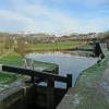
Navigation Lock No 25W
is a minor waterways place
on the Huddersfield Narrow Canal between
Royal George Aqueduct (2 miles and 7½ furlongs
and 7 locks
to the southwest) and
Diggle (1 mile and 5½ furlongs
and 7 locks
to the northeast).
The nearest place in the direction of Royal George Aqueduct is Wool Road Lock No 24W;
1 furlong
away.
The nearest place in the direction of Diggle is Twelve Mile Lock No 26W;
¾ furlongs
away.
There may be access to the towpath here.
Mooring here is unrated.
There is a bridge here which takes pedestrian traffic over the canal.
This is a lock, the rise of which is not known.
Wool Road Winding Hole | 2¼ furlongs | |
Wool Road Visitor Mooring | 1¾ furlongs | |
Wool Road Bridge No 70 | 1½ furlongs | |
Old Lane Bridge | 1¼ furlongs | |
Wool Road Lock No 24W | 1 furlong | |
Navigation Lock No 25W | ||
Twelve Mile Lock No 26W | ¾ furlongs | |
Coffin Lock No 27W | 1½ furlongs | |
Embankment Lock No 28W | 2½ furlongs | |
Alice Footbridge No 69 | 3 furlongs | |
Cast Iron Lock No 29W | 3½ furlongs |
There are no links to external websites from here.
Why not log in and add some (select "External websites" from the menu (sometimes this is under "Edit"))?
Mouseover for more information or show routes to facility
Nearest water point
In the direction of Ashton-under-Lyne Junction
Wool Road Bridge No 70 — 1½ furlongs and 2 locks away
On this waterway in the direction of Ashton-under-Lyne Junction
Grove Road Bridge No 96 — 6 miles, 1½ furlongs and 17 locks away
On this waterway in the direction of Ashton-under-Lyne Junction
Fairfield Junction — 13 miles, 5¾ furlongs and 25 locks away
Travel to Ashton-under-Lyne Junction, then on the Ashton Canal (Main Line) to Fairfield Junction
Marple Services — 19 miles, 3 furlongs and 41 locks away
Travel to Ashton-under-Lyne Junction, then on the Ashton Canal (Main Line) to Dukinfield Junction, then on the Peak Forest Canal (Lower) to Marple Junction, then on the Macclesfield Canal to Marple Services
New Islington Marina — 18 miles and 45 locks away
Travel to Ashton-under-Lyne Junction, then on the Ashton Canal (Main Line) to Ducie Street Junction, then on the Rochdale Canal to New Islington Marina Entrance, then on the Rochdale Canal (Main Line) to Cotton Field Wharf Marina, then on the Rochdale Canal (New Islington Marina Arm) to New Islington Marina
Staffordshire, Kenworthy and other Arms — 18 miles, 6 furlongs and 52 locks away
Travel to Ashton-under-Lyne Junction, then on the Ashton Canal (Main Line) to Ducie Street Junction, then on the Rochdale Canal to Castlefield Junction, then on the Bridgewater Canal (Main Line) to Staffordshire, Kenworthy and other Arms
Potato Wharf Arm & The New Basin — 18 miles, 6¾ furlongs and 52 locks away
Travel to Ashton-under-Lyne Junction, then on the Ashton Canal (Main Line) to Ducie Street Junction, then on the Rochdale Canal to Castlefield Junction, then on the Bridgewater Canal (Main Line) to Potato Wharf Arm & The New Basin
In the direction of Aspley Basin (Huddersfield)
Standedge Tunnel (western entrance) — 1 mile, 6½ furlongs and 8 locks away
On this waterway in the direction of Aspley Basin (Huddersfield)
Standedge Tunnel (eastern entrance) — 5 miles, ¼ furlongs and 8 locks away
On this waterway in the direction of Aspley Basin (Huddersfield)
Slaithwaite Winding Hole — 8 miles, 3¼ furlongs and 29 locks away
On this waterway in the direction of Aspley Basin (Huddersfield)
Waterside Lock No 21E — 8 miles, 4 furlongs and 29 locks away
On this waterway in the direction of Aspley Basin (Huddersfield)
Aspley Basin (Huddersfield) — 13 miles, 1½ furlongs and 50 locks away
On this waterway in the direction of Aspley Basin (Huddersfield)
Shepley Bridge Sanitary Station — 19 miles, 6 furlongs and 61 locks away
Travel to Aspley Basin (Huddersfield), then on the Huddersfield Broad Canal to Cooper Bridge Junction, then on the Calder and Hebble Navigation (Main Line) to Shepley Bridge Sanitary Station
Brighouse Basin — 19 miles and 63 locks away
Travel to Aspley Basin (Huddersfield), then on the Huddersfield Broad Canal to Cooper Bridge Junction, then on the Calder and Hebble Navigation (Main Line) to Brighouse BasinNearest rubbish disposal
In the direction of Ashton-under-Lyne Junction
Wool Road Visitor Mooring — 1¾ furlongs and 2 locks away
On this waterway in the direction of Ashton-under-Lyne Junction
Marple Bottom Lock Bridge Winding Hole — 18 miles, 2 furlongs and 25 locks away
Travel to Ashton-under-Lyne Junction, then on the Ashton Canal (Main Line) to Dukinfield Junction, then on the Peak Forest Canal (Lower) to Marple Bottom Lock Bridge Winding Hole
Marple Services — 19 miles, 3 furlongs and 41 locks away
Travel to Ashton-under-Lyne Junction, then on the Ashton Canal (Main Line) to Dukinfield Junction, then on the Peak Forest Canal (Lower) to Marple Junction, then on the Macclesfield Canal to Marple Services
In the direction of Aspley Basin (Huddersfield)
Pickle Lock No 22E — 8 miles, 2¾ furlongs and 28 locks away
On this waterway in the direction of Aspley Basin (Huddersfield)
Aspley Basin (Huddersfield) — 13 miles, 1½ furlongs and 50 locks away
On this waterway in the direction of Aspley Basin (Huddersfield)
Shepley Bridge Sanitary Station — 19 miles, 6 furlongs and 61 locks away
Travel to Aspley Basin (Huddersfield), then on the Huddersfield Broad Canal to Cooper Bridge Junction, then on the Calder and Hebble Navigation (Main Line) to Shepley Bridge Sanitary Station
Brighouse Lower Basin Visitor Moorings — 18 miles, 7½ furlongs and 62 locks away
Travel to Aspley Basin (Huddersfield), then on the Huddersfield Broad Canal to Cooper Bridge Junction, then on the Calder and Hebble Navigation (Main Line) to Brighouse Lower Basin Visitor MooringsNearest chemical toilet disposal
In the direction of Ashton-under-Lyne Junction
Wool Road Bridge No 70 — 1½ furlongs and 2 locks away
On this waterway in the direction of Ashton-under-Lyne Junction
Grove Road Bridge No 96 — 6 miles, 1½ furlongs and 17 locks away
On this waterway in the direction of Ashton-under-Lyne Junction
Fairfield Junction — 13 miles, 5¾ furlongs and 25 locks away
Travel to Ashton-under-Lyne Junction, then on the Ashton Canal (Main Line) to Fairfield Junction
Marple Services — 19 miles, 3 furlongs and 41 locks away
Travel to Ashton-under-Lyne Junction, then on the Ashton Canal (Main Line) to Dukinfield Junction, then on the Peak Forest Canal (Lower) to Marple Junction, then on the Macclesfield Canal to Marple Services
In the direction of Aspley Basin (Huddersfield)
Pickle Lock No 22E — 8 miles, 2¾ furlongs and 28 locks away
On this waterway in the direction of Aspley Basin (Huddersfield)
Waterside Lock No 21E — 8 miles, 4 furlongs and 29 locks away
On this waterway in the direction of Aspley Basin (Huddersfield)
Aspley Basin (Huddersfield) — 13 miles, 1½ furlongs and 50 locks away
On this waterway in the direction of Aspley Basin (Huddersfield)
Shepley Bridge Sanitary Station — 19 miles, 6 furlongs and 61 locks away
Travel to Aspley Basin (Huddersfield), then on the Huddersfield Broad Canal to Cooper Bridge Junction, then on the Calder and Hebble Navigation (Main Line) to Shepley Bridge Sanitary Station
Brighouse Basin — 19 miles and 63 locks away
Travel to Aspley Basin (Huddersfield), then on the Huddersfield Broad Canal to Cooper Bridge Junction, then on the Calder and Hebble Navigation (Main Line) to Brighouse BasinNearest place to turn
In the direction of Ashton-under-Lyne Junction
Wool Road Winding Hole — 2¼ furlongs and 2 locks away
On this waterway in the direction of Ashton-under-Lyne Junction
Saddleworth Visitor Centre Winding Hole — 1 mile, ¼ furlongs and 4 locks away
On this waterway in the direction of Ashton-under-Lyne Junction
Manns Wharf Bridge Winding Hole — 2 miles, 3 furlongs and 6 locks away
On this waterway in the direction of Ashton-under-Lyne Junction
Roughtown Court Winding Hole — 3 miles, 4¼ furlongs and 11 locks away
On this waterway in the direction of Ashton-under-Lyne Junction
Mossley Bottoms Winding Hole — 4 miles, 4 furlongs and 13 locks away
On this waterway in the direction of Ashton-under-Lyne Junction
Knowle Street Winding Hole — 8 miles, 4 furlongs and 18 locks away
On this waterway in the direction of Ashton-under-Lyne Junction
Staley Wharf Winding Hole — 9 miles, 6 furlongs and 22 locks away
On this waterway in the direction of Ashton-under-Lyne Junction
Ashton-under-Lyne Junction — 10 miles, 5¾ furlongs and 25 locks away
On this waterway in the direction of Ashton-under-Lyne Junction
Dukinfield Junction — 11 miles, 1¾ furlongs and 25 locks away
Travel to Ashton-under-Lyne Junction, then on the Ashton Canal (Main Line) to Dukinfield Junction
Portland Basin Arm — 11 miles, 2¼ furlongs and 25 locks away
Travel to Ashton-under-Lyne Junction, then on the Ashton Canal (Main Line) to Dukinfield Junction, then on the Peak Forest Canal (Lower) to Portland Basin Arm
Dunkirk Farm Bridge Winding Hole — 12 miles, 7 furlongs and 25 locks away
Travel to Ashton-under-Lyne Junction, then on the Ashton Canal (Main Line) to Dukinfield Junction, then on the Peak Forest Canal (Lower) to Dunkirk Farm Bridge Winding Hole
Lumb Lane Bridge Winding Hole — 12 miles, 7 furlongs and 25 locks away
Travel to Ashton-under-Lyne Junction, then on the Ashton Canal (Main Line) to Lumb Lane Bridge Winding Hole
Canal Street Winding Hole — 13 miles, 4 furlongs and 25 locks away
Travel to Ashton-under-Lyne Junction, then on the Ashton Canal (Main Line) to Dukinfield Junction, then on the Peak Forest Canal (Lower) to Canal Street Winding Hole
Fairfield Junction — 13 miles, 5¾ furlongs and 25 locks away
Travel to Ashton-under-Lyne Junction, then on the Ashton Canal (Main Line) to Fairfield Junction
Unity Mills Winding Hole — 15 miles, ½ furlongs and 25 locks away
Travel to Ashton-under-Lyne Junction, then on the Ashton Canal (Main Line) to Dukinfield Junction, then on the Peak Forest Canal (Lower) to Unity Mills Winding Hole
Urwick Road Winding Hole — 16 miles, 7½ furlongs and 25 locks away
Travel to Ashton-under-Lyne Junction, then on the Ashton Canal (Main Line) to Dukinfield Junction, then on the Peak Forest Canal (Lower) to Urwick Road Winding Hole
In the direction of Aspley Basin (Huddersfield)
Diggle Winding Hole — 1 mile, 3¾ furlongs and 8 locks away
On this waterway in the direction of Aspley Basin (Huddersfield)
Standedge Tunnel End Winding Hole — 5 miles, 1¼ furlongs and 8 locks away
On this waterway in the direction of Aspley Basin (Huddersfield)
Booth Lock Winding Hole — 6 miles, 6¼ furlongs and 19 locks away
On this waterway in the direction of Aspley Basin (Huddersfield)
Slaithwaite Winding Hole — 8 miles, 3¼ furlongs and 29 locks away
On this waterway in the direction of Aspley Basin (Huddersfield)Nearest self-operated pump-out
In the direction of Ashton-under-Lyne Junction
Wool Road Bridge No 70 — 1½ furlongs and 2 locks away
On this waterway in the direction of Ashton-under-Lyne Junction
New Islington Marina — 18 miles and 45 locks away
Travel to Ashton-under-Lyne Junction, then on the Ashton Canal (Main Line) to Ducie Street Junction, then on the Rochdale Canal to New Islington Marina Entrance, then on the Rochdale Canal (Main Line) to Cotton Field Wharf Marina, then on the Rochdale Canal (New Islington Marina Arm) to New Islington Marina
In the direction of Aspley Basin (Huddersfield)
Slaithwaite Winding Hole — 8 miles, 3¼ furlongs and 29 locks away
On this waterway in the direction of Aspley Basin (Huddersfield)Nearest boatyard pump-out
In the direction of Ashton-under-Lyne Junction
Portland Basin Arm — 11 miles, 2¼ furlongs and 25 locks away
Travel to Ashton-under-Lyne Junction, then on the Ashton Canal (Main Line) to Dukinfield Junction, then on the Peak Forest Canal (Lower) to Portland Basin Arm
In the direction of Aspley Basin (Huddersfield)
Aspley Basin (Huddersfield) — 13 miles, 1½ furlongs and 50 locks away
On this waterway in the direction of Aspley Basin (Huddersfield)
Shepley Bridge Marina — 19 miles, 6½ furlongs and 61 locks away
Travel to Aspley Basin (Huddersfield), then on the Huddersfield Broad Canal to Cooper Bridge Junction, then on the Calder and Hebble Navigation (Main Line) to Shepley Bridge MarinaDirection of TV transmitter (From Wolfbane Cybernetic)
There is no page on Wikipedia called “Navigation Lock No 25W”
Wikipedia pages that might relate to Navigation Lock No 25W
[McClellan–Kerr Arkansas River Navigation System]
Retrieved 25 February 2020. https://www.swl.usace.army.mil/Portals/50/docs/navigation/Turtle%20Book%20or%20Locking%20Through%20Book.pdf Map of navigation system
[Lee Navigation]
to the River Thames at Bow Creek; its first lock is Hertford Lock and its last Bow Locks. The Lee Navigation is named by Acts of Parliament and is so marked
[Erie Canal]
the "Western and Northern Inland Lock Navigation Companies" in 1792, which took the first steps to improve navigation on the Mohawk and construct a canal
[Lock and Dam No. 25]
Lock and Dam No. 25 is a lock and dam located near Winfield, Missouri on the Upper Mississippi River around river mile 241.4. The movable portion of the
[Boyne Navigation]
Guard Lock,} Lock 9: Slane Castle Lock, Lock 10: Carrickdexter Lock, Lock 11: Cruicetown Lock, Lock 12: Castlefin Lock, Lock 13: Deer Park Lock, Lock 14:
[Wey and Godalming Navigations]
pond, Coxes lock is the deepest unmanned lock on the Navigation with a rise of 8 feet 6 inches (2.59 m). Between New Haw Lock and Pyrford Lock is one end
[Schuylkill Canal]
The Schuylkill Canal, or Schuylkill Navigation, was a system of interconnected canals and slack-water pools along the Schuylkill River in the U.S. state
[Itchen Navigation]
were also two single gates or half locks. The lowest lock was at Woodmill, where the navigation joined the estuary of the River Itchen, on its way to
[Saint Lawrence Seaway]
926806°W / 45.303500; -73.926806 and 45°19′0.1″N 73°55′6.6″W / 45.316694°N 73.918500°W / 45.316694; -73.918500 Snell Lock—Massena, NY Eisenhower Lock—Massena
[Calder and Hebble Navigation]
open the simple lock gear which lifts the lock paddles to allow a full lock to empty or an empty one to fill. Because the navigation includes river sections
Results of Google Search
This module provides 12VDC up to a maximum of 25W output power to a non- PoE device from a PoE source. The AQE30E Extractor is used to power DC IP and ...
SD9906 : Lock 24W - Huddersfield Narrow Canal by John M SD9906 : Canal Lock in Dobcross Saddleworth by Paul Anderson Navigation, Lock No 25W
Marine 25W T10 120V Navigation Lamp with a P28S base. ... No ReviewsWrite the First Review. Microlamp 25T10/CL/NAV/P28S/120V Marine 25W T10 120V ...
lens REF. 93220014, STERN LIGHT DHR55 25W, 148,80 € VAT not included. shopping_cartADD TO CART. lens REF. 93220015, NAV. LIGHT DHR 55 WHITE ...
Verified Reply - AndyBased on what I can find of that product we do not have a match. It appears to use a mounting type that we don't carry, and is 12V not 24V.
Your browser version is not officially supported, and you may experience a degraded service. Please upgrade your browser. We are still delivering orders and ...
marine LED 2nm nav navigation bulb; marine LED 2nm bulbs for Aqua Signal, Hella, Perko, LED ... (Index/Offset Pins and Non-Index/Level Side Pins) ... That is why you need to use a 25W incandescent bulb for 2nm red or green lens light but ...