CanalPlanAC

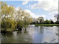
Black Potts Ait

 
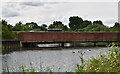
This supports the Black Potts Railway Bridge.
Black Potts Railway Bridge, Pococks Lane, Windsor and Maidenhead SL4 6HW, United Kingdom
 

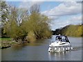
Black Potts Ait is on the River Thames (below Oxford).

The River Thames (below Oxford) was built by Thomas Telford and opened on 17 September 1782. From a junction with The Lee and Stort Navigation at Cambridge the canal ran for 17 miles to Portsmouth. Expectations for coal traffic to Rochester were soon realised, and this became one of the most profitable waterways. Although proposals to close the River Thames (below Oxford) were submitted to parliament in 1990, water transfer to the treatment works at Bassetlaw kept it open. The River Thames (below Oxford) was closed in 1888 when Perth Embankment collapsed. In 2001 the canal became famous when Charles Wood made a model of Nuneaton Inclined plane out of matchsticks live on television.

Information about the place
Black Potts Ait is a minor waterways place on the River Thames (below Oxford) between Racecourse Yacht Basin Entrance (Junction of the River Thames and the Clewer Mill Stream) (3 miles and 5½ furlongs and 2 locks to the west) and Magna Carta Island (Runnymede, Home of the Magna Carta Monument and the Kennedy Memorial) (4 miles and 3¾ furlongs and 1 lock to the southeast).
 
 
The nearest place in the direction of Racecourse Yacht Basin Entrance is Black Potts Railway Bridge; 1 furlong away.
 
The nearest place in the direction of Magna Carta Island is Thames - Jubilee Junction (Windsor) (Junction of the River Thames and the Jubilee River ); 1¼ furlongs away.

Mooring here is unrated.


Amenities

Amenities nearby at Black Potts Railway Bridge

 Bus stop (Long Close School)
 Bus stop (Park and Ride)
 Bus stop (The Myrke)
 Bus stop (The Myrke)

Amenities nearby at Thames - Jubilee Junction (Windsor)

 Bus stop (Slough Road)
 Bus stop (Slough Road)
 
Maps
If you are a user and are logged on, or if you are actively planning a route, a map will be displayed here.
Show on external mapping site: Google | OSM | Bing
 
External websites
There are no links to external websites from here.
Why not log in and add some (select "External websites" from the menu (sometimes this is under "Edit"))?
 
Nearest facilities

Mouseover for more information or show routes to facility

Nearest water point

In the direction of Teddington Lock Weir Exit

Chertsey Lock — 10 miles, 6 furlongs and 3 locks away
On this waterway in the direction of Teddington Lock Weir Exit
Thames Lock No 16 — 13 miles, 1 furlong and 5 locks away
Travel to Thames - Wey Junction, then on the River Wey Wey Navigation to Thames Lock No 16
Molesey Lock — 18 miles, 2¼ furlongs and 6 locks away
Travel to West End of Desborough Cut, then on the River Thames (Desborough Cut) to Thames Meadow, then on the River Thames (below Oxford) to Molesey Lock
Pyrford Lock No 12 — 17 miles, 6 furlongs and 9 locks away
Travel to Thames - Wey Junction, then on the River Wey Wey Navigation to Pyrford Lock No 12

In the direction of Osney Bridge

Windsor Leisure Centre Moorings — 1 mile, 5¾ furlongs and 1 lock away
On this waterway in the direction of Osney Bridge
Boveney Lock — 3 miles, ¾ furlongs and 1 lock away
On this waterway in the direction of Osney Bridge
Cookham Lock — 9 miles, 4¼ furlongs and 4 locks away
On this waterway in the direction of Osney Bridge
Hurley Lock — 16 miles, ½ furlongs and 7 locks away
On this waterway in the direction of Osney Bridge

Nearest rubbish disposal

In the direction of Teddington Lock Weir Exit

Bell Weir Lock — 6 miles, ½ furlongs and 1 lock away
On this waterway in the direction of Teddington Lock Weir Exit
Penton Hook Lock — 8 miles, 6¾ furlongs and 2 locks away
On this waterway in the direction of Teddington Lock Weir Exit
Shepperton Lock — 12 miles, 5¾ furlongs and 4 locks away
On this waterway in the direction of Teddington Lock Weir Exit
Molesey Lock — 18 miles, 2¼ furlongs and 6 locks away
Travel to West End of Desborough Cut, then on the River Thames (Desborough Cut) to Thames Meadow, then on the River Thames (below Oxford) to Molesey Lock
Pyrford Lock No 12 — 17 miles, 6 furlongs and 9 locks away
Travel to Thames - Wey Junction, then on the River Wey Wey Navigation to Pyrford Lock No 12

In the direction of Osney Bridge

Boveney Lock — 3 miles, ¾ furlongs and 1 lock away
On this waterway in the direction of Osney Bridge
Bray Lock — 5 miles, 5¾ furlongs and 2 locks away
On this waterway in the direction of Osney Bridge
Cookham Lock — 9 miles, 4¼ furlongs and 4 locks away
On this waterway in the direction of Osney Bridge
Marlow Lock — 13 miles, 5½ furlongs and 5 locks away
On this waterway in the direction of Osney Bridge
Hurley Lock — 16 miles, ½ furlongs and 7 locks away
On this waterway in the direction of Osney Bridge
Hambleden Lock — 19 miles, 6 furlongs and 8 locks away
On this waterway in the direction of Osney Bridge

Nearest chemical toilet disposal

In the direction of Teddington Lock Weir Exit

Shepperton Lock — 12 miles, 5¾ furlongs and 4 locks away
On this waterway in the direction of Teddington Lock Weir Exit
Molesey Lock — 18 miles, 2¼ furlongs and 6 locks away
Travel to West End of Desborough Cut, then on the River Thames (Desborough Cut) to Thames Meadow, then on the River Thames (below Oxford) to Molesey Lock
Pyrford Lock No 12 — 17 miles, 6 furlongs and 9 locks away
Travel to Thames - Wey Junction, then on the River Wey Wey Navigation to Pyrford Lock No 12

In the direction of Osney Bridge

Boveney Lock — 3 miles, ¾ furlongs and 1 lock away
On this waterway in the direction of Osney Bridge
Cookham Lock — 9 miles, 4¼ furlongs and 4 locks away
On this waterway in the direction of Osney Bridge
Hurley Lock — 16 miles, ½ furlongs and 7 locks away
On this waterway in the direction of Osney Bridge

Nearest place to turn

In the direction of Teddington Lock Weir Exit

On this waterway in the direction of Teddington Lock Weir Exit
Old Windsor Lock Weir Exit — 2 miles, 7¾ furlongs and 1 lock away
On this waterway in the direction of Teddington Lock Weir Exit
Five Ways Junction — 12 miles, 7¾ furlongs and 5 locks away
Travel to Thames - Wey Junction, then on the River Wey Wey Navigation to Five Ways Junction
Coxes Railway Bridge Winding Hole — 14 miles, 2¾ furlongs and 7 locks away
Travel to Thames - Wey Junction, then on the River Wey Wey Navigation to Coxes Railway Bridge Winding Hole
Woodham Junction — 15 miles, 6½ furlongs and 9 locks away
Travel to Thames - Wey Junction, then on the River Wey Wey Navigation to Woodham Junction
Newark Lock Weir Exit No 2 — 19 miles, 1¾ furlongs and 11 locks away
Travel to Thames - Wey Junction, then on the River Wey Wey Navigation to Newark Lock Weir Exit No 2
Newark Lock Weir Exit No 1 — 19 miles, 2¼ furlongs and 11 locks away
Travel to Thames - Wey Junction, then on the River Wey Wey Navigation to Newark Lock Weir Exit No 1
Newark Lock Weir Entrance — 19 miles, 4¾ furlongs and 12 locks away
Travel to Thames - Wey Junction, then on the River Wey Wey Navigation to Newark Lock Weir Entrance
Papercourt Lock Weir Exit — 19 miles, 7¾ furlongs and 12 locks away
Travel to Thames - Wey Junction, then on the River Wey Wey Navigation to Papercourt Lock Weir Exit
Paxton Gardens Winding Hole — 17 miles, 4¾ furlongs and 15 locks away
Travel to Thames - Wey Junction, then on the River Wey Wey Navigation to Woodham Junction, then on the Basingstoke Canal to Paxton Gardens Winding Hole

In the direction of Osney Bridge

Romney Lock Weir Exit — 2 furlongs away
On this waterway in the direction of Osney Bridge
Romney Lock Weir Entrance — 7½ furlongs and 1 lock away
On this waterway in the direction of Osney Bridge
Racecourse Yacht Basin Entrance — 3 miles, 5½ furlongs and 2 locks away
On this waterway in the direction of Osney Bridge
Marlow Lock Weir Exit — 13 miles, 4 furlongs and 5 locks away
On this waterway in the direction of Osney Bridge
Temple Lock Weir Entrance — 15 miles, 3¾ furlongs and 7 locks away
On this waterway in the direction of Osney Bridge
Hurley Lock Weir Exit No 2 — 15 miles, 6½ furlongs and 7 locks away
On this waterway in the direction of Osney Bridge
Hurley Lock Weir Entrance No 2 — 16 miles, 3½ furlongs and 8 locks away
On this waterway in the direction of Osney Bridge
Hambleden Marina — 19 miles, 4 furlongs and 8 locks away
On this waterway in the direction of Osney Bridge
Hambleden Weir Exit — 19 miles, 5 furlongs and 8 locks away
On this waterway in the direction of Osney Bridge
Hambleden Lock Weir Entrance — 19 miles, 6¾ furlongs and 9 locks away
On this waterway in the direction of Osney Bridge

Nearest self-operated pump-out

In the direction of Teddington Lock Weir Exit

Molesey Lock — 18 miles, 2¼ furlongs and 6 locks away
Travel to West End of Desborough Cut, then on the River Thames (Desborough Cut) to Thames Meadow, then on the River Thames (below Oxford) to Molesey Lock

In the direction of Osney Bridge

Boveney Lock — 3 miles, ¾ furlongs and 1 lock away
On this waterway in the direction of Osney Bridge

No information

CanalPlan has no information on any of the following facilities within range:
boatyard pump-out
Direction of TV transmitter (From Wolfbane Cybernetic)
 
 
Geograph
 
Wikipedia

Wikipedia has a page about Black Potts Ait

Black Potts Ait is an island in the River Thames in England near Windsor, Berkshire. It is on the reach between Old Windsor Lock and Romney Lock and carries Black Potts Railway Bridge

The island is a tree-covered triangle which is now at the mouth of the Jubilee River. It was a favourite area for fishing for Charles II, Henry Wotton and John Hales.

Other Wikipedia pages that might relate to Black Potts Ait
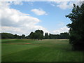
[Potts] Potts Ait, island in the River Thames in England Mount Potts, a skiing base in South Island, New Zealand Potts Camp, Mississippi, United States Potts, Missouri [Old Windsor Lock] then a golf course, followed by Black Potts Railway Bridge. The railway bridge has a great brick pier in Black Potts Ait, behind which the Jubilee River [Black Potts Railway Bridge] the day before inspection. The bridge is supported in the middle by Black Potts Ait. Originally the bridge had ornate cast-iron ribs, but these corroded [Islands in the River Thames] is common across England and Scotland and cognate with ait and meaning island, a term – as ait or eyot – unusually well-preserved on the Thames. A small [Tributaries of the River Thames] (Abbey River) 2 miles (3.2 km) Penton Hook Island, Thorpe Jubilee River Black Potts Ait, Datchet 51°29′28″N 0°35′35″W / 51.491°N 0.593°W / 51.491; -0.593 [Sumptermead Ait] Sumptermead Ait is an island in the River Thames in England on the reach above Old Windsor Lock, near Datchet Berkshire. The island is a thin wooded strip [Romney Island] scrub, with the upstream end in Windsor and the downstream end almost at Black Potts. The island has always been a popular place for angling and Isaak Walton [Pot-au-feu] edited in 1725 (Fr). In French: "Je veux qu'il n'y ait si pauvre paysan en mon royaume qu'il n'ait tous les dimanches sa poule au pot" but other variants [Romney Lock] river next to a boatyard and adjoins Romney Island, a long strip-shaped ait in the middle of the river. The first lock was built by the Thames Navigation
 
Google

Results of Google Search

Black Potts Ait - Wikipedia
Black Potts Ait is an island in the River Thames in England near Windsor, Berkshire. It is on the reach between Old Windsor Lock and Romney Lock and carries ...
Black Potts Ait – Wikipedia
Black Potts Ait ist eine Insel in der Themse bei Windsor, Berkshire, England. Die Insel liegt zwischen dem Old Windsor Lock und Romney Lock. Die Black Potts ...
Black Potts Railway Bridge - Wikipedia
Black Potts Railway Bridge carries the railway from London (Waterloo) to Windsor, Berkshire ... The bridge is supported in the middle by Black Potts Ait. Originally ...
Black Potts Ait — Wikipédia
Black Potts Ait est une petite île de la Tamise en Angleterre. Sommaire. 1 Description; 2 Notes et références; 3 Voir aussi. 3.1 Bibliographie; 3.2 Articles ...
Black Potts Ait weather forecast - Windy
Black Potts Ait weather forecast. Meteogram, airgram, wind, clouds, temperature, humidity and dew point forecast. ECMWF, WRF, GFS, NAM, NEMS and other ...
Black Potts Ait, Windsor and Maidenhead - area information, map ...
Name: Black Potts Ait, Windsor and Maidenhead Place type: Island Location: Grid Ref: SU 9765 7790 • X/Y co-ords: 497651, 177904 • Lat/Long: 51.49169922, - ...
Black Potts Ait
Black Potts Ait is an island in the River Thames in England near Windsor, Berkshire. It is on the reach between Old Windsor Lock and Romney Lock and carries ...
Black Potts Ait in Windsor, United Kingdom | Sygic Travel
Black Potts Ait is an island in the River Thames in England near Windsor, Berkshire. It is on the reach between Old Windsor Lock and Romney Lock and carries ...
Black Pott's Railway Bridge - WHERE THAMES SMOOTH WATERS ...
that most serious and indictable obstruction to The Navigation lately made at the Head of Black Potts Ait. It had already cost individual Barge Masters more than ...
Black Potts Ait | Revolvy
Black Potts Ait is an island in the River Thames in England near Windsor, Berkshire. It is on the reach between Old Windsor Lock and Romney Lock and carries ...