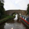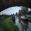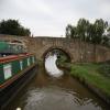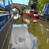
Aynho Bridge No 190 
Ayhno village 1.25 miles northeast up B4031
B4031, South Northamptonshire OX17 3BP, United Kingdom
(B4031)

Aynho Bridge No 190
is a minor waterways place
on the Oxford Canal (Southern Section - Main Line) between
Somerton Bridge No 196 (2 miles and 3¼ furlongs
and 1 lock
to the south) and
Concorde Avenue Bridge No 165 (6 miles and 6¼ furlongs
and 4 locks
to the northwest).
The nearest place in the direction of Somerton Bridge No 196 is Site of Bridge No 191;
3 furlongs
away.
The nearest place in the direction of Concorde Avenue Bridge No 165 is The Great Western Arms PH (Canalside);
¼ furlongs
away.
There is access (suitable for wheels) to the towpath here.
Mooring here is good (a nice place to moor), mooring rings or bollards are available. Mooring is limited to 48 hours. Rings to south of bridge - pins to north opposite wharf.
There is a bridge here which takes a road over the canal.
| Chisnell Lift Bridge No 193 | 1 mile, 1½ furlongs | |
| Souldern Brook Culvert | 1 mile, 1¼ furlongs | |
| Souldern Wharf | 4½ furlongs | |
| Souldern Bridge No 192 | 4¼ furlongs | |
| Site of Bridge No 191 | 3 furlongs | |
| Aynho Bridge No 190 | ||
| The Great Western Arms PH | ¼ furlongs | |
| Aynho Wharf | ½ furlongs | |
| Belchers Lift Bridge No 189 | 3¾ furlongs | |
| Aynho Weir Lock No 33 | 7¾ furlongs | |
| Aynho Weir Lock Bridge No 188 | 7¾ furlongs | |
Amenities nearby at The Great Western Arms PH
There is no other information about Aynho Bridge No 190. Why not add some
- Oxford Canal Walk - Part One - Oxford to Thrupp - YouTube — associated with Oxford Canal
- A walk along the Oxford Canal (Southern Section) from Oxford to Thrupp Wide
Mouseover for more information or show routes to facility
Nearest water point
In the direction of Napton Junction
Aynho Wharf — ½ furlongs away
On this waterway in the direction of Napton Junction
Cherwell Street Facilities — 6 miles, 6¼ furlongs and 4 locks away
On this waterway in the direction of Napton Junction
Banbury Lock No 29 — 6 miles, 6½ furlongs and 4 locks away
On this waterway in the direction of Napton Junction
Sovereign Wharf — 7 miles, ½ furlongs and 5 locks away
On this waterway in the direction of Napton Junction
Cropredy Services — 11 miles, 2¼ furlongs and 8 locks away
On this waterway in the direction of Napton Junction
Cropredy Marina (southern basin) — 11 miles, 6¾ furlongs and 9 locks away
On this waterway in the direction of Napton Junction
Cropredy Marina (northern basins) — 11 miles, 7¼ furlongs and 9 locks away
On this waterway in the direction of Napton Junction
Fenny Compton Wharf — 17 miles, 4¾ furlongs and 17 locks away
On this waterway in the direction of Napton Junction
In the direction of End of Hythe Bridge Arm
Heyford Wharf — 5 miles, 7¾ furlongs and 3 locks away
On this waterway in the direction of End of Hythe Bridge Arm
Heyford Wharf Bridge No 206 — 6 miles and 3 locks away
On this waterway in the direction of End of Hythe Bridge Arm
Thrupp Cruising Club — 13 miles, 4¼ furlongs and 8 locks away
On this waterway in the direction of End of Hythe Bridge Arm
Aubreys Lift Bridge No 221 — 13 miles, 4½ furlongs and 8 locks away
On this waterway in the direction of End of Hythe Bridge Arm
Langford Lane Bridge No 224 — 14 miles, 1¾ furlongs and 8 locks away
On this waterway in the direction of End of Hythe Bridge Arm
Wolvercote Junction Water Point — 17 miles, 1¾ furlongs and 10 locks away
On this waterway in the direction of End of Hythe Bridge Arm
Wolvercote Sanitary Station — 17 miles, 6 furlongs and 11 locks away
On this waterway in the direction of End of Hythe Bridge Arm
St Edwards Lift Bridge No 238 — 18 miles, 6¾ furlongs and 12 locks away
On this waterway in the direction of End of Hythe Bridge ArmNearest rubbish disposal
In the direction of Napton Junction
Aynho Wharf — ½ furlongs away
On this waterway in the direction of Napton Junction
Cherwell Street Facilities — 6 miles, 6¼ furlongs and 4 locks away
On this waterway in the direction of Napton Junction
Sovereign Wharf — 7 miles, ½ furlongs and 5 locks away
On this waterway in the direction of Napton Junction
Cropredy Services — 11 miles, 2¼ furlongs and 8 locks away
On this waterway in the direction of Napton Junction
Cropredy Marina (southern basin) — 11 miles, 6¾ furlongs and 9 locks away
On this waterway in the direction of Napton Junction
Cropredy Marina (northern basins) — 11 miles, 7¼ furlongs and 9 locks away
On this waterway in the direction of Napton Junction
Fenny Compton Marina — 17 miles, 2 furlongs and 17 locks away
On this waterway in the direction of Napton Junction
In the direction of End of Hythe Bridge Arm
Heyford Wharf — 5 miles, 7¾ furlongs and 3 locks away
On this waterway in the direction of End of Hythe Bridge Arm
Heyford Wharf Bridge No 206 — 6 miles and 3 locks away
On this waterway in the direction of End of Hythe Bridge Arm
Thrupp Cruising Club — 13 miles, 4¼ furlongs and 8 locks away
On this waterway in the direction of End of Hythe Bridge Arm
Aubreys Lift Bridge No 221 — 13 miles, 4½ furlongs and 8 locks away
On this waterway in the direction of End of Hythe Bridge Arm
Wolvercote Sanitary Station — 17 miles, 6 furlongs and 11 locks away
On this waterway in the direction of End of Hythe Bridge ArmNearest chemical toilet disposal
In the direction of Napton Junction
Cherwell Street Facilities — 6 miles, 6¼ furlongs and 4 locks away
On this waterway in the direction of Napton Junction
Sovereign Wharf — 7 miles, ½ furlongs and 5 locks away
On this waterway in the direction of Napton Junction
Cropredy Services — 11 miles, 2¼ furlongs and 8 locks away
On this waterway in the direction of Napton Junction
Cropredy Marina (southern basin) — 11 miles, 6¾ furlongs and 9 locks away
On this waterway in the direction of Napton Junction
In the direction of End of Hythe Bridge Arm
Thrupp Cruising Club — 13 miles, 4¼ furlongs and 8 locks away
On this waterway in the direction of End of Hythe Bridge Arm
Wolvercote Sanitary Station — 17 miles, 6 furlongs and 11 locks away
On this waterway in the direction of End of Hythe Bridge ArmNearest place to turn
In the direction of Napton Junction
Aynho Wharf — ½ furlongs away
On this waterway in the direction of Napton Junction
Winding Hole above Nell Bridge Lock — 1 mile, 3 furlongs and 2 locks away
On this waterway in the direction of Napton Junction
Twyford Wharf Winding Hole — 4 miles and 3 locks away
On this waterway in the direction of Napton Junction
Calthorpe Winding Hole — 6 miles, ¾ furlongs and 4 locks away
On this waterway in the direction of Napton Junction
Grimsbury Wharf — 7 miles, 3¾ furlongs and 5 locks away
On this waterway in the direction of Napton Junction
Southam Road Winding Hole — 7 miles, 5 furlongs and 5 locks away
On this waterway in the direction of Napton Junction
Southam Road Footbridge Arm — 7 miles, 7½ furlongs and 5 locks away
On this waterway in the direction of Napton Junction
Cropredy Services — 11 miles, 2¼ furlongs and 8 locks away
On this waterway in the direction of Napton Junction
Cropredy Marina (southern basin) — 11 miles, 6¾ furlongs and 9 locks away
On this waterway in the direction of Napton Junction
Cropredy Marina (northern basins) — 11 miles, 7¼ furlongs and 9 locks away
On this waterway in the direction of Napton Junction
Clattercote Bridge Winding Hole — 13 miles, 2 furlongs and 12 locks away
On this waterway in the direction of Napton Junction
In the direction of End of Hythe Bridge Arm
Somerton Deep Lock Winding Hole — 1 mile, 5¾ furlongs away
On this waterway in the direction of End of Hythe Bridge Arm
Heyford Wharf Winding Hole — 5 miles, 7¾ furlongs and 3 locks away
On this waterway in the direction of End of Hythe Bridge Arm
Heyford Wharf — 5 miles, 7¾ furlongs and 3 locks away
On this waterway in the direction of End of Hythe Bridge Arm
The Cleeves Winding Hole — 6 miles, 3¾ furlongs and 3 locks away
On this waterway in the direction of End of Hythe Bridge Arm
Kirtlington Winding Hole — 9 miles, 2¼ furlongs and 5 locks away
On this waterway in the direction of End of Hythe Bridge Arm
Enslow Winding Hole — 10 miles, 7¾ furlongs and 6 locks away
On this waterway in the direction of End of Hythe Bridge Arm
Shipton Weir Junction — 12 miles, 3¾ furlongs and 7 locks away
On this waterway in the direction of End of Hythe Bridge Arm
Thrupp Wide — 13 miles, 4¼ furlongs and 8 locks away
On this waterway in the direction of End of Hythe Bridge Arm
Wolvercote Junction — 17 miles, 2½ furlongs and 11 locks away
On this waterway in the direction of End of Hythe Bridge ArmNearest self-operated pump-out
In the direction of Napton Junction
Cropredy Marina (southern basin) — 11 miles, 6¾ furlongs and 9 locks away
On this waterway in the direction of Napton Junction
In the direction of End of Hythe Bridge Arm
Thrupp Cruising Club — 13 miles, 4¼ furlongs and 8 locks away
On this waterway in the direction of End of Hythe Bridge Arm
Aubreys Lift Bridge No 221 — 13 miles, 4½ furlongs and 8 locks away
On this waterway in the direction of End of Hythe Bridge ArmNearest boatyard pump-out
In the direction of Napton Junction
Aynho Wharf — ½ furlongs away
On this waterway in the direction of Napton Junction
Twyford Wharf — 3 miles, 7¾ furlongs and 3 locks away
On this waterway in the direction of Napton Junction
Sovereign Wharf — 7 miles, ½ furlongs and 5 locks away
On this waterway in the direction of Napton Junction
Cropredy Marina (southern basin) — 11 miles, 6¾ furlongs and 9 locks away
On this waterway in the direction of Napton Junction
In the direction of End of Hythe Bridge Arm
Heyford Wharf — 5 miles, 7¾ furlongs and 3 locks away
On this waterway in the direction of End of Hythe Bridge Arm
Enslow Wharf — 11 miles, ¾ furlongs and 6 locks away
On this waterway in the direction of End of Hythe Bridge ArmDirection of TV transmitter (From Wolfbane Cybernetic)
There is no page on Wikipedia called “Aynho Bridge”
Wikipedia pages that might relate to Aynho Bridge
[Aynho Park railway station]
Aynho Park was a railway station serving the village of Aynho in Northamptonshire, England. It was on what is now known as the Chiltern Main Line. Aynho
[Aynho for Deddington railway station]
Aynho for Deddington railway station was a railway station serving the village of Aynho in Northamptonshire, England. It was on what is now known as the
[Aynho Junction]
Coordinates: 51°59′41″N 1°16′45″W / 51.9946°N 1.2792°W / 51.9946; -1.2792 Aynho Junction is a railway junction in Northamptonshire, England, five miles
[Chiltern Main Line]
journey times. The only open segments of the Chiltern Main Line were the Aynho–Banbury–Leamington–Birmingham route and the single-track Wycombe Railway
[Northampton Bridge Street railway station]
Northampton Bridge Street is a former railway station in Northampton, the main town of Northamptonshire, on the Northampton and Peterborough Railway which
[River Cherwell]
further, the Cherwell reaches a neighbourhood Nell Bridge and passes under a main road leading to Aynho, a village a mile east on a low hill, overlooking
[Cherwell Valley line]
Banbury and Oxford. Banbury, formerly called Banbury Bridge Street Kings Sutton Former station at Aynho for Deddington Former station at Fritwell & Somerton
[List of members of the House of Lords]
Lord Borwick 26 July 2013 Conservative Hereditary peer Lord Boswell of Aynho 8 July 2010 Non-affiliated Life peer Former MP; Principal Deputy Chairman
[Banbury]
The villages of King's Sutton and Middleton Cheney, and possibly also Aynho, Fenny Compton, Charlton and Croughton could be considered part of Banburyshire
[Thrapston Bridge Street railway station]
See also Thrapston Midland Road Thrapston Bridge Street railway station is a former railway station in Thrapston, Northamptonshire on the former Northampton


![Flooding on the Oxford Canal at Aynho Wharf. Heavy rain caused flooding along the canal and the boats were unable to proceed. See also flooded towpath at [[7896793]]. by Caroline Martin – 24 September 2024](https://s0.geograph.org.uk/geophotos/08/07/53/8075340_ddf4a928_120x120.jpg)

![Flooded towpath beneath the road bridge at Aynho Wharf. On the right, the canal is overflowing into the neighbouring fields, the whole landscape looking like [[7896786]] the day after an amber weather warning for rain across the region. by David Martin – 24 September 2024](https://s1.geograph.org.uk/geophotos/07/89/67/7896789_3116ef27_120x120.jpg)


![Narrowboat being lifted, Aynho Wharf. A few minutes before [[8141564]]. The boat will be transferred by road to a marina on a different part of the canal network. by David Martin – 04 September 2025](https://s0.geograph.org.uk/geophotos/08/14/15/8141560_9a8485ec_120x120.jpg)

![Narrowboat being lowered onto trailer. A few minutes after [[8141560]]. The boat will be transferred by road to a marina on a different part of the canal network. by David Martin – 04 September 2025](https://s0.geograph.org.uk/geophotos/08/14/15/8141564_13e9af61_120x120.jpg)


