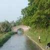
Butchers Bridge No 9
Address is taken from a point 243 yards away.

There is a bridge here which takes a track over the canal.
| Bethills Bridge No 11 | 4¾ furlongs | |
| Stoneley Green Pipe Bridge | 4¾ furlongs | |
| Stoneley Green Bridge Winding Hole | 2½ furlongs | |
| Stoneley Green Bridge No 10 | 2 furlongs | |
| Swanley Lock No 6 | ¾ furlongs | |
| Butchers Bridge No 9 | ||
| Swanley Bridge No 8 | 2¼ furlongs | |
| Swanley Lock No 5 | 2¾ furlongs | |
| Burland Pipe Bridge | 3½ furlongs | |
| Swanley Bridge Marina | 5 furlongs | |
| Burland Bridge No 6 | 6¾ furlongs | |
Why not log in and add some (select "External websites" from the menu (sometimes this is under "Edit"))?
Mouseover for more information or show routes to facility
Nearest water point
In the direction of Hurleston Junction
In the direction of Llantisilio - Horseshoe Falls
Nearest rubbish disposal
In the direction of Hurleston Junction
In the direction of Llantisilio - Horseshoe Falls
Nearest chemical toilet disposal
In the direction of Hurleston Junction
In the direction of Llantisilio - Horseshoe Falls
Nearest place to turn
In the direction of Hurleston Junction
In the direction of Llantisilio - Horseshoe Falls
Nearest self-operated pump-out
In the direction of Hurleston Junction
In the direction of Llantisilio - Horseshoe Falls
Nearest boatyard pump-out
In the direction of Hurleston Junction
In the direction of Llantisilio - Horseshoe Falls
Wikipedia has a page about Butchers Bridge
The Bucher's Mill Covered Bridge or Butcher's Mill Covered Bridge is a covered bridge that spans Cocalico Creek in Lancaster County, Pennsylvania, United States. After the Landis Mill Covered Bridge, it is the second shortest covered bridge in the county. A county-owned and maintained bridge, its official designation is the Cocalico #2 Bridge.
The bridge has a single span, wooden, double Burr arch trusses design with the addition of steel hanger rods. The deck is made from oak planks. It is painted red, the traditional color of Lancaster County covered bridges, on both the inside and outside. Both approaches to the bridge are painted in the traditional white color.
The bridge's WGCB Number is 38-36-12. In 1980 it was added to the National Register of Historic Places as structure number 80003514. It is located at 40°12′28.2″N 76°8′4.8″W (40.20783, -76.134667) to the northeast of Ephrata, Pennsylvania off Pennsylvania Route 272 on Cocalico Creek Road.


![Butcher's Bridge [No 9], Llangollen Canal. Looking south from the back of a narrowboat. by Christine Johnstone – 21 September 2016](https://s0.geograph.org.uk/geophotos/05/21/20/5212036_06476d18_120x120.jpg)


![Canal lock overflow near Ravensmoor, Cheshire. At Swanley No 1 Lock.The overflow channels by locks on the Llangollen Canal need a greater capacity than most canals because of the considerable amount of water flowing down from its source, the River Dee at Llantysilio. Not only does the river provide water for the canal, but also to the enlarged (1959) Hurleston Reservoir, which feeds the Shropshire Union Canal main line as well as domestic water requirements. This arrangement means there is a current flowing in this canal, very noticeable in some sections approaching Llangollen. Narrowboat tillermen approaching a lock from below can have real problems when crossing the sometimes fierce broadside overflow surges as they cascade back into the canal. Good gongoozler fodder![[[3207741]]] by Roger D Kidd – 20 October 2012](https://s1.geograph.org.uk/geophotos/03/21/46/3214609_5610f9f6_120x120.jpg)


