
Wyre Aqueduct No 61
is a minor waterways place
on the Lancaster Canal (Main Line) between
Ribble Link - Lancaster Canal Junction (15 miles and ½ furlongs
to the south) and
Lodge Hill Junction (Junction with Lancaster Canal - Glasson Dock Branch) (7 miles and 4½ furlongs
to the north).
The nearest place in the direction of Ribble Link - Lancaster Canal Junction is Byerworth Bridge No 60;
2½ furlongs
away.
The nearest place in the direction of Lodge Hill Junction is The Moorings Basin;
¾ furlongs
away.
Mooring here is unrated.
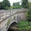
There is a small aqueduct or underbridge here which takes a river under the canal.
| Greenhalgh Castle Bridge Winding Hole | 7 furlongs | |
| Dimples Bridge No 58 | 5¼ furlongs | |
| Dimples Bridge Winding Hole | 5 furlongs | |
| Garstang Road Bridge No 59 | 3½ furlongs | |
| Byerworth Bridge No 60 | 2½ furlongs | |
| Wyre Aqueduct No 61 | ||
| The Moorings Basin | ¾ furlongs | |
| Kepple Lane Bridge No 62 | 1¼ furlongs | |
| Kepple Lane Bridge Winding Hole | 1¼ furlongs | |
| Moss Lane Bridge Winding Hole (south) | 2¾ furlongs | |
| Moss Lane Bridge No 63 | 2¾ furlongs | |
There are no links to external websites from here.
Why not log in and add some (select "External websites" from the menu (sometimes this is under "Edit"))?
Why not log in and add some (select "External websites" from the menu (sometimes this is under "Edit"))?
Mouseover for more information or show routes to facility
Nearest water point
In the direction of Preston Terminus
Bilsborrow Winding Hole — 4 miles, 6 furlongs away
On this waterway in the direction of Preston Terminus
Swill Brook Basin — 9 miles, 2¼ furlongs away
On this waterway in the direction of Preston Terminus
Blackleach Lane Marina — 9 miles, 5¾ furlongs away
On this waterway in the direction of Preston Terminus
Woodplumpton Road Bridge No 12 — 15 miles, 7¾ furlongs away
On this waterway in the direction of Preston Terminus
In the direction of Tewitfield
Moss Lane Bridge No 63 — 2¾ furlongs away
On this waterway in the direction of Tewitfield
Ratcliffe Bridge No 75 — 4 miles, 3¾ furlongs away
On this waterway in the direction of Tewitfield
Lodge Hill Junction — 7 miles, 4½ furlongs away
On this waterway in the direction of Tewitfield
Brows Bridge No 8 — 10 miles, ¼ furlongs and 6 locks away
Travel to Lodge Hill Junction, then on the Lancaster Canal (Glasson Branch) to Brows Bridge No 8
Glasson Visitor Moorings — 10 miles, 1 furlong and 6 locks away
Travel to Lodge Hill Junction, then on the Lancaster Canal (Glasson Branch) to Glasson Visitor Moorings
Glasson Basin — 10 miles, 2¼ furlongs and 6 locks away
Travel to Lodge Hill Junction, then on the Lancaster Canal (Glasson Branch) to Glasson Basin
Hest Bank Bridge No 118 — 17 miles, 7¾ furlongs away
On this waterway in the direction of TewitfieldNearest rubbish disposal
In the direction of Preston Terminus
Bilsborrow Winding Hole — 4 miles, 6 furlongs away
On this waterway in the direction of Preston Terminus
Woodplumpton Road Bridge No 12 — 15 miles, 7¾ furlongs away
On this waterway in the direction of Preston Terminus
In the direction of Tewitfield
Hest Bank Bridge No 118 — 17 miles, 7¾ furlongs away
On this waterway in the direction of TewitfieldNearest chemical toilet disposal
In the direction of Preston Terminus
Bilsborrow Winding Hole — 4 miles, 6 furlongs away
On this waterway in the direction of Preston Terminus
Woodplumpton Road Bridge No 12 — 15 miles, 7¾ furlongs away
On this waterway in the direction of Preston Terminus
In the direction of Tewitfield
Hest Bank Bridge No 118 — 17 miles, 7¾ furlongs away
On this waterway in the direction of TewitfieldNearest place to turn
In the direction of Preston Terminus
Dimples Bridge Winding Hole — 5 furlongs away
On this waterway in the direction of Preston Terminus
Greenhalgh Castle Bridge Winding Hole — 7 furlongs away
On this waterway in the direction of Preston Terminus
Catterall Bridge Winding Hole — 1 mile, 7¾ furlongs away
On this waterway in the direction of Preston Terminus
Bilsborrow Winding Hole — 4 miles, 6 furlongs away
On this waterway in the direction of Preston Terminus
White Horse Winding Hole — 5 miles, 7 furlongs away
On this waterway in the direction of Preston Terminus
Park Head Winding Hole — 6 miles, 7¼ furlongs away
On this waterway in the direction of Preston Terminus
Hollowforth Winding Hole — 7 miles, 5¼ furlongs away
On this waterway in the direction of Preston Terminus
Moons Bridge Marina — 7 miles, 6¼ furlongs away
On this waterway in the direction of Preston Terminus
Swill Brook Basin — 9 miles, 2¼ furlongs away
On this waterway in the direction of Preston Terminus
In the direction of Tewitfield
The Moorings Basin — ¾ furlongs away
On this waterway in the direction of Tewitfield
Kepple Lane Bridge Winding Hole — 1¼ furlongs away
On this waterway in the direction of Tewitfield
Moss Lane Bridge Winding Hole (south) — 2¾ furlongs away
On this waterway in the direction of Tewitfield
Moss Lane Bridge Winding Hole (north) — 2¾ furlongs away
On this waterway in the direction of Tewitfield
Cathouse Bridge Winding Hole — 4¾ furlongs away
On this waterway in the direction of Tewitfield
Bells Bridge Winding Hole — 1 mile, 7¼ furlongs away
On this waterway in the direction of Tewitfield
Ratcliffe Bridge Winding Hole — 4 miles, 3 furlongs away
On this waterway in the direction of Tewitfield
Richmond Bridge Winding Hole — 5 miles, 7¾ furlongs away
On this waterway in the direction of Tewitfield
Lodge Hill Junction — 7 miles, 4½ furlongs away
On this waterway in the direction of Tewitfield
Galgate Basin Wharf — 7 miles, 7¼ furlongs away
On this waterway in the direction of Tewitfield
Carter's Wood Winding Hole — 7 miles, 6½ furlongs and 1 lock away
Travel to Lodge Hill Junction, then on the Lancaster Canal (Glasson Branch) to Carter's Wood Winding HoleNo information
CanalPlan has no information on any of the following facilities within range:self-operated pump-out
boatyard pump-out
Direction of TV transmitter (From Wolfbane Cybernetic)
There is no page on Wikipedia called “Wyre Aqueduct”
Wikipedia pages that might relate to Wyre Aqueduct
[River Wyre]
The River Wyre is a river in Lancashire, England, United Kingdom, which flows into the Irish Sea at Fleetwood. It is approximately 28 miles (45 km) in
[Lancaster Canal]
on the level ground from Preston to Tewitfield, and in 1794 on the Lune Aqueduct, which was built of stone, although Rennie thought brick should have been
[River Calder, Wyre]
motorway, West Coast Main Line and under the Calder Aqueduct on Lancaster Canal. It meets the Wyre at Catterall near the town of Garstang, at which point
[Trough of Bowland]
western 'boundary' to encompass the rest of the wooded headwater valley of the Wyre as far as Marshaw. The Trough is very sparsely populated: there are only
[Listed buildings in Barnacre-with-Bonds]
River Wyre and its tributary the River Calder pass through the parish and many of the bridges crossing them are listed. Also listed is the aqueduct carrying
[A456 road]
route, for example Edgbaston near Bearwood, are also the route of the Elan Aqueduct which carries Birmingham's water supply from the Elan Valley. Much of the
[Listed buildings in Catterall]
Catterall is a civil parish in the Wyre district of Lancashire, England. It contains eight listed buildings that are recorded in the National Heritage
[List of bridges in the United Kingdom]
bridges and viaducts in the United Kingdom. Canal aqueducts are listed under: List of canal aqueducts in the United Kingdom All bridges are over the River
[West Coast Main Line]
Conder Viaduct 16 miles 76 chains Between Lancaster and Preston stations Wyre Viaduct 13 miles 01 chains Barton Viaduct 4 miles 30 chains Fylde Road Viaduct
[Listed buildings in Myerscough and Bilsborrow]
Myerscough and Bilsborrow is a civil parish in the Wyre district of Lancashire, England. It contains 15 listed buildings that are recorded in the National
Results of Google Search
Sep 30, 2018 ... This single span aqueduct, designed by John Rennie, dates from 1797. It is 110 feet long and carries the Lancaster Canal 34 feet above the ...
Between Bridge 60 (Byerworth Bridge) & Aqueduct 61 (Wyre Aqueduct) ... 23:59 inclusive. Type: Advice. Reason: Information. Is the towpath closed? No ...
M61. Johnsons Hillock Locks. now Leeds and Liverpool Canal. Wigan locks. The Lancaster Canal is a canal in North West England, originally planned to run from ... 61. Wyre aqueduct ... However, by 1801, no design had even been agreed for the aqueduct over the River Ribble, and in July 1801 it was agreed to build a ...
Wyre Aqueduct No 61. Over the River Wyre 16 miles and 4½ furlongs 0 locks. The Moorings Basin 16 miles and 5¼ furlongs 0 locks. Kepple Lane Bridge No 62 ...
This is a walk with a watery theme as follows parts of the Rivers Wyre and Calder ... there are no steep inclines, except for the climb up the steps of the aqueduct!
Aqueduct 61, Wyre Aqueduct. Aqueduct 52 ... Aqueduct 33, Woodplumpton Aqueduct ... Lock No. 2. Lock 3. Aqueduct 82, Cocker Aqueduct. Max 67ft. Max 67ft.
Jul 23, 2020 ... Find out times, routes and more for the Merseyside And South Lancashire 61 Blackpool - Preston. Download a timetable today at ...
Oct 25, 1973 ... October 25, 1973, Page 61Buy Reprints ... The triple combination of 1–2‐11 paid a hefty $12,331 in the ninth race at Aqueduct yesterday. The No. 1 horse, Army Hitch, returned $19,60, $9.60 and $8.60 while the No. 2 horse ...

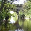
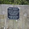
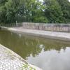
![Wyre Aqueduct (plaque). Plaque on the wall of [[[2527467]]] by David Dixon – 26 July 2011](https://s1.geograph.org.uk/geophotos/02/52/74/2527473_4a4e634c_120x120.jpg)


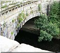


![Lancaster Canal, Wyre Aqueduct. This single-span aqueduct, designed by John Rennie, dates from 1797. It is 110 feet long and carries the canal 34 feet above the River Wyre. ([[[2527473]]]) by David Dixon – 26 July 2011](https://s3.geograph.org.uk/geophotos/02/52/74/2527467_8ee0a359_120x120.jpg)


