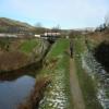
Dobcross Lock No 30W
Ravenstone Dr, Saddleworth OL3 5JU, United Kingdom
Address is taken from a point 240 yards away.

Dobcross Lock No 30W
is a minor waterways place
on the Huddersfield Narrow Canal between
Royal George Aqueduct (3 miles and 4½ furlongs
and 12 locks
to the southwest) and
Diggle (1 mile and ½ furlongs
and 2 locks
to the northeast).
The nearest place in the direction of Royal George Aqueduct is Cast Iron Lock No 29W;
1¾ furlongs
away.
The nearest place in the direction of Diggle is Diggle Subway Aqueduct;
2 furlongs
away.
There may be access to the towpath here.
Mooring here is unrated.
There is a bridge here which takes pedestrian traffic over the canal.
This is a lock, the rise of which is not known.
Twelve Mile Lock No 26W | 4½ furlongs | |
Coffin Lock No 27W | 3½ furlongs | |
Embankment Lock No 28W | 2¾ furlongs | |
Alice Footbridge No 69 | 2 furlongs | |
Cast Iron Lock No 29W | 1¾ furlongs | |
Dobcross Lock No 30W | ||
Diggle Subway Aqueduct | 2 furlongs | |
Ward Lane Bridge No 66 | 4 furlongs | |
Geoffrey Dickens Lock No 31W | 4¼ furlongs | |
Western Summit Lock No 32W | 5¾ furlongs | |
Diggle Winding Hole | 6½ furlongs |
There are no links to external websites from here.
Why not log in and add some (select "External websites" from the menu (sometimes this is under "Edit"))?
Mouseover for more information or show routes to facility
Nearest water point
In the direction of Ashton-under-Lyne Junction
Wool Road Bridge No 70 — 6½ furlongs and 7 locks away
On this waterway in the direction of Ashton-under-Lyne Junction
Grove Road Bridge No 96 — 6 miles, 6¾ furlongs and 22 locks away
On this waterway in the direction of Ashton-under-Lyne Junction
Fairfield Junction — 14 miles, 2¾ furlongs and 30 locks away
Travel to Ashton-under-Lyne Junction, then on the Ashton Canal (Main Line) to Fairfield Junction
New Islington Marina — 18 miles, 5¼ furlongs and 50 locks away
Travel to Ashton-under-Lyne Junction, then on the Ashton Canal (Main Line) to Ducie Street Junction, then on the Rochdale Canal to New Islington Marina Entrance, then on the Rochdale Canal (Main Line) to Cotton Field Wharf Marina, then on the Rochdale Canal (New Islington Marina Arm) to New Islington Marina
Staffordshire, Kenworthy and other Arms — 19 miles, 3 furlongs and 57 locks away
Travel to Ashton-under-Lyne Junction, then on the Ashton Canal (Main Line) to Ducie Street Junction, then on the Rochdale Canal to Castlefield Junction, then on the Bridgewater Canal (Main Line) to Staffordshire, Kenworthy and other Arms
Potato Wharf Arm & The New Basin — 19 miles, 3¾ furlongs and 57 locks away
Travel to Ashton-under-Lyne Junction, then on the Ashton Canal (Main Line) to Ducie Street Junction, then on the Rochdale Canal to Castlefield Junction, then on the Bridgewater Canal (Main Line) to Potato Wharf Arm & The New Basin
In the direction of Aspley Basin (Huddersfield)
Standedge Tunnel (western entrance) — 1 mile, 1¼ furlongs and 3 locks away
On this waterway in the direction of Aspley Basin (Huddersfield)
Standedge Tunnel (eastern entrance) — 4 miles, 3¼ furlongs and 3 locks away
On this waterway in the direction of Aspley Basin (Huddersfield)
Slaithwaite Winding Hole — 7 miles, 6¼ furlongs and 24 locks away
On this waterway in the direction of Aspley Basin (Huddersfield)
Waterside Lock No 21E — 7 miles, 6¾ furlongs and 24 locks away
On this waterway in the direction of Aspley Basin (Huddersfield)
Aspley Basin (Huddersfield) — 12 miles, 4¼ furlongs and 45 locks away
On this waterway in the direction of Aspley Basin (Huddersfield)
Shepley Bridge Sanitary Station — 19 miles, 1 furlong and 56 locks away
Travel to Aspley Basin (Huddersfield), then on the Huddersfield Broad Canal to Cooper Bridge Junction, then on the Calder and Hebble Navigation (Main Line) to Shepley Bridge Sanitary Station
Brighouse Basin — 18 miles, 2¾ furlongs and 58 locks away
Travel to Aspley Basin (Huddersfield), then on the Huddersfield Broad Canal to Cooper Bridge Junction, then on the Calder and Hebble Navigation (Main Line) to Brighouse BasinNearest rubbish disposal
In the direction of Ashton-under-Lyne Junction
Wool Road Visitor Mooring — 7 furlongs and 7 locks away
On this waterway in the direction of Ashton-under-Lyne Junction
Marple Bottom Lock Bridge Winding Hole — 18 miles, 7 furlongs and 30 locks away
Travel to Ashton-under-Lyne Junction, then on the Ashton Canal (Main Line) to Dukinfield Junction, then on the Peak Forest Canal (Lower) to Marple Bottom Lock Bridge Winding Hole
In the direction of Aspley Basin (Huddersfield)
Pickle Lock No 22E — 7 miles, 5½ furlongs and 23 locks away
On this waterway in the direction of Aspley Basin (Huddersfield)
Aspley Basin (Huddersfield) — 12 miles, 4¼ furlongs and 45 locks away
On this waterway in the direction of Aspley Basin (Huddersfield)
Shepley Bridge Sanitary Station — 19 miles, 1 furlong and 56 locks away
Travel to Aspley Basin (Huddersfield), then on the Huddersfield Broad Canal to Cooper Bridge Junction, then on the Calder and Hebble Navigation (Main Line) to Shepley Bridge Sanitary Station
Brighouse Lower Basin Visitor Moorings — 18 miles, 2½ furlongs and 57 locks away
Travel to Aspley Basin (Huddersfield), then on the Huddersfield Broad Canal to Cooper Bridge Junction, then on the Calder and Hebble Navigation (Main Line) to Brighouse Lower Basin Visitor MooringsNearest chemical toilet disposal
In the direction of Ashton-under-Lyne Junction
Wool Road Bridge No 70 — 6½ furlongs and 7 locks away
On this waterway in the direction of Ashton-under-Lyne Junction
Grove Road Bridge No 96 — 6 miles, 6¾ furlongs and 22 locks away
On this waterway in the direction of Ashton-under-Lyne Junction
Fairfield Junction — 14 miles, 2¾ furlongs and 30 locks away
Travel to Ashton-under-Lyne Junction, then on the Ashton Canal (Main Line) to Fairfield Junction
In the direction of Aspley Basin (Huddersfield)
Pickle Lock No 22E — 7 miles, 5½ furlongs and 23 locks away
On this waterway in the direction of Aspley Basin (Huddersfield)
Waterside Lock No 21E — 7 miles, 6¾ furlongs and 24 locks away
On this waterway in the direction of Aspley Basin (Huddersfield)
Aspley Basin (Huddersfield) — 12 miles, 4¼ furlongs and 45 locks away
On this waterway in the direction of Aspley Basin (Huddersfield)
Shepley Bridge Sanitary Station — 19 miles, 1 furlong and 56 locks away
Travel to Aspley Basin (Huddersfield), then on the Huddersfield Broad Canal to Cooper Bridge Junction, then on the Calder and Hebble Navigation (Main Line) to Shepley Bridge Sanitary Station
Brighouse Basin — 18 miles, 2¾ furlongs and 58 locks away
Travel to Aspley Basin (Huddersfield), then on the Huddersfield Broad Canal to Cooper Bridge Junction, then on the Calder and Hebble Navigation (Main Line) to Brighouse BasinNearest place to turn
In the direction of Ashton-under-Lyne Junction
Wool Road Winding Hole — 7¼ furlongs and 7 locks away
On this waterway in the direction of Ashton-under-Lyne Junction
Saddleworth Visitor Centre Winding Hole — 1 mile, 5¼ furlongs and 9 locks away
On this waterway in the direction of Ashton-under-Lyne Junction
Manns Wharf Bridge Winding Hole — 3 miles and 11 locks away
On this waterway in the direction of Ashton-under-Lyne Junction
Roughtown Court Winding Hole — 4 miles, 1½ furlongs and 16 locks away
On this waterway in the direction of Ashton-under-Lyne Junction
Mossley Bottoms Winding Hole — 5 miles, 1 furlong and 18 locks away
On this waterway in the direction of Ashton-under-Lyne Junction
Knowle Street Winding Hole — 9 miles, 1¼ furlongs and 23 locks away
On this waterway in the direction of Ashton-under-Lyne Junction
Staley Wharf Winding Hole — 10 miles, 3¼ furlongs and 27 locks away
On this waterway in the direction of Ashton-under-Lyne Junction
Ashton-under-Lyne Junction — 11 miles, 2¾ furlongs and 30 locks away
On this waterway in the direction of Ashton-under-Lyne Junction
Dukinfield Junction — 11 miles, 6¾ furlongs and 30 locks away
Travel to Ashton-under-Lyne Junction, then on the Ashton Canal (Main Line) to Dukinfield Junction
Portland Basin Arm — 11 miles, 7¼ furlongs and 30 locks away
Travel to Ashton-under-Lyne Junction, then on the Ashton Canal (Main Line) to Dukinfield Junction, then on the Peak Forest Canal (Lower) to Portland Basin Arm
Dunkirk Farm Bridge Winding Hole — 13 miles, 4¼ furlongs and 30 locks away
Travel to Ashton-under-Lyne Junction, then on the Ashton Canal (Main Line) to Dukinfield Junction, then on the Peak Forest Canal (Lower) to Dunkirk Farm Bridge Winding Hole
Lumb Lane Bridge Winding Hole — 13 miles, 4¼ furlongs and 30 locks away
Travel to Ashton-under-Lyne Junction, then on the Ashton Canal (Main Line) to Lumb Lane Bridge Winding Hole
Canal Street Winding Hole — 14 miles, 1 furlong and 30 locks away
Travel to Ashton-under-Lyne Junction, then on the Ashton Canal (Main Line) to Dukinfield Junction, then on the Peak Forest Canal (Lower) to Canal Street Winding Hole
Fairfield Junction — 14 miles, 2¾ furlongs and 30 locks away
Travel to Ashton-under-Lyne Junction, then on the Ashton Canal (Main Line) to Fairfield Junction
Unity Mills Winding Hole — 15 miles, 5½ furlongs and 30 locks away
Travel to Ashton-under-Lyne Junction, then on the Ashton Canal (Main Line) to Dukinfield Junction, then on the Peak Forest Canal (Lower) to Unity Mills Winding Hole
In the direction of Aspley Basin (Huddersfield)
Diggle Winding Hole — 6½ furlongs and 3 locks away
On this waterway in the direction of Aspley Basin (Huddersfield)
Standedge Tunnel End Winding Hole — 4 miles, 4 furlongs and 3 locks away
On this waterway in the direction of Aspley Basin (Huddersfield)
Booth Lock Winding Hole — 6 miles, 1¼ furlongs and 14 locks away
On this waterway in the direction of Aspley Basin (Huddersfield)
Slaithwaite Winding Hole — 7 miles, 6¼ furlongs and 24 locks away
On this waterway in the direction of Aspley Basin (Huddersfield)
Linthwaite Winding Hole — 8 miles, 6¾ furlongs and 29 locks away
On this waterway in the direction of Aspley Basin (Huddersfield)Nearest self-operated pump-out
In the direction of Ashton-under-Lyne Junction
Wool Road Bridge No 70 — 6½ furlongs and 7 locks away
On this waterway in the direction of Ashton-under-Lyne Junction
New Islington Marina — 18 miles, 5¼ furlongs and 50 locks away
Travel to Ashton-under-Lyne Junction, then on the Ashton Canal (Main Line) to Ducie Street Junction, then on the Rochdale Canal to New Islington Marina Entrance, then on the Rochdale Canal (Main Line) to Cotton Field Wharf Marina, then on the Rochdale Canal (New Islington Marina Arm) to New Islington Marina
In the direction of Aspley Basin (Huddersfield)
Slaithwaite Winding Hole — 7 miles, 6¼ furlongs and 24 locks away
On this waterway in the direction of Aspley Basin (Huddersfield)Nearest boatyard pump-out
In the direction of Ashton-under-Lyne Junction
Portland Basin Arm — 11 miles, 7¼ furlongs and 30 locks away
Travel to Ashton-under-Lyne Junction, then on the Ashton Canal (Main Line) to Dukinfield Junction, then on the Peak Forest Canal (Lower) to Portland Basin Arm
In the direction of Aspley Basin (Huddersfield)
Aspley Basin (Huddersfield) — 12 miles, 4¼ furlongs and 45 locks away
On this waterway in the direction of Aspley Basin (Huddersfield)
Shepley Bridge Marina — 19 miles, 1¼ furlongs and 56 locks away
Travel to Aspley Basin (Huddersfield), then on the Huddersfield Broad Canal to Cooper Bridge Junction, then on the Calder and Hebble Navigation (Main Line) to Shepley Bridge MarinaDirection of TV transmitter (From Wolfbane Cybernetic)
There is no page on Wikipedia called “Dobcross Lock No 30W”
Wikipedia pages that might relate to Dobcross Lock No 30W
[Listed buildings in Saddleworth to 1800]
England, "Huddersfield Narrow Canal Lock No. 23 (Lime Kiln Lock and adjoining tailbridge No. 75 and Aqueduct No. 74), Dobcross, Saddleworth (1356719)", National
[Huddersfield Narrow Canal]
Manchester-Huddersfield railway over the canal between Saddleworth and Dobcross The section of canal through Slaithwaite town centre, between locks 21E
[Listed buildings in Saddleworth from 1800]
Oldham. The principal settlements are Austerlands, Delph, Denshaw, Diggle, Dobcross, Grasscroft, Greenfield, Grotton, Lydgate, Springhead, and Uppermill. The
[Oldham]
in the field of engineering. The Platt Brothers, originated in nearby Dobcross village, but moved to Oldham. They were pioneers of cotton-spinning machinery
[Royton railway station]
and two severely damaged. No fatal or severe injuries to the public resulted in these two houses since one of them was a lock-up shop, and in the other
Results of Google Search
... SE0007 : A boater's view of Cast Iron Lock [29W] by Christine Johnstone Dobcross, Lock No 30W SE0007 : Lock 30W - Huddersfield Narrow Canal by John M
The Huddersfield Narrow Canal is an inland waterway in northern England. It runs just under ... Standedge Tunnel proved to be a bottleneck having been constructed without a ... of broad canal from the bridge to Lock 1E is not accessible to vessels wider than 7 ... railway over the canal between Saddleworth and Dobcross ...
Hope RD40 Carbon - RS4 S-Pull Centre Lock. Our performance road/gravel disc wheelset. Hope 20FIVE - RS4 J-Bend Centre lock 24 Hole. Lightweight Disc ...
Saddleworth is a civil parish in the Metropolitan Borough of Oldham, Greater Manchester, ... parish, and the listed buildings associated with this are bridges, locks, a milestone, and an aqueduct. ... 199 is in the gable end, and that to No. ... Narrow Canal Diggle Subway under canal after lock 30 W, Saddleworth ( 1261755)", ...
Listed Buildings in Saddleworth, Oldham at British Listed Buildings. ... Saddleworth, Oldham, OL3; II Huddersfield Narrow Canal Lock No 22w ... Saddleworth, Oldham, OL3; II Huddersfield Narrow Canal Subway Under Canal After Lock 30 W
Huddersfield Narrow Canal. Length, 19.3 miles. Locks, 74. Maximum boat dimensions ... Lock 30W, Marslands, Huddersfield Narrow Canal ... At three and a quarter miles long, it is not for the faint-hearted and takes around three hours to get ... Uppermill is a great place for canal and riverside walks with friends and family.