

Thwaite Lane Bridge
Thwaite Lane, Leeds LS10 1RZ, United Kingdom
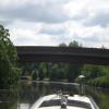
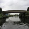
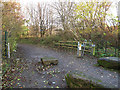
Thwaite Lane Bridge carries a footpath over the Aire and Calder Navigation (Main Line - Castleford to Leeds) near to Macclesfield.
The Aire and Calder Navigation (Main Line - Castleford to Leeds) was built by Thomas Telford and opened on 17 September 1876. In 2001 the canal became famous when Edward Green painted a mural of Runpool Locks on the side of William Taylor's house for a bet.

Thwaite Lane Bridge
is a minor waterways place
on the Aire and Calder Navigation (Main Line - Castleford to Leeds) between
Castleford Junction (Junction of the Aire and Calder Navigation (Wakefield Section) and the Aire and Calder Navigation (Main Line)) (7 miles and 7½ furlongs
and 3 locks
to the east) and
Leeds Dock Entrance (1 mile and 5½ furlongs
and 2 locks
to the northwest).
The nearest place in the direction of Castleford Junction is Thwaite Mills;
1 furlong
away.
The nearest place in the direction of Leeds Dock Entrance is Junction with River Aire (Old Channel) South;
1½ furlongs
away.
There may be access to the towpath here.
Mooring here is unrated.
There is a bridge here which takes a minor road over the canal.
Stourton wharf  | 7 furlongs | |
| Skelton Grange Bridge No 6 | 2¾ furlongs | |
| Thwaite Mills Pontoon | 2¼ furlongs | |
| Site of Thwaite Swing Bridge | 1¼ furlongs | |
| Thwaite Mills | 1 furlong | |
| Thwaite Lane Bridge | ||
| Junction with River Aire (Old Channel) South | 1½ furlongs | |
| Knostrop Fall Lock No 3 | 1¾ furlongs | |
| Pipe Bridge (Knostrop) | 3¼ furlongs | |
| Knostrop Depot | 5½ furlongs | |
| Knostrop Flood Footbridge | 6¼ furlongs | |
Amenities here
 Bus stop (Haigh Park Road)
Bus stop (Ida Street)
Bus stop (Intermezzo Drive)
Bus stop (Haigh Park Road)
Bus stop (Haigh Park Road)
Bus stop (Ida Street)
Bus stop (Intermezzo Drive)
Amenities nearby at Junction with River Aire (Old Channel) South
 BP Jet Bus stop (Belle Isle Centre)
Bus stop (Belle Isle Centre)
Bus stop (East Grange Drive East Grange View)
Bus stop (East Grange Drive East Grange View)
Bus stop (First Direct)
Bus stop (First Direct)
Bus stop (Hunslet Cemetery)
Bus stop (Hunslet Cemetery)
Bus stop (Ida Street)
Bus stop (Leasowe Road)
Bus stop (Leasowe Road)
Bus stop (Pontefract Road Jct)
Bus stop (Pontefract Road Jct)
Bus stop (Queen Street)
Bus stop (Queen Street)
Bus stop (Stourton Park and Ride)
Bus stop (Woodhouse Hill Road)
Bus stop (Woodhouse Hill Road)
BP Jet Bus stop (Belle Isle Centre)
Bus stop (Belle Isle Centre)
Bus stop (East Grange Drive East Grange View)
Bus stop (East Grange Drive East Grange View)
Bus stop (First Direct)
Bus stop (First Direct)
Bus stop (Hunslet Cemetery)
Bus stop (Hunslet Cemetery)
Bus stop (Ida Street)
Bus stop (Leasowe Road)
Bus stop (Leasowe Road)
Bus stop (Pontefract Road Jct)
Bus stop (Pontefract Road Jct)
Bus stop (Queen Street)
Bus stop (Queen Street)
Bus stop (Stourton Park and Ride)
Bus stop (Woodhouse Hill Road)
Bus stop (Woodhouse Hill Road)


There are no links to external websites from here.
Why not log in and add some (select "External websites" from the menu (sometimes this is under "Edit"))?
Why not log in and add some (select "External websites" from the menu (sometimes this is under "Edit"))?
Mouseover for more information or show routes to facility
Nearest water point
In the direction of Castleford Junction
Fishpond Lock No 4 — 2 miles, 2¼ furlongs away
On this waterway in the direction of Castleford Junction
Woodlesford Lock No 5 — 3 miles, 1¼ furlongs and 1 lock away
On this waterway in the direction of Castleford Junction
Lemonroyd Marina — 4 miles, 3 furlongs and 2 locks away
On this waterway in the direction of Castleford Junction
Lemonroyd Lock No 7 — 4 miles, 4 furlongs and 2 locks away
On this waterway in the direction of Castleford Junction
Castleford Sanitary Station — 8 miles, ¼ furlongs and 4 locks away
Travel to Castleford Junction, then on the Aire and Calder Navigation (Main Line - Goole to Castleford) to Castleford Sanitary Station
Bulholme Lock No 10 — 8 miles, 5 furlongs and 4 locks away
Travel to Castleford Junction, then on the Aire and Calder Navigation (Main Line - Goole to Castleford) to Bulholme Lock No 10
Woodnook Lock No 6 — 10 miles, 1¼ furlongs and 3 locks away
Travel to Castleford Junction, then on the Aire and Calder Navigation (Wakefield Section) to Woodnook Lock No 6
Fairies Hill Moorings — 9 miles, 7¾ furlongs and 4 locks away
Travel to Castleford Junction, then on the Aire and Calder Navigation (Wakefield Section) to Fairies Hill Lock Junction, then on the Aire and Calder Navigation (Fairies Hill Mooring Arm) to Fairies Hill Moorings
King's Road Lock No 3 — 11 miles, 2¾ furlongs and 4 locks away
Travel to Castleford Junction, then on the Aire and Calder Navigation (Wakefield Section) to King's Road Lock No 3
Ferrybridge Flood Lock No 11 — 13 miles, 3 furlongs and 5 locks away
Travel to Castleford Junction, then on the Aire and Calder Navigation (Main Line - Goole to Castleford) to Ferrybridge Flood Lock No 11
Stanley Ferry Water Point — 12 miles, 7¾ furlongs and 6 locks away
Travel to Castleford Junction, then on the Aire and Calder Navigation (Wakefield Section) to Stanley Ferry Water Point
Ramsdens Swing Bridge — 13 miles, ½ furlongs and 6 locks away
Travel to Castleford Junction, then on the Aire and Calder Navigation (Wakefield Section) to Ramsdens Swing Bridge
Ramsdens Bridge Sanitary Station — 13 miles, ½ furlongs and 6 locks away
Travel to Castleford Junction, then on the Aire and Calder Navigation (Wakefield Section) to Ramsdens Bridge Sanitary Station
Bank Dole Lock No 1 — 15 miles, 1¼ furlongs and 6 locks away
Travel to Castleford Junction, then on the Aire and Calder Navigation (Main Line - Goole to Castleford) to Bank Dole Junction, then on the Aire and Calder Navigation (Selby Section) to Bank Dole Lock No 1
Beal Bridge — 17 miles, 3¾ furlongs and 7 locks away
Travel to Castleford Junction, then on the Aire and Calder Navigation (Main Line - Goole to Castleford) to Bank Dole Junction, then on the Aire and Calder Navigation (Selby Section) to Beal Bridge
Beal Lock No 2 — 17 miles, 5 furlongs and 7 locks away
Travel to Castleford Junction, then on the Aire and Calder Navigation (Main Line - Goole to Castleford) to Bank Dole Junction, then on the Aire and Calder Navigation (Selby Section) to Beal Lock No 2
In the direction of Leeds Bridge
Leeds Dock Visitor Moorings — 1 mile, 6 furlongs and 2 locks away
Travel to Leeds Dock Entrance, then on the Aire and Calder Navigation (Leeds Dock) to Leeds Dock Visitor Moorings
Leeds Visitor Moorings — 2 miles, 3½ furlongs and 4 locks away
Travel to Leeds Bridge, then on the Leeds and Liverpool Canal (Main Line - Wigan to Leeds) to Leeds Visitor Moorings
Oddy Staircase Locks Nos 4 and 5 — 2 miles, 7¼ furlongs and 5 locks away
Travel to Leeds Bridge, then on the Leeds and Liverpool Canal (Main Line - Wigan to Leeds) to Oddy Staircase Locks Nos 4 and 5
Apperley Bridge Marina — 10 miles, 5¾ furlongs and 15 locks away
Travel to Leeds Bridge, then on the Leeds and Liverpool Canal (Main Line - Wigan to Leeds) to Apperley Bridge MarinaNearest rubbish disposal
In the direction of Castleford Junction
Woodlesford Lock No 5 — 3 miles, 1¼ furlongs and 1 lock away
On this waterway in the direction of Castleford Junction
Lemonroyd Marina — 4 miles, 3 furlongs and 2 locks away
On this waterway in the direction of Castleford Junction
Castleford Sanitary Station — 8 miles, ¼ furlongs and 4 locks away
Travel to Castleford Junction, then on the Aire and Calder Navigation (Main Line - Goole to Castleford) to Castleford Sanitary Station
Ramsdens Bridge Visitor Moorings — 13 miles, ¼ furlongs and 6 locks away
Travel to Castleford Junction, then on the Aire and Calder Navigation (Wakefield Section) to Ramsdens Bridge Visitor Moorings
Ramsdens Swing Bridge — 13 miles, ½ furlongs and 6 locks away
Travel to Castleford Junction, then on the Aire and Calder Navigation (Wakefield Section) to Ramsdens Swing Bridge
Whitley Lock No 12 — 18 miles, 7 furlongs and 6 locks away
Travel to Castleford Junction, then on the Aire and Calder Navigation (Main Line - Goole to Castleford) to Whitley Lock No 12
In the direction of Leeds Bridge
Leeds Basin — 2 miles, 2¾ furlongs and 3 locks away
Travel to Leeds Bridge, then on the Leeds and Liverpool Canal (Main Line - Wigan to Leeds) to Leeds Basin
Dobson Locks Services — 11 miles, ½ furlongs and 17 locks away
Travel to Leeds Bridge, then on the Leeds and Liverpool Canal (Main Line - Wigan to Leeds) to Dobson Locks Services
Bingley Services — 18 miles, 1¾ furlongs and 31 locks away
Travel to Leeds Bridge, then on the Leeds and Liverpool Canal (Main Line - Wigan to Leeds) to Bingley ServicesNearest chemical toilet disposal
In the direction of Castleford Junction
Lemonroyd Marina — 4 miles, 3 furlongs and 2 locks away
On this waterway in the direction of Castleford Junction
Castleford Sanitary Station — 8 miles, ¼ furlongs and 4 locks away
Travel to Castleford Junction, then on the Aire and Calder Navigation (Main Line - Goole to Castleford) to Castleford Sanitary Station
Fairies Hill Moorings — 9 miles, 7¾ furlongs and 4 locks away
Travel to Castleford Junction, then on the Aire and Calder Navigation (Wakefield Section) to Fairies Hill Lock Junction, then on the Aire and Calder Navigation (Fairies Hill Mooring Arm) to Fairies Hill Moorings
Ramsdens Bridge Sanitary Station — 13 miles, ½ furlongs and 6 locks away
Travel to Castleford Junction, then on the Aire and Calder Navigation (Wakefield Section) to Ramsdens Bridge Sanitary Station
Whitley Lock No 12 — 18 miles, 7 furlongs and 6 locks away
Travel to Castleford Junction, then on the Aire and Calder Navigation (Main Line - Goole to Castleford) to Whitley Lock No 12
In the direction of Leeds Bridge
Dobson Locks Services — 11 miles, ½ furlongs and 17 locks away
Travel to Leeds Bridge, then on the Leeds and Liverpool Canal (Main Line - Wigan to Leeds) to Dobson Locks Services
Bingley Services — 18 miles, 1¾ furlongs and 31 locks away
Travel to Leeds Bridge, then on the Leeds and Liverpool Canal (Main Line - Wigan to Leeds) to Bingley ServicesNearest place to turn
In the direction of Castleford Junction
Fleet Lane Arm — 4 miles, ¾ furlongs and 2 locks away
On this waterway in the direction of Castleford Junction
Lemonroyd Lock Weir Exit — 4 miles, 4¾ furlongs and 3 locks away
On this waterway in the direction of Castleford Junction
Bulholme Lock Weir Exit — 8 miles, 5½ furlongs and 5 locks away
Travel to Castleford Junction, then on the Aire and Calder Navigation (Main Line - Goole to Castleford) to Bulholme Lock Weir Exit
Fairies Hill Lock Arm — 10 miles, 2¾ furlongs and 4 locks away
Travel to Castleford Junction, then on the Aire and Calder Navigation (Wakefield Section) to Fairies Hill Lock Arm
Stanley Ferry Marina — 12 miles, 7 furlongs and 6 locks away
Travel to Castleford Junction, then on the Aire and Calder Navigation (Wakefield Section) to Stanley Ferry Marina
Ferrybridge Lock Visitor Mooring — 13 miles, 3½ furlongs and 6 locks away
Travel to Castleford Junction, then on the Aire and Calder Navigation (Main Line - Goole to Castleford) to Ferrybridge Lock Visitor Mooring
Bank Dole Lock Junction — 15 miles, 1½ furlongs and 7 locks away
Travel to Castleford Junction, then on the Aire and Calder Navigation (Main Line - Goole to Castleford) to Bank Dole Junction, then on the Aire and Calder Navigation (Selby Section) to Bank Dole Lock Junction
Wakefield Weir Entrance — 15 miles, 7½ furlongs and 8 locks away
Travel to Castleford Junction, then on the Aire and Calder Navigation (Wakefield Section) to Fall Ing Junction, then on the Calder and Hebble Navigation (Main Line) to Wakefield Weir Entrance
Beal Lock No 2 Weir Entrance — 17 miles, 4 furlongs and 7 locks away
Travel to Castleford Junction, then on the Aire and Calder Navigation (Main Line - Goole to Castleford) to Bank Dole Junction, then on the Aire and Calder Navigation (Selby Section) to Beal Lock No 2 Weir Entrance
Broad Cut Weir Entrance — 18 miles, 4 furlongs and 9 locks away
Travel to Castleford Junction, then on the Aire and Calder Navigation (Wakefield Section) to Fall Ing Junction, then on the Calder and Hebble Navigation (Main Line) to Broad Cut Weir Entrance
Waller Bridge Winding Hole — 18 miles, 6 furlongs and 10 locks away
Travel to Castleford Junction, then on the Aire and Calder Navigation (Wakefield Section) to Fall Ing Junction, then on the Calder and Hebble Navigation (Main Line) to Waller Bridge Winding Hole
In the direction of Leeds Bridge
Junction with River Aire (Old Channel) South — 1½ furlongs away
On this waterway in the direction of Leeds Bridge
Junction with River Aire (Old Channel) North — 6½ furlongs and 1 lock away
On this waterway in the direction of Leeds Bridge
Knostrop Flood Lock Weir Entrance — 6¾ furlongs and 1 lock away
On this waterway in the direction of Leeds Bridge
Leeds Dock Side Arm — 1 mile, 5¾ furlongs and 2 locks away
Travel to Leeds Dock Entrance, then on the Aire and Calder Navigation (Leeds Dock) to Leeds Dock Side Arm
River Aire Junction — 2 miles, 2¼ furlongs and 2 locks away
Travel to Leeds Bridge, then on the Leeds and Liverpool Canal (Main Line - Wigan to Leeds) to River Aire Junction
Leeds Basin — 2 miles, 2¾ furlongs and 3 locks away
Travel to Leeds Bridge, then on the Leeds and Liverpool Canal (Main Line - Wigan to Leeds) to Leeds Basin
Aire Valley Marina (eastern entrance) — 3 miles, 6 furlongs and 8 locks away
Travel to Leeds Bridge, then on the Leeds and Liverpool Canal (Main Line - Wigan to Leeds) to Aire Valley Marina (eastern entrance)
Calverley Winding Hole — 8 miles, 5¾ furlongs and 15 locks away
Travel to Leeds Bridge, then on the Leeds and Liverpool Canal (Main Line - Wigan to Leeds) to Calverley Winding Hole
The Moorings Winding Hole — 10 miles, 6 furlongs and 15 locks away
Travel to Leeds Bridge, then on the Leeds and Liverpool Canal (Main Line - Wigan to Leeds) to The Moorings Winding HoleNearest self-operated pump-out
In the direction of Castleford Junction
Castleford Sanitary Station — 8 miles, ¼ furlongs and 4 locks away
Travel to Castleford Junction, then on the Aire and Calder Navigation (Main Line - Goole to Castleford) to Castleford Sanitary Station
Ramsdens Bridge Sanitary Station — 13 miles, ½ furlongs and 6 locks away
Travel to Castleford Junction, then on the Aire and Calder Navigation (Wakefield Section) to Ramsdens Bridge Sanitary Station
In the direction of Leeds Bridge
Dobson Locks Services — 11 miles, ½ furlongs and 17 locks away
Travel to Leeds Bridge, then on the Leeds and Liverpool Canal (Main Line - Wigan to Leeds) to Dobson Locks ServicesNearest boatyard pump-out
In the direction of Castleford Junction
Lemonroyd Marina — 4 miles, 3 furlongs and 2 locks away
On this waterway in the direction of Castleford Junction
In the direction of Leeds Bridge
Apperley Bridge Marina — 10 miles, 5¾ furlongs and 15 locks away
Travel to Leeds Bridge, then on the Leeds and Liverpool Canal (Main Line - Wigan to Leeds) to Apperley Bridge Marina
Gallows Bridge Boatyard and Moorings — 14 miles, 3¾ furlongs and 20 locks away
Travel to Leeds Bridge, then on the Leeds and Liverpool Canal (Main Line - Wigan to Leeds) to Gallows Bridge Boatyard and Moorings
Hainsworth’s Boatyard — 18 miles, 3¼ furlongs and 31 locks away
Travel to Leeds Bridge, then on the Leeds and Liverpool Canal (Main Line - Wigan to Leeds) to Hainsworth’s BoatyardDirection of TV transmitter (From Wolfbane Cybernetic)






There is no page on Wikipedia called “Thwaite Lane Bridge”
Wikipedia pages that might relate to Thwaite Lane Bridge
[Putney Bridge]
first bridge was built in 1729, a ferry had shuttled between the two banks. The current format is three lanes southbound (including one bus lane) and one
[List of Chelsea people]
Electoral roll no 1378 [1] Archived 11 October 2011 at the Wayback Machine Thwaite, Ann (1990) A.A. Milne His Life. Faber & Faber. ODNB: Charlotte Mitchell
[List of 21st-century classical composers]
2016 American John Rea 1944 Canadian Leif Segerstam 1944 Finnish Penelope Thwaites 1944 Australian John Tavener 1944 2013 British László Vidovszky 1944 Hungarian
[Big Ben]
maintenance of the clock was carried out by the old firm of clockmakers Thwaites & Reed, these were often repaired within the permitted two-hour downtime
[List of places in Cumbria]
Thurstonfield Lough, Thwaites Tirril Todhills, Torpenhow, Torver Troutbeck (near Penrith), Troutbeck (near Windermere), Troutbeck Bridge Uldale, Ulpha, Ulverston
[Hammersmith Bridge]
Hammersmith Bridge is a suspension bridge that crosses the River Thames in west London. It links the southern part of Hammersmith in the London Borough
[List of American films of 2020]
Release – Update". Deadline Hollywood. Retrieved August 24, 2020. "Brenton Thwaites Hopes She is Real in Romance 'I Met a Girl' Trailer | FirstShowing.net"
[Yorkshire Dales]
Clapdale near Clapham Stump Cross Caverns near Pateley Bridge Goyden System near Pateley Bridge Dry stone fences in the Yorkshire Dales Typical Dales barn
[Stockton-on-Tees]
centre, from the junction of Bridge Road and Yarm Lane, culminating at Maxwells Corner, where Norton Road and Bishopton Lane begin. Dovecot Street runs
[Victoria Embankment]
appropriately civilized, cityscape for a prosperous commercial society." John Thwaites, the chair of the Metropolitan Board of Works, made note that the embankments