CanalPlanAC

Footbridge (Ashness Close)

 
Morrisons, Ambleside, West Bridgford NG2 6PS, United Kingdom
 
Information about the place
Footbridge (Ashness Close) is a minor waterways place on the Grantham Canal between Grantham Canal Junction (Junction of the River Trent with the abandoned Grantham Canal) (1 mile and 7¼ furlongs and 3 locks to the northwest) and Grantham Basin (Infilled) (31 miles and ¼ furlongs and 15 locks to the east).
 
 
The nearest place in the direction of Grantham Canal Junction is Gamston Lock No 3; ¾ furlongs away.
 
The nearest place in the direction of Grantham Basin is Gamston Lings Bar Road Bridge No 6A; 1½ furlongs away.

There may be access to the towpath here.

Mooring here is unrated.

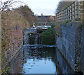
There is a bridge here which takes a footpath over the canal.


Amenities

Amenities here

 SEE ADDRESS
 Cashpoint

Amenities nearby at Gamston Lings Bar Road Bridge No 6A

 Morison's
 Morrisons
 SEE ADDRESS
 Cashpoint
 Morrisons Fuel
 Wm Morrison Supermarkets 238
 
Maps
If you are a user and are logged on, or if you are actively planning a route, a map will be displayed here.
Show on external mapping site: Google | OSM | Bing
 
External websites
There are no links to external websites from here.
Why not log in and add some (select "External websites" from the menu (sometimes this is under "Edit"))?
 
Nearest facilities

Mouseover for more information or show routes to facility

Nearest water point

In the direction of Grantham Canal Junction

Holme Lock No 54 miles, ¾ furlongs and 3 locks away
Travel to Grantham Canal Junction, then on the River Trent (non-tidal section) to Holme Lock No 5
Stoke Lock No 67 miles, 1 furlong and 4 locks away
Travel to Grantham Canal Junction, then on the River Trent (non-tidal section) to Stoke Lock No 6
Beeston Lock No 58 miles and 5 locks away
Travel to Grantham Canal Junction, then on the River Trent (non-tidal section) to Meadow Lane Junction, then on the River Trent (Nottingham Canal) to Lenton Chain, then on the River Trent (Beeston Canal) to Beeston Lock No 5
Gunthorpe Lock No 711 miles, 7 furlongs and 5 locks away
Travel to Grantham Canal Junction, then on the River Trent (non-tidal section) to Gunthorpe Lock No 7
Cranfleet Lock No 312 miles, 2½ furlongs and 6 locks away
Travel to Grantham Canal Junction, then on the River Trent (non-tidal section) to Meadow Lane Junction, then on the River Trent (Nottingham Canal) to Lenton Chain, then on the River Trent (Beeston Canal) to Beeston Lock No 5, then on the River Trent (Western End) to Cranfleet Lock No 3
Former BW Trent Lock Waterway Office13 miles, 1 furlong and 9 locks away
Travel to Grantham Canal Junction, then on the River Trent (non-tidal section) to Meadow Lane Junction, then on the River Trent (Nottingham Canal) to Lenton Chain, then on the River Trent (Beeston Canal) to Beeston Lock No 5, then on the River Trent (Western End) to Trent Junction, then on the Grand Union Canal (Erewash Canal) to Former BW Trent Lock Waterway Office
Sawley Locks No 213 miles, 7 furlongs and 8 locks away
Travel to Grantham Canal Junction, then on the River Trent (non-tidal section) to Meadow Lane Junction, then on the River Trent (Nottingham Canal) to Lenton Chain, then on the River Trent (Beeston Canal) to Beeston Lock No 5, then on the River Trent (Western End) to Sawley Locks No 2
Hazelford Lock No 816 miles, 5 furlongs and 6 locks away
Travel to Grantham Canal Junction, then on the River Trent (non-tidal section) to Hazelford Lock No 8
Shardlow16 miles, ¾ furlongs and 11 locks away
Travel to Grantham Canal Junction, then on the River Trent (non-tidal section) to Meadow Lane Junction, then on the River Trent (Nottingham Canal) to Lenton Chain, then on the River Trent (Beeston Canal) to Beeston Lock No 5, then on the River Trent (Western End) to Derwent Mouth, then on the Trent and Mersey Canal (Main Line - Derwent Mouth to Burton) to Shardlow
Weston Lock No 419 miles, ½ furlongs and 13 locks away
Travel to Grantham Canal Junction, then on the River Trent (non-tidal section) to Meadow Lane Junction, then on the River Trent (Nottingham Canal) to Lenton Chain, then on the River Trent (Beeston Canal) to Beeston Lock No 5, then on the River Trent (Western End) to Derwent Mouth, then on the Trent and Mersey Canal (Main Line - Derwent Mouth to Burton) to Weston Lock No 4

Nearest rubbish disposal

In the direction of Grantham Canal Junction

Holme Lock No 54 miles, ¾ furlongs and 3 locks away
Travel to Grantham Canal Junction, then on the River Trent (non-tidal section) to Holme Lock No 5
Stoke Lock No 67 miles, 1 furlong and 4 locks away
Travel to Grantham Canal Junction, then on the River Trent (non-tidal section) to Stoke Lock No 6
Beeston Lock No 58 miles and 5 locks away
Travel to Grantham Canal Junction, then on the River Trent (non-tidal section) to Meadow Lane Junction, then on the River Trent (Nottingham Canal) to Lenton Chain, then on the River Trent (Beeston Canal) to Beeston Lock No 5
Gunthorpe Lock No 711 miles, 7 furlongs and 5 locks away
Travel to Grantham Canal Junction, then on the River Trent (non-tidal section) to Gunthorpe Lock No 7
Cranfleet Lock No 312 miles, 2½ furlongs and 6 locks away
Travel to Grantham Canal Junction, then on the River Trent (non-tidal section) to Meadow Lane Junction, then on the River Trent (Nottingham Canal) to Lenton Chain, then on the River Trent (Beeston Canal) to Beeston Lock No 5, then on the River Trent (Western End) to Cranfleet Lock No 3
Former BW Trent Lock Waterway Office13 miles, 1 furlong and 9 locks away
Travel to Grantham Canal Junction, then on the River Trent (non-tidal section) to Meadow Lane Junction, then on the River Trent (Nottingham Canal) to Lenton Chain, then on the River Trent (Beeston Canal) to Beeston Lock No 5, then on the River Trent (Western End) to Trent Junction, then on the Grand Union Canal (Erewash Canal) to Former BW Trent Lock Waterway Office
Sawley Locks No 213 miles, 7 furlongs and 8 locks away
Travel to Grantham Canal Junction, then on the River Trent (non-tidal section) to Meadow Lane Junction, then on the River Trent (Nottingham Canal) to Lenton Chain, then on the River Trent (Beeston Canal) to Beeston Lock No 5, then on the River Trent (Western End) to Sawley Locks No 2
Hazelford Lock No 816 miles, 5 furlongs and 6 locks away
Travel to Grantham Canal Junction, then on the River Trent (non-tidal section) to Hazelford Lock No 8

Nearest chemical toilet disposal

In the direction of Grantham Canal Junction

Meadow Lane Lock No 72 miles, 1 furlong and 3 locks away
Travel to Grantham Canal Junction, then on the River Trent (non-tidal section) to Meadow Lane Junction, then on the River Trent (Nottingham Canal) to Meadow Lane Lock No 7
Holme Lock No 54 miles, ¾ furlongs and 3 locks away
Travel to Grantham Canal Junction, then on the River Trent (non-tidal section) to Holme Lock No 5
Stoke Lock No 67 miles, 1 furlong and 4 locks away
Travel to Grantham Canal Junction, then on the River Trent (non-tidal section) to Stoke Lock No 6
Beeston Lock No 58 miles and 5 locks away
Travel to Grantham Canal Junction, then on the River Trent (non-tidal section) to Meadow Lane Junction, then on the River Trent (Nottingham Canal) to Lenton Chain, then on the River Trent (Beeston Canal) to Beeston Lock No 5
Gunthorpe Lock No 711 miles, 7 furlongs and 5 locks away
Travel to Grantham Canal Junction, then on the River Trent (non-tidal section) to Gunthorpe Lock No 7
Former BW Trent Lock Waterway Office13 miles, 1 furlong and 9 locks away
Travel to Grantham Canal Junction, then on the River Trent (non-tidal section) to Meadow Lane Junction, then on the River Trent (Nottingham Canal) to Lenton Chain, then on the River Trent (Beeston Canal) to Beeston Lock No 5, then on the River Trent (Western End) to Trent Junction, then on the Grand Union Canal (Erewash Canal) to Former BW Trent Lock Waterway Office
Sawley Locks No 213 miles, 7 furlongs and 8 locks away
Travel to Grantham Canal Junction, then on the River Trent (non-tidal section) to Meadow Lane Junction, then on the River Trent (Nottingham Canal) to Lenton Chain, then on the River Trent (Beeston Canal) to Beeston Lock No 5, then on the River Trent (Western End) to Sawley Locks No 2
Sawley Cut Wharf14 miles, ½ furlongs and 9 locks away
Travel to Grantham Canal Junction, then on the River Trent (non-tidal section) to Meadow Lane Junction, then on the River Trent (Nottingham Canal) to Lenton Chain, then on the River Trent (Beeston Canal) to Beeston Lock No 5, then on the River Trent (Western End) to Sawley Cut Wharf

Nearest place to turn

In the direction of Grantham Canal Junction

Poplar Arms Corner2 miles, 4 furlongs and 4 locks away
Travel to Grantham Canal Junction, then on the River Trent (non-tidal section) to Meadow Lane Junction, then on the River Trent (Nottingham Canal) to Poplar Arms Corner
Canal Museum Wharf2 miles, 5½ furlongs and 4 locks away
Travel to Grantham Canal Junction, then on the River Trent (non-tidal section) to Meadow Lane Junction, then on the River Trent (Nottingham Canal) to Canal Museum Wharf
Holme Lock Weir Entrance3 miles, 7¼ furlongs and 3 locks away
Travel to Grantham Canal Junction, then on the River Trent (non-tidal section) to Holme Lock Weir Entrance
Holme Lock Weir Exit4 miles, 2 furlongs and 4 locks away
Travel to Grantham Canal Junction, then on the River Trent (non-tidal section) to Holme Lock Weir Exit
Redfield Road Bridge Winding Hole4 miles, 5½ furlongs and 5 locks away
Travel to Grantham Canal Junction, then on the River Trent (non-tidal section) to Meadow Lane Junction, then on the River Trent (Nottingham Canal) to Lenton Chain, then on the River Trent (Beeston Canal) to Redfield Road Bridge Winding Hole
Rylands Bridge Winding Hole6 miles, 5¾ furlongs and 5 locks away
Travel to Grantham Canal Junction, then on the River Trent (non-tidal section) to Meadow Lane Junction, then on the River Trent (Nottingham Canal) to Lenton Chain, then on the River Trent (Beeston Canal) to Rylands Bridge Winding Hole
Cranfleet Lock Weir Exit12 miles, 2 furlongs and 6 locks away
Travel to Grantham Canal Junction, then on the River Trent (non-tidal section) to Meadow Lane Junction, then on the River Trent (Nottingham Canal) to Lenton Chain, then on the River Trent (Beeston Canal) to Beeston Lock No 5, then on the River Trent (Western End) to Cranfleet Lock Weir Exit
Soar Mouth13 miles, 1½ furlongs and 8 locks away
Travel to Grantham Canal Junction, then on the River Trent (non-tidal section) to Meadow Lane Junction, then on the River Trent (Nottingham Canal) to Lenton Chain, then on the River Trent (Beeston Canal) to Beeston Lock No 5, then on the River Trent (Western End) to Trent Junction, then on the Grand Union Canal (Leicester Section - River Soar Navigation) to Soar Mouth
Redhill Lock Junction13 miles, 4¼ furlongs and 8 locks away
Travel to Grantham Canal Junction, then on the River Trent (non-tidal section) to Meadow Lane Junction, then on the River Trent (Nottingham Canal) to Lenton Chain, then on the River Trent (Beeston Canal) to Beeston Lock No 5, then on the River Trent (Western End) to Trent Junction, then on the Grand Union Canal (Leicester Section - River Soar Navigation) to Redhill Lock Junction
Sawley Lock No 2 Weir Exit13 miles, 6¼ furlongs and 8 locks away
Travel to Grantham Canal Junction, then on the River Trent (non-tidal section) to Meadow Lane Junction, then on the River Trent (Nottingham Canal) to Lenton Chain, then on the River Trent (Beeston Canal) to Beeston Lock No 5, then on the River Trent (Western End) to Sawley Lock No 2 Weir Exit
Former BW Trent Lock Waterway Office13 miles, 1 furlong and 9 locks away
Travel to Grantham Canal Junction, then on the River Trent (non-tidal section) to Meadow Lane Junction, then on the River Trent (Nottingham Canal) to Lenton Chain, then on the River Trent (Beeston Canal) to Beeston Lock No 5, then on the River Trent (Western End) to Trent Junction, then on the Grand Union Canal (Erewash Canal) to Former BW Trent Lock Waterway Office
Hazelford Lock East Weir Entrance15 miles, 7¾ furlongs and 6 locks away
Travel to Grantham Canal Junction, then on the River Trent (non-tidal section) to Hazelford Lock East Weir Entrance
Hazelford Ferry16 miles, ¼ furlongs and 6 locks away
Travel to Grantham Canal Junction, then on the River Trent (non-tidal section) to Hazelford Ferry
Hazelford Lock Main Weir Entrance16 miles, 3¾ furlongs and 6 locks away
Travel to Grantham Canal Junction, then on the River Trent (non-tidal section) to Hazelford Lock Main Weir Entrance
Sheet Stores Basin13 miles, 6 furlongs and 9 locks away
Travel to Grantham Canal Junction, then on the River Trent (non-tidal section) to Meadow Lane Junction, then on the River Trent (Nottingham Canal) to Lenton Chain, then on the River Trent (Beeston Canal) to Beeston Lock No 5, then on the River Trent (Western End) to Trent Junction, then on the Grand Union Canal (Erewash Canal) to Sheet Stores Basin
Redhill Marine Ltd14 miles, ½ furlongs and 9 locks away
Travel to Grantham Canal Junction, then on the River Trent (non-tidal section) to Meadow Lane Junction, then on the River Trent (Nottingham Canal) to Lenton Chain, then on the River Trent (Beeston Canal) to Beeston Lock No 5, then on the River Trent (Western End) to Trent Junction, then on the Grand Union Canal (Leicester Section - River Soar Navigation) to Redhill Marine Ltd
Ratcliffe Lock Junction14 miles, 3 furlongs and 9 locks away
Travel to Grantham Canal Junction, then on the River Trent (non-tidal section) to Meadow Lane Junction, then on the River Trent (Nottingham Canal) to Lenton Chain, then on the River Trent (Beeston Canal) to Beeston Lock No 5, then on the River Trent (Western End) to Trent Junction, then on the Grand Union Canal (Leicester Section - River Soar Navigation) to Ratcliffe Lock Junction
Hazelford Lock Main Weir Exit16 miles, 5¾ furlongs and 7 locks away
Travel to Grantham Canal Junction, then on the River Trent (non-tidal section) to Hazelford Lock Main Weir Exit
Hazelford Lock East Weir Exit16 miles, 6¾ furlongs and 7 locks away
Travel to Grantham Canal Junction, then on the River Trent (non-tidal section) to Hazelford Lock East Weir Exit
Sawley Flood Lock Weir Entrance14 miles, 4¼ furlongs and 10 locks away
Travel to Grantham Canal Junction, then on the River Trent (non-tidal section) to Meadow Lane Junction, then on the River Trent (Nottingham Canal) to Lenton Chain, then on the River Trent (Beeston Canal) to Beeston Lock No 5, then on the River Trent (Western End) to Sawley Flood Lock Weir Entrance

No information

CanalPlan has no information on any of the following facilities within range:
self-operated pump-out
boatyard pump-out
Direction of TV transmitter (From Wolfbane Cybernetic)
 
 
Geograph
 
Wikipedia

Wikipedia has a page about Footbridge

A footbridge (also a pedestrian bridge, pedestrian overpass, or pedestrian overcrossing) is a bridge designed solely for pedestrians. While the primary meaning for a bridge is a structure which links "two points at a height above the ground", a footbridge can also be a lower structure, such as a boardwalk, that enables pedestrians to cross wet, fragile, or marshy land. Bridges range from stepping stones–possibly the earliest man-made structure to "bridge" water–to elaborate steel structures. Another early bridge would have been simply a fallen tree. In some cases a footbridge can be both functional and artistic.

For rural communities in the developing world, a footbridge may be a community's only access to medical clinics, schools, businesses and markets. Simple suspension bridge designs have been developed to be sustainable and easily constructed in such areas using only local materials and labor.

An enclosed footbridge between two buildings is sometimes known as a skyway. Bridges providing for both pedestrians and cyclists are often referred to as greenbridges and form an important part of a sustainable transport system.

Footbridges are often situated to allow pedestrians to cross water or railways in areas where there are no nearby roads. They are also located across roads to let pedestrians cross safely without slowing traffic. The latter is a type of pedestrian separation structure, examples of which are particularly found near schools.

Other Wikipedia pages that might relate to Footbridge
[Multnomah Falls] bridge at the falls to allow visitor access. This bridge, named the Benson Footbridge, spans the lower falls at a height of 105 feet (32 m), and provides an [Cox Green Footbridge] Cox Green Footbridge is a footbridge spanning the River Wear in North East England, linking Cox Green and Washington Staithes. The bridge opened in 1958 [Teddington Lock Footbridges] The Teddington Lock Footbridges are two footbridges over the River Thames in England, situated just upstream of Teddington Lock at Teddington. There is [Footbridge across a Ditch] Footbridge across a Ditch is an oil painting created in 1883 by Vincent van Gogh. [Summerleaze Footbridge] The Summerleaze Footbridge is a footbridge across the River Thames in England linking Dorney, Buckinghamshire and Bray, Berkshire; it is about two miles [Jefferson Avenue Footbridge] Jefferson Avenue Footbridge is a historic footbridge located in Springfield, Missouri, United States. Built in 1902, it measures 562-foot (171 m) long [Lal Mandi Footbridge] Mandi Footbridge". A view of Footbridge. Footbridge and Jhelum. Footbridge connecting Abi Guzar Bund and Silk Factory road. A view of Footbridge during [Millennium Bridge, London] The Millennium Bridge, officially known as the London Millennium Footbridge, is a steel suspension bridge for pedestrians crossing the River Thames in [Lambley Footbridge] Lambley Footbridge is a wooden bridge across the River South Tyne at Lambley in Northumberland. The present wooden structure replaces an old derelict footbridge
 
Google

Results of Google Search

Walla Crag to Ashness Bridge walk | National Trust
Ashness Bridge, with the lake and the mass of Skiddaw as a backdrop, is a classic ... Crossing the beck at the wooden footbridge, follow the track up to the gate and ... A path across the road from the car park leads to Calf Close Bay and the ...
Walla Crag via Castle Head and Ashness Bridge
Watering Holes - Tea Shop at Ashness Farm (GR 273193) and Ice Creams at Springs Farm (Both seasonal). Difficulty ... turns right and on to Calf Close Bay and the National Trust Millenium Stone. ... the footbridge at the bottom of Cat Gill.
Ashness Bridge
Ashness Bridge, the Bowder Stone and Watendlath Tarn ... South from Keswick, the B5289 winds along close to the shore of Derwentwater, offering magnificent ...
Walla Crag and Ashness Bridge
white front of Ashness Farm ahead and Ashness. Bridge down on your ... the edge of wood and across the footbridge ... Keep dogs under close control. • Protect ...
derwentwater walk downloadable map.pdf
wooden footbridge over a ghyll. If the lake level is low enough you may be able to continue along the stony lake shore from here to. Ashness Gate. Otherwise ...
Walla Crag from Great Wood Walk
This is a fairly easy walk to the top of Walla Crag via Ashness Bridge and finishing ... eventually turns in to a path and crosses Cat Gill over a wooden footbridge.
Borrowdale | Great British walks | Travel | The Guardian
May 11, 2012 ... Ashness bridge, with Derwent Water and Skiddaw as a backdrop, ... 4 Crossing the beck at the wooden footbridge, follow the track up to the ...
Derwent Water is one of the most picturesque areas of the Lake ...
The normal bridge over Watendlath Beck was closed due to the flooding however ... The next bit of the walk follows the road until you cross Ashness Bridge.
Keswick Landings to Ashness Gate – Keswick Launch Co.
Cross the small footbridge and go to the end of this path where you meet a gate ... Continue on the lakeshore path until you finally reach Ashness Gate and take ...
Closures and diversions : Cumbria County Council
It is sometimes necessary to temporarily close roads and divert traffic via an alternative route. There are several reasons for this, and these include:-.