CanalPlanAC

Works Road Bridge

 
Works Road, Barrow Hill S43 2PF, United Kingdom
 
Information about the place
Works Road Bridge is a minor waterways place on the Chesterfield Canal (Derbyshire restored section) between Chesterfield Waterside (New development under construction and limit of navigation) (3 miles and 7½ furlongs and 5 locks to the southwest) and Staveley Town Lock No 5A (1 mile and 4¾ furlongs to the east).
 
 
The nearest place in the direction of Chesterfield Waterside is Hollingwood Lock No 5; ¼ furlongs away.
 
The nearest place in the direction of Staveley Town Lock No 5A is Works Road Winding Hole; ¾ furlongs away.

There may be access to the towpath here.

Mooring here is unrated.

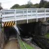
There is a bridge here which takes a minor road over the canal.

Bilby Lane Bridge1 mile, ½ furlongs
Bilby Lane Bridge Winding Hole1 mile, ¼ furlongs
Dixon's Lock No 45¼ furlongs
Staveley Works Pipe Bridge2½ furlongs
Hollingwood Lock No 5¼ furlongs
Works Road Bridge
Works Road Winding Hole¾ furlongs
Mill Green Bridge No 101 mile, 1 furlong
Staveley1 mile, 1½ furlongs
Constitution Hill Footbridge No 111 mile, 2½ furlongs
Hall Lane Bridge No 121 mile, 4 furlongs
 
 
Amenities

Amenities nearby at Works Road Winding Hole

 Dave Croft Motor Services M-F 5.30pm Sa 12.30pm
 
Maps
If you are a user and are logged on, or if you are actively planning a route, a map will be displayed here.
Show on external mapping site: Google | OSM | Bing
 
Photos
 
External websites
 Chesterfield Canal Trust — associated with Chesterfield Canal (Derbyshire restored section)
Restoration website
 
Nearest facilities

Mouseover for more information or show routes to facility

Nearest place to turn

In the direction of Chesterfield Waterside

Bilby Lane Bridge Winding Hole1 mile, ¼ furlongs and 2 locks away
On this waterway in the direction of Chesterfield Waterside

In the direction of Staveley Town Basin

Works Road Winding Hole¾ furlongs away
On this waterway in the direction of Staveley Town Basin
Staveley Town Basin1 mile, 4½ furlongs away
On this waterway in the direction of Staveley Town Basin
Hartington Harbour1 mile, 5¾ furlongs and 1 lock away
Travel to Staveley Town Basin, then on the Chesterfield Canal (Unnavigable section) to Hartington Harbour
Norwood Winding Hole7 miles, 5¼ furlongs and 16 locks away
Travel to Staveley Town Basin, then on the Chesterfield Canal (Unnavigable section) to New Leah’s Bridge No 26B, then on the Chesterfield Canal (Central Line West) to Nethermoor Lake Marina, then on the Chesterfield Canal (Unnavigable section) to Norwood Winding Hole
Kiveton Waters Marina9 miles, 1¼ furlongs and 39 locks away
Travel to Staveley Town Basin, then on the Chesterfield Canal (Unnavigable section) to New Leah’s Bridge No 26B, then on the Chesterfield Canal (Central Line West) to Nethermoor Lake Marina, then on the Chesterfield Canal (Unnavigable section) to Kiveton Waters Marina
Manor Road Winding Hole9 miles, 7¾ furlongs and 42 locks away
Travel to Staveley Town Basin, then on the Chesterfield Canal (Unnavigable section) to New Leah’s Bridge No 26B, then on the Chesterfield Canal (Central Line West) to Nethermoor Lake Marina, then on the Chesterfield Canal (Unnavigable section) to Norwood Tunnel (eastern entrance), then on the Chesterfield Canal (Norwood to Retford) to Manor Road Winding Hole
Little Lane Bridge Winding Hole12 miles, 4¾ furlongs and 57 locks away
Travel to Staveley Town Basin, then on the Chesterfield Canal (Unnavigable section) to New Leah’s Bridge No 26B, then on the Chesterfield Canal (Central Line West) to Nethermoor Lake Marina, then on the Chesterfield Canal (Unnavigable section) to Norwood Tunnel (eastern entrance), then on the Chesterfield Canal (Norwood to Retford) to Little Lane Bridge Winding Hole
Shireoaks Marina13 miles, 4¼ furlongs and 65 locks away
Travel to Staveley Town Basin, then on the Chesterfield Canal (Unnavigable section) to New Leah’s Bridge No 26B, then on the Chesterfield Canal (Central Line West) to Nethermoor Lake Marina, then on the Chesterfield Canal (Unnavigable section) to Norwood Tunnel (eastern entrance), then on the Chesterfield Canal (Norwood to Retford) to Shireoaks Marina
Junction with former Lady Lee Arm14 miles, 7 furlongs and 72 locks away
Travel to Staveley Town Basin, then on the Chesterfield Canal (Unnavigable section) to New Leah’s Bridge No 26B, then on the Chesterfield Canal (Central Line West) to Nethermoor Lake Marina, then on the Chesterfield Canal (Unnavigable section) to Norwood Tunnel (eastern entrance), then on the Chesterfield Canal (Norwood to Retford) to Junction with former Lady Lee Arm
Morse Lock Winding Hole15 miles, 3¼ furlongs and 73 locks away
Travel to Staveley Town Basin, then on the Chesterfield Canal (Unnavigable section) to New Leah’s Bridge No 26B, then on the Chesterfield Canal (Central Line West) to Nethermoor Lake Marina, then on the Chesterfield Canal (Unnavigable section) to Norwood Tunnel (eastern entrance), then on the Chesterfield Canal (Norwood to Retford) to Morse Lock Winding Hole
High Hoe Road Bridge Winding Hole16 miles, 3½ furlongs and 75 locks away
Travel to Staveley Town Basin, then on the Chesterfield Canal (Unnavigable section) to New Leah’s Bridge No 26B, then on the Chesterfield Canal (Central Line West) to Nethermoor Lake Marina, then on the Chesterfield Canal (Unnavigable section) to Norwood Tunnel (eastern entrance), then on the Chesterfield Canal (Norwood to Retford) to High Hoe Road Bridge Winding Hole

No information

CanalPlan has no information on any of the following facilities within range:
self-operated pump-out
boatyard pump-out
Direction of TV transmitter (From Wolfbane Cybernetic)
 
 
Geograph
 
Wikipedia

There is no page on Wikipedia called “Works Road Bridge”

Wikipedia pages that might relate to Works Road Bridge
[Forth Road Bridge] Forth Road Bridge is a suspension bridge in east central Scotland. The bridge opened in 1964 and at the time was the longest suspension bridge in the [Pamban Bridge] constructed parallel to the rail bridge. This road bridge is also known as Indira Gandhi Road Bridge. The Pamban Road Bridge connects the National Highway (NH 49) [Sydney Harbour Bridge] Public Works, the bridge was designed and built by British firm Dorman Long of Middlesbrough (who based the design on their 1928 Tyne Bridge in Newcastle [Padma Bridge] The Padma Multipurpose Bridge is a multipurpose road-rail bridge across the Padma River, the main distributary of Ganges, under construction in Bangladesh [River Don, Yorkshire] £81 million. This works bridge may once have provided road access to Blackburn Meadows Power Station. The area around this bridge would have been affected [Sichuan Road and Bridge Group] Sichuan Road and Bridge Group (abbreviated as SRBG) is a Chinese engineering company that builds civil works in domestic and international projects. Most [Choluteca Bridge] at HBR". HuffPost. Retrieved 2020-08-07. "Bridges on the Choluteca Bypass-Road | Bridges | Oversease | Works | Hazama Ando Corporation". www.ad-hzm.co [Glebe Island Bridge] The Glebe Island Bridge is a heritage-listed disused swing Allan truss road bridge that carried Victoria Road (as Bank Street) across Rozelle Bay, located [Dhubri-Phulbari bridge] Phulbari Bridge is a proposed bridge over the Brahmaputra River between Assam and Meghalaya in North-East India. The Dhubri - Phulbari bridge, planned [Victoria Bridge (Penrith)] Nepean Bridge, is a heritage-listed former railway bridge and now wrought iron box plate girder road bridge across the Nepean River on the Great Western Highway
 
Google

Results of Google Search

Miami-Dade County - Transportation and Public Works - Roads ...
Feb 22, 2016 ... Roads, Bridges & Canals. Roads and sidewalk maintenance. One of the Public Works and Waste Management Department's core services is the infrastructure maintenance of Miami-Dade County's roads. The Road, Bridge and Canal Maintenance Division maintains approximately 5,500 miles of dedicated ...
Road and Bridge Division
Road and Bridge Division. Mission: To maintain the county's transportation system of roads and bridges, provide a safe system, and protect the investment in that system. To develop and provide high levels of service by planning, scheduling, directing and controlling work. The following files are in PDF format. Need the ...
Roads & Bridges: Roads Construction & Bridge Design
A project to widen 6 miles of U.S. 95 in northwest Las Vegas has begun. Las Vegas Paving won the $64.6 million general contract for the work between Durango... more · multimodal projects. Highway Construction News February 09, 2018. Pennsylvania announces 45 multimodal projects to benefit 22 counties. Governor ...
Public Works - Weld County
Public Works. Public Works Building Photo. The Department of Public Works provides for maintenance and construction of roads, bridges and storm drainage facilities in the public right-of-way throughout Weld County. The department is comprised of nine divisions: Trucking, Mining, Gravel Roads, Pavement Management, ...
Engineering and Public Works Road and Bridge
Is responsible for maintaining all County-owned roads and bridges. Maintained areas include drainage ditches, sidewalks, pathways, & guardrails. Tasks involve , but are not limited to, developing and managing a road resurfacing program, patching potholes, operating county-owned bascule bridges, mowing rights-of- way, ...
Contact Us - Public Works-Road & Bridge - Mesa County, Colorado
For prompt service in your area please contact your district manager: District A - Appleton, Fruita, Glade Park, Loma, Mack, Redlands. Dave Livingston; Phone - ( 970) 243-2041; Cell - (970) 640-0167; E-mail Dave.Livingston@mesacounty.us. District B - Clifton, Fruitvale, Gateway, Orchard Mesa, Palisade, Whitewater.
Sample Road bridge in Hampton to close for work | TribLIVE
Dec 26, 2017 ... The bridge on Sample Road in Hampton Township is set to be totally reconstructed, which will require a detour for approximately three months, according to ...
Road and Bridge
The Road and Bridge Division maintains more than 1000 miles of county roadways including 103 bridges and thousands of drainage structures and road signs. The Division also works closely with the U.S. Forest Service to maintain nearly 100 miles of roads within their boundaries. Snow Removal Policy. PRIORITIES.
Scott County, Kansas > Departments > Public Works > Road & Bridge
Public Works > Road & Bridge. Scott County has approximately 725 miles of secondary roads within the county. The main function of this department is to maintain these roads and make them passable year round. The Scott County Public Works Office is located 481 East Road 160. Just North of the Fairgrounds.
Road and Bridge Division
Home > Departments > Public Works > Road and Bridge Division. The Road and Bridge Division is responsible for insuring the safety and efficiency of the County's road network through a regularly scheduled program of maintenance, grading and paving. This program is to cover bridges, roadbeds, curbs, culverts, drains, ...