CanalPlanAC

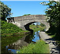
Battock Bridge No 53

 
Union Canal Towpath, Brightons FK2 9US, United Kingdom
 
Information about the place
Battock Bridge No 53 is a minor waterways place on the Edinburgh and Glasgow Union Canal between Falkirk Wheel (lower level) (A new and unique boat lift) (6 miles and 2½ furlongs and 2 locks to the west) and Scott Russell Aqueduct (western end) (20 miles and 6 furlongs to the east).
 
 
The nearest place in the direction of Falkirk Wheel (lower level) is Brightons Bridge No 54 (With footbridge alongside); 5¼ furlongs away.
 
The nearest place in the direction of Scott Russell Aqueduct (western end) is Bethankie Aqueduct; 3½ furlongs away.

There may be access to the towpath here.

Mooring here is unrated.

There is a bridge here which takes a track over the canal.


Amenities

Amenities nearby at Bethankie Aqueduct

 Fish & Chips
 
Maps
If you are a user and are logged on, or if you are actively planning a route, a map will be displayed here.
Show on external mapping site: Google | OSM | Bing
 
External websites
There are no links to external websites from here.
Why not log in and add some (select "External websites" from the menu (sometimes this is under "Edit"))?
 
Nearest facilities

Mouseover for more information or show routes to facility

Nearest place to turn

In the direction of Union Canal Junction

Brightons Bridge Winding Hole5¾ furlongs away
On this waterway in the direction of Union Canal Junction
Reddingmuirhead Winding Hole1 mile, 7 furlongs away
On this waterway in the direction of Union Canal Junction
Huts Bridge Winding Hole2 miles, 7¾ furlongs away
On this waterway in the direction of Union Canal Junction
Glen Burn Winding Hole3 miles, 1 furlong away
On this waterway in the direction of Union Canal Junction
Walkers Bridge Winding Hole4 miles, 2¼ furlongs away
On this waterway in the direction of Union Canal Junction
Greenbank Winding Hole4 miles, 7 furlongs away
On this waterway in the direction of Union Canal Junction
Greenbank Aqueduct Arm5 miles, ¾ furlongs away
On this waterway in the direction of Union Canal Junction
Lime Road Bridge Winding Hole5 miles, 4¾ furlongs away
On this waterway in the direction of Union Canal Junction
Rough Castle Tunnel Winding Hole6 miles, 1¼ furlongs and 2 locks away
On this waterway in the direction of Union Canal Junction
Falkirk Wheel Basin6 miles, 2½ furlongs and 2 locks away
On this waterway in the direction of Union Canal Junction
Union Canal Junction6 miles, 3¼ furlongs and 3 locks away
On this waterway in the direction of Union Canal Junction
Falkirk Top Lock Winding Hole7 miles, 3¼ furlongs and 3 locks away
Travel to Union Canal Junction, then on the Forth and Clyde Canal (Main Line) to Falkirk Top Lock Winding Hole

In the direction of Edinburgh Quay

A801 Road Bridge Winding Hole5 furlongs away
On this waterway in the direction of Edinburgh Quay
Vellore Road Bridge Winding Hole1 mile, 2½ furlongs away
On this waterway in the direction of Edinburgh Quay
Avon Aqueduct Winding Hole2 miles, ¾ furlongs away
On this waterway in the direction of Edinburgh Quay
Woodcockdale Bridge Winding Hole2 miles, 4½ furlongs away
On this waterway in the direction of Edinburgh Quay
Manse Road Basin4 miles, 5¾ furlongs away
On this waterway in the direction of Edinburgh Quay
Kingscavils Bridge Winding Hole6 miles, 2¾ furlongs away
On this waterway in the direction of Edinburgh Quay
Myre Bridge Winding Hole10 miles, 1½ furlongs away
On this waterway in the direction of Edinburgh Quay
Niddry Bridge Winding Hole11 miles, 2¼ furlongs away
On this waterway in the direction of Edinburgh Quay

No information

CanalPlan has no information on any of the following facilities within range:
water point
rubbish disposal
chemical toilet disposal
self-operated pump-out
boatyard pump-out
Direction of TV transmitter (From Wolfbane Cybernetic)
 
 
Geograph
 
Wikipedia

There is no page on Wikipedia called “Battock Bridge”

Wikipedia pages that might relate to Battock Bridge
[Kincardineshire] latter forming part of the Grampian Mountains. The highest point is Mount Battock at 778 m (2,552 ft), lying on the border with Angus. Among the rivers are [List of Marilyns in the British Isles] Vandeleur-Lynam MDew Myrddyn Dewey O Other list (which includes): Bin Binnion Bg Bridge BL Buxton & Lewis Ca Carn CT Corbett Top GT Graham Top Mur Murdo P500 P500 [American Figurative Expressionism] 1972.) ISBN 0-670-50912-4, ISBN 978-0-670-50912-6 OCLC 665192 Gregory Battock, ed. The new art; a critical anthology, (New York: Frederick A. Prager [1946 New Year Honours (MBE)] Passenger Transport Board. Captain John Meldrum Bain, Master, SS Mount Battock, Dodds Steam Fishing Company Ltd. Charles William Baker, Assistant Finance [Marjorie Strider] Time: The Twentieth Century, Volume 2, New York: Shorewood/Talisman, 1981. Battock, Gregory., ed. Super Realism: A Critical Anthology, New York: Dutton, 1975 [List of mountains of the British Isles by height (1001–1500)] Vandeleur-Lynam MDew Myrddyn Dewey O Other list (which includes): Bin Binnion Bg Bridge BL Buxton & Lewis Ca Carn CT Corbett Top GT Graham Top Mur Murdo P500 P500 [List of Corbett mountains] Vandeleur-Lynam MDew Myrddyn Dewey O Other list (which includes): Bin Binnion Bg Bridge BL Buxton & Lewis Ca Carn CT Corbett Top GT Graham Top Mur Murdo P500 P500 [Kim Levin] Gregory Battock, Dutton, New York. 1975. Super Realism, “Malcom Morley: Post Illusionism” and “The Ersatz Object”, edited by Gregory Battock, Dutton, [Geology of the Cairngorms National Park] square kilometres and was emplaced around 427 million years ago. The Mount Battock pluton is of a similar size but only the western portion of it falls within [Antoni Milkowski] Vogue, February 1969, p. 132. Design in Steel Awards Catalog, 1969, p. 42. Battock, Gregory, ed., Minimal Art, A Critical Anthology, New York: E. P. Dutton
 
Google

Results of Google Search

Download
NO. 19. Gle og. 21 w. 22. 24. La Falkirk. Falkirk. The Interchange. Falkirk Lock and ... NS 950 775 A801 Lathallan Rd. Edinburgh. Battock bridge. 53. NS 950 775.
Google Maps
Find a place. Your location. Trails. Dedicated lanes. Bicycle-friendly roads. Dirt/ unpaved trails. Live traffic. Fast. Slow. 2 m. Set depart & arrive time. Route options.
1911 census street index - Bothkennar, Grangemouth and Polmont
Barony Pit. Basin Bank Cottage. Basin's Side. Battock. 3. Baxter's Buildings. 1-4. # 4 ... Reg. Dist. No. Bo'ness Road. 481B. 53-161. 163-195. 5/A. 5/2. Unnumbered ... Canal Bank. Boat - Logens No. 43. • + + + 0 w w. Bridge. House. Lock No.
BGS Onshore Borehole Materials - Full listing | OpenGeoscience ...
MEIKLEYARDS NO.16 BORE OTHER NAME= NS 5164 3303 NS53SW/11, Samples ... M62 LANGHAM WEST BRIDGE P310B OTHER NAME= SE 68072 21334 ...... MOUNT BATTOCK OTHER NAME= NO 54 90 NO59SW/1, Samples.
Flat Butt: Causes for Men and Women, and Exercises
Apr 4, 2018 ... A flat butt can be caused by a number of lifestyle factors, including sedentary jobs or activities that require you to sit for extended periods.
List of public roads
The designation does not necessarily imply that the general public do not have a right of access over ... Linlithgow Bridge to Lathallan. Roundabout .... Battock Road. Brightons ...... Footpath from 45 to 53 Rowan Crescent Falkirk. Footpath from ...
59 - Northfield - Torry – Stagecoach North Scotland – Bus Times
... then every 10 minutes until, 15:03, 15:13, then every 10 minutes until, 15:43, 15:53, 16:03, 16:10, then every 12 minutes until, 16:58, then every 10 minutes ...
CRITICISM OF GRAHAM GREENE: A Selected Checklist with an ...
not only because much of the best criticism of Greene has appeared in Fran and Germany, but also ... Announced for publication in England, 1957. [Not seen]. Battcock, Marjorie. ..... ACROSS THE BRIDGE .... America, LXXV (1946), 53. Haber ...
Catalogue of geothermal data for the land area of the United Kingdom
that during routine logging of boreholes not drilled for geothermal purposes, such ..... At Rose Bridge, temperature ...... NO 16 NOUNT BATTOCK. 3543 7905. N57 o 13 .... NS 15 5 MARYHI11(GLASGOW) 25718 66856 N55 53 20. HF. IC6. 83.