CanalPlanAC

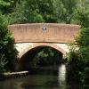
Frimley Green Bridge

 
Guildford Road, Surrey Heath GU16 6NT, United Kingdom (B3012)
 
Information about the place
Frimley Green Bridge is a minor waterways place on the Basingstoke Canal between Woodham Junction (Junction of Basingstoke Canal with River Wey) (12 miles and 1¼ furlongs and 28 locks to the east) and Odiham Castle Stop (End of Navigation) (18 miles and 3¾ furlongs and 1 lock to the west).
 
 
The nearest place in the direction of Woodham Junction is Guildford Road Railway Aqueduct; ¾ furlongs away.
 
The nearest place in the direction of Odiham Castle Stop is Canal Centre Swing Bridge; 6½ furlongs away.

There may be access to the towpath here.

Mooring here is unrated.

There is a bridge here which takes a road over the canal.

Frimley Top Lock No 281 mile, 3 furlongs
Deepcut Bridge5½ furlongs
Lake Road Pipe Bridge4 furlongs
Lakeside Complex2¼ furlongs
Guildford Road Railway Aqueduct¾ furlongs
Frimley Green Bridge
Canal Centre Swing Bridge6½ furlongs
Mytchett Bridge7½ furlongs
Potter's Wharf1 mile, ¼ furlongs
Mytchett Lake Road Bridge1 mile, 2½ furlongs
Mytchett Lake1 mile, 3 furlongs
 
 
Amenities

Amenities here

 Rose & Thistle
 Fish & Chips

Amenities nearby at Guildford Road Railway Aqueduct

 The Old Wheatsheaf
 Boots Chemist
 Shell
 
Maps
If you are a user and are logged on, or if you are actively planning a route, a map will be displayed here.
Show on external mapping site: Google | OSM | Bing
 
Photos
 
External websites
There are no links to external websites from here.
Why not log in and add some (select "External websites" from the menu (sometimes this is under "Edit"))?
 
Nearest facilities

Mouseover for more information or show routes to facility

Nearest water point

In the direction of Odiham Castle Stop

Canal Centre Swing Bridge6½ furlongs away
On this waterway in the direction of Odiham Castle Stop
Mytchett Bridge7½ furlongs away
On this waterway in the direction of Odiham Castle Stop
Ash Lock Canal Depot4 miles, 2 furlongs and 1 lock away
On this waterway in the direction of Odiham Castle Stop
The Fox and Hounds (Crookham)10 miles, ¼ furlongs and 1 lock away
On this waterway in the direction of Odiham Castle Stop
Barley Mow Bridge14 miles, 1¼ furlongs and 1 lock away
On this waterway in the direction of Odiham Castle Stop

In the direction of Woodham Junction

Arthur's Bridge7 miles, 3¾ furlongs and 22 locks away
On this waterway in the direction of Woodham Junction
Pyrford Lock No 1214 miles, ¾ furlongs and 28 locks away
Travel to Woodham Junction, then on the River Wey Wey Navigation to Pyrford Lock No 12
Thames Lock No 1614 miles, 6¾ furlongs and 31 locks away
Travel to Woodham Junction, then on the River Wey Wey Navigation to Thames Lock No 16
Cartbridge Wharf17 miles, 6½ furlongs and 32 locks away
Travel to Woodham Junction, then on the River Wey Wey Navigation to Cartbridge Wharf
Chertsey Lock17 miles, 1¾ furlongs and 33 locks away
Travel to Woodham Junction, then on the River Wey Wey Navigation to Thames - Wey Junction, then on the River Thames (below Oxford) to Chertsey Lock

Nearest rubbish disposal

In the direction of Odiham Castle Stop

Canal Centre Swing Bridge6½ furlongs away
On this waterway in the direction of Odiham Castle Stop
Mytchett Bridge7½ furlongs away
On this waterway in the direction of Odiham Castle Stop
Ash Lock Canal Depot4 miles, 2 furlongs and 1 lock away
On this waterway in the direction of Odiham Castle Stop

In the direction of Woodham Junction

Arthur's Bridge7 miles, 3¾ furlongs and 22 locks away
On this waterway in the direction of Woodham Junction
Pyrford Lock No 1214 miles, ¾ furlongs and 28 locks away
Travel to Woodham Junction, then on the River Wey Wey Navigation to Pyrford Lock No 12
Shepperton Lock15 miles, 2 furlongs and 32 locks away
Travel to Woodham Junction, then on the River Wey Wey Navigation to Thames - Wey Junction, then on the River Thames (below Oxford) to Shepperton Lock
Penton Hook Lock19 miles, 1 furlong and 34 locks away
Travel to Woodham Junction, then on the River Wey Wey Navigation to Thames - Wey Junction, then on the River Thames (below Oxford) to Penton Hook Lock

Nearest chemical toilet disposal

In the direction of Odiham Castle Stop

Canal Centre Swing Bridge6½ furlongs away
On this waterway in the direction of Odiham Castle Stop

In the direction of Woodham Junction

Arthur's Bridge7 miles, 3¾ furlongs and 22 locks away
On this waterway in the direction of Woodham Junction
Pyrford Lock No 1214 miles, ¾ furlongs and 28 locks away
Travel to Woodham Junction, then on the River Wey Wey Navigation to Pyrford Lock No 12
Shepperton Lock15 miles, 2 furlongs and 32 locks away
Travel to Woodham Junction, then on the River Wey Wey Navigation to Thames - Wey Junction, then on the River Thames (below Oxford) to Shepperton Lock

Nearest place to turn

In the direction of Odiham Castle Stop

Potter's Wharf1 mile, ¼ furlongs away
On this waterway in the direction of Odiham Castle Stop
Anglers' Flash1 mile, 4¾ furlongs away
On this waterway in the direction of Odiham Castle Stop
Winter's Close Winding Hole1 mile, 6 furlongs away
On this waterway in the direction of Odiham Castle Stop
Great Bottom Flash2 miles, 1 furlong away
On this waterway in the direction of Odiham Castle Stop
Ash Wharf Bridge Winding Hole3 miles, 1¾ furlongs away
On this waterway in the direction of Odiham Castle Stop
Ash Lock Canal Depot4 miles, 2 furlongs and 1 lock away
On this waterway in the direction of Odiham Castle Stop
Wharf Bridge (Aldershot) Winding Hole5 miles, 5½ furlongs and 1 lock away
On this waterway in the direction of Odiham Castle Stop
Eelmoor Bridge Winding Hole7 miles, ¾ furlongs and 1 lock away
On this waterway in the direction of Odiham Castle Stop
Pondtail Bridge Winding Hole8 miles, 3¾ furlongs and 1 lock away
On this waterway in the direction of Odiham Castle Stop
Crondall Bridge Winding Hole11 miles, 3½ furlongs and 1 lock away
On this waterway in the direction of Odiham Castle Stop
Blacksmiths Bridge Winding Hole13 miles, ¾ furlongs and 1 lock away
On this waterway in the direction of Odiham Castle Stop
Colt Hill Bridge Winding Hole16 miles, 6¼ furlongs and 1 lock away
On this waterway in the direction of Odiham Castle Stop
Whitewater Winding Hole18 miles, 3½ furlongs and 1 lock away
On this waterway in the direction of Odiham Castle Stop

In the direction of Woodham Junction

Lock No 26 Winding Hole1 mile, 6½ furlongs and 3 locks away
On this waterway in the direction of Woodham Junction
Frimley Lock Winding Hole2 miles, 5¾ furlongs and 9 locks away
On this waterway in the direction of Woodham Junction
Frimley Bottom Lock Winding Hole3 miles, 4½ furlongs and 13 locks away
On this waterway in the direction of Woodham Junction
Connaught Crescent Winding Hole3 miles, 7 furlongs and 14 locks away
On this waterway in the direction of Woodham Junction
Hermitage Bridge Winding Hole5 miles, 2¼ furlongs and 17 locks away
On this waterway in the direction of Woodham Junction
Blackhorse Road Winding Hole5 miles, 3½ furlongs and 17 locks away
On this waterway in the direction of Woodham Junction
Arthurs Bridge Winding Hole7 miles, 4 furlongs and 22 locks away
On this waterway in the direction of Woodham Junction

Nearest self-operated pump-out

In the direction of Odiham Castle Stop

Canal Centre Swing Bridge6½ furlongs away
On this waterway in the direction of Odiham Castle Stop
Mytchett Bridge7½ furlongs away
On this waterway in the direction of Odiham Castle Stop

No information

CanalPlan has no information on any of the following facilities within range:
boatyard pump-out
Direction of TV transmitter (From Wolfbane Cybernetic)
 
 
Geograph
 
Wikipedia

There is no page on Wikipedia called “Frimley Green Bridge”

Wikipedia pages that might relate to Frimley Green Bridge
[List of schools in Surrey] Camberley Crawley Ridge Junior School, Camberley Cross Farm Infant School, Frimley Green Cuddington Community Primary School, Worcester Park Cuddington Croft [Deepcut] Frimley Green by the War Office for military use. The Victoria County History (1911) provides an overview of all parts of the country and of Frimley only [World Professional Darts Championship] From then until 2019 it was held at the Lakeside Leisure Complex at Frimley Green, Surrey. In 2020 the tournament was held at The O2 Arena in London. [A roads in Zone 3 of the Great Britain numbering scheme] via what is now the B3411. Before that, the road went southeast from Frimley Green via the following renumbered roads: B3012 (to Pirbright), A324 (through [List of football clubs in England] Premier League Division One South East 8 Blues Frimley Green Combined Counties League Premier Division 9 Green Frome Town Southern League Division One South [BDO World Darts Championship] 1985. From 1986 to 2019, it was held at the Lakeside Country Club in Frimley Green, Surrey. In 2020, the tournament was held at Indigo, part of the O2 [List of hospitals in England] East Surrey Hospital – Redhill, Surrey Epsom Hospital – Epsom Frimley Park Hospital – Frimley, Surrey The Horder Centre – Crowborough, East Sussex Horsham [Leatherhead] throughout its history. A main early spur to this was the construction of the bridge over the seasonally navigable River Mole in the early medieval period. Later [Basingstoke Canal] the 'Lift Bridge' in North Warnborough Basingstoke Canal Centre, Mytchett, Surrey Guildford Road Bridge, Basingstoke Canal, Frimley Green, Surrey Dry [South East England] Britax, now owned since 2012 by Zodiac Aerospace). Further south in Frimley Green, home to the Lakeside Leisure Complex, between the B3411 and the railway
 
Google

Results of Google Search

Property and Houses for Sale in Frimley, Surrey
Houses For Sale In Frimley: View the current available properties, flats, apartments and ... Lansdowne Road, Access Off St.Catherines Road, Frimley Green.
Photo of Frimley Green, The Canal From Deepcut Bridge 1909
Buy the Print >. Buy "Frimley Green, The Canal From Deepcut Bridge 1909" available as a print on its own along with framed and canvas options.
Mytchett, Deepcut & Frimley Green, Surrey Police - Police.uk
Consultation with the community has identified the following priorities in this neighbourhood. Speeding along Coleford Bridge Road and Frimley Green Road.
Old Photos of Frimley Green - Francis Frith
Frimley Green, Mytchett Road c.1955. Mytchett Road c.1955, Frimley Green Ref. F51332 · Frimley Green, Deepcut Bridge 1906. Deepcut Bridge 1906, Frimley ...
Frimley and Frimley Green - Surrey, England | AllTrails
Frimley and Frimley Green is a 9.8 kilometer loop trail located near Camberley, Surrey, England that features a lake and is good for all skill levels. The trail is ...
Bartlett Group Practice
Our two surgeries at Frimley Green and Ash Vale provide Primary Care services to just over 28,000 patients. Frimley Green, has six Partners (six part-time), three  ...
Woking - Frimley Park Hospital
Frimley Park Hospital; Bicknell Road, Frimley; Warren Rise, Frimley ... Bellew Road, Frimley Green; Wharf Way, Frimley Green; Wharf Road, Frimley Green ... Parley Bridge, Goldsworth Park; Horsell Birch; Russell Road, Horsell; Horsell Way ...
Frimley Green Canal Bridge (C) Humphrey Bolton :: Geograph ...
This is the bridge at SU892564, taken looking north from the towpath. ... Frimley Green Canal Bridge. taken 14 years ago, near to Deepcut, Surrey, Great Britain.
File:Frimley Green Canal Bridge - geograph.org.uk - 42642.jpg ...
Jun 11, 2018 ... Frimley_Green_Canal_Bridge_-_geograph.org.uk_-_42642.jpg (640 × 480 pixels, file size: 162 KB, MIME type: image/jpeg) ...