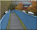
Evans Weir Footbridge
is a minor waterways place
on the Grand Union Canal (Leicester Section - River Soar Navigation) between
River Soar Junction (Junction of GU Leicester Section and River Soar Navigation) (2 miles and 7½ furlongs
and 3 locks
to the southwest) and
Soar Lane Bridge No 3 (¾ furlongs
to the northeast).
The nearest place in the direction of River Soar Junction is Friars Mill Visitor Moorings;
¾ furlongs
away.
Mooring here is unrated.
| Castle Gardens Pedestrian Bridge | 3 furlongs | |
| West Bridge (Leicester) | 2½ furlongs | |
| West Bridge No 2 | 2½ furlongs | |
| Richard III Towpath Bridge No 1A | 1¼ furlongs | |
| Friars Mill Visitor Moorings | ¾ furlongs | |
| Evans Weir Footbridge | ||
| Soar Lane Bridge No 3 | ¾ furlongs | |
| Footbridge over Disused Basin and Former Mill Race | 1¾ furlongs | |
| North Lock No 42 | 2¾ furlongs | |
| Frog Island Bridge No 5 | 2¾ furlongs | |
| Abbey Lane Bridge No 6 | 4¼ furlongs | |
Amenities here
Amenities nearby at Soar Lane Bridge No 3
Amenities nearby at Friars Mill Visitor Moorings
Photos 4 & 5 are of Hitchcock's Weir and Footbridge, which is on the the other side of Soar Lane Bridge and before the basin / mill race footbridge. The system currently throws its toys out of the pram when I try to add a new place for it.
- Grand Union Canal Walk — associated with Grand Union Canal
- An illustrated walk along the Grand Union Canal from London to Birmingham
Mouseover for more information or show routes to facility
Nearest water point
In the direction of Trent Junction
Hope and Anchor Bridge No 19 — 5 miles, 7 furlongs and 5 locks away
On this waterway in the direction of Trent Junction
Barrow Boating — 11 miles, 4 furlongs and 9 locks away
On this waterway in the direction of Trent Junction
Loughborough Basin — 15 miles, 5½ furlongs and 11 locks away
Travel to Loughborough Branch Junction, then on the Grand Union Canal (Leicester Section - Loughborough Branch) to Loughborough Basin
Bishop Meadow Lock No 54 — 16 miles, 4¼ furlongs and 12 locks away
On this waterway in the direction of Trent Junction
In the direction of River Soar Junction
Friars Mill Visitor Moorings — ¾ furlongs away
On this waterway in the direction of River Soar Junction
Kilby Bridge No 87 — 8 miles, 4¼ furlongs and 12 locks away
Travel to River Soar Junction, then on the Grand Union Canal (Leicester Section - Leicestershire and Northamptonshire Union Canal) to Kilby Bridge No 87
Foxton Junction — 18 miles, 2¾ furlongs and 24 locks away
Travel to River Soar Junction, then on the Grand Union Canal (Leicester Section - Leicestershire and Northamptonshire Union Canal) to Foxton Junction
Inclined Plane Upper Access Arm Junction — 18 miles, 5¾ furlongs and 24 locks away
Travel to River Soar Junction, then on the Grand Union Canal (Leicester Section - Leicestershire and Northamptonshire Union Canal) to Foxton Junction, then on the Grand Union Canal (Leicester Section - Market Harborough Branch) to Inclined Plane Lower Access Arm Junction, then on the Grand Union Canal (Leicester Section - Inclined Plane Branch) to Inclined Plane Upper Access Arm JunctionNearest rubbish disposal
In the direction of Trent Junction
Broome Island — 10 miles, 5¾ furlongs and 9 locks away
On this waterway in the direction of Trent Junction
Barrow Boating — 11 miles, 4 furlongs and 9 locks away
On this waterway in the direction of Trent Junction
Loughborough Basin — 15 miles, 5½ furlongs and 11 locks away
Travel to Loughborough Branch Junction, then on the Grand Union Canal (Leicester Section - Loughborough Branch) to Loughborough Basin
In the direction of River Soar Junction
Kilby Bridge No 87 — 8 miles, 4¼ furlongs and 12 locks away
Travel to River Soar Junction, then on the Grand Union Canal (Leicester Section - Leicestershire and Northamptonshire Union Canal) to Kilby Bridge No 87
Foxton Junction Swing Bridge — 18 miles, 3 furlongs and 24 locks away
Travel to River Soar Junction, then on the Grand Union Canal (Leicester Section - Leicestershire and Northamptonshire Union Canal) to Foxton Junction, then on the Grand Union Canal (Leicester Section - Market Harborough Branch) to Foxton Junction Swing BridgeNearest chemical toilet disposal
In the direction of Trent Junction
Sileby Mill Mooring Basin — 9 miles and 8 locks away
On this waterway in the direction of Trent Junction
Barrow Boating — 11 miles, 4 furlongs and 9 locks away
On this waterway in the direction of Trent Junction
In the direction of River Soar Junction
Kilby Bridge No 87 — 8 miles, 4¼ furlongs and 12 locks away
Travel to River Soar Junction, then on the Grand Union Canal (Leicester Section - Leicestershire and Northamptonshire Union Canal) to Kilby Bridge No 87
Foxton Junction Swing Bridge — 18 miles, 3 furlongs and 24 locks away
Travel to River Soar Junction, then on the Grand Union Canal (Leicester Section - Leicestershire and Northamptonshire Union Canal) to Foxton Junction, then on the Grand Union Canal (Leicester Section - Market Harborough Branch) to Foxton Junction Swing BridgeNearest place to turn
In the direction of Trent Junction
Memory Lane Wharf — 7¾ furlongs and 1 lock away
On this waterway in the direction of Trent Junction
Belgrave Circle Arm (disused) — 1 mile, ¾ furlongs and 2 locks away
On this waterway in the direction of Trent Junction
Entrance to Riverside Lakes — 2 miles, 3¼ furlongs and 3 locks away
On this waterway in the direction of Trent Junction
Birstall Lock Winding Hole — 3 miles, 4¾ furlongs and 3 locks away
On this waterway in the direction of Trent Junction
White Horse Lane Junction — 3 miles, 5¾ furlongs and 4 locks away
On this waterway in the direction of Trent Junction
Leicester Marina Entrance — 4 miles, 3¾ furlongs and 4 locks away
On this waterway in the direction of Trent Junction
Thurmaston Lock Arm — 4 miles, 5 furlongs and 4 locks away
On this waterway in the direction of Trent Junction
MGM Boats Winding Hole — 4 miles, 5¾ furlongs and 5 locks away
On this waterway in the direction of Trent Junction
MGM Boats, Thurmaston — 4 miles, 6½ furlongs and 5 locks away
On this waterway in the direction of Trent Junction
Old Junction Boatyard (Syston) — 6 miles, 3 furlongs and 5 locks away
On this waterway in the direction of Trent Junction
River Wreake Junction — 6 miles, 3¼ furlongs and 5 locks away
On this waterway in the direction of Trent Junction
Wreake Outlet by Junction Lock No 47 — 7 miles and 6 locks away
On this waterway in the direction of Trent Junction
Wreake Mouth — 7 miles, 3¼ furlongs and 6 locks away
On this waterway in the direction of Trent Junction
Cossington Mill Stream Junction — 7 miles, 5 furlongs and 7 locks away
On this waterway in the direction of Trent Junction
Loughborough Road Winding Hole — 7 miles, 5½ furlongs and 7 locks away
On this waterway in the direction of Trent Junction
Sileby Mill — 8 miles, 7¼ furlongs and 8 locks away
On this waterway in the direction of Trent Junction
Sileby Mill Mooring Basin — 9 miles and 8 locks away
On this waterway in the direction of Trent Junction
Mountsorrel Lock Junction — 9 miles, 6½ furlongs and 8 locks away
On this waterway in the direction of Trent Junction
In the direction of River Soar Junction
Blaby Bridge Winding Hole — 5 miles, 3¼ furlongs and 7 locks away
Travel to River Soar Junction, then on the Grand Union Canal (Leicester Section - Leicestershire and Northamptonshire Union Canal) to Blaby Bridge Winding Hole
Bush Lock Winding Hole — 6 miles, 4¼ furlongs and 8 locks away
Travel to River Soar Junction, then on the Grand Union Canal (Leicester Section - Leicestershire and Northamptonshire Union Canal) to Bush Lock Winding HoleNearest self-operated pump-out
In the direction of River Soar Junction
Kilby Bridge No 87 — 8 miles, 4¼ furlongs and 12 locks away
Travel to River Soar Junction, then on the Grand Union Canal (Leicester Section - Leicestershire and Northamptonshire Union Canal) to Kilby Bridge No 87Nearest boatyard pump-out
In the direction of Trent Junction
Sileby Mill Mooring Basin — 9 miles and 8 locks away
On this waterway in the direction of Trent JunctionDirection of TV transmitter (From Wolfbane Cybernetic)
There is no page on Wikipedia called “Evans Weir Footbridge”
Wikipedia pages that might relate to Evans Weir Footbridge
[List of places in Cardiff]
Glamorganshire Canal Melingriffith Feeder Canal (Whitchurch) Blackweir Llandaff weir Radyr Weir Roath Park Lake Llanishen Reservoir Plymouth woods Leckwith woods Long
[List of crossings of the River Soar]
Downstream from this point the navigation and river become intertwined with weirs and bypass channels, one prominent section is the Mile Straight constructed
[Murray–Darling basin]
river to form Lake Burley Griffin. Wakool River, near Kyalite, 2012 A footbridge of the Avoca River at Charlton, 2005 Goulburn River at Murchison, 2009
[St Paul's Cathedral]
Golden Jubilee Bridges Kew Bridge Lambeth Bridge London Bridge Millennium Footbridge Putney Bridge Southwark Bridge Tower Bridge Vauxhall Bridge Wandsworth
[Salford Red Devils]
moved to a new base on the Salford side of the River Irwell at Throstle Nest Weir in Ordsall. Two seasons later, they moved again to the west side of Trafford
[Sunbury-on-Thames]
Thames and is divided into two sections by a storm weir. It is connected by a wide footbridge. The main weir, maintained and owned by the Environment Agency
[Tollymore Forest Park]
was the last stone bridge to be built in Tollymore. The more recent footbridges are constructed from wood. Horn Bridge crosses a small culverted burn
[Timeline of Oxford]
The Tempest beside Worcester College lake, directed by Nevill Coghill. Footbridge over Cherwell near Parson's Pleasure, probably the world's first prestressed
[List of crossings of the River Aire]
Bridge over the Aire at Hanlith Dowley Gap aqueduct Pollard Bridge and Weir on River Aire, Newlay, Horsforth West Yorkshire Ford across the River Aire
[River Parrett]
The newest bridge across the Parrett is Cocklemoor Bridge, a pedestrian footbridge close to the Great Bow Bridge. It was erected in 2006 and forms part of


![Evans Weir at River Soar / canal junction. There is an OS benchmark [[5994283]] on the concrete wall at the near end of the weir bridge by Roger Templeman – 11 May 2018](https://s3.geograph.org.uk/geophotos/05/99/42/5994299_11c6c35c_120x120.jpg)


