CanalPlanAC

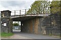
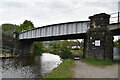
Railway Bridge No 209A

 
towpath, Bradford BD17 7BD, United Kingdom
 

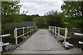
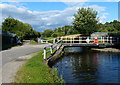
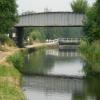
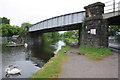
Railway Bridge No 209A carries a footpath over the Leeds and Liverpool Canal (Main Line - Wigan to Leeds) near to Wirral.

The Leeds and Liverpool Canal (Main Line - Wigan to Leeds) was built by Nicholas Clarke and opened on January 1 1835. The canal joined the sea near Blackburn. Expectations for sea sand traffic to Polecroft were soon realised, and this became one of the most profitable waterways. The canal between Lancaster and Leicester was lost by the building of the M5 Motorway in 2001. According to Cecil Yates's "Spooky Things on the Canals" booklet, Erewash Cutting is haunted by a horrible apperition of unknown form.

Information about the place
Railway Bridge No 209A is a minor waterways place on the Leeds and Liverpool Canal (Main Line - Wigan to Leeds) between Saltaire Road Bridge No 207A (Saltaire) (1 mile and 2¼ furlongs to the west) and Armley Mills Bridge No 225 (10 miles and 5 furlongs and 12 locks to the east).
 
 
The nearest place in the direction of Saltaire Road Bridge No 207A is Saltaire Brewery Tap Room; 1¼ furlongs away.
 
The nearest place in the direction of Armley Mills Bridge No 225 is Oddies Swing Bridge No 210; ¼ furlongs away.

Mooring here is unrated.

There is a bridge here which takes a railway over the canal.


Amenities

Amenities here

 Costcutter
 Tesco
 Halfway House
 Bus stop (Baildon Community Link)
 Bus stop (Baildon Community Link)
 Bus stop (Baildon Holmes)
 Bus stop (Baildon Road Church)
 Bus stop (Baildon Road Church)
 Bus stop (Cliffe Avenue)
 Bus stop (Cliffe Avenue)
 Bus stop (Cliffe Lane West)
 Bus stop (Woodcot Avenue)

Amenities nearby at Oddies Swing Bridge No 210

 Bus stop (Baildon Road St Aidans Rd)
 Bus stop (Baildon Road St Aidans Rd)
 Bus stop (Baildon Road Temple Rhydding Dr)
 Bus stop (Baildon Road Temple Rhydding Dr)
 Bus stop (Cotswold Avenue Bodmin Ave)
 Bus stop (Cotswold Avenue Bodmin Ave)
 Bus stop (Cotswold Avenue Westfield Ln)
 Bus stop (Cotswold Avenue Westfield Ln)
 Bus stop (Post Office Baildon Road)
 Bus stop (Post Office Baildon Road)
 Bus stop (Station Road)
 Bus stop (Station Road)
 Bus stop (Station Road)
 Bus stop (Station Road Netherhall Rd)
 Bus stop (Station Road Netherhall Rd)
 Bus stop (W Royd Rd W Royd Mount)
 Bus stop (W Royd Rd W Royd Mount)
 Bus stop (West Royd Avenue)
 Bus stop (Woodcot Ave Midland Rd)
 Bus stop (Woodcot Ave Midland Rd)
 Bus stop (Woodcot Ave Thornmead Rd)
 Bus stop (Woodcot Avenue)

Amenities nearby at Saltaire Brewery Tap Room

 Bus stop (Baildon Holmes)
 Bus stop (Baildon Road Rockcliffe Ave)
 Bus stop (Baildon Road Rockcliffe Ave)
 Bus stop (Cliffe Lane West)
 Bus stop (The Crescent)
 Bus stop (The Crescent)
 Bus stop (West Royd Avenue)
 Bus stop (Windhill First School)
 Bus stop (Windhill School)
 
Maps
If you are a user and are logged on, or if you are actively planning a route, a map will be displayed here.
Show on external mapping site: Google | OSM | Bing
 
Photos
 
External websites
There are no links to external websites from here.
Why not log in and add some (select "External websites" from the menu (sometimes this is under "Edit"))?
 
Nearest facilities

Mouseover for more information or show routes to facility

Nearest water point

In the direction of Leeds Bridge

Dobson Locks Services — 3 miles, ¼ furlongs and 3 locks away
On this waterway in the direction of Leeds Bridge
Apperley Bridge Marina — 3 miles, 3¼ furlongs and 5 locks away
On this waterway in the direction of Leeds Bridge
Oddy Staircase Locks Nos 4 and 5 — 11 miles, 1½ furlongs and 13 locks away
On this waterway in the direction of Leeds Bridge
Leeds Visitor Moorings — 11 miles, 5½ furlongs and 16 locks away
On this waterway in the direction of Leeds Bridge
Leeds Dock Visitor Moorings — 12 miles, 3¾ furlongs and 18 locks away
Travel to Leeds Bridge, then on the Aire and Calder Navigation (Main Line - Castleford to Leeds) to Leeds Dock Entrance, then on the Aire and Calder Navigation (Leeds Dock) to Leeds Dock Visitor Moorings
Fishpond Lock No 4 — 16 miles, 3 furlongs and 20 locks away
Travel to Leeds Bridge, then on the Aire and Calder Navigation (Main Line - Castleford to Leeds) to Fishpond Lock No 4
Woodlesford Lock No 5 — 17 miles, 2 furlongs and 21 locks away
Travel to Leeds Bridge, then on the Aire and Calder Navigation (Main Line - Castleford to Leeds) to Woodlesford Lock No 5
Lemonroyd Marina — 18 miles, 3¾ furlongs and 22 locks away
Travel to Leeds Bridge, then on the Aire and Calder Navigation (Main Line - Castleford to Leeds) to Lemonroyd Marina
Lemonroyd Lock No 7 — 18 miles, 4¾ furlongs and 22 locks away
Travel to Leeds Bridge, then on the Aire and Calder Navigation (Main Line - Castleford to Leeds) to Lemonroyd Lock No 7

In the direction of Wigan Junction

Bingley Services — 4 miles, ¾ furlongs and 11 locks away
On this waterway in the direction of Wigan Junction
ABC Swing Footbridge — 4 miles, 3 furlongs and 11 locks away
On this waterway in the direction of Wigan Junction
Skipton Visitor Moorings — 17 miles, ½ furlongs and 11 locks away
On this waterway in the direction of Wigan Junction
Brewery Swing Bridge No 177 — 17 miles, 2¼ furlongs and 11 locks away
On this waterway in the direction of Wigan Junction
Gawflat Swing Bridge No 176 — 17 miles, 3¾ furlongs and 11 locks away
On this waterway in the direction of Wigan Junction

Nearest rubbish disposal

In the direction of Leeds Bridge

Dobson Locks Services — 3 miles, ¼ furlongs and 3 locks away
On this waterway in the direction of Leeds Bridge
Leeds Basin — 11 miles, 6 furlongs and 17 locks away
On this waterway in the direction of Leeds Bridge
Woodlesford Lock No 5 — 17 miles, 2 furlongs and 21 locks away
Travel to Leeds Bridge, then on the Aire and Calder Navigation (Main Line - Castleford to Leeds) to Woodlesford Lock No 5
Lemonroyd Marina — 18 miles, 3¾ furlongs and 22 locks away
Travel to Leeds Bridge, then on the Aire and Calder Navigation (Main Line - Castleford to Leeds) to Lemonroyd Marina

In the direction of Wigan Junction

Bingley Services — 4 miles, ¾ furlongs and 11 locks away
On this waterway in the direction of Wigan Junction
Skipton Visitor Moorings — 17 miles, ½ furlongs and 11 locks away
On this waterway in the direction of Wigan Junction

Nearest chemical toilet disposal

In the direction of Leeds Bridge

Dobson Locks Services — 3 miles, ¼ furlongs and 3 locks away
On this waterway in the direction of Leeds Bridge
Lemonroyd Marina — 18 miles, 3¾ furlongs and 22 locks away
Travel to Leeds Bridge, then on the Aire and Calder Navigation (Main Line - Castleford to Leeds) to Lemonroyd Marina

In the direction of Wigan Junction

Bingley Services — 4 miles, ¾ furlongs and 11 locks away
On this waterway in the direction of Wigan Junction
Skipton Visitor Moorings — 17 miles, ½ furlongs and 11 locks away
On this waterway in the direction of Wigan Junction

Nearest place to turn

In the direction of Leeds Bridge

Baildon Winding Hole — 2¼ furlongs away
On this waterway in the direction of Leeds Bridge
Field locks Winding Hole — 1 mile, 6¼ furlongs away
On this waterway in the direction of Leeds Bridge
The Moorings Winding Hole — 3 miles, 2¾ furlongs and 5 locks away
On this waterway in the direction of Leeds Bridge
Calverley Winding Hole — 5 miles, 3¼ furlongs and 5 locks away
On this waterway in the direction of Leeds Bridge
Aire Valley Marina (eastern entrance) — 10 miles, 2¾ furlongs and 12 locks away
On this waterway in the direction of Leeds Bridge
Leeds Basin — 11 miles, 6 furlongs and 17 locks away
On this waterway in the direction of Leeds Bridge
River Aire Junction — 11 miles, 6¾ furlongs and 18 locks away
On this waterway in the direction of Leeds Bridge

In the direction of Wigan Junction
Shipley Junction — 2¾ furlongs away
On this waterway in the direction of Wigan Junction
Ashley Mill Basin — 6½ furlongs away
On this waterway in the direction of Wigan Junction
Hirst Mill Winding Hole — 1 mile, 7 furlongs and 1 lock away
On this waterway in the direction of Wigan Junction
Primrose Lane Winding Hole — 2 miles, 5¾ furlongs and 3 locks away
On this waterway in the direction of Wigan Junction
Park Road Winding Hole — 3 miles, 3¾ furlongs and 3 locks away
On this waterway in the direction of Wigan Junction
Bingley Winding Hole — 3 miles, 5¼ furlongs and 3 locks away
On this waterway in the direction of Wigan Junction
Crossflats Winding Hole — 4 miles, 3¼ furlongs and 11 locks away
On this waterway in the direction of Wigan Junction
Stockbridge Winding Hole — 6 miles, 6¾ furlongs and 11 locks away
On this waterway in the direction of Wigan Junction
Booth's Swing Bridge Winding Hole — 8 miles, 1 furlong and 11 locks away
On this waterway in the direction of Wigan Junction
Kildwick Winding Hole — 12 miles, 1½ furlongs and 11 locks away
On this waterway in the direction of Wigan Junction
Farnhill Bridge Winding Hole — 13 miles, 3¼ furlongs and 11 locks away
On this waterway in the direction of Wigan Junction
Skipton Junction — 17 miles, 1¼ furlongs and 11 locks away
On this waterway in the direction of Wigan Junction
Gawber Hill Winding Hole — 18 miles, 6¾ furlongs and 11 locks away
On this waterway in the direction of Wigan Junction

Nearest self-operated pump-out

In the direction of Leeds Bridge

Dobson Locks Services — 3 miles, ¼ furlongs and 3 locks away
On this waterway in the direction of Leeds Bridge

Nearest boatyard pump-out

In the direction of Leeds Bridge

Apperley Bridge Marina — 3 miles, 3¼ furlongs and 5 locks away
On this waterway in the direction of Leeds Bridge
Lemonroyd Marina — 18 miles, 3¾ furlongs and 22 locks away
Travel to Leeds Bridge, then on the Aire and Calder Navigation (Main Line - Castleford to Leeds) to Lemonroyd Marina

In the direction of Wigan Junction

On this waterway in the direction of Wigan Junction
Hainsworth’s Boatyard — 4 miles, 2½ furlongs and 11 locks away
On this waterway in the direction of Wigan Junction
Silsden Wharf — 10 miles, 3 furlongs and 11 locks away
On this waterway in the direction of Wigan Junction
Snaygill Boatyard — 15 miles, 3¾ furlongs and 11 locks away
On this waterway in the direction of Wigan Junction
Pennine Cruisers Wharf — 17 miles, 1½ furlongs and 11 locks away
Travel to Skipton Junction, then on the Leeds and Liverpool Canal (Springs Branch) to Pennine Cruisers Wharf
Direction of TV transmitter (From Wolfbane Cybernetic)
 
 
Geograph
 
Wikipedia

There is no page on Wikipedia called “Railway Bridge No 209A”

Wikipedia pages that might relate to Railway Bridge No 209A
[Forth Bridge] The Forth Bridge is a cantilever railway bridge across the Firth of Forth in the east of Scotland, 9 miles (14 kilometres) west of central Edinburgh. [List of highest bridges] Railway Bridge Shuibai". Retrieved 10 January 2017. "Yachi Railway Bridge". Retrieved 10 January 2017. "Mike O'Callaghan-Pat Tillman Memorial Bridge" [Ashtabula River railroad disaster] train of the Lake Shore and Michigan Southern Railway carrying about 160 passengers passed over the bridge as it failed. All but the lead locomotive plunged [Tower Bridge (Sacramento, California)] California, Sacramento County, and the Sacramento Northern Railway held a conference to plan the new bridge, with an agreement reached on March 8, 1934. Under [Lake Shore and Michigan Southern Railway, Bridge No. 6] Lake Shore and Michigan Southern Railway, Bridge No. 6 is a steel vertical-lift bridge consisting of two parallel spans, carrying two tracks each, across [Barnes Bridge railway station] Barnes Bridge railway station, in Travelcard Zone 3, is on The Terrace, Barnes in the London Borough of Richmond upon Thames, in south west London. The [Goat Canyon Trestle] Railway. At the opening of the railway, and prior to the construction of the Goat Canyon Trestle, the most significant bridge on the route was the Campo Creek [London, Brighton and South Coast Railway] main London terminus was the L&CR station at London Bridge, built by the London and Greenwich Railway (L&GR) in 1836, and exchanged for the original L&CR [Santahar Junction railway station] Hardinge Bridge was under construction. The Hardinge Bridge was opened in 1915 and the Santahar-Parbatipur section was converted in 1924. Ahsanganj railway station [Interstate Bridge] The Interstate Bridge (also Columbia River Interstate Bridge, I-5 Bridge, Portland-Vancouver Interstate Bridge, Vancouver-Portland Bridge) is a pair of
 
Google

Results of Google Search

Map 22: East of Shipley
when passing under the railway bridge. To the west ... and no buildings in the conservation area along this section. ... Railway bridge (209a?): This railway was  ...
Augustus Close Bridge No 209a © Mat Fascione :: Geograph Britain ...
Aug 26, 2015 ... Augustus Close Bridge No 209a ... Subject of Photo: Bridge; Subject Location: OSGB36: geotagged! ... TQ1777 : Canal/Railway bridge sign
List of railway bridges and viaducts in the United Kingdom - Wikipedia
This is a list of viaducts and significant bridges of the United Kingdom's railways, past and ... No longer used for rail traffic, Kielder Viaduct near Kielder (1) ( geograph 2376656).jpg. Kilwinning Caledonian Railway viaduct, north of Kilwinning, ...
LONDON - WEST MIDLANDS
Work No. 3/205A includes a bridge over the. Grand Union Canal;. (c) Work No. 3/ 209A - a railway (2.66 kilometres in length) commencing at a point 80 metres ...
BRIDGE PROJECT PROPOSED DEVELOPMENT AGENCY OF ...
May 17, 2019 ... AND ON MERCHANTS ROW (TH 8); BRIDGE NO. 2 OVER VERMONT RAILWAY , APPROXIMATELY 230 FT WEST OF THE. VERMONT ... NEW 8" X 61.8, PVC C900. STA. 25+91, L, TO 26+26, L. S26. 209A. W11. S23. W12.
Timetables - Translink
Service/Route No. Showing Current Timetables. No. Route. 30 · Enniskillen - Donegal Town · 209 · Belfast - Cookstown · 209a · Cookstown - Belfast.