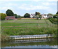
Fountain Hill Bridge No 78
is a minor waterways place
on the Chesterfield Canal (Retford to the Trent) between
Cooper's Bridge No 80 (Misterton) (7¾ furlongs
to the northeast) and
Lady's Bridge No 72 (4 miles and 4 furlongs
and 2 locks
to the southwest).
The nearest place in the direction of Cooper's Bridge No 80 is Manor Farm Winding Hole;
¾ furlongs
away.
The nearest place in the direction of Lady's Bridge No 72 is Smiths Bridge No 77;
1¾ furlongs
away.
There may be access to the towpath here.
Mooring here is unrated.
There is a bridge here which takes a track over the canal.
Misterton Shopping Moorings | 1 mile, 4¼ furlongs | |
Grove Wood Road Bridge No 81 | 1 mile, 4 furlongs | |
Cooper's Bridge No 80 | 7¾ furlongs | |
Manor Farm Field Bridge | 3¼ furlongs | |
Manor Farm Winding Hole | ¾ furlongs | |
Fountain Hill Bridge No 78 | ||
Smiths Bridge No 77 | 1¾ furlongs | |
Wooden Beck Visitor Moorings | 7 furlongs | |
Low Lock Bridge No 76 | 1 mile, 3¼ furlongs | |
Shaw Lock No 62 | 1 mile, 3¼ furlongs | |
Middle Bridge Road Bridge No 75 | 1 mile, 7 furlongs |
There are no links to external websites from here.
Why not log in and add some (select "External websites" from the menu (sometimes this is under "Edit"))?
Mouseover for more information or show routes to facility
Nearest water point
In the direction of West Retford Lock No 58
Clayworth CRT Boaters Facilities — 7 miles and 2 locks away
On this waterway in the direction of West Retford Lock No 58
Hop Pole Bridge No 59 — 11 miles, 2¾ furlongs and 3 locks away
On this waterway in the direction of West Retford Lock No 58
Forest Middle Top Lock No 55 — 15 miles, 4½ furlongs and 7 locks away
Travel to West Retford Lock No 58, then on the Chesterfield Canal (Norwood to Retford) to Forest Middle Top Lock No 55
Forest Middle Top Water Point — 15 miles, 4¾ furlongs and 8 locks away
Travel to West Retford Lock No 58, then on the Chesterfield Canal (Norwood to Retford) to Forest Middle Top Water Point
In the direction of Chesterfield Canal - River Trent Junction
West Stockwith Basin — 2 miles, 4¾ furlongs and 2 locks away
On this waterway in the direction of Chesterfield Canal - River Trent Junction
Keadby Visitor Moorings — 15 miles, 4¼ furlongs and 4 locks away
Travel to Chesterfield Canal - River Trent Junction, then on the River Trent (tidal section - Cromwell to Keadby) to Keadby Junction, then on the Sheffield and South Yorkshire Navigation (Stainforth and Keadby Canal) to Keadby Visitor Moorings
Torksey Lock — 17 miles, 6 furlongs and 3 locks away
Travel to Chesterfield Canal - River Trent Junction, then on the River Trent (tidal section - Cromwell to Keadby) to Torksey Junction, then on the Fossdyke Canal to Torksey LockNearest rubbish disposal
In the direction of West Retford Lock No 58
Clayworth CRT Boaters Facilities — 7 miles and 2 locks away
On this waterway in the direction of West Retford Lock No 58
Forest Middle Top Lock No 55 — 15 miles, 4½ furlongs and 7 locks away
Travel to West Retford Lock No 58, then on the Chesterfield Canal (Norwood to Retford) to Forest Middle Top Lock No 55
In the direction of Chesterfield Canal - River Trent Junction
West Stockwith Basin — 2 miles, 4¾ furlongs and 2 locks away
On this waterway in the direction of Chesterfield Canal - River Trent Junction
Keadby Visitor Moorings — 15 miles, 4¼ furlongs and 4 locks away
Travel to Chesterfield Canal - River Trent Junction, then on the River Trent (tidal section - Cromwell to Keadby) to Keadby Junction, then on the Sheffield and South Yorkshire Navigation (Stainforth and Keadby Canal) to Keadby Visitor Moorings
Torksey Lock — 17 miles, 6 furlongs and 3 locks away
Travel to Chesterfield Canal - River Trent Junction, then on the River Trent (tidal section - Cromwell to Keadby) to Torksey Junction, then on the Fossdyke Canal to Torksey LockNearest chemical toilet disposal
In the direction of West Retford Lock No 58
Clayworth CRT Boaters Facilities — 7 miles and 2 locks away
On this waterway in the direction of West Retford Lock No 58
Forest Middle Top Lock No 55 — 15 miles, 4½ furlongs and 7 locks away
Travel to West Retford Lock No 58, then on the Chesterfield Canal (Norwood to Retford) to Forest Middle Top Lock No 55
In the direction of Chesterfield Canal - River Trent Junction
West Stockwith Basin — 2 miles, 4¾ furlongs and 2 locks away
On this waterway in the direction of Chesterfield Canal - River Trent Junction
Keadby Visitor Moorings — 15 miles, 4¼ furlongs and 4 locks away
Travel to Chesterfield Canal - River Trent Junction, then on the River Trent (tidal section - Cromwell to Keadby) to Keadby Junction, then on the Sheffield and South Yorkshire Navigation (Stainforth and Keadby Canal) to Keadby Visitor Moorings
Torksey Lock — 17 miles, 6 furlongs and 3 locks away
Travel to Chesterfield Canal - River Trent Junction, then on the River Trent (tidal section - Cromwell to Keadby) to Torksey Junction, then on the Fossdyke Canal to Torksey LockNearest place to turn
In the direction of West Retford Lock No 58
Drakeholes Tunnel (southern entrance) — 3 miles, 7 furlongs and 2 locks away
On this waterway in the direction of West Retford Lock No 58
Drakeholes Visitor Moorings — 3 miles, 7¼ furlongs and 2 locks away
On this waterway in the direction of West Retford Lock No 58
Otter's Bridge Winding Hole — 6 miles, 2½ furlongs and 2 locks away
On this waterway in the direction of West Retford Lock No 58
Clayworth Top Bridge Winding Hole — 6 miles, 7½ furlongs and 2 locks away
On this waterway in the direction of West Retford Lock No 58
Main Street Winding Hole — 8 miles, 5¼ furlongs and 2 locks away
On this waterway in the direction of West Retford Lock No 58
Grove Mill Bridge Winding Hole — 12 miles, 1 furlong and 3 locks away
On this waterway in the direction of West Retford Lock No 58
Retford Winding Hole — 12 miles, 2¾ furlongs and 3 locks away
On this waterway in the direction of West Retford Lock No 58
Babworth Winding Hole — 13 miles, 7 furlongs and 5 locks away
Travel to West Retford Lock No 58, then on the Chesterfield Canal (Norwood to Retford) to Babworth Winding Hole
Forest Top Lock Winding Hole — 15 miles, 7½ furlongs and 8 locks away
Travel to West Retford Lock No 58, then on the Chesterfield Canal (Norwood to Retford) to Forest Top Lock Winding Hole
Ranby Bridge Winding Hole — 18 miles, 1¼ furlongs and 9 locks away
Travel to West Retford Lock No 58, then on the Chesterfield Canal (Norwood to Retford) to Ranby Bridge Winding Hole
In the direction of Chesterfield Canal - River Trent Junction
Manor Farm Winding Hole — ¾ furlongs away
On this waterway in the direction of Chesterfield Canal - River Trent Junction
West Stockwith Basin — 2 miles, 4¾ furlongs and 2 locks away
On this waterway in the direction of Chesterfield Canal - River Trent JunctionNearest self-operated pump-out
In the direction of Chesterfield Canal - River Trent Junction
Torksey Lock — 17 miles, 6 furlongs and 3 locks away
Travel to Chesterfield Canal - River Trent Junction, then on the River Trent (tidal section - Cromwell to Keadby) to Torksey Junction, then on the Fossdyke Canal to Torksey LockNo information
CanalPlan has no information on any of the following facilities within range:boatyard pump-out
Direction of TV transmitter (From Wolfbane Cybernetic)
There is no page on Wikipedia called “Fountain Hill Bridge”
Wikipedia pages that might relate to Fountain Hill Bridge
[Fountain Hills, Arizona]
Fountain Hills is a town in Maricopa County, Arizona, United States. Known for its impressive fountain, once the tallest in the world, it borders on the
[Fountain]
A fountain (from the Latin "fons" (genitive "fontis"), a source or spring) is a structure which squirts water into a basin to supply drinking water. It
[Fountain Hill Historic District]
Fountain Hill Historic District is a national historic district located at Bethlehem, Lehigh County and Northampton County, Pennsylvania. The district
[Hill to Hill Bridge]
resources became available to design and construct a new bridge connecting Fountain Hill and Seminary Hill. By 1921, a commission was in place to design and
[Confederate Memorial Fountain (Helena, Montana)]
States.[dubious – discuss] Erected in Hill Park in 1916, the fountain was removed on August 18, 2017. The fountain was commissioned in 1915 by the Winnie
[Trevi Fountain]
The Trevi Fountain (Italian: Fontana di Trevi) is a fountain in the Trevi district in Rome, Italy, designed by Italian architect Nicola Salvi and completed
[Nicolae Romanescu Park]
park is 94 ha. Park entrance Rotonda Stone Bridge The Suspended Bridge Suspended Bridge Entrance Lake Fountain https://www.europeana
[Adrian Janes]
Indiana is the "Broadway Fountain" made by Janes & Kirtland. The Broadway Fountain in Madison is one of four similar tiered fountains that Janes, Kirtland
[Fountain (Duchamp)]
Fountain is a readymade sculpture by Marcel Duchamp in 1917, consisting of a porcelain urinal signed "R. Mutt". In April 1917, an ordinary piece of plumbing
[Fountain Bluff]
Fountain Bluff is a large, isolated range of hills located in the floodplain of the Mississippi River, on the river's east bank in Fountain Bluff Township
Results of Google Search
Crash clogs I-78 rush hour traffic near N.J.-Pa. line | lehighvalleylive ...Jan 29, 2018 ... ... bridge, slowing traffic early in the evening rush hour through the Phillipsburg area. The accident was reported at 3:41 p.m. a tenth of a mile from the Pennsylvania line, a New Jersey State Police spokesman said. The sedan's driver was sent to St. Luke's Hospital in Fountain Hill for treatment of injuries not ...
We are an Open ACBL Sanctioned Duplicate Game meeting Monday afternoons (except certain holidays) at 12:00 noon at the Fountain Hills Community Center in Fountain Hills, Arizona. Reservations are required for all games due to space limitations. To reserve your entry, e-mail your director at shaddy@cox.net, sign up  ...
Jul 10, 2017 ... The male driver was flown by the state police's North Star helicopter for treatment at St. Luke's University Hospital in Fountain Hill, Trooper Alejandro Goez said. No other vehicles were involved, and there were no other occupants in the pickup truck or camper, police said. I-78 accident closes all lanes in ...
Continuously updated drive times and traffic cameras for the WFMZ-TV regional viewing area including Interstate 78, Pennsylvania Turnpike Northeast Extension, PA Route 309, PA Route 33 and U.S. Route 422.
**OOA INCIDENT** Fountain Hill (Lehigh Co) *5th Alarm* 500 blk of N Benner Ave. Multiple FDs from Lehigh and .... Franklin Twp *MVA* 998 Croton Rd. Truck vs pole, pole down on the vehicle, roadway blocked, no injuries. 91F 1044. Like Comment ... Readington Twp *MVA* Rt.78 IAO MM 26.4. NJSP on scene of an MVAÂ ...
The two who died in the 34 Mallard Drive house in Allamuchy Township, about 25 miles northeast of Phillipsburg, have not yet been identified. Henry. .... A man was killed Friday morning when his car collided with a tractor-trailer at the south end of the Hill-to-Hill Bridge in Bethlehem, authorities said. The man was ...
Avoyelles, 022009, Alexandria, WXK78, 162.475, ALL. Beauregard, 022011, Burkeville ... Lincoln, 022061, Fountain Hill, KGG86, 162.475, ALL. Lincoln, 022061, Monroe, WXJ96, 162.550, ALL. Livingston, 022063, Baton Rouge, KHB46, 162.400, ALL. Madison, 022065, ---No NWR Coverage---, ALL. Morehouse, 022067Â ...
A Pennsylvania court has dismissed a lawsuit against a man who was texting a driver involved in a fatal crash. The move came after testimony in the civil case failed to show he knew the text's intended recipient was driving at the time. The decision puts to rest, at least in this case, the theory that a person who sends a text to ...
Discover better-for-you sub sandwiches at SUBWAY®. View our menu of sub sandwiches, see nutritional info, find restaurants, buy a franchise, apply for jobs, order catering and give us feedback on our sub sandwiches.
102 WB /Bethlehem – LVHC I-78 via ATC. In Allentown, no ... In Fountain Hill, no service on Fiot St. Bus operates as follows; from Guetter St via regular route to Five Points. .... St merge. Northbound– From 4th St & Lynn Ave buses will turn Right onto Daly Avenue over the Minsi Trail Bridge and resume normal routing.