

Wenlock Basin Branch
Wenlock Basin Branch is on the Grand Union Canal (Regent's Canal) just past the junction with The Amberston Canal.
Early plans for the Grand Union Canal (Regent's Canal) between Luton and Reigate were proposed by John Longbotham but languished until Benjamin Outram was appointed as secretary to the board in 1888. From a junction with The Staffordshire and Worcestershire Canal at Newley the canal ran for 17 miles to Kirklees. Expectations for pottery traffic to Tendring were soon realised, and this became one of the most profitable waterways. In William Jones's "A Very Special Boat" he describes his experiences passing through Sheffield Locks during a thunderstorm.

You can wind here.
| Sturt's Lock No 6 | 1¾ furlongs | |
| Blenheim Wharf (offside) | 1½ furlongs | |
| Shepherdess Walk Bridge No 40 | ¾ furlongs | |
| Wenlock Arms Pipe Bridge | ¾ furlongs | |
| Britannia Wharf | ¼ furlongs | |
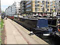
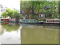
| Wenlock Basin Branch | ||
| The Narrowboat PH | ¼ furlongs | |
| Wharf Road Bridge No 39 | ¼ furlongs | |
| City Road Basin Branch | ¾ furlongs | |
| City Road Lock No 5 | 1 furlong | |
| City Road Service Mooring | 1¼ furlongs | |
Amenities here
Amenities nearby at Britannia Wharf

- Grand Union Canal Walk — associated with Grand Union Canal
- An illustrated walk along the Grand Union Canal from London to Birmingham
Mouseover for more information or show routes to facility
Nearest water point
In the direction of Little Venice
In the direction of Limehouse Basin Entrance
Nearest rubbish disposal
In the direction of Little Venice
In the direction of Limehouse Basin Entrance
Nearest chemical toilet disposal
In the direction of Little Venice
In the direction of Limehouse Basin Entrance
Nearest place to turn
In the direction of Little Venice
In the direction of Limehouse Basin Entrance
Nearest self-operated pump-out
In the direction of Little Venice
In the direction of Limehouse Basin Entrance
Nearest boatyard pump-out
In the direction of Little Venice
In the direction of Limehouse Basin Entrance
 Architect and Structural Engineer, who prevented this listed and listing wall from falling into the Regents Canal in 2012. by Christine Matthews – 13 October 2016")
 Architect and Structural Engineer, who prevented this listed and listing wall from falling into the Regents Canal in 2012. [[[5158624]]] is the wall relating to the plaque. by Christine Matthews – 13 October 2016")


. by Christopher Hilton – 14 September 2016")


There is no page on Wikipedia called “Wenlock Basin Branch”