CanalPlanAC

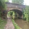
Hadzor Bridge No 33

 
Hadzor WR9 7EX, United Kingdom
Address is taken from a point 372 yards away.
 
Information about the place
Hadzor Bridge No 33 is a minor waterways place on the Worcester and Birmingham Canal (Diglis Basin to King's Norton Junction) between Diglis Basin (Tow-path goes around the first basin) (8 miles and 5 furlongs and 14 locks to the southwest) and Hanbury Junction (Junction with Droitwich Junction Canal (Restored - Opened 1/July/2011). Hanbury Wharf) (3½ furlongs to the northeast).
 
 
The nearest place in the direction of Diglis Basin is Hammonds Bridge No 32; 2¾ furlongs away.
 
The nearest place in the direction of Hanbury Junction is Coffin Bridge No 34; 1½ furlongs away.

There is access (via steps) to the towpath here.

Mooring here is unrated.

There is a bridge here which takes a track over the canal.


Amenities
 
Maps
If you are a user and are logged on, or if you are actively planning a route, a map will be displayed here.
Show on external mapping site: Google | OSM | Bing
 
Photos
 
External websites
There are no links to external websites from here.
Why not log in and add some (select "External websites" from the menu (sometimes this is under "Edit"))?
 
Nearest facilities

Mouseover for more information or show routes to facility

Nearest water point

In the direction of King's Norton Junction

Hanbury Boatyard2½ furlongs away
On this waterway in the direction of King's Norton Junction
Droitwich Spa Marina6¾ furlongs and 3 locks away
Travel to Hanbury Junction, then on the Droitwich Canals (Droitwich Junction Canal) to Droitwich Spa Marina
Stoke Works Water Point2 miles, 7¾ furlongs and 6 locks away
On this waterway in the direction of King's Norton Junction
Netherwich Basin2 miles, 2¼ furlongs and 8 locks away
Travel to Hanbury Junction, then on the Droitwich Canals (Droitwich Junction Canal) to Droitwich Junction, then on the Droitwich Canals (Droitwich Barge Canal) to Netherwich Basin
Holt Lock (Holt Fleet)10 miles, 5½ furlongs and 16 locks away
Travel to Hanbury Junction, then on the Droitwich Canals (Droitwich Junction Canal) to Droitwich Junction, then on the Droitwich Canals (Droitwich Barge Canal) to Hawford Junction, then on the River Severn (main river - Stourport to Worcester) to Holt Lock (Holt Fleet)
Lincomb Lock14 miles, 7¼ furlongs and 17 locks away
Travel to Hanbury Junction, then on the Droitwich Canals (Droitwich Junction Canal) to Droitwich Junction, then on the Droitwich Canals (Droitwich Barge Canal) to Hawford Junction, then on the River Severn (main river - Stourport to Worcester) to Lincomb Lock
Upper Basin Waterpoint16 miles, 2¾ furlongs and 20 locks away
Travel to Hanbury Junction, then on the Droitwich Canals (Droitwich Junction Canal) to Droitwich Junction, then on the Droitwich Canals (Droitwich Barge Canal) to Hawford Junction, then on the River Severn (main river - Stourport to Worcester) to Severn - Stourport Broad Locks Entrance, then on the Staffordshire and Worcestershire Canal (Stourport Basins: Broad Route) to Stourport Upper Basin, then on the Staffordshire and Worcestershire Canal (Stourport Basins: Narrow Route) to Upper Basin Waterpoint
Tardebigge Wharf7 miles and 42 locks away
On this waterway in the direction of King's Norton Junction
Hopwood Visitor Moorings12 miles, 3¾ furlongs and 42 locks away
On this waterway in the direction of King's Norton Junction
King's Norton Water Point15 miles, 5¼ furlongs and 42 locks away
On this waterway in the direction of King's Norton Junction
Yardley Wood Water Point18 miles, 2½ furlongs and 42 locks away
Travel to King's Norton Junction, then on the Stratford-on-Avon Canal (Northern Section) to Yardley Wood Water Point

In the direction of Diglis Basin

Lowesmoor Basin7 miles, 4¾ furlongs and 12 locks away
On this waterway in the direction of Diglis Basin
Diglis Services8 miles, 4½ furlongs and 14 locks away
On this waterway in the direction of Diglis Basin
Diglis Locks9 miles, ½ furlongs and 16 locks away
Travel to Diglis Basin, then on the Worcester and Birmingham Canal (Diglis Junction to Diglis Basin) to Diglis Junction, then on the River Severn (main river - Worcester to Gloucester) to Diglis Locks
Worcester Trip Boat Moorings9 miles, 4¼ furlongs and 16 locks away
Travel to Diglis Basin, then on the Worcester and Birmingham Canal (Diglis Junction to Diglis Basin) to Diglis Junction, then on the River Severn (main river - Stourport to Worcester) to Worcester Trip Boat Moorings

Nearest rubbish disposal

In the direction of King's Norton Junction

Droitwich Spa Marina6¾ furlongs and 3 locks away
Travel to Hanbury Junction, then on the Droitwich Canals (Droitwich Junction Canal) to Droitwich Spa Marina
Stoke Bottom Lock No 233 miles, 5½ furlongs and 6 locks away
On this waterway in the direction of King's Norton Junction
Netherwich Basin2 miles, 2¼ furlongs and 8 locks away
Travel to Hanbury Junction, then on the Droitwich Canals (Droitwich Junction Canal) to Droitwich Junction, then on the Droitwich Canals (Droitwich Barge Canal) to Netherwich Basin
Upper Basin Waterpoint16 miles, 2¾ furlongs and 20 locks away
Travel to Hanbury Junction, then on the Droitwich Canals (Droitwich Junction Canal) to Droitwich Junction, then on the Droitwich Canals (Droitwich Barge Canal) to Hawford Junction, then on the River Severn (main river - Stourport to Worcester) to Severn - Stourport Broad Locks Entrance, then on the Staffordshire and Worcestershire Canal (Stourport Basins: Broad Route) to Stourport Upper Basin, then on the Staffordshire and Worcestershire Canal (Stourport Basins: Narrow Route) to Upper Basin Waterpoint
Tardebigge Wharf7 miles and 42 locks away
On this waterway in the direction of King's Norton Junction

In the direction of Diglis Basin

Lowesmoor Basin7 miles, 4¾ furlongs and 12 locks away
On this waterway in the direction of Diglis Basin
Diglis Basin8 miles, 5 furlongs and 14 locks away
On this waterway in the direction of Diglis Basin
Sabrina Footbridge9 miles, 6 furlongs and 16 locks away
Travel to Diglis Basin, then on the Worcester and Birmingham Canal (Diglis Junction to Diglis Basin) to Diglis Junction, then on the River Severn (main river - Stourport to Worcester) to Sabrina Footbridge

Nearest chemical toilet disposal

In the direction of King's Norton Junction

Droitwich Spa Marina6¾ furlongs and 3 locks away
Travel to Hanbury Junction, then on the Droitwich Canals (Droitwich Junction Canal) to Droitwich Spa Marina
Stoke Bottom Lock No 233 miles, 5½ furlongs and 6 locks away
On this waterway in the direction of King's Norton Junction
Stourport Marina15 miles, 2¾ furlongs and 18 locks away
Travel to Hanbury Junction, then on the Droitwich Canals (Droitwich Junction Canal) to Droitwich Junction, then on the Droitwich Canals (Droitwich Barge Canal) to Hawford Junction, then on the River Severn (main river - Stourport to Worcester) to Stourport Marina
Upper Basin Waterpoint16 miles, 2¾ furlongs and 20 locks away
Travel to Hanbury Junction, then on the Droitwich Canals (Droitwich Junction Canal) to Droitwich Junction, then on the Droitwich Canals (Droitwich Barge Canal) to Hawford Junction, then on the River Severn (main river - Stourport to Worcester) to Severn - Stourport Broad Locks Entrance, then on the Staffordshire and Worcestershire Canal (Stourport Basins: Broad Route) to Stourport Upper Basin, then on the Staffordshire and Worcestershire Canal (Stourport Basins: Narrow Route) to Upper Basin Waterpoint
Tardebigge Wharf7 miles and 42 locks away
On this waterway in the direction of King's Norton Junction

In the direction of Diglis Basin

Lowesmoor Basin7 miles, 4¾ furlongs and 12 locks away
On this waterway in the direction of Diglis Basin
Diglis Services8 miles, 4½ furlongs and 14 locks away
On this waterway in the direction of Diglis Basin

Nearest place to turn

In the direction of King's Norton Junction

Hanbury Boatyard2½ furlongs away
On this waterway in the direction of King's Norton Junction
Hanbury Junction3½ furlongs away
On this waterway in the direction of King's Norton Junction
Hanbury Junction Winding Hole4¾ furlongs away
On this waterway in the direction of King's Norton Junction
Droitwich Spa Marina6¾ furlongs and 3 locks away
Travel to Hanbury Junction, then on the Droitwich Canals (Droitwich Junction Canal) to Droitwich Spa Marina
Astwood Winding Hole2 miles, 1 furlong and 2 locks away
On this waterway in the direction of King's Norton Junction
Lock No 6 Winding Hole1 mile, 1¾ furlongs and 5 locks away
Travel to Hanbury Junction, then on the Droitwich Canals (Droitwich Junction Canal) to Lock No 6 Winding Hole
Droitwich Town Wharf2 miles, ¼ furlongs and 8 locks away
Travel to Hanbury Junction, then on the Droitwich Canals (Droitwich Junction Canal) to Droitwich Junction, then on the Droitwich Canals (Droitwich Barge Canal) to Droitwich Town Wharf
Netherwich Basin2 miles, 2¼ furlongs and 8 locks away
Travel to Hanbury Junction, then on the Droitwich Canals (Droitwich Junction Canal) to Droitwich Junction, then on the Droitwich Canals (Droitwich Barge Canal) to Netherwich Basin
Winding Hole (east of Salwarpe Road Bridge)2 miles, 3¾ furlongs and 8 locks away
Travel to Hanbury Junction, then on the Droitwich Canals (Droitwich Junction Canal) to Droitwich Junction, then on the Droitwich Canals (Droitwich Barge Canal) to Winding Hole (east of Salwarpe Road Bridge)
Stoke Wharf3 miles, 6 furlongs and 7 locks away
On this waterway in the direction of King's Norton Junction
Ladywood Top Lock Winding Hole5 miles, ¼ furlongs and 8 locks away
Travel to Hanbury Junction, then on the Droitwich Canals (Droitwich Junction Canal) to Droitwich Junction, then on the Droitwich Canals (Droitwich Barge Canal) to Ladywood Top Lock Winding Hole
Bevere Lock Weir Entrance8 miles and 16 locks away
Travel to Hanbury Junction, then on the Droitwich Canals (Droitwich Junction Canal) to Droitwich Junction, then on the Droitwich Canals (Droitwich Barge Canal) to Hawford Junction, then on the River Severn (main river - Stourport to Worcester) to Bevere Lock Weir Entrance
Bevere Lock Weir Exit8 miles, 2½ furlongs and 17 locks away
Travel to Hanbury Junction, then on the Droitwich Canals (Droitwich Junction Canal) to Droitwich Junction, then on the Droitwich Canals (Droitwich Barge Canal) to Hawford Junction, then on the River Severn (main river - Stourport to Worcester) to Bevere Lock Weir Exit

In the direction of Diglis Basin

Dunhampstead Boatyard1 mile, 3¾ furlongs away
On this waterway in the direction of Diglis Basin
Dunhampstead Winding Hole1 mile, 6 furlongs away
On this waterway in the direction of Diglis Basin
Tibberton Winding Hole2 miles, 5½ furlongs away
On this waterway in the direction of Diglis Basin
Bilford Locks Winding Hole6 miles, 3 furlongs and 9 locks away
On this waterway in the direction of Diglis Basin
Lowesmoor Basin7 miles, 4¾ furlongs and 12 locks away
On this waterway in the direction of Diglis Basin
Diglis Junction8 miles, 6¼ furlongs and 16 locks away
Travel to Diglis Basin, then on the Worcester and Birmingham Canal (Diglis Junction to Diglis Basin) to Diglis Junction
Diglis Locks Weir Exit9 miles, 1¼ furlongs and 17 locks away
Travel to Diglis Basin, then on the Worcester and Birmingham Canal (Diglis Junction to Diglis Basin) to Diglis Junction, then on the River Severn (main river - Worcester to Gloucester) to Diglis Locks Weir Exit

Nearest self-operated pump-out

In the direction of King's Norton Junction

Droitwich Spa Marina6¾ furlongs and 3 locks away
Travel to Hanbury Junction, then on the Droitwich Canals (Droitwich Junction Canal) to Droitwich Spa Marina

In the direction of Diglis Basin

Diglis Services8 miles, 4½ furlongs and 14 locks away
On this waterway in the direction of Diglis Basin

Nearest boatyard pump-out

In the direction of King's Norton Junction

Hanbury Boatyard2½ furlongs away
On this waterway in the direction of King's Norton Junction
Stourport Marina15 miles, 2¾ furlongs and 18 locks away
Travel to Hanbury Junction, then on the Droitwich Canals (Droitwich Junction Canal) to Droitwich Junction, then on the Droitwich Canals (Droitwich Barge Canal) to Hawford Junction, then on the River Severn (main river - Stourport to Worcester) to Stourport Marina
Stourport Upper Basin16 miles, 2½ furlongs and 20 locks away
Travel to Hanbury Junction, then on the Droitwich Canals (Droitwich Junction Canal) to Droitwich Junction, then on the Droitwich Canals (Droitwich Barge Canal) to Hawford Junction, then on the River Severn (main river - Stourport to Worcester) to Severn - Stourport Broad Locks Entrance, then on the Staffordshire and Worcestershire Canal (Stourport Basins: Broad Route) to Stourport Upper Basin
Upper Staircase Lock Landing Pontoon16 miles, 3¼ furlongs and 20 locks away
Travel to Hanbury Junction, then on the Droitwich Canals (Droitwich Junction Canal) to Droitwich Junction, then on the Droitwich Canals (Droitwich Barge Canal) to Hawford Junction, then on the River Severn (main river - Stourport to Worcester) to Severn - Stourport Broad Locks Entrance, then on the Staffordshire and Worcestershire Canal (Stourport Basins: Broad Route) to Stourport Upper Basin, then on the Staffordshire and Worcestershire Canal (Stourport Basins: Narrow Route) to Upper Staircase Lock Landing Pontoon

In the direction of Diglis Basin

Dunhampstead Boatyard1 mile, 3¾ furlongs away
On this waterway in the direction of Diglis Basin
Lowesmoor Basin7 miles, 4¾ furlongs and 12 locks away
On this waterway in the direction of Diglis Basin
Direction of TV transmitter (From Wolfbane Cybernetic)
 
 
Geograph
 
Wikipedia

There is no page on Wikipedia called “Hadzor Bridge”

Wikipedia pages that might relate to Hadzor Bridge
[List of places in Worcestershire] Hill, Grimley, Guarlford, Guller's End Habberley, Hackmans Gate, Hadley, Hadzor, Hagley, Hales Park, Hall Flat, Hallow, Hallow Heath, Ham Green, Hampton [List of United Kingdom locations: Ha-Ham] Hady Derbyshire 53°13′N 1°25′W / 53.22°N 01.41°W / 53.22; -01.41 SK3970 Hadzor Worcestershire 52°15′N 2°08′W / 52.25°N 02.13°W / 52.25; -02.13 SO9162 [Ab Lench] Heath Fladbury Flyford Flavell Grafton Flyford Grafton Great Comberton Hadzor Hampton Hanbury Hartlebury Harvington Hatfield Hawbridge Hawford Himbleton [Bredicot] Heath Fladbury Flyford Flavell Grafton Flyford Grafton Great Comberton Hadzor Hampton Hanbury Hartlebury Harvington Hatfield Hawbridge Hawford Himbleton [Church Lench] Heath Fladbury Flyford Flavell Grafton Flyford Grafton Great Comberton Hadzor Hampton Hanbury Hartlebury Harvington Hatfield Hawbridge Hawford Himbleton [List of poor law unions in England] (part), Crowle, Crutch, Dodderhill, Doverdale, Elmbridge, Elmley Lovett, Hadzor, Hampton Lovett, Hanbury, Hartlebury, Himbleton, Hindlip, Huddington, Martin
 
Google

Results of Google Search

Hadzor Bridge on the Worcester and... © Roger Kidd cc-by-sa/2.0 ...
Dec 29, 2010 ... Bridge No 33 is a farm accommodation bridge with no public right of way across it . It has been a listed building since 1975. The Worcester and ...
Listed Buildings in Hadzor, Wychavon, Worcestershire
Listed Buildings in Hadzor, Wychavon, Worcestershire at British Listed Buildings. ... Hadzor, Wychavon, Worcestershire, WR9; II Hadzor Bridge No 33. Hadzor ...
Coffin Bridge No 34, Hadzor, Worcestershire
Aug 26, 1975 ... Coffin Bridge No 34 is a Grade II listed building in Hadzor, Worcestershire, England. See why it was listed, view it on a map, see visitor ...
Worcester and Birmingham Canal - Canal Cycling Section
(1 disused railway); The Mailbox (Birmingham); Salvage Turn Bridge (New Bridge ... No TowPath; Wast Hill Tunnel South Portal; Lea End Lane Bridge ( Bridge 69) ... Hanbury Boatyard; Coffin bridge (34); Hadzor Bridge (33); Hammonds Bridge ...
Template:Trent and Mersey Canal map - Wikipedia
Dutton Stop Lock No76. 213. Lodge Lane Bridge ... 33. B5017 Shobnall Road Bridge. Dallow Lane Lock No 7. Horninglow Basin. 32. A511 Horninglow Bridge.
Worcester and Birmingham Canal (King's Norton to Worcester) DAY ...
Mar 11, 2010 ... Hadzor Bridge No 33. 8.0 - 42. Hammonds Bridge No 32. 8.4 - 42. Shernal Green Bridge No 31. 8.5 - 42. Shernal Green Gas Pipe Bridge No ...
Grand Union Canal, Saltisford via River Avon Aqueduct to Splash ...
Canal Bridge no:50b - The Grand Union Canal in England. Bridge no.50b. Saltisford ... Railway bridge 33a going over The Grand Union Canal. Bridge 33a.
Culvert approximately 500m north of Bridge 33, Higherfold Bridge ...
Oct 2, 2019 ... The end date of the closure is not affected. Description. A closure is required to carry out significant culvert and washwall repairs.
Old Wye Bridge (Chepstow) - 2020 All You Need to Know BEFORE ...
Sorry, there are no tours or activities available to book online for the date(s) you selected. Please choose a ... Contact. Old Town Bridge, Bridge St, Tutshill, Chepstow NP16 5HF Wales. Website. Best nearby. 33Restaurantswithin 0.75 miles.