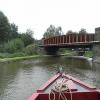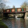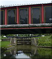
Lower King's Road Bridge

There is a bridge here which takes a minor road over the canal.
| Park Street Footbridge No 140A | 2¾ furlongs | |
| Berkhamsted Visitor Moorings | 2 furlongs | |
| Broadwater Pedestrian Bridge | 1¼ furlongs | |
| Berkhamsted Services | 1 furlong | |
| Berkhamsted Top Lock No 53 | ¼ furlongs | |
| Lower King's Road Bridge | ||
| The Moor Park | ¾ furlongs | |
| Berkhamsted Bridge No 141 | 1½ furlongs | |
| Milepost 61 | 1½ furlongs | |
| The Crystal Palace PH | 1¾ furlongs | |
| Berkhamsted Middle Lock No 54 | 3 furlongs | |
- Grand Union Canal Walk — associated with Grand Union Canal
- An illustrated walk along the Grand Union Canal from London to Birmingham
- THE GRAND JUNCTION CANAL - a highway laid with water. — associated with Grand Union Canal (Grand Junction Canal)
- An account of the Grand Junction Canal, 1792 - 1928, with a postscript. By Ian Petticrew and Wendy Austin.
- The Boatmen's Institute in Brentford — associated with Grand Union Canal (Grand Junction Canal - Main Line - Gayton to Brentford)
Mouseover for more information or show routes to facility
Nearest water point
In the direction of Gayton Junction
In the direction of Thames - Grand Union Canal Junction
Nearest rubbish disposal
In the direction of Gayton Junction
In the direction of Thames - Grand Union Canal Junction
Nearest chemical toilet disposal
In the direction of Gayton Junction
In the direction of Thames - Grand Union Canal Junction
Nearest place to turn
In the direction of Thames - Grand Union Canal Junction
In the direction of Gayton Junction
Nearest self-operated pump-out
In the direction of Thames - Grand Union Canal Junction
In the direction of Gayton Junction
Nearest boatyard pump-out
In the direction of Thames - Grand Union Canal Junction
In the direction of Gayton Junction
Wikipedia has a page about Lower King's Road Bridge
Lower King is a town in the Great Southern region of Western Australia. It is located 385 km (239 mi) south-east of Perth; the closest populated town is Albany.
Located along the lower reaches of the King River on the western shore of Oyster Harbour, both the town and the river were named after Captain Philip Parker King, who first visited the area in 1818 aboard Mermaid.
The area around Lower King was a known haunt for sealers in 1831; it was settled in the 1830s with the townsite not being gazetted until 1959.
It had a population of 1604 in 2006, which increased to 1738 in 2011.


![Grand Union Canal: Lower Kings Road Bridge, Berkhamsted. Travel along the Grand Union Canal.North: [[1213263]]. You are Here.South: [[1524884]]. by Chris Reynolds – 20 March 2009](https://s2.geograph.org.uk/geophotos/01/52/48/1524874_68c02c04_120x120.jpg)
![Lower King's Road Bridge. One of the brightly painted canal bridges celebrating Berkhamsted's industrial past. [[7812032]] shows the reverse view, from the bridge. From the left, the panels read](https://s3.geograph.org.uk/geophotos/07/81/20/7812035_c8e4e8d3_120x120.jpg)


![Grand Union Canal, Berkhamsted in 1970. Taken from under the bridge carrying Lower Kings Road over the canal, showing the water emptying from the lock. Not long after, I took [[1754803]] showing the boat much lower in the water. by John Baker – 16 May 1970](https://s1.geograph.org.uk/geophotos/02/66/47/2664705_24fd780c_120x120.jpg)


![Derailment at Berkhamsted Station (1). The aftermath of a freight train derailment in the station.Here we are looking north of west, away from London, at the two Fast lines. On the left is the Down Fast, and closest to the camera is the Up Fast, on which the freight train was travelling. The S-bend mentioned in the Shared Description below can be clearly seen. It looks fairly mild here, but if you are driving a train at 70mph it may seem different!For further photos of the incident, see [[7737922]], [[7371896]], [[7737933]] and [[7737940]].The Slow (commuter) lines run between the platforms visible on the far right. by David Purchase – 13 June 1968](https://s1.geograph.org.uk/geophotos/07/37/18/7371889_74212444_120x120.jpg)


