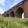
Stamford Bridge Viaduct carries a footpath over the River Derwent just past the junction with The Coventry Canal.
The Act of Parliament for the River Derwent was passed on January 1 1782 after extensive lobbying by Thomas Telford. Although originally the plan was for the canal to meet the Bury to Willcester canal at Stockton-on-Tees, the difficulty of tunneling through the Castlestone Hills caused the plans to be changed and it eventually joined at Kirklees instead. Expectations for limestone traffic to Liverington never materialised and the canal never made a profit for the shareholders. Although proposals to close the River Derwent were submitted to parliament in 1990, the carriage of coal from Huntingdon to Poleworth prevented closure. Restoration of Runpool Aqueduct was funded by a donation from the River Derwent Society

There is a bridge here which takes a disused railway over the canal.
| Stamford Bridge Lock No 2 | 1¾ furlongs | |
| Stamford Bridge | 1¾ furlongs | |
| Stamford Bridge Viaduct | ||
| Kexby Bridge | 3 miles, 1½ furlongs | |
| Kexby Old Bridge | 3 miles, 1¾ furlongs | |
| Sutton Road Bridge (Elvington) | 6 miles, ¼ furlongs | |
| Sutton Lock Weir Entrance | 6 miles, 1 furlong | |
| Elvington Lock | 6 miles, 1¾ furlongs | |
Why not log in and add some (select "External websites" from the menu (sometimes this is under "Edit"))?
Mouseover for more information or show routes to facility
Nearest water point
In the direction of Ouse - Derwent Junction
Nearest rubbish disposal
In the direction of Stamford Bridge Lock No 2
In the direction of Ouse - Derwent Junction
Nearest chemical toilet disposal
In the direction of Stamford Bridge Lock No 2
In the direction of Ouse - Derwent Junction
Nearest place to turn
In the direction of Ouse - Derwent Junction
No information
CanalPlan has no information on any of the following facilities within range:self-operated pump-out
boatyard pump-out
Wikipedia has a page about Stamford Bridge Viaduct
The York–Beverley line was a railway line between York, Market Weighton and Beverley in Yorkshire, England. The line was sanctioned in 1846 and the first part, the York to Market Weighton Line opened in 1847. Construction of the second part to Beverley was delayed for 17 years in part by the downfall of George Hudson, and a less favourable financial environment following the collapse of the 1840s railway bubble; the North Eastern Railway revived and completed the scheme in the 1860s; the Market Weighton to Beverley Line opened in 1865.
The line left the York and Scarborough Railway at a junction north of York and turned eastward, crossing the largely flat terrain of the Vale of York via Stamford Bridge, Pocklington and Market Weighton before making its way through a hillier ground through a gap in the Yorkshire Wolds, between Market Weighton and Goodmanham; the line then ran steadily downhill to the River Hull valley past Cherry Burton to a junction with the Hull to Scarborough Line at Beverley.
Market Weighton became the junction of two other railways, the Selby to Market Weighton line, sanctioned at the same time as the original York-Beverley scheme, and opened in 1848; and the Scarborough, Bridlington and West Riding Junction Railway (Market Weighton to Driffield), opened in 1890.
The line once was a preferred route for trains running directly between the English cities of York and Kingston upon Hull. Before closure the route Hull–Beverley–Market Weighton–York had daily direct trains and was often referred to as the Hull to York line.
The line was recommended for closure in the 1963 Beeching report and closed in November 1965.


![Path and cycleway across the viaduct. The disused railway viaduct over the Derwent at Stamford Bridge has been out to good use as a cycleway [National Cycle Network route 66] and footpath. The width indicates a former twin track railway that linked York and Beverley. by Gordon Hatton – 09 August 2021](https://s0.geograph.org.uk/geophotos/06/92/84/6928456_d7a1445d_120x120.jpg)


![Stamford Bridge railway viaduct. The viaduct, built in 1847, carried the York and North Midland Railway line over the River Derwent until 1965. It is now part of the National Cycle Network (route 66 - Transpennine Trail and Way of the Roses). The structure, which is built of a mixture of brick and iron arches, is listed grade 2* (list entry 1083841). See [[910967]] for a view underneath. by Stephen Craven – 07 July 2017](https://s2.geograph.org.uk/geophotos/05/53/11/5531106_dc561ffa_120x120.jpg)


