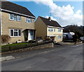
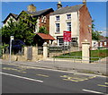
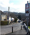
Strachan's Close Slipway
Strachans Close, Stroud GL5 3EB, United Kingdom
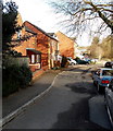
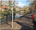
Strachan's Close Slipway is on the Cotswold Canals (Stroudwater Navigation - Un-navigable Section) near to Conway.
Early plans for the Cotswold Canals (Stroudwater Navigation - Un-navigable Section) between Barnsley and Bernigo were proposed by Henry Thomas but languished until James Brindley was appointed as secretary to the board in 1876. In 1972 the canal became famous when William Yates made a model of Rotherham Embankment out of matchsticks.

Strachan's Close Slipway
is a minor waterways place
on the Cotswold Canals (Stroudwater Navigation - Un-navigable Section) between
Saul Junction Marina (6 miles and 3½ furlongs
and 12 locks
to the west) and
Site of Entrance to Wallbridge Basin (The junction between the Stroudwater Navigation and the Thames & Severn Canal.) (2½ furlongs
to the east).
The nearest place in the direction of Saul Junction Marina is Chestnut Lane Bridge (Built 2012);
¼ furlongs
away.
The nearest place in the direction of Site of Entrance to Wallbridge Basin is Lodgemore Lane Bridge (Built 2016);
1¼ furlongs
away.
Mooring here is unrated.
| Dudbridge Lock No 2 | 2½ furlongs | |
| Ruscombe Brook Feeder | 2 furlongs | |
| Foundry Lock No 1 | 1¾ furlongs | |
| Dudbridge Locks Bypass Channel | 1¾ furlongs | |
| Chestnut Lane Bridge | ¼ furlongs | |
| Strachan's Close Slipway | ||
| Lodgemore Lane Bridge | 1¼ furlongs | |
| Painswick Stream joins Stroudwater Navigation | 1½ furlongs | |
| Site of Entrance to Wallbridge Basin | 2½ furlongs | |
There are no links to external websites from here.
Why not log in and add some (select "External websites" from the menu (sometimes this is under "Edit"))?
Why not log in and add some (select "External websites" from the menu (sometimes this is under "Edit"))?
Mouseover for more information or show routes to facility
Nearest water point
In the direction of Walk Bridge
Saul Junction Marina — 6 miles, 3½ furlongs and 12 locks away
Travel to Walk Bridge, then on the Cotswold Canals (Stroudwater Navigation - Navigable Section) to Saul Junction Marina
Saul Junction Winding Hole — 6 miles, 4¾ furlongs and 12 locks away
Travel to Walk Bridge, then on the Cotswold Canals (Stroudwater Navigation - Navigable Section) to Saul Junction, then on the Gloucester and Sharpness Canal to Saul Junction Winding Hole
Cotswold Canals Trust Visitor Centre - Saul Junction — 6 miles, 5¾ furlongs and 12 locks away
Travel to Walk Bridge, then on the Cotswold Canals (Stroudwater Navigation - Navigable Section) to Saul Junction, then on the Gloucester and Sharpness Canal to Cotswold Canals Trust Visitor Centre - Saul Junction
Fretherne Bridge — 7 miles, 2¾ furlongs and 12 locks away
Travel to Walk Bridge, then on the Cotswold Canals (Stroudwater Navigation - Navigable Section) to Saul Junction, then on the Gloucester and Sharpness Canal to Fretherne Bridge
Splatt Bridge — 8 miles, 3½ furlongs and 12 locks away
Travel to Walk Bridge, then on the Cotswold Canals (Stroudwater Navigation - Navigable Section) to Saul Junction, then on the Gloucester and Sharpness Canal to Splatt Bridge
Patch Bridge — 10 miles, 2½ furlongs and 12 locks away
Travel to Walk Bridge, then on the Cotswold Canals (Stroudwater Navigation - Navigable Section) to Saul Junction, then on the Gloucester and Sharpness Canal to Patch Bridge
Sellars Bridge — 10 miles, 2½ furlongs and 12 locks away
Travel to Walk Bridge, then on the Cotswold Canals (Stroudwater Navigation - Navigable Section) to Saul Junction, then on the Gloucester and Sharpness Canal to Sellars Bridge
Purton Lower Bridge — 12 miles, 6 furlongs and 12 locks away
Travel to Walk Bridge, then on the Cotswold Canals (Stroudwater Navigation - Navigable Section) to Saul Junction, then on the Gloucester and Sharpness Canal to Purton Lower Bridge
Llanthony Pontoons — 14 miles, ½ furlongs and 12 locks away
Travel to Walk Bridge, then on the Cotswold Canals (Stroudwater Navigation - Navigable Section) to Saul Junction, then on the Gloucester and Sharpness Canal to Llanthony Pontoons
Llanthony Road Bridge — 14 miles, 1¼ furlongs and 12 locks away
Travel to Walk Bridge, then on the Cotswold Canals (Stroudwater Navigation - Navigable Section) to Saul Junction, then on the Gloucester and Sharpness Canal to Llanthony Road Bridge
Gloucester Waterways Museum Arm — 14 miles, 1¾ furlongs and 12 locks away
Travel to Walk Bridge, then on the Cotswold Canals (Stroudwater Navigation - Navigable Section) to Saul Junction, then on the Gloucester and Sharpness Canal to Gloucester Waterways Museum Arm
Gloucester Dock Lock — 14 miles, 2¾ furlongs and 12 locks away
Travel to Walk Bridge, then on the Cotswold Canals (Stroudwater Navigation - Navigable Section) to Saul Junction, then on the Gloucester and Sharpness Canal to Gloucester Dock LockNearest rubbish disposal
In the direction of Walk Bridge
Saul Junction Marina — 6 miles, 3½ furlongs and 12 locks away
Travel to Walk Bridge, then on the Cotswold Canals (Stroudwater Navigation - Navigable Section) to Saul Junction Marina
Saul Junction Winding Hole — 6 miles, 4¾ furlongs and 12 locks away
Travel to Walk Bridge, then on the Cotswold Canals (Stroudwater Navigation - Navigable Section) to Saul Junction, then on the Gloucester and Sharpness Canal to Saul Junction Winding Hole
Fretherne Bridge — 7 miles, 2¾ furlongs and 12 locks away
Travel to Walk Bridge, then on the Cotswold Canals (Stroudwater Navigation - Navigable Section) to Saul Junction, then on the Gloucester and Sharpness Canal to Fretherne Bridge
Parkend Bridge — 8 miles, 1¼ furlongs and 12 locks away
Travel to Walk Bridge, then on the Cotswold Canals (Stroudwater Navigation - Navigable Section) to Saul Junction, then on the Gloucester and Sharpness Canal to Parkend Bridge
Splatt Bridge — 8 miles, 3½ furlongs and 12 locks away
Travel to Walk Bridge, then on the Cotswold Canals (Stroudwater Navigation - Navigable Section) to Saul Junction, then on the Gloucester and Sharpness Canal to Splatt Bridge
Patch Bridge — 10 miles, 2½ furlongs and 12 locks away
Travel to Walk Bridge, then on the Cotswold Canals (Stroudwater Navigation - Navigable Section) to Saul Junction, then on the Gloucester and Sharpness Canal to Patch Bridge
Sellars Bridge — 10 miles, 2½ furlongs and 12 locks away
Travel to Walk Bridge, then on the Cotswold Canals (Stroudwater Navigation - Navigable Section) to Saul Junction, then on the Gloucester and Sharpness Canal to Sellars Bridge
Purton Lower Bridge — 12 miles, 6 furlongs and 12 locks away
Travel to Walk Bridge, then on the Cotswold Canals (Stroudwater Navigation - Navigable Section) to Saul Junction, then on the Gloucester and Sharpness Canal to Purton Lower Bridge
Sharpness Barge Arm — 14 miles, 1¼ furlongs and 12 locks away
Travel to Walk Bridge, then on the Cotswold Canals (Stroudwater Navigation - Navigable Section) to Saul Junction, then on the Gloucester and Sharpness Canal to Sharpness Barge Arm
Llanthony Road Bridge — 14 miles, 1¼ furlongs and 12 locks away
Travel to Walk Bridge, then on the Cotswold Canals (Stroudwater Navigation - Navigable Section) to Saul Junction, then on the Gloucester and Sharpness Canal to Llanthony Road BridgeNearest chemical toilet disposal
In the direction of Walk Bridge
Saul Junction Marina — 6 miles, 3½ furlongs and 12 locks away
Travel to Walk Bridge, then on the Cotswold Canals (Stroudwater Navigation - Navigable Section) to Saul Junction Marina
Cotswold Canals Trust Visitor Centre - Saul Junction — 6 miles, 5¾ furlongs and 12 locks away
Travel to Walk Bridge, then on the Cotswold Canals (Stroudwater Navigation - Navigable Section) to Saul Junction, then on the Gloucester and Sharpness Canal to Cotswold Canals Trust Visitor Centre - Saul Junction
Sharpness Barge Arm — 14 miles, 1¼ furlongs and 12 locks away
Travel to Walk Bridge, then on the Cotswold Canals (Stroudwater Navigation - Navigable Section) to Saul Junction, then on the Gloucester and Sharpness Canal to Sharpness Barge Arm
Llanthony Road Bridge — 14 miles, 1¼ furlongs and 12 locks away
Travel to Walk Bridge, then on the Cotswold Canals (Stroudwater Navigation - Navigable Section) to Saul Junction, then on the Gloucester and Sharpness Canal to Llanthony Road BridgeNearest place to turn
In the direction of Walk Bridge
Ryeford Winding Hole — 1 mile, 6 furlongs and 4 locks away
On this waterway in the direction of Walk Bridge
The Ocean — 2 miles, 5¾ furlongs and 4 locks away
On this waterway in the direction of Walk Bridge
Saul Junction Winding Hole — 6 miles, 4¾ furlongs and 12 locks away
Travel to Walk Bridge, then on the Cotswold Canals (Stroudwater Navigation - Navigable Section) to Saul Junction, then on the Gloucester and Sharpness Canal to Saul Junction Winding Hole
Pegthorne Bridge Winding Hole — 7 miles, 1½ furlongs and 12 locks away
Travel to Walk Bridge, then on the Cotswold Canals (Stroudwater Navigation - Navigable Section) to Saul Junction, then on the Gloucester and Sharpness Canal to Pegthorne Bridge Winding Hole
Quedgeley Oil Depot — 10 miles, 4 furlongs and 12 locks away
Travel to Walk Bridge, then on the Cotswold Canals (Stroudwater Navigation - Navigable Section) to Saul Junction, then on the Gloucester and Sharpness Canal to Quedgeley Oil Depot
Monk Meadow Dock — 13 miles, 6¼ furlongs and 12 locks away
Travel to Walk Bridge, then on the Cotswold Canals (Stroudwater Navigation - Navigable Section) to Saul Junction, then on the Gloucester and Sharpness Canal to Monk Meadow Dock
Sharpness Barge Arm — 14 miles, 1¼ furlongs and 12 locks away
Travel to Walk Bridge, then on the Cotswold Canals (Stroudwater Navigation - Navigable Section) to Saul Junction, then on the Gloucester and Sharpness Canal to Sharpness Barge Arm
Gloucester Docks — 14 miles, 2 furlongs and 12 locks away
Travel to Walk Bridge, then on the Cotswold Canals (Stroudwater Navigation - Navigable Section) to Saul Junction, then on the Gloucester and Sharpness Canal to Gloucester Docks
Waterways Office (South Wales and Severn Waterways) - Canal & River Trust — 14 miles, 2½ furlongs and 12 locks away
Travel to Walk Bridge, then on the Cotswold Canals (Stroudwater Navigation - Navigable Section) to Saul Junction, then on the Gloucester and Sharpness Canal to Waterways Office (South Wales and Severn Waterways) - Canal & River Trust
Gloucester / Sharpness - Severn Junction — 14 miles, 3 furlongs and 13 locks away
Travel to Walk Bridge, then on the Cotswold Canals (Stroudwater Navigation - Navigable Section) to Saul Junction, then on the Gloucester and Sharpness Canal to Gloucester / Sharpness - Severn Junction
Upper Parting Junction — 16 miles, 7¾ furlongs and 13 locks away
Travel to Walk Bridge, then on the Cotswold Canals (Stroudwater Navigation - Navigable Section) to Saul Junction, then on the Gloucester and Sharpness Canal to Gloucester / Sharpness - Severn Junction, then on the River Severn (main river - Worcester to Gloucester) to Upper Parting Junction
Over Winding Hole — 16 miles, 2¾ furlongs and 14 locks away
Travel to Walk Bridge, then on the Cotswold Canals (Stroudwater Navigation - Navigable Section) to Saul Junction, then on the Gloucester and Sharpness Canal to Gloucester / Sharpness - Severn Junction, then on the River Severn (old river navigation) to Lower Parting, then on the River Severn (Maisemore Channel - Southern Section) to Over Junction, then on the Hereford and Gloucester Canal to Over Winding Hole
In the direction of Site of Entrance to Wallbridge Basin
Brimscombe Port — 3 miles, ½ furlongs and 7 locks away
Travel to Site of Entrance to Wallbridge Basin, then on the Cotswold Canals (Thames and Severn Canal - Wide section) to Brimscombe PortNearest self-operated pump-out
In the direction of Walk Bridge
Cotswold Canals Trust Visitor Centre - Saul Junction — 6 miles, 5¾ furlongs and 12 locks away
Travel to Walk Bridge, then on the Cotswold Canals (Stroudwater Navigation - Navigable Section) to Saul Junction, then on the Gloucester and Sharpness Canal to Cotswold Canals Trust Visitor Centre - Saul Junction
Purton Lower Bridge — 12 miles, 6 furlongs and 12 locks away
Travel to Walk Bridge, then on the Cotswold Canals (Stroudwater Navigation - Navigable Section) to Saul Junction, then on the Gloucester and Sharpness Canal to Purton Lower Bridge
Llanthony Pontoons — 14 miles, ½ furlongs and 12 locks away
Travel to Walk Bridge, then on the Cotswold Canals (Stroudwater Navigation - Navigable Section) to Saul Junction, then on the Gloucester and Sharpness Canal to Llanthony PontoonsNearest boatyard pump-out
In the direction of Walk Bridge
Saul Junction Marina — 6 miles, 3½ furlongs and 12 locks away
Travel to Walk Bridge, then on the Cotswold Canals (Stroudwater Navigation - Navigable Section) to Saul Junction Marina
Patch Bridge — 10 miles, 2½ furlongs and 12 locks away
Travel to Walk Bridge, then on the Cotswold Canals (Stroudwater Navigation - Navigable Section) to Saul Junction, then on the Gloucester and Sharpness Canal to Patch BridgeDirection of TV transmitter (From Wolfbane Cybernetic)
Wikipedia has a page about Strachan's Close Slipway
Strachan is a surname of Scottish origin (see Clan Strachan, Strachan Baronets), which is pronounced or . Notable people with the surname include:
- Allerdyce Strachan, Bahamian police officer
- Andy Strachan, drummer
- Anthonique Strachan, Bahamian runner
- Archibald Strachan, Scottish soldier
- Douglas Strachan, Scottish designer of stained glass windows
- Gavin Strachan, Scottish footballer
- Geoffrey Strachan, translator of French and German into English
- Gilbert Strachan, Professor of medicine
- Graeme Strachan, Australian singer and television personality, known as "Shirley" Strachan
- Gordon Strachan, Scottish footballer and manager
- Gordon Strachan (minister) (1934–2010), Church of Scotland minister, theologian, university lecturer and author
- Gordon C. Strachan, aide to H R Haldeman
- Harcus Strachan, a Scottish-born Canadian recipient of the Victoria Cross
- Hew Strachan, military historian
- Hugh Strachan, Scottish footballer
- James Strachan (ice hockey), Canadian ice hockey executive
- James Strachan (programmer), developer of the Apache Groovy programming language
- James McGill Strachan, Canadian lawyer
- Sir John Strachan, 5th Baronet, British captain
- John Strachan (1778–1867), Anglican bishop in Canada
- John Strachan (linguist), scholar of Celtic languages
- John Strachan (singer)
- Keith Strachan, (composer, theatre director)
- Linda Strachan, Scottish author
- Merrill Strachan, Canadian politician
- Michael Strachan, British businessman and biographer
- Michaela Strachan, British TV presenter
- Matthew Strachan, songwriter
- Sir Richard Strachan, 6th Baronet, British admiral
- Steve Strachan (sheriff), American law enforcement officer and politician
- Zoë Strachan, Scottish novelist
Other Wikipedia pages that might relate to Strachan's Close Slipway
[Strachan]
Strachan, Bahamian police officer Andy Strachan, drummer Anthonique Strachan, Bahamian runner Archibald Strachan, Scottish soldier Douglas Strachan,
[Gordon Strachan]
Gordon David Strachan OBE (/ˈstræxən/ born 9 February 1957) is a Scottish football coach and former player. He played for Dundee, Aberdeen, Manchester
[Graeme Strachan]
Graeme Ronald Strachan (2 January 1952 – 29 August 2001), professionally billed and known as "Shirley" Strachan or Shirl, was an Australian singer, songwriter
[Michaela Strachan]
Michaela Evelyn Ann Strachan (born 7 April 1966) is an English television presenter and singer. Born in Ewell, Surrey, Strachan grew up in Hinchley Wood
[Gavin Strachan]
Gavin David Strachan (born 23 December 1978 in Aberdeen) is a Scottish former professional footballer, current coach and sports journalist, who is currently
[Clan Strachan]
Clan Strachan is a Scottish clan originating from the barony (now village) of Strachan, in Aberdeenshire. The clan does not have a chief, therefore it
[Mike Strachan]
Michael David Strachan (born May 24, 1953) is a former professional American football running back in the National Football League (NFL). Strachan played for
[Robert Kenneth Strachan]
Kenneth Strachan (1910–1965) was the first son to Harry and Susan Strachan, the founders of the Latin America Mission (LAM). In 1945, Strachan became a
[Keith Strachan]
Keith Strachan (born 21 January 1944) is an English composer and theatre director. He co-wrote the song "Mistletoe and Wine", which got Cliff Richard the
[Hew Strachan]
Sir Hew Francis Anthony Strachan (/strɔːn/ STRAWN), DL, FRSE, FRHistS, FBA (born 1 September 1949) is a British military historian, well known for his

