CanalPlanAC

Warland Pipe Bridge

 
Rochdale OL14 6XA, United Kingdom
 
Information about the place
Warland Pipe Bridge is a minor waterways place on the Rochdale Canal between Littleborough Lower Lock No 48 (2 miles and 4¾ furlongs and 13 locks to the south) and Hollings Lock No 27 (Walsden) (1 mile and 4½ furlongs and 7 locks to the northwest).
 
 
The nearest place in the direction of Littleborough Lower Lock No 48 is Warland Upper Lock No 35; ¼ furlongs away.
 
The nearest place in the direction of Hollings Lock No 27 is Warland Lower Lock No 34; ¾ furlongs away.

Mooring here is unrated.

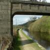
There is a bridge here which takes a pipe over the canal.


Amenities
 
Maps
If you are a user and are logged on, or if you are actively planning a route, a map will be displayed here.
Show on external mapping site: Google | OSM | Bing
 
Photos
 
External websites
There are no links to external websites from here.
Why not log in and add some (select "External websites" from the menu (sometimes this is under "Edit"))?
 
Nearest facilities

Mouseover for more information or show routes to facility

Nearest water point

In the direction of Castlefield Junction

Littleborough Sanitary Station2 miles, 2½ furlongs and 12 locks away
On this waterway in the direction of Castlefield Junction
New Islington Marina17 miles, 6¼ furlongs and 47 locks away
Travel to New Islington Marina Entrance, then on the Rochdale Canal (Main Line) to Cotton Field Wharf Marina, then on the Rochdale Canal (New Islington Marina Arm) to New Islington Marina
Staffordshire, Kenworthy and other Arms19 miles, 1½ furlongs and 58 locks away
Travel to Castlefield Junction, then on the Bridgewater Canal (Main Line) to Staffordshire, Kenworthy and other Arms
Potato Wharf Arm & The New Basin19 miles, 2¼ furlongs and 58 locks away
Travel to Castlefield Junction, then on the Bridgewater Canal (Main Line) to Potato Wharf Arm & The New Basin

In the direction of Sowerby Bridge Junction

Travis Mill Lock No 281 mile, 2¾ furlongs and 6 locks away
On this waterway in the direction of Sowerby Bridge Junction
Fielden Wharf & Services3 miles and 16 locks away
On this waterway in the direction of Sowerby Bridge Junction
Baltimore Marina3 miles, 3 furlongs and 17 locks away
On this waterway in the direction of Sowerby Bridge Junction
Hebden Bridge Services7 miles, 2½ furlongs and 26 locks away
On this waterway in the direction of Sowerby Bridge Junction
Sowerby Bridge Basin12 miles, 7¾ furlongs and 33 locks away
Travel to Sowerby Bridge Junction, then on the Calder and Hebble Navigation (Main Line) to Sowerby Bridge Basin
Salterhebble Junction14 miles, 7¾ furlongs and 33 locks away
Travel to Sowerby Bridge Junction, then on the Calder and Hebble Navigation (Main Line) to Salterhebble Junction
Salterhebble Sanitary Station15 miles and 34 locks away
Travel to Sowerby Bridge Junction, then on the Calder and Hebble Navigation (Main Line) to Salterhebble Junction, then on the Calder and Hebble Navigation (Main Line) to Salterhebble Sanitary Station
Brighouse Basin19 miles, 2 furlongs and 43 locks away
Travel to Sowerby Bridge Junction, then on the Calder and Hebble Navigation (Main Line) to Salterhebble Junction, then on the Calder and Hebble Navigation (Main Line) to Brighouse Basin

Nearest rubbish disposal

In the direction of Castlefield Junction

Littleborough Sanitary Station2 miles, 2½ furlongs and 12 locks away
On this waterway in the direction of Castlefield Junction

In the direction of Sowerby Bridge Junction

Fielden Wharf & Services3 miles and 16 locks away
On this waterway in the direction of Sowerby Bridge Junction
Hebden Bridge Services7 miles, 2½ furlongs and 26 locks away
On this waterway in the direction of Sowerby Bridge Junction
Sowerby Bridge Basin12 miles, 7¾ furlongs and 33 locks away
Travel to Sowerby Bridge Junction, then on the Calder and Hebble Navigation (Main Line) to Sowerby Bridge Basin
Salterhebble Sanitary Station15 miles and 34 locks away
Travel to Sowerby Bridge Junction, then on the Calder and Hebble Navigation (Main Line) to Salterhebble Junction, then on the Calder and Hebble Navigation (Main Line) to Salterhebble Sanitary Station
Brighouse Lower Basin Visitor Moorings19 miles, 2½ furlongs and 44 locks away
Travel to Sowerby Bridge Junction, then on the Calder and Hebble Navigation (Main Line) to Salterhebble Junction, then on the Calder and Hebble Navigation (Main Line) to Brighouse Lower Basin Visitor Moorings

Nearest chemical toilet disposal

In the direction of Castlefield Junction

Littleborough Sanitary Station2 miles, 2½ furlongs and 12 locks away
On this waterway in the direction of Castlefield Junction

In the direction of Sowerby Bridge Junction

Baltimore Marina3 miles, 3 furlongs and 17 locks away
On this waterway in the direction of Sowerby Bridge Junction
Hebden Bridge Services7 miles, 2½ furlongs and 26 locks away
On this waterway in the direction of Sowerby Bridge Junction
Sowerby Bridge Basin12 miles, 7¾ furlongs and 33 locks away
Travel to Sowerby Bridge Junction, then on the Calder and Hebble Navigation (Main Line) to Sowerby Bridge Basin
Salterhebble Sanitary Station15 miles and 34 locks away
Travel to Sowerby Bridge Junction, then on the Calder and Hebble Navigation (Main Line) to Salterhebble Junction, then on the Calder and Hebble Navigation (Main Line) to Salterhebble Sanitary Station
Brighouse Basin19 miles, 2 furlongs and 43 locks away
Travel to Sowerby Bridge Junction, then on the Calder and Hebble Navigation (Main Line) to Salterhebble Junction, then on the Calder and Hebble Navigation (Main Line) to Brighouse Basin

Nearest place to turn

In the direction of Castlefield Junction

Summit Pound Winding Hole1¾ furlongs and 2 locks away
On this waterway in the direction of Castlefield Junction
Bent House Bridge Winding Hole1 mile, 7¾ furlongs and 11 locks away
On this waterway in the direction of Castlefield Junction
Bent House Winding Hole2 miles, ¾ furlongs and 11 locks away
On this waterway in the direction of Castlefield Junction
Littleborough Winding Hole2 miles, 6½ furlongs and 14 locks away
On this waterway in the direction of Castlefield Junction
Moss Upper Lock Winding Hole6 miles, 1½ furlongs and 15 locks away
On this waterway in the direction of Castlefield Junction
Rochdale Junction6 miles, 2½ furlongs and 16 locks away
On this waterway in the direction of Castlefield Junction
Dicken Green Winding Hole6 miles, 5¼ furlongs and 16 locks away
On this waterway in the direction of Castlefield Junction
Edinburgh Way Tunnel Winding Hole7 miles, 1¼ furlongs and 16 locks away
On this waterway in the direction of Castlefield Junction
Boarshaw Bridge Winding Hole10 miles, 2¼ furlongs and 26 locks away
On this waterway in the direction of Castlefield Junction

In the direction of Sowerby Bridge Junction

Bottomley Road Winding Hole4¼ furlongs and 2 locks away
On this waterway in the direction of Sowerby Bridge Junction
Lightbank Lock Winding Hole6 furlongs and 3 locks away
On this waterway in the direction of Sowerby Bridge Junction
Winding Hole between Nip Square and Winterbutlee Locks1 mile, 1¼ furlongs and 5 locks away
On this waterway in the direction of Sowerby Bridge Junction
Todmorden Bridge Winding Hole2 miles, 7¾ furlongs and 16 locks away
On this waterway in the direction of Sowerby Bridge Junction
Baltimore Winding Hole3 miles, 3¼ furlongs and 17 locks away
On this waterway in the direction of Sowerby Bridge Junction
Lobb Mill Lock Winding Hole4 miles, 2¼ furlongs and 19 locks away
On this waterway in the direction of Sowerby Bridge Junction
Stoodley Bridge Winding Hole4 miles, 7 furlongs and 20 locks away
On this waterway in the direction of Sowerby Bridge Junction
Winding Hole below Holmcoat Lock5 miles, 1¼ furlongs and 21 locks away
On this waterway in the direction of Sowerby Bridge Junction
Rawden Mill Lock Winding Hole6 miles, ¾ furlongs and 23 locks away
On this waterway in the direction of Sowerby Bridge Junction
Hebden Bridge Wharf7 miles, 2¾ furlongs and 26 locks away
On this waterway in the direction of Sowerby Bridge Junction
Walkley's Clog Mill8 miles, ¾ furlongs and 27 locks away
On this waterway in the direction of Sowerby Bridge Junction

Nearest self-operated pump-out

In the direction of Castlefield Junction

New Islington Marina17 miles, 6¼ furlongs and 47 locks away
Travel to New Islington Marina Entrance, then on the Rochdale Canal (Main Line) to Cotton Field Wharf Marina, then on the Rochdale Canal (New Islington Marina Arm) to New Islington Marina

In the direction of Sowerby Bridge Junction

Hebden Bridge Services7 miles, 2½ furlongs and 26 locks away
On this waterway in the direction of Sowerby Bridge Junction

Nearest boatyard pump-out

In the direction of Sowerby Bridge Junction

Pickwell and Arnold Boatyard4 miles, 4½ furlongs and 20 locks away
On this waterway in the direction of Sowerby Bridge Junction
Sowerby Bridge Basin12 miles, 7¾ furlongs and 33 locks away
Travel to Sowerby Bridge Junction, then on the Calder and Hebble Navigation (Main Line) to Sowerby Bridge Basin
Direction of TV transmitter (From Wolfbane Cybernetic)
 
 
Geograph
 
Wikipedia

There is no page on Wikipedia called “Warland Pipe Bridge”

Wikipedia pages that might relate to Warland Pipe Bridge
[Apollo Club of Minneapolis] River Ride the Chariot The St. Olaf College Choir Dr. Anton Armstrong Dale Warland Cabaret Minnetonka Chamber Choir Dr Roger S. Hoel The Augsburg College [2001 Australia Day Honours] through the Novocastrian Tales project and Yallarwah Place Ronald Fowler Warland For service to the foundry industry, particularly in New South Wales Joyce
 
Google

Results of Google Search

Ken Wickward - GovTribe
KOOTENAI NF, Libby RD, East Fork Pipe Creek Bridge NFSR 336 MP 15. 8 ... and Milepost 1.4 on National Forest System Road #4891, Warland Basin Road.
Can you believe this?
Jan 11, 2010 ... Bird i'th Hand at Warland in autumn and in January 2010 from above the canal and showing Warland pipe bridge below Warland Upper Lock.
The Town of Union Bridge, Carroll County, Maryland - The Town of ...
Settled as a farming community before the Revolutionary War, land was ... renamed the town to commemorate the bridge that spanned Little Pipe Creek to unite ...
Muskingum County, Ohio - County Website - Offices - Agencies ...
The first bridge in Zanesville was built by the Putnam Yankees in 1813 and named the Third Street bridge. Moses Dillon and others planned to build a bridge "from ...
Kootenai National Forest
application, excluding the Pipe Creek Ranger ... camp on Pipe Creek had started work for the company and ... build the Warland Bridge across the Kootenai.
Warland Impounding Reservoir (2019) – Water Projects
Nov 11, 2019 ... Several combinations of siphon pipe sizes and materials were considered. The preferred option was for 3 (No.) DN600 ductile iron pipes through ...
Rochdale Canal - Wikipedia
The Rochdale Canal is in Northern England, between Manchester and Sowerby Bridge, part of ... Dam, Higher and Lower Chelburn, Hollingworth Lake, Light Hazzles, Warland and Whiteholme, to those corporations to supply drinking water .