Sandholme Aqueduct No 33
Crosses the River Brun
The Queen Victoria, Queen Victoria Road, Burnley BB10 3EF, United Kingdom

Sandholme Aqueduct No 33
is a minor waterways place
on the Leeds and Liverpool Canal (Main Line - Wigan to Leeds) between
Feniscowles Bridge No 93B (20 miles and 7½ furlongs
and 6 locks
to the west) and
Salterforth Bridge No 151 (Salterforth village 200 yards northeast) (9 miles and 4¼ furlongs
and 7 locks
to the northeast).
The nearest place in the direction of Feniscowles Bridge No 93B is Sandholme Aqueduct Winding Hole;
¼ furlongs
away.
The nearest place in the direction of Salterforth Bridge No 151 is Bank Hall Works Arm (Unnavigable arm );
¾ furlongs
away.
Mooring here is unrated.
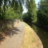
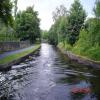
There is a small aqueduct or underbridge here which takes a river under the canal.
| Finsley Gate Bridge No 130E | 7¾ furlongs | |
| Calder Aqueduct No 31 | 6¼ furlongs | |
| Yorkshire Street Aqueduct No 32 | 4¾ furlongs | |
| Godley Bridge No 130H | 1¾ furlongs | |
| Sandholme Aqueduct Winding Hole | ¼ furlongs | |
| Sandholme Aqueduct No 33 | ||
| Bank Hall Works Arm | ¾ furlongs | |
| Winding Hole North of Burnley Embankment | 1¼ furlongs | |
| Colne Road Bridge No 131 | 2½ furlongs | |
| Danes House Bridge No 131A | 4 furlongs | |
| Old Hall Street Bridge No 131B | 5 furlongs | |
Amenities here
Amenities nearby at Bank Hall Works Arm
Amenities nearby at Sandholme Aqueduct Winding Hole
There are no links to external websites from here.
Why not log in and add some (select "External websites" from the menu (sometimes this is under "Edit"))?
Mouseover for more information or show routes to facility
Nearest water point
In the direction of Leeds Bridge
Reedley Marina — 1 mile, 6½ furlongs away
On this waterway in the direction of Leeds Bridge
Barrowford Top Lock No 45 — 5 miles, 7½ furlongs and 6 locks away
On this waterway in the direction of Leeds Bridge
Foulridge Wharf — 7 miles, 6¾ furlongs and 7 locks away
On this waterway in the direction of Leeds Bridge
Salterforth Bridge No 151 — 9 miles, 4¼ furlongs and 7 locks away
On this waterway in the direction of Leeds Bridge
Lower Park Marina — 10 miles, 1½ furlongs and 7 locks away
On this waterway in the direction of Leeds Bridge
Greenberfield Services — 11 miles, 6 furlongs and 7 locks away
On this waterway in the direction of Leeds Bridge
East Marton Visitor Moorings — 14 miles, 5¼ furlongs and 10 locks away
On this waterway in the direction of Leeds Bridge
Priest Holme Water Point — 17 miles, 2¾ furlongs and 16 locks away
On this waterway in the direction of Leeds Bridge
Gargrave Services — 18 miles, 4¾ furlongs and 19 locks away
On this waterway in the direction of Leeds Bridge
In the direction of Wigan Junction
Rose Grove Services — 3 miles, 4½ furlongs away
On this waterway in the direction of Wigan Junction
Blackburn Lock Sanitary Station — 18 miles, 2¾ furlongs and 4 locks away
On this waterway in the direction of Wigan JunctionNearest rubbish disposal
In the direction of Leeds Bridge
Barrowford Lock No 47 — 5 miles, 6½ furlongs and 4 locks away
On this waterway in the direction of Leeds Bridge
Foulridge Wharf — 7 miles, 6¾ furlongs and 7 locks away
On this waterway in the direction of Leeds Bridge
Salterforth Bridge No 151 — 9 miles, 4¼ furlongs and 7 locks away
On this waterway in the direction of Leeds Bridge
Lower Park Marina — 10 miles, 1½ furlongs and 7 locks away
On this waterway in the direction of Leeds Bridge
Greenberfield Services — 11 miles, 6 furlongs and 7 locks away
On this waterway in the direction of Leeds Bridge
Gargrave Services — 18 miles, 4¾ furlongs and 19 locks away
On this waterway in the direction of Leeds Bridge
In the direction of Wigan Junction
Rose Grove Services — 3 miles, 4½ furlongs away
On this waterway in the direction of Wigan Junction
Blackburn Lock Sanitary Station — 18 miles, 2¾ furlongs and 4 locks away
On this waterway in the direction of Wigan JunctionNearest chemical toilet disposal
In the direction of Leeds Bridge
Barrowford Top Lock No 45 — 5 miles, 7½ furlongs and 6 locks away
On this waterway in the direction of Leeds Bridge
Foulridge Wharf — 7 miles, 6¾ furlongs and 7 locks away
On this waterway in the direction of Leeds Bridge
Salterforth Bridge No 151 — 9 miles, 4¼ furlongs and 7 locks away
On this waterway in the direction of Leeds Bridge
Lower Park Marina — 10 miles, 1½ furlongs and 7 locks away
On this waterway in the direction of Leeds Bridge
Greenberfield Services — 11 miles, 6 furlongs and 7 locks away
On this waterway in the direction of Leeds Bridge
Gargrave Services — 18 miles, 4¾ furlongs and 19 locks away
On this waterway in the direction of Leeds Bridge
In the direction of Wigan Junction
Rose Grove Services — 3 miles, 4½ furlongs away
On this waterway in the direction of Wigan Junction
Blackburn Lock Sanitary Station — 18 miles, 2¾ furlongs and 4 locks away
On this waterway in the direction of Wigan JunctionNearest place to turn
In the direction of Leeds Bridge
Winding Hole North of Burnley Embankment — 1¼ furlongs away
On this waterway in the direction of Leeds Bridge
Burley Lane Winding Hole — 1 mile, 1¾ furlongs away
On this waterway in the direction of Leeds Bridge
Hawks House Winding Hole — 2 miles, 3 furlongs away
On this waterway in the direction of Leeds Bridge
Hodge Bank Winding Hole — 4 miles, 4¾ furlongs away
On this waterway in the direction of Leeds Bridge
Wanless Bridge Winding Hole — 6 miles, 3¾ furlongs and 7 locks away
On this waterway in the direction of Leeds Bridge
Foulridge Wharf Winding Hole — 7 miles, 7¼ furlongs and 7 locks away
On this waterway in the direction of Leeds Bridge
Long Ing Bridge Winding Hole — 10 miles, 5¼ furlongs and 7 locks away
On this waterway in the direction of Leeds Bridge
In the direction of Wigan Junction
Sandholme Aqueduct Winding Hole — ¼ furlongs away
On this waterway in the direction of Wigan Junction
Nelson Square Winding Hole — 1 mile, 3½ furlongs away
On this waterway in the direction of Wigan Junction
Old Rose Grove Winding Hole — 3 miles, 6¾ furlongs away
On this waterway in the direction of Wigan Junction
Hapton Winding Hole — 5 miles, 5 furlongs away
On this waterway in the direction of Wigan Junction
Shuttleworth Winding Hole — 6 miles, 4 furlongs away
On this waterway in the direction of Wigan Junction
Clough Bank Winding Hole — 7 miles, 2¼ furlongs away
On this waterway in the direction of Wigan Junction
Whalley Road Bridge Winding Hole — 9 miles, ½ furlongs away
On this waterway in the direction of Wigan Junction
Church Kirk Bridge Winding Hole — 10 miles, 5 furlongs away
On this waterway in the direction of Wigan Junction
Railway Bridge No 110B Winding Hole — 11 miles, 2½ furlongs away
On this waterway in the direction of Wigan Junction
Dunkenhalgh Aqueduct Winding Hole — 12 miles, 2¾ furlongs away
On this waterway in the direction of Wigan Junction
Rishton Winding Hole — 12 miles, 4¼ furlongs away
On this waterway in the direction of Wigan Junction
Trident Way Winding Hole — 15 miles, ¼ furlongs away
On this waterway in the direction of Wigan Junction
Eanam Bridge Winding Hole — 17 miles, 1¼ furlongs away
On this waterway in the direction of Wigan JunctionNearest self-operated pump-out
In the direction of Wigan Junction
Rose Grove Services — 3 miles, 4½ furlongs away
On this waterway in the direction of Wigan JunctionNearest boatyard pump-out
In the direction of Leeds Bridge
Reedley Marina — 1 mile, 6½ furlongs away
On this waterway in the direction of Leeds Bridge
Lower Park Marina — 10 miles, 1½ furlongs and 7 locks away
On this waterway in the direction of Leeds BridgeDirection of TV transmitter (From Wolfbane Cybernetic)
There is no page on Wikipedia called “Sandholme Aqueduct”
Wikipedia pages that might relate to Sandholme Aqueduct
[Leven Canal]
taken place subsequently, as reeds were choking the waterway. The aqueduct at Sandholme Farm, which carries the canal over a drainage ditch which was already
[Listed buildings in Barnacre-with-Bonds]
"Wyre Aqueduct, Barnacre-with-Bonds (1072931)", National Heritage List for England, retrieved 28 November 2015 Historic England, "Sandholme Bridge,
[River Calder, Wyre]
passing under the M6 motorway, West Coast Main Line and under the Calder Aqueduct on Lancaster Canal. It meets the Wyre at Catterall near the town of Garstang
Results of Google Search
1 of 100. 12-05-2017 01:30:33 ... Unfortunately there is no passage window or diversion due to the dewatering of the whole ...... Sandholme winding hole. Downstream ... Aqueduct 18, Arley, Leeds & Liverpool Canal. Upstream winding hole.
Sandholme Bridge. Sandholme Mill. M6 Motorway · West Coast Main Line. Canal feeder. Lancaster Canal. B6430 Garstang Road. River Wyre. River Wyre. The River Calder is a 13-mile (21 km) long river that is one of the main tributaries of the River ... West Coast Main Line and under the Calder Aqueduct on Lancaster Canal.
A Trunk opposite Sandholme. Forge Three Locks ... Three foot Culvert at Tail, a Waster here. Large Aqueduct over River Aire. 33. Dowley Gap ... The first section of the following list comes from a list dated 1843 which gives not just the bridges  ...
... Lancaster Canal winds through Bonds and crosses the Wyre into Garstang by an aqueduct. ... 5) the place was formerly no more than a hamlet in the manor of Garstang or Nether Wyresdale. (fn. ... 33) He died between 1598 (fn. ... 45) Sandholme, Sullam and Eidsforth are other places in Barnacre occasionally mentioned.
Turn L into North Bar Without. The half ..... He was 33 years old. This was a ..... Sandholme Aqueduct, built 1801, carrying the canal over Burshill Drain is listed.
No part of this document may be reproduced, stored in a retrieval system, ... AB106 CHATTAN PLACE AB10 31. AB106BQ 231 UNION STREET AB10 33. AB106 ...... AQUEDUCT ASTON CANTLOW RD B95 237 ...... 60 SANDHOLME DRIVE
33, 10541630, 10Th Mansfield Scout Group, Trinity House, Robey Close ...... Isle of Wight, England, PO33 3DS, Not for Profit, Housing Associations ...... 1931, 10566536, Aqueduct Primary School, Castlefields Way, Aqueduct, TF4 3RP, Education ...... 6632, 10038132, Burley and Woodhead CE Primary School, Sandholme ...
Jun 2, 2014 ... Backfilling. 33. Post Construction Drainage. 34. Reinstatement. 34. Integrity Testing and .... “National Gridâ€) is a non-regulated independent subsidiary of National Grid ...... SANDHOLME. El Sub Sta ...... Aqueduct. Cattle Grid.


![Aqueduct over the River Brun, Burnley, Lancashire. This is the Leeds and Liverpool Canal Aqueduct which crosses the River Brun in Thompson Park, Burnley. For a photograph taken further up the River Brun refer to picture [[4506116]]. by Len Williams – 22 May 2015](https://s1.geograph.org.uk/geophotos/04/50/61/4506101_e9885b0d_120x120.jpg)


![Leeds and Liverpool Canal 53¼ miles from Leeds. The milepost [[7963367]] marking the distance to Leeds can see seen against the wall at the left middle ground. Ordnance Survey documents indicate that a benchmark levelled at 127.894m above Newlyn Datum was verified in 1961 on the wall 13.7m on the nearside of the milepost by Roger Templeman – 19 April 2025](https://s0.geograph.org.uk/geophotos/08/17/63/8176388_f3dda7e5_120x120.jpg)

![Leeds & Liverpool Canal heading north at 74 miles from Liverpool. There is a canal milepost [[7963367]] against the wall on the left hand side of the towpath in the left foreground by Roger Templeman – 23 January 2025](https://s2.geograph.org.uk/geophotos/07/96/33/7963390_432cf4dc_120x120.jpg)
![Leeds & Liverpool Canal at Sandy Holme Aqueduct over River Brun. There is an Ordnance Survey benchmark [[8176513]] at the base of the aqueduct parapet at its junction with the stone wall. by Roger Templeman – 19 April 2025](https://s1.geograph.org.uk/geophotos/08/17/65/8176529_57658d2d_120x120.jpg)
![Leeds and Liverpool Canal milepost 74 miles from Liverpool. The plate on the left hand face giving the distance to Liverpool is missing - see 2015 photo [[4590362]] when the plate was missing but the distance was painted on. The post, 53¼ miles from Leeds, is against the wall on the west hand side of the canal towpath and has Milestone Society National ID: LLC-074 by Roger Templeman – 23 January 2025](https://s3.geograph.org.uk/geophotos/07/96/33/7963367_332dcbad_120x120.jpg)


![River Brun Thompson Park, Burnley. This is the view looking downstream on the River Brun in Thompson Park Burnley. For the upstream view refer to picture [[4506121]]. by Len Williams – 22 May 2015](https://s0.geograph.org.uk/geophotos/04/50/61/4506116_20664985_120x120.jpg)