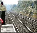
Laurel Avenue Bridge No 74
is a minor waterways place
on the Rochdale Canal between
New Islington Marina Entrance (6 miles and ¾ furlongs
and 18 locks
to the southwest) and
Littleborough (8 miles and 6½ furlongs
and 15 locks
to the northeast).
The nearest place in the direction of New Islington Marina Entrance is Firwood Footbridge;
1¾ furlongs
away.
The nearest place in the direction of Littleborough is Chadderton Pipe Bridge;
1½ furlongs
away.
There may be access to the towpath here.
Mooring here is unrated.
There is a bridge here which takes a minor road over the canal.
| Causeway Bridge Winding Hole | 7 furlongs | |
| Grimshaw Lane Vertical Lift Bridge No 75A | 3¾ furlongs | |
| Drummer Hill Branch Basin | 3 furlongs | |
| Kay Lane Lock No 64 | 2¾ furlongs | |
| Firwood Footbridge | 1¾ furlongs | |
| Laurel Avenue Bridge No 74 | ||
| Chadderton Pipe Bridge | 1½ furlongs | |
| Chadderton Bridge | 2½ furlongs | |
| The Rose of Lancaster PH | 3 furlongs | |
| The Rose of Lancaster Visitor Moorings | 3¾ furlongs | |
| River Irk Aqueduct | 4½ furlongs | |
There are no links to external websites from here.
Why not log in and add some (select "External websites" from the menu (sometimes this is under "Edit"))?
Mouseover for more information or show routes to facility
Nearest water point
In the direction of Castlefield Junction
New Islington Marina — 6 miles, 2¼ furlongs and 18 locks away
Travel to New Islington Marina Entrance, then on the Rochdale Canal (Main Line) to Cotton Field Wharf Marina, then on the Rochdale Canal (New Islington Marina Arm) to New Islington Marina
Staffordshire, Kenworthy and other Arms — 7 miles, 5¼ furlongs and 29 locks away
Travel to Castlefield Junction, then on the Bridgewater Canal (Main Line) to Staffordshire, Kenworthy and other Arms
Potato Wharf Arm & The New Basin — 7 miles, 6 furlongs and 29 locks away
Travel to Castlefield Junction, then on the Bridgewater Canal (Main Line) to Potato Wharf Arm & The New Basin
Stretford Marina — 10 miles, 5¼ furlongs and 29 locks away
Travel to Castlefield Junction, then on the Bridgewater Canal (Main Line) to Stretford Marina
Watch House Cruising Club — 11 miles, 5½ furlongs and 29 locks away
Travel to Castlefield Junction, then on the Bridgewater Canal (Main Line) to Watch House Cruising Club
Worsley Visitor Moorings — 14 miles, 7¼ furlongs and 29 locks away
Travel to Castlefield Junction, then on the Bridgewater Canal (Main Line) to Stretford - Waters Meeting, then on the Bridgewater Canal (Stretford and Leigh Branch) to Worsley Visitor Moorings
Bridgewater Marina — 16 miles, 3¼ furlongs and 29 locks away
Travel to Castlefield Junction, then on the Bridgewater Canal (Main Line) to Stretford - Waters Meeting, then on the Bridgewater Canal (Stretford and Leigh Branch) to Bridgewater Marina
Ye Olde Number 3 Transit Moorings — 18 miles, 4½ furlongs and 29 locks away
Travel to Castlefield Junction, then on the Bridgewater Canal (Main Line) to Ye Olde Number 3 Transit Moorings
Fairfield Junction — 10 miles, 1¾ furlongs and 38 locks away
Travel to Ducie Street Junction, then on the Ashton Canal (Main Line) to Fairfield Junction
Grove Road Bridge No 96 — 17 miles, 6 furlongs and 46 locks away
Travel to Ducie Street Junction, then on the Ashton Canal (Main Line) to Ashton-under-Lyne Junction, then on the Huddersfield Narrow Canal to Grove Road Bridge No 96
In the direction of Sowerby Bridge Junction
Littleborough Sanitary Station — 9 miles, 1½ furlongs and 17 locks away
On this waterway in the direction of Sowerby Bridge Junction
Travis Mill Lock No 28 — 12 miles, 6¾ furlongs and 35 locks away
On this waterway in the direction of Sowerby Bridge Junction
Fielden Wharf & Services — 14 miles, 4 furlongs and 45 locks away
On this waterway in the direction of Sowerby Bridge Junction
Baltimore Marina — 14 miles, 7¼ furlongs and 46 locks away
On this waterway in the direction of Sowerby Bridge Junction
Hebden Bridge Services — 18 miles, 6¾ furlongs and 55 locks away
On this waterway in the direction of Sowerby Bridge JunctionNearest rubbish disposal
In the direction of Castlefield Junction
Marple Bottom Lock Bridge Winding Hole — 19 miles, 6 furlongs and 38 locks away
Travel to Ducie Street Junction, then on the Ashton Canal (Main Line) to Dukinfield Junction, then on the Peak Forest Canal (Lower) to Marple Bottom Lock Bridge Winding Hole
In the direction of Sowerby Bridge Junction
Littleborough Sanitary Station — 9 miles, 1½ furlongs and 17 locks away
On this waterway in the direction of Sowerby Bridge Junction
Fielden Wharf & Services — 14 miles, 4 furlongs and 45 locks away
On this waterway in the direction of Sowerby Bridge Junction
Hebden Bridge Services — 18 miles, 6¾ furlongs and 55 locks away
On this waterway in the direction of Sowerby Bridge JunctionNearest chemical toilet disposal
In the direction of Castlefield Junction
Watch House Cruising Club — 11 miles, 5½ furlongs and 29 locks away
Travel to Castlefield Junction, then on the Bridgewater Canal (Main Line) to Watch House Cruising Club
Fairfield Junction — 10 miles, 1¾ furlongs and 38 locks away
Travel to Ducie Street Junction, then on the Ashton Canal (Main Line) to Fairfield Junction
Grove Road Bridge No 96 — 17 miles, 6 furlongs and 46 locks away
Travel to Ducie Street Junction, then on the Ashton Canal (Main Line) to Ashton-under-Lyne Junction, then on the Huddersfield Narrow Canal to Grove Road Bridge No 96
In the direction of Sowerby Bridge Junction
Littleborough Sanitary Station — 9 miles, 1½ furlongs and 17 locks away
On this waterway in the direction of Sowerby Bridge Junction
Baltimore Marina — 14 miles, 7¼ furlongs and 46 locks away
On this waterway in the direction of Sowerby Bridge Junction
Hebden Bridge Services — 18 miles, 6¾ furlongs and 55 locks away
On this waterway in the direction of Sowerby Bridge JunctionNearest place to turn
In the direction of Castlefield Junction
Causeway Bridge Winding Hole — 7 furlongs and 1 lock away
On this waterway in the direction of Castlefield Junction
Broadway Bridge Winding Hole — 1 mile, 3½ furlongs and 1 lock away
On this waterway in the direction of Castlefield Junction
Failsworth Pool Winding Hole — 2 miles, 5¾ furlongs and 2 locks away
On this waterway in the direction of Castlefield Junction
Butler Lane Lock Winding Hole — 5 miles, 5 furlongs and 17 locks away
On this waterway in the direction of Castlefield Junction
New Islington Marina Entrance — 6 miles, ¾ furlongs and 18 locks away
On this waterway in the direction of Castlefield Junction
Ducie Street Junction — 6 miles, 3½ furlongs and 20 locks away
On this waterway in the direction of Castlefield Junction
New Viaduct Winding Hole — 7 miles, 5½ furlongs and 23 locks away
Travel to Ducie Street Junction, then on the Ashton Canal (Main Line) to New Viaduct Winding Hole
Ashton New Road Winding Hole — 8 miles, 3 furlongs and 27 locks away
Travel to Ducie Street Junction, then on the Ashton Canal (Main Line) to Ashton New Road Winding Hole
Castlefield Junction — 7 miles, 5 furlongs and 29 locks away
On this waterway in the direction of Castlefield Junction
Staffordshire, Kenworthy and other Arms — 7 miles, 5¼ furlongs and 29 locks away
Travel to Castlefield Junction, then on the Bridgewater Canal (Main Line) to Staffordshire, Kenworthy and other Arms
Grocer's Wharf — 7 miles, 5¾ furlongs and 29 locks away
Travel to Castlefield Junction, then on the Bridgewater Canal (Main Line) to Grocer's Wharf
Potato Wharf Arm & The New Basin — 7 miles, 6 furlongs and 29 locks away
Travel to Castlefield Junction, then on the Bridgewater Canal (Main Line) to Potato Wharf Arm & The New Basin
In the direction of Sowerby Bridge Junction
Boarshaw Bridge Winding Hole — 1 mile, 1¾ furlongs and 3 locks away
On this waterway in the direction of Sowerby Bridge Junction
Edinburgh Way Tunnel Winding Hole — 4 miles, 2¾ furlongs and 13 locks away
On this waterway in the direction of Sowerby Bridge Junction
Dicken Green Winding Hole — 4 miles, 7 furlongs and 13 locks away
On this waterway in the direction of Sowerby Bridge Junction
Rochdale Junction — 5 miles, 1¾ furlongs and 13 locks away
On this waterway in the direction of Sowerby Bridge Junction
Moss Upper Lock Winding Hole — 5 miles, 2½ furlongs and 14 locks away
On this waterway in the direction of Sowerby Bridge Junction
Littleborough Winding Hole — 8 miles, 5¾ furlongs and 15 locks away
On this waterway in the direction of Sowerby Bridge Junction
Bent House Winding Hole — 9 miles, 3½ furlongs and 18 locks away
On this waterway in the direction of Sowerby Bridge Junction
Bent House Bridge Winding Hole — 9 miles, 4½ furlongs and 18 locks away
On this waterway in the direction of Sowerby Bridge JunctionNearest self-operated pump-out
In the direction of Castlefield Junction
New Islington Marina — 6 miles, 2¼ furlongs and 18 locks away
Travel to New Islington Marina Entrance, then on the Rochdale Canal (Main Line) to Cotton Field Wharf Marina, then on the Rochdale Canal (New Islington Marina Arm) to New Islington Marina
In the direction of Sowerby Bridge Junction
Hebden Bridge Services — 18 miles, 6¾ furlongs and 55 locks away
On this waterway in the direction of Sowerby Bridge JunctionNearest boatyard pump-out
In the direction of Castlefield Junction
Stretford Marina — 10 miles, 5¼ furlongs and 29 locks away
Travel to Castlefield Junction, then on the Bridgewater Canal (Main Line) to Stretford Marina
Bridgewater Marina — 16 miles, 3¼ furlongs and 29 locks away
Travel to Castlefield Junction, then on the Bridgewater Canal (Main Line) to Stretford - Waters Meeting, then on the Bridgewater Canal (Stretford and Leigh Branch) to Bridgewater Marina
Portland Basin Arm — 12 miles, 6¼ furlongs and 38 locks away
Travel to Ducie Street Junction, then on the Ashton Canal (Main Line) to Dukinfield Junction, then on the Peak Forest Canal (Lower) to Portland Basin Arm
In the direction of Sowerby Bridge Junction
Pickwell and Arnold Boatyard — 16 miles, ¾ furlongs and 49 locks away
On this waterway in the direction of Sowerby Bridge JunctionDirection of TV transmitter (From Wolfbane Cybernetic)
There is no page on Wikipedia called “Laurel Avenue Bridge”
Wikipedia pages that might relate to Laurel Avenue Bridge
[Kosciuszko Bridge]
The older truss bridge replaced a swing bridge called the Meeker Avenue Bridge, which connected Meeker Avenue in Brooklyn to Laurel Hill Boulevard in
[Harrison Avenue Bridge]
Harrison Avenue Bridge was a concrete deck arch bridge carrying Harrison Avenue (unsigned SR 6011) in Scranton, Pennsylvania, United States. Its three
[Laurel, Maryland]
streets. In 1870, the Patuxent Bank of Laurel was founded on the corner of Main Street and Washington Avenue. In 1874 a delegation was sent to Annapolis
[Penny Bridge station]
formerly connected Laurel Hill Boulevard to Meeker Avenue before it was closed in 1939) prior to the closure and removal of the bridge. This station first
[Cabrillo Bridge]
ends at Sixth Avenue, and some refer to the bridge as the Laurel Street Bridge. Sixth Avenue forms the western boundary of Balboa Park. Laurel Street continues
[New York State Route 25]
Peconic River Bridge to Kroemer Avenue. In Laurel, New York (Southold township), A quarter mile section was rerouted past the town hamlet of Laurel in a more
[Laurel Hill Historic District]
characterized by relatively steep hillsides Laurel Hill Avenue, its principal roadway, runs south from a pair of bridges over that river, parallel to the Thames
[U.S. Route 1 in Maryland]
eastbound Gorman Avenue and westbound Talbott Avenue. US 1 continues through the city of Laurel, intersecting Main Street just west of the Laurel MARC Station
[Patuxent River]
the lower Patuxent. The two largest cities in the watershed are Bowie and Laurel, Maryland. There is a percentage of agricultural activity in the region
[Newtown Creek]
Bushwick Branch and the Metropolitan Avenue Bridge. The East Branch originates at Metropolitan and Onkerdonk Avenues, at a CSO pipe that drains 586,000
Results of Google Search
May 18, 2014 ... Laurel Avenue Bridge [No 74], Rochdale Canal. taken 6 years ago, near to Chadderton, Oldham, Great Britain. More sizes. Laurel Avenue ...
C109-0.01 Replacement; Round Bottom Road Bridge No. C106-4.18 ... Run Road Bridge No. T767-0.68 Replacement; Clermontville-Laurel Road Bridge No.
Aug 30, 2018 ... View 1 photos for 74 Laurel Ave, Spruce Pine, NC 28777 a bed, bath, 0.25 acres. single family home built in . ... Estimated values are not a substitute for professional expertise. ... 581 Eagle Bridge Rd, Spruce Pine, NC 28777.
County Courthouse, 201 Laurel Avenue, Tillamook, Oregon ... to Local Agency Agreement #33229 for the Curl Road Kilchis River Bridge (Bridge No. ... Proposed Second Amendments to Tillamook County Ordinance #74 and Ordinance #75Â ...
Quadrant Routes in Pennsylvania are maintained by the Pennsylvania Department of ... There is no explicit pattern for numbering order. ... Old York Road, QR 2036 (Cumberland County) Bridge Street at the Cumberland County line ... 2044, QR 2046 Laurel Road / High Rock Road in East Hopewell Township , Muddy Creek ...
The property 16 Laurel Ave, Old Bridge, NJ 08857 is currently not for sale. View details, sales history and Zestimate data for this property on Zillow.
Jun 4, 2018 ... 19 Laurel Ave is a house in Old Bridge, NJ 08857. This 1,434 square foot house sits on a 6,599 square foot lot. This property was built in 1954.
Interstate 74 (I-74) in the U.S. state of Illinois is a major northwest–southeast Interstate Highway ... The Iowa-bound bridge opened in 1935; the Illinois bridge in 1958. ... of I-74 mainline and interchanges from 53rd Street in Davenport to the Avenue ... Jefferson Avenue, Former interchange with no eastbound exit; replaced by ...
Jun 28, 2018 ... Road and Bridge Naming Honorary Designations. Chairman ... LOCATION. I-74/ US-311 AND NC-68 (EASTCHESTER DR) INTERCHANGE IMPROVEMENTS. ... from east of SR 1902 (Glen Laurel Road) to SR 1003. (Buffalo ...


![Laurel Avenue Bridge [No 74], Rochdale Canal. Looking back from a southbound boat that has just passed underneath. by Christine Johnstone – 08 May 2014](https://s0.geograph.org.uk/geophotos/03/98/21/3982156_711fd092_120x120.jpg)