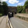
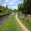
Worksop Road Aqueduct (northern end)
is a minor waterways place
on the Sheffield and South Yorkshire Navigation (Sheffield Canal) between
Rawmarsh Road Bridge No 39 (5 miles and 2¾ furlongs
and 15 locks
to the northeast) and
Sheffield Terminal Warehouse (1 mile and 5¾ furlongs
to the west).
The nearest place in the direction of Rawmarsh Road Bridge No 39 is Don Valley Stadium Visitor Moorings;
1¼ furlongs
away.
The nearest place in the direction of Sheffield Terminal Warehouse is Worksop Road Aqueduct (southern end) (Nameplate on stonework states Worksop Road);
¼ furlongs
away.
There may be access to the towpath here.
Mooring here is unrated.
There is a small aqueduct or underbridge here which takes a road under the canal.
| Greenland Road Narrows | 4½ furlongs | |
| Greenland Road Pedestrian Bridge | 4¼ furlongs | |
| Coleridge Road Bridge No 11 | 2½ furlongs | |
| Brown Bayley Footbridge No 10A | 1¾ furlongs | |
| Don Valley Stadium Visitor Moorings | 1¼ furlongs | |
| Worksop Road Aqueduct (northern end) | ||
| Worksop Road Aqueduct (southern end) | ¼ furlongs | |
| Attercliffe Railway Bridge | 1 furlong | |
| Shirland Road Bridge Winding Hole | 1¼ furlongs | |
| Shirland Road Bridge No 9 | 1½ furlongs | |
| Shirland Road Footbridge No 9 | 1¾ furlongs | |
- S&SY navigation info — associated with Sheffield and South Yorkshire Navigation
- Sheffield & South Yorkshire navigation info from IWA
Mouseover for more information or show routes to facility
Nearest water point
In the direction of Rawmarsh Road Bridge No 39
Eastwood Lock No 5 — 5 miles, 7½ furlongs and 15 locks away
Travel to Rawmarsh Road Bridge No 39, then on the Sheffield and South Yorkshire Navigation (Main Line) to Eastwood Lock No 5
Kilnhurst Flood Lock No 7 — 8 miles, 5¼ furlongs and 17 locks away
Travel to Rawmarsh Road Bridge No 39, then on the Sheffield and South Yorkshire Navigation (Main Line) to Kilnhurst Flood Lock No 7
Swinton Lock Activity Centre and CRT Sanitary Station — 10 miles, 2½ furlongs and 19 locks away
Travel to Rawmarsh Road Bridge No 39, then on the Sheffield and South Yorkshire Navigation (Main Line) to Swinton Lock Activity Centre and CRT Sanitary Station
Mexborough Low Lock No 10 — 12 miles, 7½ furlongs and 20 locks away
Travel to Rawmarsh Road Bridge No 39, then on the Sheffield and South Yorkshire Navigation (Main Line) to Mexborough Low Lock No 10
Sprotbrough Lock No 11 — 16 miles, 3 furlongs and 21 locks away
Travel to Rawmarsh Road Bridge No 39, then on the Sheffield and South Yorkshire Navigation (Main Line) to Sprotbrough Lock No 11
Doncaster Town Lock No 12 — 19 miles, 5 furlongs and 22 locks away
Travel to Rawmarsh Road Bridge No 39, then on the Sheffield and South Yorkshire Navigation (Main Line) to Doncaster Town Lock No 12
Doncaster Visitor Pontoon Moorings — 19 miles, 7¼ furlongs and 23 locks away
Travel to Rawmarsh Road Bridge No 39, then on the Sheffield and South Yorkshire Navigation (Main Line) to Doncaster Visitor Pontoon Moorings
In the direction of Sheffield Terminal Warehouse
Victoria Quays — 1 mile, 5¼ furlongs away
On this waterway in the direction of Sheffield Terminal WarehouseNearest rubbish disposal
In the direction of Rawmarsh Road Bridge No 39
Tinsley CRT facilities — 1 mile, ¼ furlongs and 1 lock away
On this waterway in the direction of Rawmarsh Road Bridge No 39
Eastwood Lock No 5 — 5 miles, 7½ furlongs and 15 locks away
Travel to Rawmarsh Road Bridge No 39, then on the Sheffield and South Yorkshire Navigation (Main Line) to Eastwood Lock No 5
Doncaster Visitor Pontoon Moorings — 19 miles, 7¼ furlongs and 23 locks away
Travel to Rawmarsh Road Bridge No 39, then on the Sheffield and South Yorkshire Navigation (Main Line) to Doncaster Visitor Pontoon Moorings
In the direction of Sheffield Terminal Warehouse
Victoria Quays — 1 mile, 5¼ furlongs away
On this waterway in the direction of Sheffield Terminal WarehouseNearest chemical toilet disposal
In the direction of Rawmarsh Road Bridge No 39
Tinsley CRT facilities — 1 mile, ¼ furlongs and 1 lock away
On this waterway in the direction of Rawmarsh Road Bridge No 39
Eastwood Lock No 5 — 5 miles, 7½ furlongs and 15 locks away
Travel to Rawmarsh Road Bridge No 39, then on the Sheffield and South Yorkshire Navigation (Main Line) to Eastwood Lock No 5
Swinton Lock Activity Centre and CRT Sanitary Station — 10 miles, 2½ furlongs and 19 locks away
Travel to Rawmarsh Road Bridge No 39, then on the Sheffield and South Yorkshire Navigation (Main Line) to Swinton Lock Activity Centre and CRT Sanitary Station
In the direction of Sheffield Terminal Warehouse
Victoria Quays — 1 mile, 5¼ furlongs away
On this waterway in the direction of Sheffield Terminal WarehouseNearest place to turn
In the direction of Rawmarsh Road Bridge No 39
Don Valley Stadium Visitor Moorings — 1¼ furlongs away
On this waterway in the direction of Rawmarsh Road Bridge No 39
Tinsley Lower Flight Weir Exit — 2 miles, 1½ furlongs and 11 locks away
On this waterway in the direction of Rawmarsh Road Bridge No 39
Rotherham Junction — 4 miles, 1¾ furlongs and 14 locks away
On this waterway in the direction of Rawmarsh Road Bridge No 39
Main Street Junction — 4 miles, 3¼ furlongs and 14 locks away
On this waterway in the direction of Rawmarsh Road Bridge No 39
Central Road Winding Hole — 4 miles, 4¼ furlongs and 15 locks away
On this waterway in the direction of Rawmarsh Road Bridge No 39
Rawmarsh Road Winding Hole — 5 miles, 2¼ furlongs and 15 locks away
On this waterway in the direction of Rawmarsh Road Bridge No 39
Sir Frank Price Lock Arm — 5 miles, 7 furlongs and 15 locks away
Travel to Rawmarsh Road Bridge No 39, then on the Sheffield and South Yorkshire Navigation (Main Line) to Sir Frank Price Lock Arm
Sir Frank Price Lock Weir Exit — 6 miles and 16 locks away
Travel to Rawmarsh Road Bridge No 39, then on the Sheffield and South Yorkshire Navigation (Main Line) to Sir Frank Price Lock Weir Exit
Kilnhurst Flood Lock Winding Hole — 8 miles, 3¼ furlongs and 17 locks away
Travel to Rawmarsh Road Bridge No 39, then on the Sheffield and South Yorkshire Navigation (Main Line) to Kilnhurst Flood Lock Winding Hole
Swinton Junction — 10 miles, 1¾ furlongs and 18 locks away
Travel to Rawmarsh Road Bridge No 39, then on the Sheffield and South Yorkshire Navigation (Main Line) to Swinton Junction
Swinton Road Corner — 10 miles, 5¾ furlongs and 19 locks away
Travel to Rawmarsh Road Bridge No 39, then on the Sheffield and South Yorkshire Navigation (Main Line) to Swinton Road Corner
Sprotbrough Lock Weir Exit — 16 miles, 3½ furlongs and 22 locks away
Travel to Rawmarsh Road Bridge No 39, then on the Sheffield and South Yorkshire Navigation (Main Line) to Sprotbrough Lock Weir Exit
Doncaster Visitor Pontoon Moorings — 19 miles, 7¼ furlongs and 23 locks away
Travel to Rawmarsh Road Bridge No 39, then on the Sheffield and South Yorkshire Navigation (Main Line) to Doncaster Visitor Pontoon Moorings
In the direction of Sheffield Terminal Warehouse
Shirland Road Bridge Winding Hole — 1¼ furlongs away
On this waterway in the direction of Sheffield Terminal Warehouse
Victoria Quays — 1 mile, 5¼ furlongs away
On this waterway in the direction of Sheffield Terminal Warehouse
Sheffield Terminal Warehouse — 1 mile, 5¾ furlongs away
On this waterway in the direction of Sheffield Terminal WarehouseNo information
CanalPlan has no information on any of the following facilities within range:self-operated pump-out
boatyard pump-out
Direction of TV transmitter (From Wolfbane Cybernetic)
There is no page on Wikipedia called “Worksop Road Aqueduct”
Wikipedia pages that might relate to Worksop Road Aqueduct
[Sheffield & Tinsley Canal]
Victoria Quays, Bacon Lane Bridge, Cadman Street Bridge and Darnall Canal Aqueduct. The Sheffield & Tinsley Canal featured in the opening scene of the 1997
[River Ryton]
three-arched aqueduct below the Canal, to pass through Shireoaks. It then loops around the village of Rhodesia, crossing under the Worksop to Nottingham
[Chesterfield Canal]
Coal, a £4.5 million scheme began to restore the canal between Worksop and the aqueduct over the River Ryton which forms the county boundary. Rotherham
[Little Swinburne Reservoir]
readers. The contract for construction was awarded to Rigby of Worksop, and the aqueduct between Swinburne and Hallington was commissioned in late 1879
[Old Hay Brook]
crosses over the tunnel entrance cutting in an aqueduct. Continuing eastwards, it passes under the A621 road to reach Totley Rise, where it joins the Totley
[National Cycle Route 6]
as Worksop as it passes through Sherwood Pines Forest Park, Sherwood Forest Country Park and Clumber Park. Using the canal towpath between Worksop and
[M1 motorway]
to build a 'motorway like road' from London to Birmingham in 1923, but it was a further 26 years before the Special Roads Act 1949 was passed, which
[Manchester Piccadilly station]
England. Opened as Store Street in 1842, it was renamed Manchester London Road in 1847 and became Manchester Piccadilly in 1960. Located to the south-east
[Listed buildings in Sheffield S9]
century Darnall Canal Aqueduct II Worksop Road 1819 Designed by William Chapman Darnall School Front Range and Wall II Darnall Road 1874 Designed by Innocent
[Ambergate railway station]
with the Cromford Canal, where the line intersected with the Bullbridge Aqueduct, before it carried on through a station at Wingfield to Stretton. However
Results of Google Search
Sheffield Canal Aqueduct, Darnall Road and Worksop Road, Attercliffe, ... Haweswater Aqueduct, starting at the southern end of Haweswater Reservoir, Cumbria . ... Stainforth Packhorse Bridge, River Ribble, Stainforth, North Yorkshire, UK ...
The Chesterfield Canal is a narrow canal in the East Midlands of England and it is known ... The eastern end was restored from Worksop to the mouth of the Norwood ... It includes Tapton Lock Visitor Centre, located to the north of Tapton Park, ... The route of the canal was surveyed by James Brindley and John Varley, who ...
At the southern end of the Delta, giant pumps of the SWP and federal Central Valley Project feed aqueducts carrying water to the rest of the state. With our ...
While much of its route is rural, its course through Worksop is man made, a result of development and milling. It used to flow through Scrooby, where there was a ...
Jul 16, 2020 ... Explore world landmarks, discover natural wonders and step inside locations such as museums, arenas, restaurants and small businesses with ...
Jul 13, 2019 ... Whether you want to linger over a family feast or just stop to drink in the landscape, we've found 100 perfect picnic spots. ... Carry picnic for a few minutes north along river path. ... Cosgrove Aqueduct, near Milton Keynes, Northamptonshire ... Creswell Crags, Welbeck Estate, near Worksop, Nottinghamshire.


![Railway bridge over Worksop Road. The bridge shown in the centre of the photo carries the single track Don Valley freight line, but at one time this was the busy Great Central line.Beyond that, another bridge carries the present Supertram lines - the electrification masts can just be seen. In the foreground the canal narrows at the start of the Worksop Road Aqueduct [[2880680]] - listed grade 2 (List Entry Number 1270905). by Stephen Craven – 03 April 2012](https://s0.geograph.org.uk/geophotos/02/88/73/2887300_d48cccf4_120x120.jpg)
![Attercliffe 1st railway station (site), Sheffield. Opened in 1874 by the Manchester Sheffield & Lincolnshire Railway, later the Great Central railway, on their line from Barnsley to Sheffield Victoria. This station closed in 1900 when it was replaced by a new station some 300m further south.View east towards the site of the station building. The railway bridge is in the middle of the three bridges shown here. The bridge in the foreground is a new tram bridge and the wall supporting it in the centre of the image is on the site of the station building. Old maps show that access to the platforms was by steps from the rear of the building, which would have been on the far left of this image.See also [[7687472]]. by Nigel Thompson – 10 January 2024](https://s0.geograph.org.uk/geophotos/07/68/74/7687476_aa1dd10a_120x120.jpg)


![Attercliffe 1st railway station (site), Sheffield. Opened in 1874 by the Manchester Sheffield & Lincolnshire Railway, later the Great Central railway, on their line from Barnsley to Sheffield. This station closed in 1900 when it was replaced by a new station some 300m further south.View south towards Sheffield Victoria. The track beyond the fence is Network Rail and when this was double track, the two passenger platforms fronted these lines. The tram tracks have been laid on the site of a previous siding and goods shed.See also [[7687476]] and [[7687478]] by Nigel Thompson – 10 January 2024](https://s0.geograph.org.uk/geophotos/07/68/74/7687472_deb1cd11_120x120.jpg)

![Worksop Road from aqueduct. Looking ESE along the B6085 Worksop Road which then turns into Darnall Road, from the Worksop Road Aqueduct on the Sheffield and Tinsley Canal. The aqueduct was constructed in 1819 according to a plaque mounted near it. For a view from four years earlier see [[1184273]]. Taken during the Geograph Conference 2012 first guided walk. by David P Howard – 03 April 2012](https://s1.geograph.org.uk/geophotos/02/88/81/2888121_bdd2bf30_120x120.jpg)


![Attercliffe 2nd railway station (site), Sheffield. Opened in 1901 by the Manchester Sheffield & Lincolnshire Railway, later the Great Central railway, on their line from Barnsley to Sheffield Victoria, this station replaced an earlier one some 300m further north, around the bend in the track. In turn, this station closed in 1927.View north towards Broughton Lane and Barnsley. The site of the two parallel platforms was beyond the bridge decking in the centre of the image, as far as the 2nd bridge parapet just visible in the distance. The track was double, at the time. The main building was to the left of the track with access being from Great Central Street, now gone.See also [[7687476]]. by Nigel Thompson – 10 January 2024](https://s2.geograph.org.uk/geophotos/07/68/74/7687478_dce60578_120x120.jpg)


![Sheffield Olympic Legacy Park Community Stadium. The stadium is built at the Sheffield Olympic Legacy Park. It occupies part of the site of the former Don Valley Stadium and is the home of the Sheffield Eagles rugby league team. [[2764363]] by Graham Hogg – 26 March 2023](https://s2.geograph.org.uk/geophotos/07/44/22/7442274_ee844b51_120x120.jpg)